Great Bear Lake
Large subarctic lake in the Northwest Territories of Canada; the largest lake entirely within Canada, important for Indigenous communities, fisheries, and northern ecology.
Great Bear Lake lies in Canada’s subarctic and is one of the continent’s great inland waters. Located in the Northwest Territories, the lake is the largest body of water entirely inside Canada, ranks fourth by area in North America, and is counted among the world’s largest lakes.
Image gallery
10 Images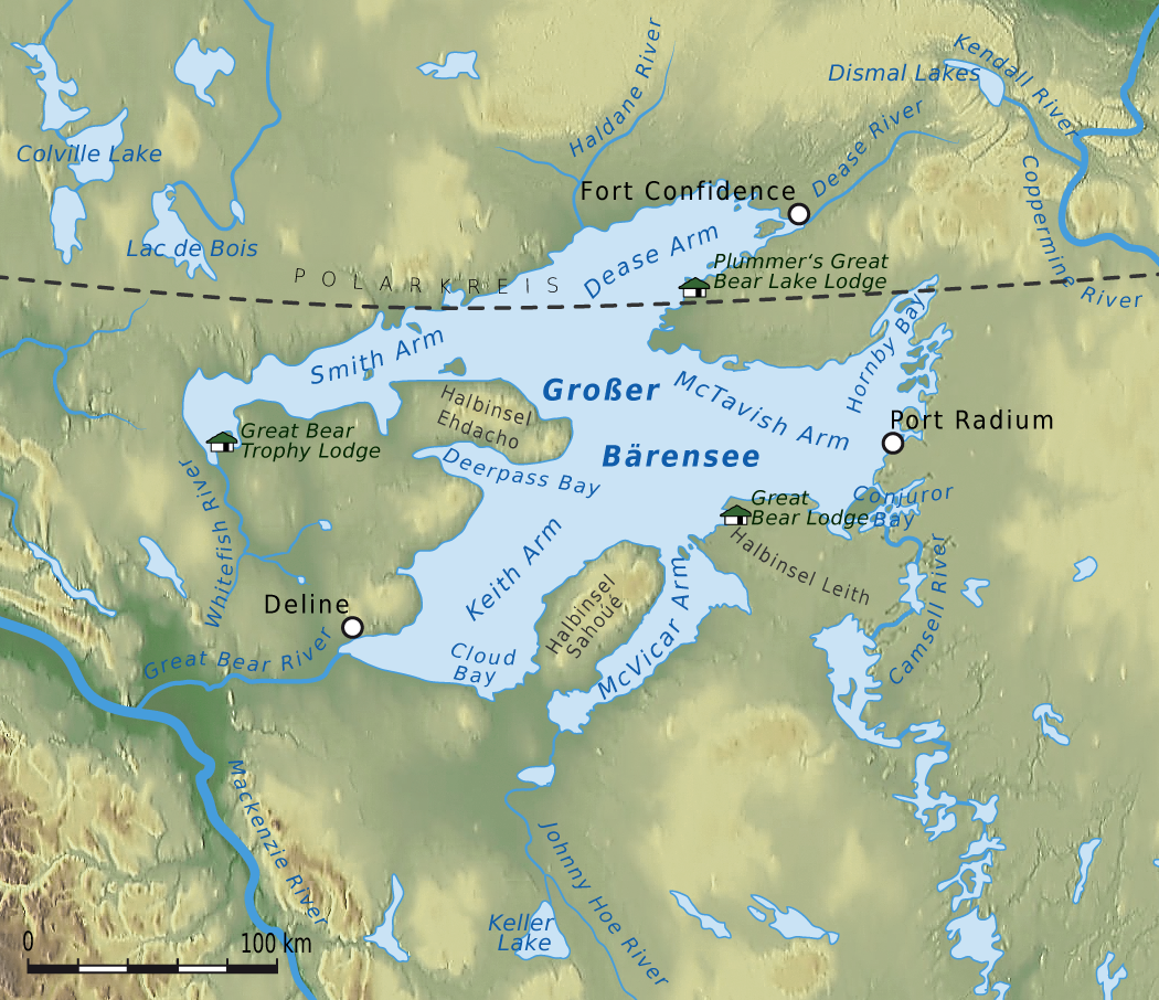


Geography and physical characteristics
The lake has a complex shoreline with several large arms and many bays. Its water originates from meltwater and small rivers and drains into the Mackenzie River system via an outlet channel. The surface lies in a sparsely populated, boreal and tundra landscape; seasonal ice cover persists for much of the year, and open-water conditions are limited to the warmer months.
Origin and hydrology
Great Bear Lake is a glacially carved basin formed during the last ice age, when advancing and retreating ice sculpted deep depressions in the bedrock. It holds cold, clear water and reaches considerable depths in places. The lake contributes to northern river networks and plays a role in regional hydrology and climate moderation.
Ecology and human use
The lake supports cold-water fish species that sustain local fisheries and traditional subsistence activities. Communities of Indigenous peoples, especially the Sahtu (Dene), have lived on its shores for generations and maintain cultural and economic ties to the lake. Local towns and settlements depend on the lake for transport, fishing and cultural practices. Historical mineral exploration and limited mining in the region have at times affected shoreline areas.
Importance and notable facts
- It is the largest lake entirely within Canada and one of North America’s biggest freshwater basins.
- Its remote setting and cold waters support distinctive northern ecosystems and fisheries.
- Communities around the lake preserve long-standing cultural connections and rely on it for food and travel.
- For maps and broader context see regional sources and national overviews (reference and additional information).
Because of its size and remote location, Great Bear Lake remains important for scientific research into northern freshwater systems, climate effects at high latitudes, and the conservation of Arctic and subarctic habitats.
Gallery
· 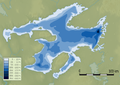
Bathymetric chart
· 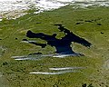
Satellite image looking southwest
· 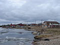
Déline on the lakeshore in May 2006
· 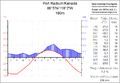
Climate diagram Port Radium at Great Bear Lake
· 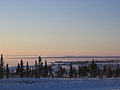
Frozen lake in November 2006
· 
Fort Confidence in 1902
· 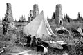
Ruins of Fort Confidence, 1911
· 
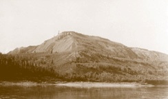
The Grizzly Bear Mountain, a mountain sacred to the Saintu Dené, who belong to the Slavey, before 1936.
Related articles
Author
AlegsaOnline.com Great Bear Lake Leandro Alegsa
URL: https://en.alegsaonline.com/art/40462