Great Australian Bight
A vast open bay along Australia's southern coast between Cape Pasley (WA) and Cape Carnot (SA), known for its long cliffs, diverse marine life, remote coastline and debates over ocean naming and resource use.
Overview
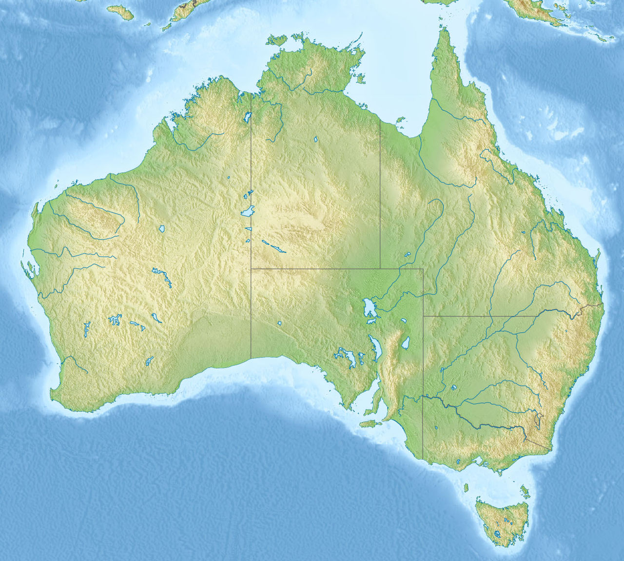
The Great Australian Bight is an extensive open bay — a large bight — indenting the southern coastline of mainland Australia. Its approximate central coordinates are noted at 33°S 130°E. The bight stretches across the central and western portions of Australia’s southern seaboard and forms a distinct coastal and marine region characterized by a sweeping arc of shoreline.
Image gallery
8 Images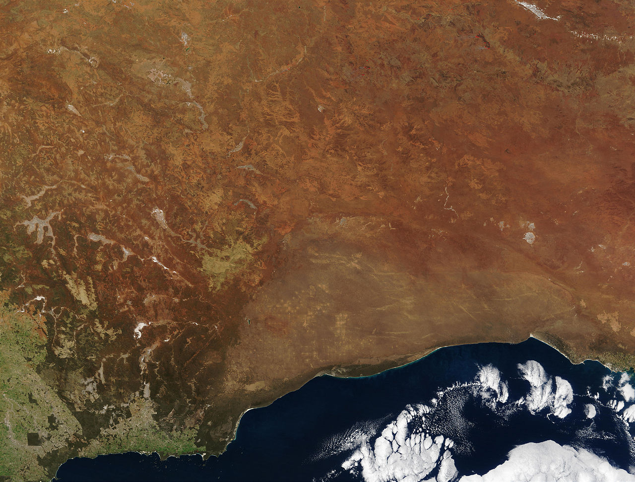


Geography and boundaries
Geographically the Bight is commonly defined as extending from Cape Pasley in Western Australia eastward to Cape Carnot in South Australia, a linear distance of roughly 1,160 km (about 720 miles). Much of the adjacent land is sparsely populated and includes the Nullarbor Plain; road access is limited to a few settlements and major cross-country routes such as the Eyre Highway and remote roadhouses.
Ocean naming and classification
There is some variation in how the connected waters are named. In Australia the sea south of the continent is commonly referred to as the Southern Ocean, while older international charts and some other sources have labelled parts of the area as an extension of the Indian Ocean. This difference reflects conventions in oceanography, cartography and national usage rather than a change to the physical environment.
Natural features and ecology
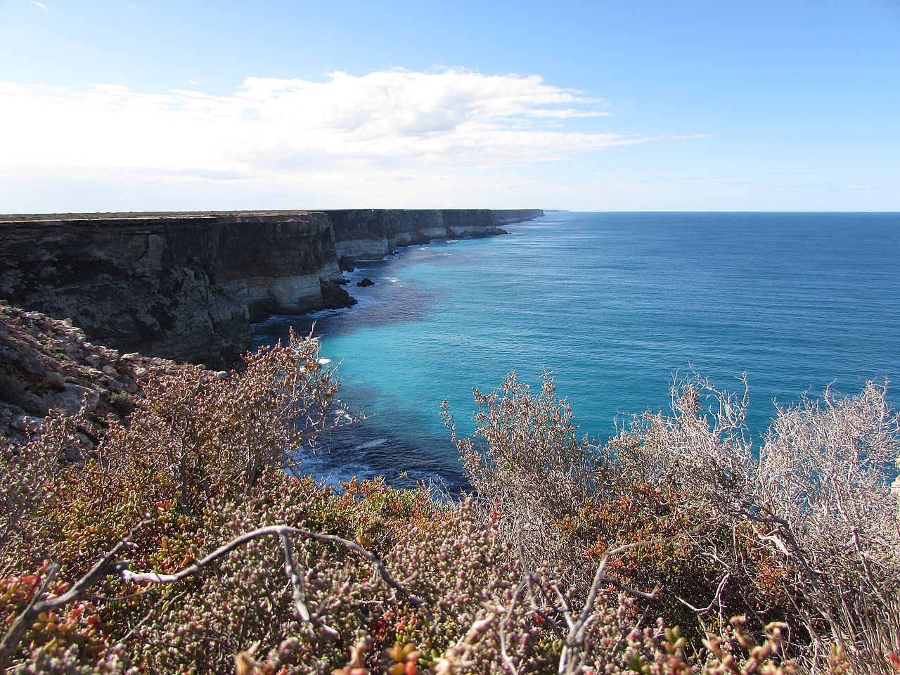
The coastline of the Great Australian Bight includes long stretches of sandy beaches, limestone platforms and some dramatic cliffs, notably along sections of the Nullarbor coast. The marine environment supports a variety of wildlife: migratory whales (including southern right whales), seals, sea lions, seabirds and rich benthic communities. These ecosystems are valued for biodiversity, scientific study, and tourism.
Human use and settlements
Settlement along the Bight is limited; towns with direct access to the shore include Ceduna and Eucla, which serve as service hubs for travelers and local fisheries. Much of the coastline remains remote with few facilities, and visitors often rely on the Eyre Highway or inland routes to reach viewing sites. The region has been the focus of discussions about marine conservation and sustainable use, including proposed protective measures and scrutiny of exploration activities.
Notable facts and distinctions
- The Bight’s broad, concave shape is the origin of its name: a bight is a wide bay formed by a gradual curve in a coastline.
- Coastal and marine management in the area balances conservation, local livelihoods, and occasional resource exploration, prompting public debate.
- Visitors and researchers often reference geographical resources and maps, and regional information is available via maritime and environmental authorities here.
- Important local landscape features and travel points include the Nullarbor Plain and transport links such as the Eyre Highway and road stops near Nullarbor settlements.
For further regional maps, navigational details and environmental information, consult official sources and regional guides via the anchors above or additional authoritative references Cape Carnot and Cape Pasley provide fixed coastal markers used in defining the Bight.
Questions and answers
Q: What is the Great Australian Bight?
A: The Great Australian Bight is a large bight, or open bay, off the central and western parts of the southern coastline of mainland Australia.
Q: What are the boundaries of the Great Australian Bight?
A: The Great Australian Bight's boundaries are from Cape Pasley, Western Australia, to Cape Carnot, South Australia, which is a distance of 1,160 km or 720 miles.
Q: What is the Southern Ocean?
A: The Southern Ocean is the much more accepted name in Australia for the connected water body that includes the Great Australian Bight, rather than the Indian Ocean.
Q: What are some settlements along the coastline with access to the Great Australian Bight?
A: Ceduna and Eucla are settlements along the coastline with access to the Great Australian Bight and facilities.
Q: Are there any locations on the Eyre Highway or on the Nullarbor that do not have facilities or easy access to the Great Australian Bight?
A: Yes, some other locations on the Eyre Highway or on the Nullarbor do not have facilities or easy access to the Great Australian Bight.
Q: Where are the coordinates for the Great Australian Bight?
A: The coordinates for the Great Australian Bight are 33°S 130°E / 33°S 130°E / -33; 130.
Q: How long is the Great Australian Bight?
A: The Great Australian Bight is a distance of 1,160 km or 720 miles from Cape Pasley, Western Australia, to Cape Carnot, South Australia.
Related articles
Author
AlegsaOnline.com Great Australian Bight Leandro Alegsa
URL: https://en.alegsaonline.com/art/40455
Sources
- britannica.com : "Great Australian Bight"