Görlitz — German town on the Lusatian Neisse, opposite Zgorzelec
Historic easternmost city in Germany, in Saxony on the Lusatian Neisse. Split from Zgorzelec in 1945, noted for preserved architecture, cross-border ties, cultural life and use as a film location.
Overview
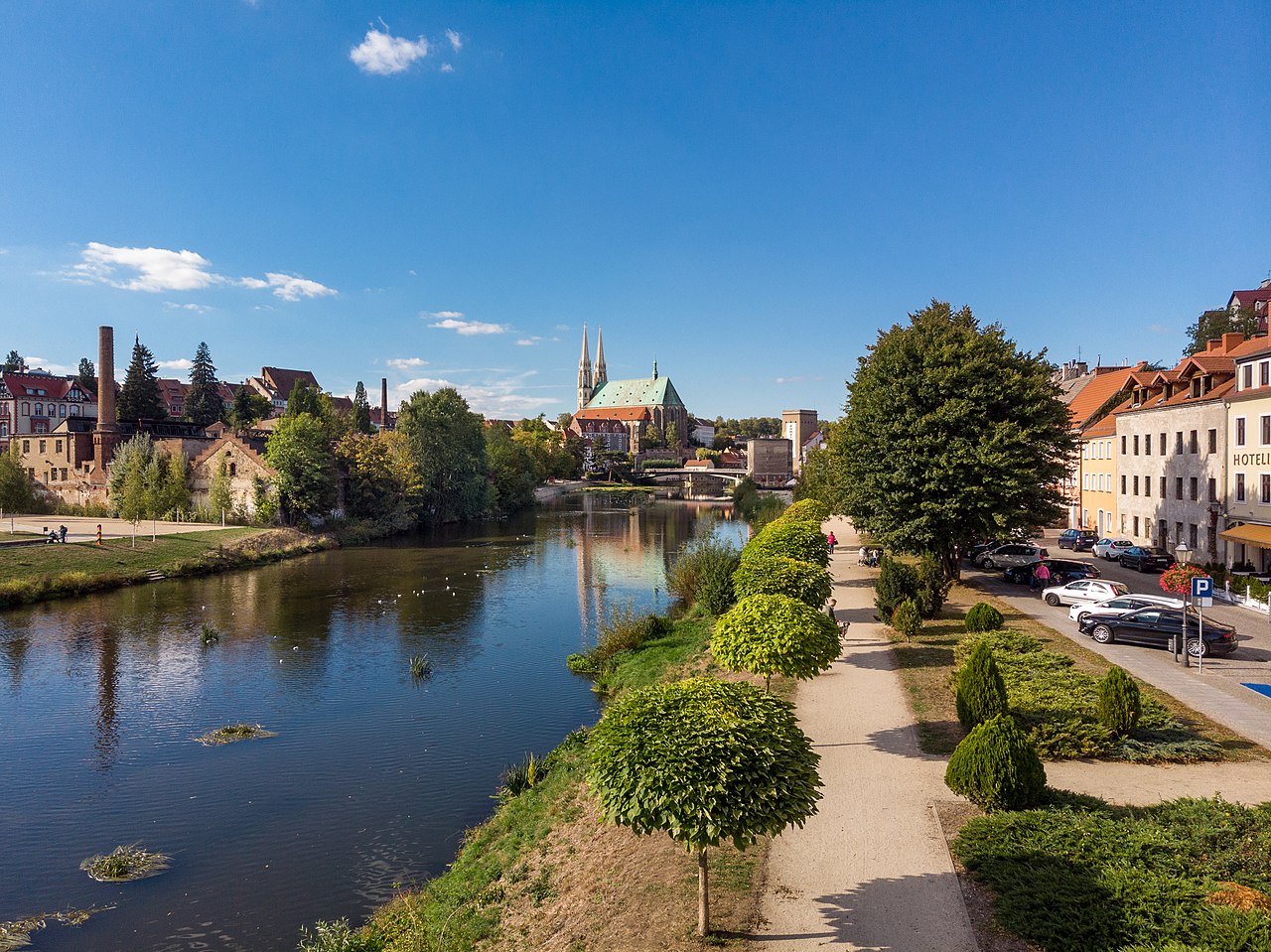
Görlitz is a German town on the banks of the Lusatian Neisse, directly opposite the Polish town of Zgorzelec. The name contains the character ö and is sometimes written as Goerlitz. It is located in the federal state (Bundesland) of Saxony and is often described as the easternmost city in Germany. Görlitz has historical ties to the regions of Lusatia and Silesia and reflects a Central European linguistic and cultural mix: Upper Sorbian Zhorjelc, Czech Zhořelec, and Polish Zgorzelec are traditional names for the place.
Image gallery
10 Images


Geography and cityscape
The town stretches along the river Lusatian Neisse, with a historic old town on the western bank and newer development on the river plain. The urban fabric includes narrow medieval streets, market squares and bridges that link the German and Polish sides.
History and division
Görlitz developed in the Middle Ages as a trade and crafts centre in Central Europe. Over centuries it belonged at times to different territorial entities, reflecting the shifting borders of Lusatia and Silesia. After World War II the town was divided when the Neisse became part of the new Polish–German boundary; the eastern neighbourhood became the separate Polish town of Zgorzelec in 1945. Since then the two towns have retained distinct administrations while cooperating closely on cross-border matters.
Architecture, culture and uses
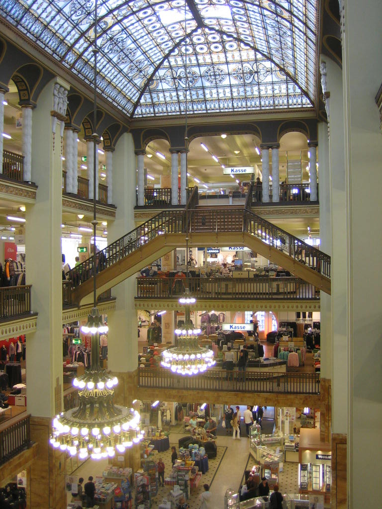
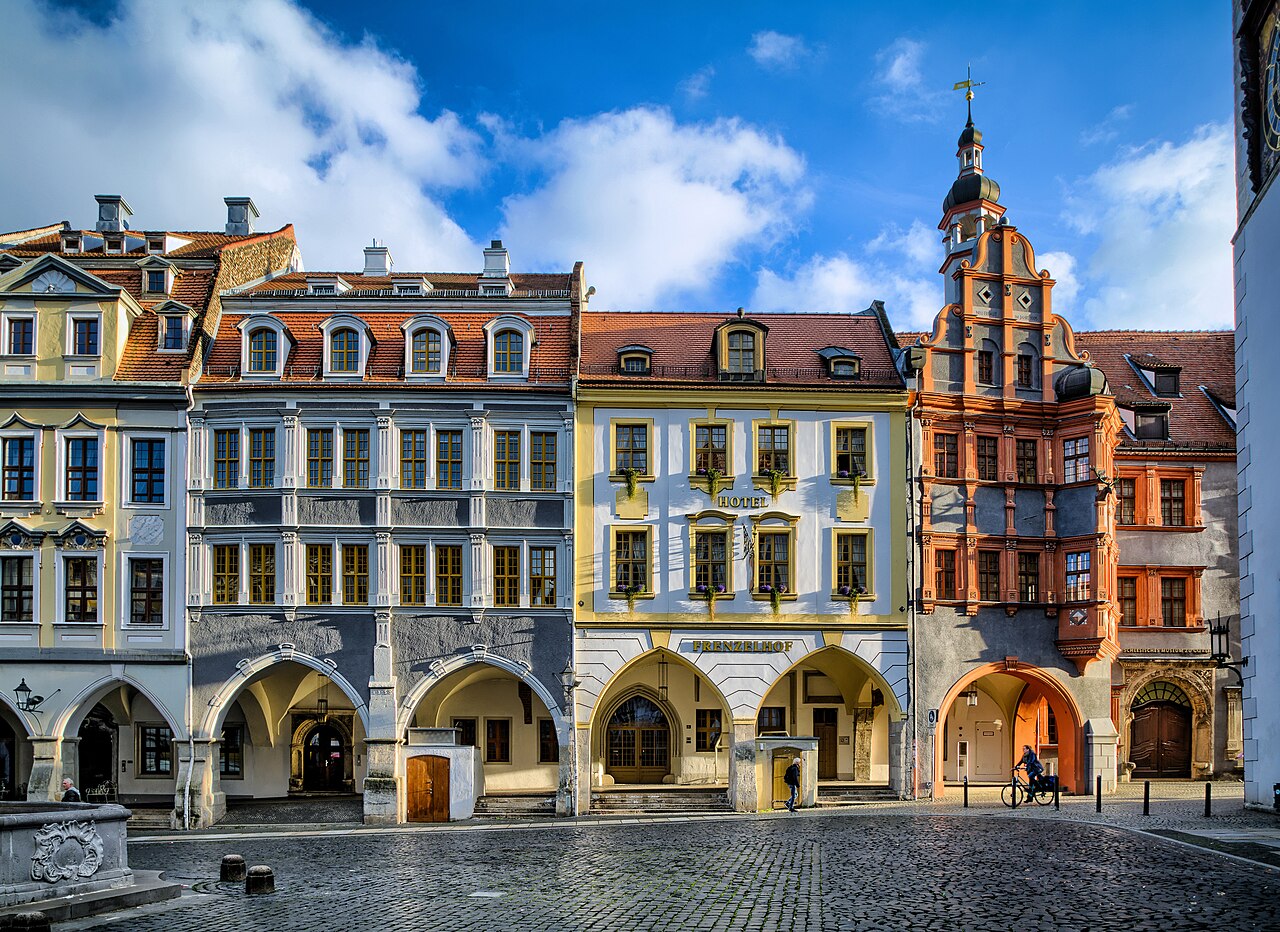
Görlitz is noted for a large, well-preserved collection of historic buildings spanning Gothic, Renaissance, Baroque and Art Nouveau styles. The old town contains churches, merchant houses and civic buildings that are often highlighted on cultural tours. The town has museums, theatres and festivals that serve the local population and visitors. In recent decades Görlitz has attracted international film productions because of its intact historical settings and streetscapes, a contribution to local tourism and the creative economy.
Economy and cross‑border cooperation
Local economic life combines services, light industry and tourism. The presence of a nearby university campus and vocational institutions supports education and skilled trades. Görlitz and Zgorzelec work together on transport links, heritage conservation and joint cultural initiatives; bridges across the Neisse and shared events reinforce practical and social connections.
Notable facts and distinctions
- Alternate spellings and names exist across languages; the German spelling with ö is standard locally.
- The town lies within Germany's Saxony region and historically belongs to Lusatia and Silesia.
- Görlitz is frequently used as a filming location and collaborates with its Polish neighbour on tourism and heritage projects.
- Local cultural life reflects influences and languages such as Upper Sorbian (Zhorjelc), Czech (Zhořelec) and Polish (Zgorzelec), underlining the town's Central European position.
- Administrative and geographical details are set within Germany (country) and the federal state of Saxony.

Geography
Location
Görlitz is located in the former Prussian-Lower Silesian part of Upper Lusatia on the western bank of the Lusatian Neisse River, which there breaks through the eastern edge of the Lusatian granite massif with the foothills of the Bohemian-Lusatian border mountains. It forms the transition between the northern Upper Lusatian heath and pond area and the southern Lusatian mountains. The former districts on the eastern bank of the river have formed the Polish city of Zgorzelec since 1945. Görlitz and its sister city Zgorzelec jointly call themselves a European city.
The centre of the town lies at an altitude of 201 m above sea level. The highest elevation of the Görlitz city area - the Landeskrone - is 420 m above sea level. The lowest point of the city with 185 m above sea level is located at the river Neiße. The average value for the city area is 220 m above sea level. The water level of the Berzdorfer See, located in the south of the city, is 185.6 m above sea level. The lake is 72 m deep at its deepest point.
The meridian of longitude 15° east of Greenwich, to which the time zone of Central European Time is oriented, crosses the city. As a result, Central European Time coincides with the mean solar time of Görlitz. The city is located at 51° 09′ north latitude. In honor of Yuri Gagarin, the first man in space, a meridian monument was erected in 1961 southwest of the town hall immediately adjacent to the road bridge to Poland. According to today's measuring methods, however, the location of the stone is no longer exact. According to this, the 15th meridian runs about 137 m away at the Neißewiesen below the town hall.
The city area stretches 19.4 km from north to south and 7.3 km from east to west. The nearest larger cities are the Czech Liberec (Reichenberg) about 50 km south, Cottbus about 80 km northwest, the Silesian Legnica (Liegnitz) about 80 km east and Dresden about 90 km west of Görlitz. It is about 50 km to Bautzen.
Geology
During the Tertiary period, bog forests formed in drainless depressions. Flooding, the death of plants and the resulting deposits led to the formation of lignite basins such as in the former Berzdorf open-cast mine. The basalt and phonolite peaks like the Landeskrone are of volcanic origin.
The geological subsoil in the Görlitz area consists of Lusatian greywacke in the north. It is composed of biotite, grey quartz and light feldspar with layers of fine-grained greywacke and dense greywacke shales. The south of the urban area is dominated by Ostlausitzer granodiorite. The border between the different types of subsoil runs approximately along the line Ochsenbastei, Neißstraße, Peterstraße, Heiliges Grab to beyond Girbigsdorf. The narrowing of the Neisse valley caused by the hard granodiorite ends at the Obermühle.
Nature
Four areas according to the Fauna-Flora-Habitat Directive (FFH area) and one bird sanctuary partially extend on the city area. The bird sanctuary Neisse valley and the FFH area Neisse area overlap in large parts. They extend from the Obermühle in the north, through the Neisse valley, the Neisse floodplains to the southern borders of the town in the district of Hagenwerder. They include the vineyard area with its wooded valley slopes, the wine puddle as well as the Neisse meadows and the farmland between the district of Weinhübel and the district of Hagenwerder. In the bird sanctuary, 26 bird species have been identified according to categories 1 and 2 of Saxony's Red List. These include the kingfisher, the sandpiper, the middle spotted woodpecker and the ortolan. For these four bird species, the bird sanctuary is one of the most important breeding areas in the Free State of Saxony. The FFH area Pließnitzgebiet in the districts of Hagenwerder and Tauchritz borders on the areas. It comprises the floodplains of the Pließnitz - a tributary of the Lusatian Neisse.
The Landeskrone (see also section The Landeskrone) is part of the FFH area Basalt and Phonolite Domes of Eastern Upper Lusatia. It is also part of the FFH site Separate bat roosts and habitats in Lusatia. The aim here is to protect the nursery roosts, roosts and foraging habitats of the pug bat and greater mouse-eared bat, as well as numerous other endangered bat species.
With the ordinance on the designation of natural monuments in the city area from 1997 and the amended ordinances from 2001 and 2005, 27 natural monuments were designated by the city.
See also: List of natural monuments in Görlitz
City breakdown
The urban area of Görlitz is divided into nine city and five districts. The districts have grown historically, were created by the settlement of displaced persons after 1945 or were incorporated as previously independent communities or parishes until 1952. The five districts were added to the city during the most recent municipal reform in the 1990s and are spatially distant from the core city area.
The districts are Altstadt, Biesnitz, Innenstadt, Klingewalde, Königshufen, Nikolaivorstadt, Rauschwalde, Südstadt and Weinhübel (until 1937 Posottendorf-Leschwitz).
The following formerly independent villages also belong to the town area: Deutsch Ossig, Hagenwerder (until 1936 Nikrisch), Klein Neundorf, Kunnerwitz, Ludwigsdorf, Ober-Neundorf, Schlauroth and Tauchritz. The following formerly independent villages form a common district: Hagenwerder and Tauchritz, Kunnerwitz and Deutsch-Ossig with Klein Neundorf as well as Ludwigsdorf and Ober-Neundorf. The village Deutsch-Ossig is uninhabited due to the expansion of the Berzdorf open-cast mine, after the inhabitants were resettled. A large part moved to the new housing estate south of Kunnerwitz.
Surrounding Area
The surrounding area of Görlitz is mainly rural, the nearest larger towns are Weißwasser in the north, Bautzen and Löbau in the west, Zittau in the south and Lubań (Lauban) and Bolesławiec (Bunzlau) in the east. Of the five cities, Löbau is the closest at a distance of around 20 km.
The municipality of Schöpstal with the districts of Girbigsdorf, Ebersbach and Kunnersdorf as well as the municipality of Neißeaue with the district of Zodel border on the city area to the north, Markersdorf to the west. East of the Neisse River is the Polish city of Zgorzelec (Görlitz) and the rural municipality of the same name with the localities starting in the north and heading south with Żarka nad Nysą (Sercha), Jędrzychowice (Hennersdorf), Koźlice (Köslitz), Osiek Łużycki (Wendisch-Ossig) and Radomierzyce (Radmeritz). To the southwest lies the municipality of Schönau-Berzdorf auf dem Eigen, to the south the rural town of Ostritz with the district of Leuba. Northwest of Görlitz are the small towns of Niesky and Rothenburg, which, however, do not directly border the city area.
Except for the sister city Zgorzelec, all bordering communities and cities belong to the district of Görlitz. On today's Polish territory, the Görlitzer Heide (Görlitz Heath) adjoins to the north-east of the neighbouring Polish city. Until 30 April 1929 it was a separate estate district, the Görlitzer Kommunalheide. The majority of the Görlitz Heath now lies in the Polish Powiat Zgorzelecki (Zgorzelec County). It also includes the nearest larger country towns Pieńsk (Penzig) and Węgliniec (Kohlfurt) in the northeast.
Land use
More than 60 % of the urban area of Görlitz consists of green spaces. There are 1484.6 ha available as building land, which is divided into several types of use or development. In the city centre the buildings are very dense. Especially the Old Town and the Nikolaivorstadt are characterized by narrow streets and high old buildings. Some of the buildings reach directly to the banks of the Neisse River. In the districts of Königshufen, Rauschwalde and Weinhübel, on the other hand, apartment blocks of municipal and cooperative housing dominate the scene, with the typical WBS 70 prefabricated housing being found mainly in Königshufen. These districts surround the city centre in the north, west and south. In Biesnitz there is an increasing number of owner-occupied houses, which densify the suburb, which originally consisted of villas. The structure of the recently incorporated districts is rural. The city's largest industrial and commercial area is located on the former power plant site in Hagenwerder in the far south. Another commercial area is located between Königshufen and the federal motorway 4. Water areas make up about 11 %. The flooded Berzdorf open-cast mine is located south of Weinhübel and reaches as far as the localities of Hagenwerder and Tauchritz.
| Type of use | Area in ha | Percentage |
| Residential land | 675,3 | 10,05 % |
| Special residential area | 14,7 | 0,22 % |
| Mixed construction areas | 215,7 | 3,21 % |
| Core area | 17,1 | 0,25 % |
| Commercial building area | 428,3 | 6,37 % |
| Special construction area | 165,3 | 2,46 % |
| common land | 105,4 | 1,57 % |
| Supply and disposal | 35,3 | 0,53 % |
| Road traffic | 112,0 | 1,67 % |
| Special purpose traffic areas | 33,6 | 0,50 % |
| Areas for railway facilities | 115,7 | 1,72 % |
| Green and open spaces (incl. forest) | 4062,1 | 60,43 % |
| Water areas | 741,5 | 11,03 % |
| Total | 6722,0 | 100 % |
Climate
The average daily maximum temperature in the summer months is over 20 °C, the average nightly lows in the winter months are 0 to -5 °C. The average air temperature in Görlitz is 8.2 °C, the annual precipitation 657 mm. On average, the highest amount of precipitation occurs in August with 74 mm, while February is the driest month with about 37 mm.
July has the longest sunshine duration with about 7 hours per day. December, on the other hand, averages only 1 hour and 30 minutes per day.
The urban climate of the city is particularly influenced by the dense development of the city centre. This is the reason for a higher air temperature and less air circulation than in the surrounding area. During the warmer season, the heat load and sultriness increase. Air exchange in the city core is severely restricted. During the night, a heat island can form. Compared to the cold air areas in the surrounding countryside, this heat island can have a difference of 10 °C. However, these effects are typical for cities. Görlitz has climate-ecologically and air-hygienically effective open spaces that intensify the air exchange with the built-up areas and thus improve the urban climate.
| Monthly average temperatures and precipitation for Görlitz
Source: | |||||||||||||||||||||||||||||||||||||||||||||||||||||||||||||||||||||||||||||||||||||||||||||||||||||||||||||||||||||||||||||||||||||||||||||||||||||||||||||||||||||||||||||||||||||||||||||||||||||||||||||||||||||||||||||||||||||||||||||||||||||||||||||||||||||||||||
Görlitz is the seat of the easternmost weather station in Germany, which is permanently manned by staff of the German Weather Service.
The history of weather observation in Görlitz goes back to 1848 when Josef Theodor Hertel began meteorological measurements and observations at Demianiplatz. In 1887, the weather station moved to Hospitalstraße 20-21 and was moved in 1891 to the hospital opposite. In 1930 a climate hut was built in its park, while around 1936 the weather station was moved to Girbigsdorfer Straße at the airfield. After the Second World War, the observations in Görlitz were resumed on 1 July 1946 by the Saxon State Weather Service at the same location. In 1990, the automatic collection of weather data began. In October 1991, the radioactivity monitoring was also established. Due to the construction of a bypass road, the weather station had to be moved 400 meters to the west in 1994 and a container complex was erected. In 2007, the meteorological observatory moved into the new building at the same location. In 2008, the weather station Görlitz is inaugurated as the first climate reference station of the German Weather Service.


History
→ Main article: History of Görlitz
Original settlement and foundation of the town
Archaeological finds in the town area prove a settlement since the late Neolithic period (Corded Ware Culture). From the time of the Lusatian culture there are finds of cremations. Furthermore, copper and bronze coins from the late Roman Empire were recovered. After the Germanic population had left the area of eastern Upper Lusatia during the Migration Period in the 4th and 5th centuries, the region was not repopulated by Slavic groups until the late 7th and 8th centuries, which can still be seen today in the numerous place and field names of Sorbian origin, including "Görlitz" itself. It is uncertain whether these were Besunzans, of whom nothing else is known. Finds of pottery in today's Nikolaivorstadt and the eastern old town date from this period.
At the beginning of the 960s, the Margrave of the Saxon Ostmark Gero subjugated the Slavic tribes in Lower Lusatia. It was not until around 990 that Margrave Ekkehard I of Meissen was also able to subjugate the Milzen people in Upper Lusatia. Lusatia, however, remained a source of conflict between Bohemia, Poland and the Holy Roman Empire for a long time. Görlitz was first mentioned in a document of King Henry IV in 1071. In it, the Bishop of Meissen received the Slavic village of Goreliz as a gift. The area of today's Upper and Lower Lusatia came in 1075 as a pledge and 1089 as an imperial fief under the rule of the Bohemian dukes and later kings, who were with interruptions until 1635 thus also city rulers of Gorlitz.
The Yzcorelik castle, which was probably located in the area of St. Peter's Church, was expanded in 1126 and 1131 along with other castles on the border of Bohemia by Duke Soběslav I.
Based on the village settlement or the castle, a settlement of merchants probably developed in the middle of the 12th century on the Via Regia with the Nikolai Church at its core. Around 1200, a planned town complex developed around the Lower Market in the area of today's Old Town. A representative of the Bohemian king, who came from the circle of leading families from which the large landowners and long-distance traders emerged, resided in the town in 1234 and 1238. They broke away from the city authority by 1282 at the latest.
Under the rule of the Ascanians, who had received the eastern part of the land of Bautzen with the city of Görlitz as a pledge from the Bohemian king in 1253, the city complex was extended to the west and a city fortification was erected, which now also included the Franciscan monastery founded in 1234.
In 1268, under the margraves of Brandenburg, a mint of Bautzen, which had existed from time immemorial, was mentioned in documents. In the same year, the mint was supplemented by a newly founded Görlitz mint, with which it was to mint annually on an alternating basis.
Rise to a medieval trading centre
For the time shortly before 1300 a city council with mayor, twelve aldermen and four aldermen is documented. In 1303, Görlitz was the first city in the region to be granted independence from the bailiwick court of the sovereign and to receive higher jurisdiction, which is considered the date of urban independence. A short time later a Jewish community developed. After the city fell back to Bohemia in 1329, King John of Luxembourg confirmed the developing settlement of the Jews and endowed Görlitz with numerous rights, in particular the minting regal.
In 1339, the town was additionally granted the stacking right for a dyeing plant in demand throughout Europe, woad, for the colour blue in cloth dyeing. The town became the most important trading town between Erfurt and Wroclaw due to its flourishing trade as well as due to the monopoly position for woad trade in the Bohemian countries and thanks to a flourishing cloth production. In the middle of the 14th century the council held the town court. Since that time a double wall ring is attested, which enclosed an area of 24 ha.
Based on their economic power and the royal privilege, Bautzen, Görlitz, Kamenz, Lauban, Löbau and Zittau founded the Upper Lusatian Six Towns League on August 21, 1346, in order to preserve the peace of the land on behalf of the sovereign, the King of Bohemia and later German Emperor Charles IV. Legally Görlitz was hardly inferior to the free imperial cities. With the economic upswing, the guilds rose to local power factors. They rejected the foreign policy of the council and rebelled in 1369, 1390 and 1405 in vain against the council authority.
In the years 1377 to 1396 the city was the centre of the Duchy of Görlitz, which Charles IV had founded for his seven-year-old son Johann. He allowed the expulsion of the Jews from Görlitz in 1389. After his death in 1396, the duchy was dissolved again.
During the Hussite wars, the southern and eastern suburbs were burned down in 1429, but the walled town was not besieged. After numerous feuds waged by the city in the 14th and 15th centuries to preserve the peace of the land and its extensive privileges, it was also involved in the 15th century in the disputes between the church and the nobility with the King of Bohemia, George of Podiebrad, who was hostile to it as a Calixtine, resulting in the Gunpowder Plot of 1466/68. Görlitz was also involved in the dispute over the Bohemian throne between George of Podiebrad and Matthias Corvinus. Therefore, until 1477 also the suburbs were surrounded with a moat and palisades and the city fortifications were modernized and strengthened.
The tensions between Görlitz and Zittau, which had already begun after the end of the Hussite Wars, erupted in 1491 in a beer war, which was about the right of the Zittauers to import and sell beer duty-free to Görlitz. Görlitz, however, refused to import and sell foreign beer and confiscated it. Zittau reacted to this with attacks on villages in the immediate vicinity of Görlitz. The feud between the two cities could only be ended by an arbitrator's decision of the bailiff, who forbade both cities to attack each other and obligated Zittau to make up for the damage done.
Under the rule of the Hungarian king Matthias Corvinus, the city came to its highest bloom in the late 15th century, which lasted well into the 16th century. Numerous burgher houses and church buildings of the late Gothic and Renaissance originate from this time. At the same time, Görlitz citizens acquired extensive land holdings from the 1440s onwards. Around 1500 the city had about 10,000 inhabitants.
The tensions between guilds and council continued into the 16th century and led to the dispute over the Reformation. From 1521 Protestant preaching was practiced in Görlitz, even though the council resisted for a long time. A Protestant church order was introduced in 1539. In the aftermath of the Schmalkaldic War, the city was affected by the Upper Lusatian Pönfall in 1547, because the Six Cities were very reluctant to provide troops for the war, which, moreover, left the imperial camp again before the battle of Mühlberg. The city was obliged to pay a heavy fine and lost numerous rights and all land ownership. Although many possessions and privileges were bought back in the following years, the power of the towns in the Upper Lusatian Estates Republic was broken in favour of the sovereign and the large noble families.
Görlitz in the Electorate of Saxony
In April 1636, Görlitz, together with Upper Lusatia, whose estates had joined the rebellious Bohemia, was given to the Electorate of Saxony as compensation for the Emperor's war debts. In 1637, the Emperor confirmed the confessional relations found with the Traditionsrezess, whereupon he accepted the homage in Görlitz. In the further course of the Thirty Years' War, Görlitz, which was occupied by the Swedes, was successfully besieged in 1641. It suffered heavy damage. In the Seven Years' War, the city was again the scene of military conflicts in the Battle of Moys.
In 1779, the Upper Lusatian Society of Sciences was founded there, which later grew to become the largest civic society of its kind in Germany.
When Napoleon's army returned from the Russian campaign, army units moved through the Görlitz area and plundered the surrounding villages, regardless of whether they were allies or opponents. Within a year, more than 30 units of troops thus marched past Görlitz; the allied French had to be quartered and fed. Mayor Samuel August Sohr reported especially about the rapidly spreading epidemics. After Napoleon's defeat, the Saxon army defected to the allies, but Saxony was treated as an enemy. Therefore Saxony was not represented at the Congress of Vienna. There, in 1815, Upper Lusatia was divided and Görlitz was added to the Prussian province of Silesia and at the same time became the seat of the district of Görlitz with the same name within the administrative district of Liegnitz.
Second flowering in the Prussian state
The affiliation to Prussia had a considerable influence on the political and social development of the city. The Prussian town charter was introduced in 1833 and the town flourished again under the first mayor Gottlob Ludwig Demiani. In 1847 it received a railway connection to Dresden and was at the same time connected to Berlin and Breslau by a branch line. In 1867 the Berlin-Görlitzer Eisenbahn-Gesellschaft opened its railway line from Berlin to Görlitz from the Görlitzer Bahnhof in Berlin. In 1873 a separate city district was formed for Görlitz.
This was associated with rapid industrialisation. Numerous large public buildings, industrial plants and housing estates of the Wilhelminian period still characterize the cityscape south of the old town. With the division of Silesia into the provinces of Upper and Lower Silesia, Görlitz became part of the western province of Lower Silesia in 1919.
National Socialism and the Second World War
During the National Socialist era, the Jewish population was systematically disenfranchised and deported to concentration camps, as was the case everywhere in the German Reich. However, the Görlitz fire brigade thwarted the attempt to set fire to the Görlitz synagogue on Reichspogromnacht 1938, so that it remained largely intact as one of the few synagogues in what is now Saxony. In 1944, the Görlitz subcamp was established. It is proven that more than 400 Jewish prisoners from Hungary, Poland, the Czech Republic and Russia were murdered there or died of diseases and exhaustion. During the war and especially towards its end, a total of 37 houses were destroyed and, depending on the source, between 78 and 89 were damaged, some of them severely. All seven Neisse bridges were blown up on May 7, 1945 - the last day of the war - at about 7 p.m. by retreating Wehrmacht troops. These blasts also affected numerous adjacent buildings, including the windows of the Church of St. Peter and Paul near the Old Town Bridge. The city was occupied by the Red Army and thus became part of the Soviet Occupation Zone (SBZ) and, from 1949, of the GDR.
Socialism and GDR
After the Second World War, Görlitz was divided by the Oder-Neisse border. The part of the city east of the Neisse came under Polish administration and has since been called Zgorzelec. The population living there was expelled from 21 June 1945. 650 people who were born in Görlitz or had their last place of residence there were arrested by the Soviet secret police of the NKVD. About 250 of them died in the special camps. Due to the refugees and displaced persons from the areas east of the Oder and Neisse rivers, the population in the western part of the city briefly grew to over 100,000. The larger part of the city that remained with Germany became part of the state of Saxony, which was dissolved in 1952. After that, the city belonged to the district of Dresden.
With the signing of the Görlitz Agreement on 6 July 1950, the German Democratic Republic and the Polish People's Republic recognised the Oder-Neisse border as a national border. The border was recognized under international law by the reunified Germany with the Two-plus-Four Treaty and the bilateral German-Polish Border Treaty between Germany and Poland in 1990.
On 17 June 1953, after a rally of 30,000 people in Görlitz, the "uprising" was initially successful, but after the imposition of the state of emergency by the Soviet occupation forces, it was put down by units of the Ministry of State Security and the barracked people's police.
From 1975 onwards, the new housing estates Königshufen and Rauschwalde were built, while the building fabric of the old and inner city decayed. At the end of the 1980s, area-wide demolitions were planned, which, however, did not take place due to the political turnaround in 1989. There are very few cities in Germany with a population comparable to that of Görlitz that can boast such a density of well-preserved architectural monuments. Especially the inner city could profit from the building and redevelopment boom after the reunification, which was mainly supported by subsidies of the state and the European Union. However, the continuing population decline in the eastern federal states is also making itself felt in this region.
Görlitz in the Free State of Saxony
In the reestablished Free State of Saxony, the city district of Görlitz became an independent city in the newly formed administrative district of Dresden. In the course of the district reform in 1994, the district of Görlitz surrounding the city was absorbed into the new Niederschlesischer Oberlausitzkreis. Görlitz initially became the district seat, but soon lost this function to Niesky. In the course of the Saxon district reform in 2008, the Lower Silesian Upper Lusatian District, the independent city of Görlitz and the district of Löbau-Zittau merged on 1 August 2008 to form the district of Görlitz. District seat became Görlitz. Thus, the status of an independent city ceased. Görlitz received the title of large district city.
Since 1991, the city has been a member of the Working Group of Historic Cities, to which the cities of Bamberg, Lübeck, Meißen, Regensburg and Stralsund also belong. The aims include the mutual exchange of experience, the definition of common positions vis-à-vis political leaders and decision-makers on topics of urban development in Germany and urban development with a focus on sustainable concepts for historic urban structures and their building fabric. With the foundation of the University of Applied Sciences Zittau/Görlitz on 13 July 1992, Görlitz becomes one of the two university locations of the University of Applied Sciences. From 3 to 5 September 1993, the city hosted the second Day of Saxony under the motto We in Saxony. There were about 270,000 visitors. In 1996 the 925-year-celebration took place. The celebration was opened with a procession and in the middle of the Obermarkt a scaffold in the basic shape of the former salt house was erected and covered with tarpaulins. At the beginning of the 1990s, there were considerations to rebuild the building, but this was rejected on the grounds that the function of the square as a link between the old town and the Gründerzeit district would be destroyed.
After the political turnaround, there were serious changes, especially in the economic field. The once state-owned enterprises (VEB) in the city were to be privatised in accordance with the principles of the social market economy. On 1 May 1990, for example, the VEB Waggonbau Görlitz became the DWA subsidiary Waggonbau Görlitz GmbH. The VEB Görlitzer Maschinenbau was taken over as Siemens Turbinenbau GmbH by the Siemens group from the Treuhandanstalt. The privatization of the former VEB Kondensatorenwerk Görlitz failed and the company had to file for insolvency in 1992. The Feinoptische Werk Görlitz was also separated from the VEB Carl Zeiss and converted into a GmbH. For a short period of time it again supplied lenses with the brand name Meyer-Optik. Due to a lack of investors, the Treuhandanstalt liquidated the Feinoptische Werk Görlitz on 30 June 1991.
Between January 1991 and 28 December 1997, plant sections I to III of the Hagenwerder lignite-fired power station were shut down because, among other things, the demand for electricity fell, more economical new power station construction made the retrofitting of dust removal and desulphurisation plants appear unprofitable and the supply of lignite from the neighbouring Berzdorf opencast mine was only guaranteed for a maximum of 15 years. Opencast mining operations were also discontinued on 28 December 1997 after more than 170 years of lignite production. The following years saw extensive rehabilitation work for the subsequent flooding of the former opencast mine. Most of the structures of the disused power station were demolished or blown up and the site was redesignated as an industrial estate. With the closure of the power plant and the opencast mine, a total of about 6,000 employees lost their jobs.
Görlitz and Zgorzelec applied together in 2001 for the title of "European Capital of Culture 2010". In the final jury decision, the twin city lost out to the city of Essen, which had applied on behalf of the Ruhr region.
During the August flood of the Lusatian Neisse in 2010, the dam wall of the Witka reservoir broke. The Witka is a tributary of the Neisse and flows into it south of the Görlitz district of Hagenwerder. The flood wave flooded large parts of Hagenwerder in a short time. By the undercutting of the tracks of the railway line Görlitz-Hagenwerder and thus the breaking of the floods into the nearby Berzdorfer Lake were mitigated. However, the water level reached 7.07 m, one of the highest values since they were recorded. The average water level is 1.75 m. There was considerable damage, particularly in the lower-lying districts and parts of the city to the south and north of the city centre, but also to the buildings close to the banks in the inner and old city, in the Neisse valley south of the Obermühle mill and in the Neisse suburb of Zgorzelec.
In the night from 14 to 15 March 2020, Poland closed its border crossings with Germany as a result of the COVID-19 pandemic and thus also the border crossings in the Görlitz city area. The Old Town Bridge was completely sealed off with construction fences and guarded with machine guns armed Polish border guards of the Straż Graniczna. The border crossing at the city bridge as well as the highway border crossing in Ludwigsdorf remained open for Polish returnees, who had to go into quarantine for 14 days. During the border closure, especially before the Easter and Whitsun holidays, as well as before Ascension Day, there were kilometre-long backups through the entire Görlitz city area, as well as up to 63 km long traffic jams on the motorway 4 to Burkau. The borders were reopened in the night from 12 to 13 June 2020. The mayor of Zgorzelec, Rafał Gronicz, together with his Görlitz counterpart, Octavian Ursu, ceremoniously opened the border fence on the Old Town Bridge in the presence of several hundred people.
Incorporations
Before the Second World War, Rauschwalde was incorporated into Görlitz in 1925 and Moys (Polish: Zgorzelec-Ujazd) in 1929. The district of Moys and the city area lying east of the Neisse River fell under Polish administration after the end of World War II in accordance with the Potsdam Agreement. After the war, on 1 January 1949 Weinhübel and Klingewalde and on 1 October 1951 Groß and Klein Biesnitz came to Görlitz. On 1 January 1994 followed Deutsch-Ossig and on 1 March of the same year Hagenwerder/Tauchritz and Schlauroth. Finally, on 1 January 1999, Kunnerwitz with Klein Neundorf, Ludwigsdorf with Ober-Neundorf as well as parts of the industrial areas of the municipality of Schöpstal (Girbigsdorf and Ebersbach) were added.
Population development
→ Main article: Population development of Görlitz
Whereas Görlitz had barely 10,000 inhabitants before the industrial revolution, the number of inhabitants increased eightfold from 10,724 to 83,766 in just eight decades between 1825 and 1905. With the strong increase in population since the founding of the German Empire and in the following years of the Gründerhof, the city burst its medieval boundaries and grew beyond the city walls. Even after the end of the First World War, the population continued to rise. In 1939, about 94,000 people finally lived in the city.
The population of the city of Görlitz exceeded the mark of 100,000 inhabitants in 1949 in the city area located west of the Neisse River, mainly due to the influx of the numerous refugees and displaced persons from the former German eastern territories, which briefly turned the city into a large city. The city's population also reached its historic high at that time with 101,742 residents. By 1988, there was then a decline to 77,609 inhabitants. Since the fall of communism in the GDR, the city has lost almost a third of its population again, measured against its territorial status at the time, due to emigration and a decline in the birth rate.
On 31 December 2011, the official population of Görlitz was only 54,691 (main residences only). Compared to the last pre-war population census in May 1939 with 93,823 inhabitants, this corresponds to a decline of about 40 percent, although the loss of housing located east of the Neisse could be compensated by three new housing estates built west of the Neisse after 1945. Thus, before the war, about 8,800 citizens lived in the eastern part of the city. In comparison, about 20,000 citizens lived in the three new development areas in July 2011. This shows that the lost living space east of the Neisse could be more than compensated for after the war until 1990.
Although a further decline in population was expected, the State Statistical Office predicted a population of 46,400 for Görlitz in 2020, which would be about half of the pre-war population. However, the forecast of the state office is considered controversial, because since 2006, Görlitz has again recorded more in-migrants than out-migrants and has reached the level of 57,228 residents in November 2017, with every tenth of the 2000 new citizens over 60 years old. By 2007, over 1000 senior citizens had already moved to the city. For them, the city is considered a popular retirement destination due to its ambience, culture, quiet location as well as the up to 20% lower cost of living, also due to the low rents. Already in the 19th century Görlitz got the nickname "Pensionopolis". It was especially popular with Prussian officials as a retirement residence. This development is now noticeable again, pensioners move their residence in the old town of Gorlitz. A large part of them comes from the old federal states.
Görlitz and its Polish neighbour Zgorzelec have a combined population of around 86,600, of which 31,359 live in Zgorzelec (as of 2015). This roughly corresponds to the population of the entire city in the early 1920s.


Questions and answers
Q: What is the title of the article and what character does it contain?
A: The title of the article contains the character ö.
Q: What is the alternate name for the town of Görlitz?
A: The alternate name for the town of Görlitz is Goerlitz, which is used when the character ö is unavailable or not wanted.
Q: Where is Görlitz located?
A: Görlitz is located in Germany.
Q: What river is Görlitz situated on?
A: Görlitz is situated on the river Lusatian Neisse.
Q: What is the Polish town opposite Görlitz?
A: The Polish town opposite Görlitz is Zgorzelec.
Q: What is the historical significance of Görlitz in terms of regions?
A: Historically, Görlitz has belonged at times to the regions of Lusatia and Silesia.
Q: What is the current status of Görlitz?
A: Today, Görlitz is the easternmost city in Germany.
Related articles
Author
AlegsaOnline.com Görlitz — German town on the Lusatian Neisse, opposite Zgorzelec Leandro Alegsa
URL: https://en.alegsaonline.com/art/39792