Andaman Sea — Geography, Ecology, and Human Use
The Andaman Sea, a northeastern extension of the Indian Ocean, lies between Myanmar, Thailand and the Andaman and Nicobar Islands. It is noted for its shallow northern shelf, coral reefs, fisheries and tsunami history.
Overview
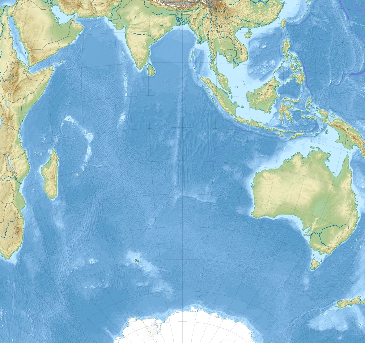
The Andaman Sea, also historically called the Burma Sea, is a marginal sea that forms the southeastern extension of the Bay of Bengal. It lies south of Myanmar, west of Thailand and east of the Andaman Islands and Nicobar group administered by India. As part of the greater Indian Ocean region, the Andaman Sea connects to the Bay of Bengal in the northwest and opens toward the open ocean in the south and southwest. The sea has long been important for regional navigation, coastal livelihoods and island tourism.
Image gallery
10 Images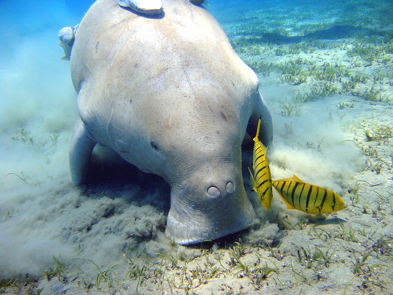


Physical characteristics
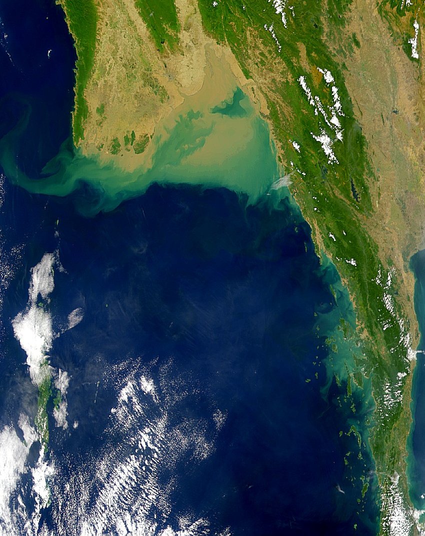
The basin is relatively shallow in its northern and eastern reaches where sediment from large rivers has formed an extensive continental shelf. Overall average depth is near 1,000 metres, but much of the shelf is less than 200 metres deep. Sediment carried by rivers — notably the Irrawaddy — produces silting and complex coastal features; these processes are sometimes described collectively as silt deposition. In contrast, the central and western parts of the sea drop to several thousand metres and include deep submarine valleys cut east of the Andaman–Nicobar ridge. The bathymetry and substrate (sand, gravel and occasional pebbles) influence currents and habitat distribution.
Ecology and natural resources
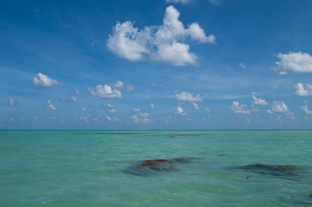
The Andaman Sea supports a diversity of coastal and marine ecosystems. Coral reefs, seagrass beds and mangrove forests provide nursery grounds for fish and invertebrates and sustain local fisheries; some reef sites are well known among recreational divers and researchers alike (coral reefs). Commercial and small-scale fisheries harvest a range of species for domestic consumption and export. The combination of productive coastal waters and island topography also supports migratory birds and marine megafauna, although habitat loss and overfishing have created conservation concerns in parts of the basin.
Human use, hazards and history
Coastal communities and ports around the sea depend on fishing, tourism and maritime trade. Island chains and archipelagos have developed resorts, dive sites and transportation links that attract international visitors. The region is tectonically active: major earthquakes and undersea thrusting can generate tsunamis, as occurred during the 2004 Indian Ocean event that severely affected many coasts along this sea (2004 tsunami). Rivers such as the Irrawaddy drain large inland catchments into the northern sea, influencing sediment budgets and coastal landforms.
Notable features and contemporary issues
Important geographic and human features include island groups, protected marine areas and busy shipping lanes that link regional ports. Examples of well-known island and archipelago groups bordering the sea include the Andaman and Nicobar Islands, Myanmar’s Mergui Archipelago and Thailand’s western seaboard. Environmental pressures include coastal development, unsustainable fishing practices and pollution from shipping and river-borne sediments. International and national authorities work through maritime law, marine protected areas and fisheries management to balance use and conservation.
Further context
- Connection to larger basins: the Andaman Sea sits between the Bay of Bengal to the northwest and the broader Indian Ocean system to the south.
- Regional geography: it borders Myanmar to the north, Thailand to the east and island territories of India to the west.
- Natural hazards and recovery: the coastline experienced intense damage from the 2004 tsunami, prompting improvements in early warning and disaster preparedness.
- Rivers and sediments: major rivers such as the Irrawaddy contribute to the sediment regime and coastal morphology (silt).
- Conservation and tourism: coral reefs (coral reefs) and island ecosystems are both economic assets and conservation priorities.
For readers seeking maps, port information or ecological studies, regional marine institutes and national agencies maintain updated resources and guidelines on navigation, conservation and coastal management; these can be consulted through local government and research portals (India, Thailand, Andaman administrations and others).


Questions and answers
Q: What is the Andaman Sea?
A: The Andaman Sea or Burma Sea is a body of water to the southeast of the Bay of Bengal, part of the Indian Ocean.
Q: Which countries are located around the Andaman Sea?
A: The Andaman Sea is south of Burma, west of Thailand, and east of the Andaman Islands, India.
Q: What is the main use of the Andaman Sea?
A: The Andaman Sea has been used for fishery and transportation of goods between the coastal countries.
Q: What are the popular tourist attractions in the Andaman Sea?
A: The coral reefs and islands in the Andaman Sea are popular for tourism.
Q: What event caused damage to buildings in the Andaman Sea?
A: The 2004 Indian Ocean earthquake and tsunami badly damaged many buildings in the Andaman Sea.
Q: What is the average depth of the Andaman Sea?
A: The average depth of the Andaman Sea is about 1,000 meters (3,300 ft).
Q: What is the deepest point in the Andaman Sea?
A: In a system of submarine valleys east of the Andaman-Nicobar Ridge, the depth is more than 4,000 meters (13,200 ft).
Related articles
Author
AlegsaOnline.com Andaman Sea — Geography, Ecology, and Human Use Leandro Alegsa
URL: https://en.alegsaonline.com/art/3882
Sources
- bse.sci-lib.com : Andaman Sea
- britannica.com : Andaman Sea
- books.google.com : Geothermal energy resources for developing countries
- volcano.si.edu : Barren Island
- volcano.si.edu : Narcondum