
Geological formation (lithostratigraphic unit)
A geological formation is a mappable, lithologically distinct body of rock used in lithostratigraphy to describe, correlate and interpret Earth's layered rock record across regions.
Overview
A geological formation is the basic mappable unit in lithostratigraphy: a body of rock identified and mapped because it displays a consistent set of lithologic characteristics that distinguish it from adjacent rock. The word is often used as rock formation when emphasis is on lithology and mapping rather than age. Formations allow geologists to describe the distribution of rock types and to communicate the spatial patterns of sedimentary, volcanic or other rock bodies.
Image gallery
6 Images


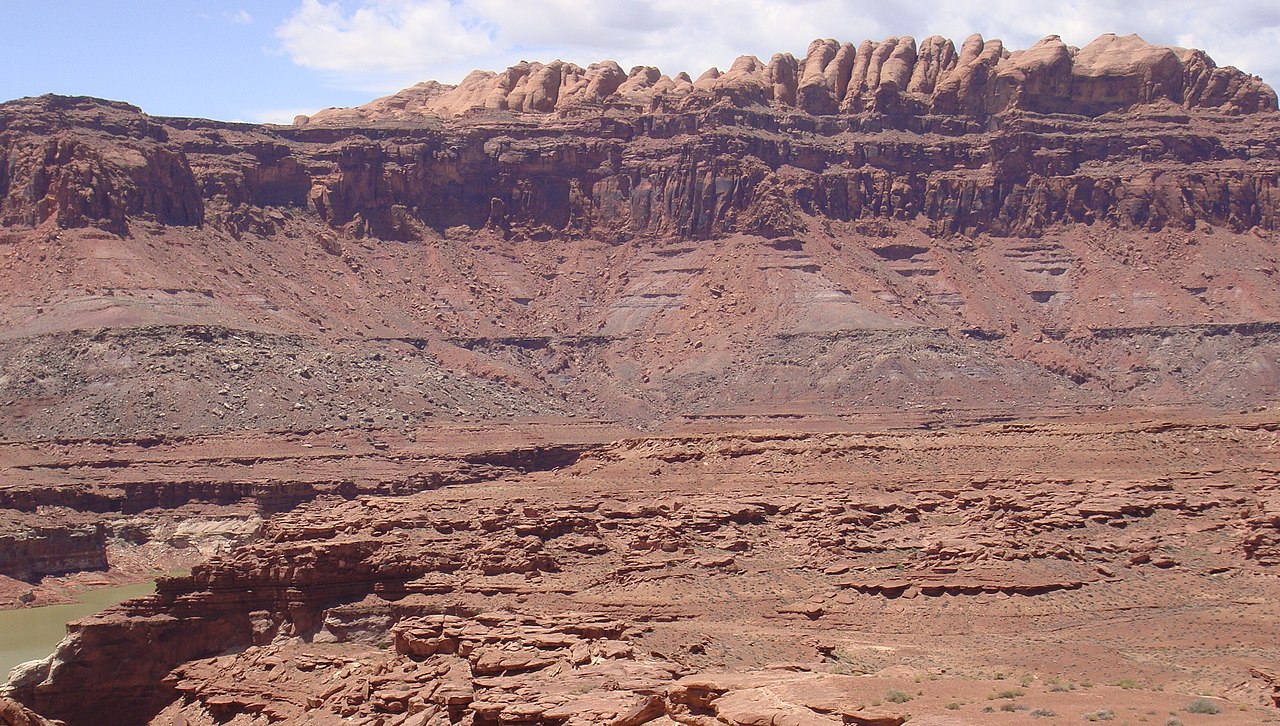

Definition, naming and type sections
Formations are defined by observable properties such as rock type, grain size, color, sedimentary structures or mineral composition. They are commonly named for a geographic locality combined with a lithologic term or the word "Formation". Formal definitions typically include a type section or stratotype — a reference exposure or well interval where the unit is well displayed and described — and descriptive boundaries that can be recognized in the field or in subsurface data.
Hierarchy and subdivisions
Within the standard stratigraphic hierarchy a formation may be subdivided into members and beds where useful, and several formations may be combined into a group or subdivided into a supergroup. This hierarchical arrangement facilitates mapping and correlation. The concept is central to stratigraphy, enabling rock units to be traced and compared across different areas.
Recognition and mapping
Geologists recognize formations in outcrop, in drill cores, and by geophysical logs and seismic data. They trace characteristic rock strata, marker beds, or geophysical signatures that persist laterally. Although some formations are very thick, thickness is not a defining criterion: a formation may be a few metres thick or many hundreds of metres, and its lateral extent can range from local exposures to widespread regional units.
Formation boundaries and correlation
Boundaries between formations are based on changes in lithology or other rock properties. They may be conformable where deposition was continuous, or marked by unconformities where erosion or non-deposition removed time. Correlation of formations between areas uses lithologic similarity, fossil content, and geophysical data. While early geologists sometimes used rock units as time markers through relative dating and the law of superposition, modern lithostratigraphy separates lithologic definition from time, so a formation is defined by rocks, not by an assumed age. For discussions of deep time and the divisions of the Earth's layered record see resources on Earth's history.
Origins and depositional environments
Many formations originate from repeated depositional processes, chemical precipitation, volcanic activity or later alteration. Sedimentary formations commonly record depositional regimes such as rivers, deltas, coastal shelves or deep basins created by ongoing sedimentary deposition in particular environmental settings. Understanding the depositional environments helps interpret facies changes and lateral variation within a formation.
Examples and applied significance
Formations are essential for geological mapping, mineral and hydrocarbon exploration, groundwater studies and engineering geology. A notable example of large-scale, long-lived deposition is the Hammersley region; the Hammersley Basin of Western Australia preserves extensive Precambrian successions in a sedimentary basin setting. Units there record long intervals of Proterozoic deposition and include thick packages of banded iron formation and shale, illustrating how single formation-scale units may represent protracted depositional histories.
Practical notes and standards
- Formations are defined by rock attributes and mapped where their features are practical to trace at a chosen scale.
- Formal naming and boundary definitions follow regional or national stratigraphic codes; informal names are used during preliminary studies.
- Different facies of the same time interval may be assigned to distinct formations if their lithologies differ, reflecting lateral changes in depositional settings.
History of the concept
The practice of naming and correlating rock units developed as geologists organized the layered record and set out to correlate units across regions. Early work used field mapping and the law of superposition to order rock sequences; over time the emphasis shifted to defining units by rock characteristics and standardizing names and type sections for consistent use.
Further reading and resources
For introductory material consult general accounts of rock formations and stratigraphy, and for technical practice see regional geological survey guides. Topics linked above — strata, relative dating, Earth's history, sedimentary deposition, environments, the Hammersley Basin, Western Australia, the Proterozoic, sedimentary basin concepts, banded iron formations and shales — provide entry points to regional examples and technical literature.
Questions and answers
Q: What is a formation?
A: A formation, or rock formation, is the fundamental unit of lithostratigraphy. It consists of a certain number of rock strata that have similar lithology (rocks), sedimentary facies (appearance) or other properties.
Q: How are formations defined?
A: Formations are not defined on the thickness of the rock strata, and the thickness of different formations can therefore vary widely. The concept of formally defined layers or strata is central to stratigraphy.
Q: What are members and groups in relation to formations?
A: A formation can be divided into 'members' and are themselves packed together in 'groups'.
Q: How were formations initially described?
A: Formations were initially described as time markers, based on relative dating and the law of superposition. The divisions of the history of the Earth were the formations described and put in chronological order by geologists and stratigraphers during the 18th and 19th centuries.
Q: How long do environments persist for where sedimentary deposition occurs to form rock formations?
A: Environments where sedimentary deposition occurs to form rock formations may persist for hundreds of millions of years. For example, up to 1200 million years worth sedimentation has been preserved intact in Pilbara's Hammersley Basin in Western Australia. Here, up to 300 million years is represented by a single unit consisting banded iron formation and shale.
Q: Who first studied geological stratigraphy?
A: Geologists and stratigraphers during the 18th and 19th centuries first studied geological stratigraphy by describing various rock formations as time markers based on relative dating principles such as law superposition.
Related articles
Author
AlegsaOnline.com Geological formation (lithostratigraphic unit) Leandro Alegsa
URL: https://en.alegsaonline.com/art/38140