
Gelderland (Guelders) — province in the east of the Netherlands
Gelderland is a large eastern Dutch province known for the Veluwe, major rivers (Rhine, Waal, IJssel), historic cities Arnhem and Nijmegen, varied landscapes and a medieval history as Guelders.
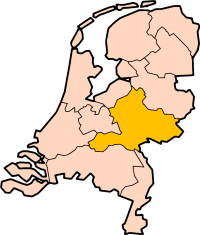
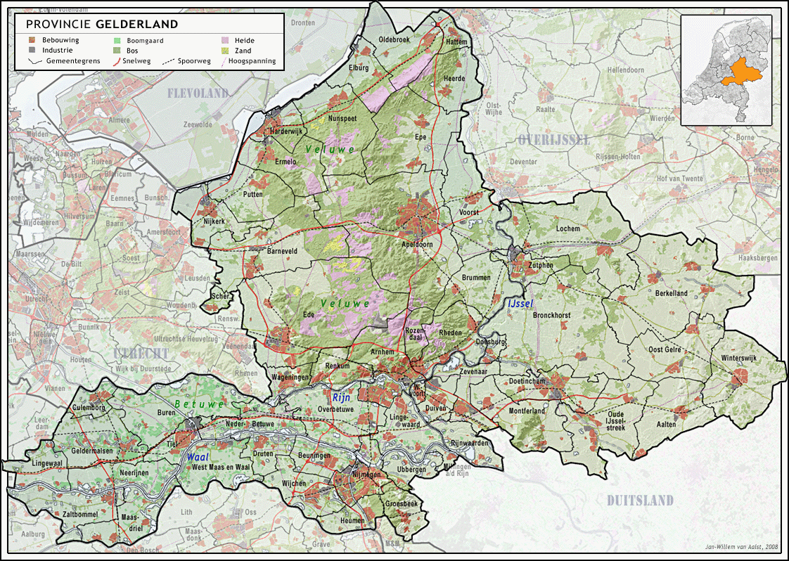
Gelderland, also historically known as Guelders, is a significant province in the eastern Netherlands. It combines extensive natural areas, important river systems and several of the country's oldest cities. Arnhem serves as the official capital, while Nijmegen and Apeldoorn are among the largest urban centers. The province's population is roughly two million people, distributed between city regions, agricultural zones and forests.
Image gallery
8 Images



Principal cities and towns
- Arnhem — provincial capital and administrative center.
- Nijmegen — one of the Netherlands' oldest cities, with Roman roots.
- Apeldoorn — a major inland city known for parks and institutions.
- Zutphen, Doetinchem, Harderwijk and Tiel — other notable municipalities with regional roles.
Geography and landscape
Gelderland is varied geographically: to the west and south it contains riverine floodplains, to the north and center a broad sandy upland called the Veluwe, and stretches of fertile river lands known as the Betuwe. Major rivers that shape the province are the Rhine (Rijn), its distributary the Waal, the IJssel and the Maas along parts of the southern margin. The province borders several Dutch provinces and a German state; these boundaries influence transport and regional cooperation.
- Bordering Dutch provinces: Limburg, North Brabant, South Holland, Utrecht, Flevoland and Overijssel.
- International border: the German federal state North Rhine-Westphalia and neighbouring Germany.
History and development
The name Guelders refers to a medieval duchy that played a role in the Low Countries' history. Over centuries the territory was reshaped by wars, dynastic changes and the growing influence of the Dutch Republic. Many towns in the province have medieval cores, fortifications and churches that reflect this layered past. Modern administrative boundaries were formed later and Gelderland developed into an important mix of urban centres, farmland and protected natural areas.
Economy, transport and land use
Economic activity in Gelderland ranges from agriculture and fruit cultivation in the river areas, to forestry and tourism in the Veluwe, and industry and services in the cities. The dense network of rivers and waterways historically supported trade and remains important for freight transport. Road and rail links connect the province to Amsterdam, Utrecht, and neighboring Germany, making it a transit region as well as a destination.
Nature, culture and notable facts
The Veluwe includes heathland, woodlands and sand drifts and is a major nature reserve attracting visitors for walking, cycling and wildlife observation. Cultural attractions include museums, historic town centres and festivals in Arnhem, Nijmegen and other towns. Flood management and river engineering are important ongoing concerns because of the Rhine and its branches. Gelderland is sometimes noted for being the largest Dutch province by land area and for the variety of landscapes it contains.
For administrative and visitor information see provincial resources and municipal pages (province overview: Gelderland). Additional regional references and travel guides can be found via official city portals and nature organisations.
Questions and answers
Q: What is the capital of Gelderland?
A: The capital city of Gelderland is Arnhem.
Q: How many people live in Gelderland?
A: Approximately 2,097,000 people are living in Gelderland (2021).
Q: What provinces border Gelderland?
A: Gelderland is surrounded by the provinces of Limburg, North Brabant, South Holland, Utrecht, Flevoland and Overijssel and the German federal state North Rhine-Westphalia.
Q: What are some important cities in Gelderland?
A: Some important cities in Gelderland include Nijmegen, Apeldoorn, Zutphen, Doetinchem, Harderwijk and Tiel.
Q: What rivers flow through or border with Gelderland?
A: The most important rivers that flow through or border with Gelderland are the Rhine (Rijn), the Waal, the IJssel and the Maas (border with North Brabant).
Q: How does Flevoland's border with Gelderand differ from other borders?
A: The border between Flevoland and Guelders is formed by a so-called randmeer ("border lake") of the Flevopolder.
Related articles
Author
AlegsaOnline.com Gelderland (Guelders) — province in the east of the Netherlands Leandro Alegsa
URL: https://en.alegsaonline.com/art/37859