Geddes Plan for Tel Aviv
The Geddes Plan (1925–1929) was the first master plan for Tel Aviv, prepared by Sir Patrick Geddes. It shaped the city’s Old North with garden‑city ideas, a street hierarchy, public spaces and zoning.
Introduction
The Geddes Plan is the inaugural master plan for the modern city of Tel Aviv, drawn up between 1925 and 1929 by the Scottish planner Sir Patrick Geddes. Commissioned to guide rapid growth and to extend the early Hebrew neighbourhoods north of the older port town of Jaffa, the plan established a framework of streets, parks, civic sites and residential blocks that formed what is today known as Tel Aviv’s "Old North." The scheme is notable as one of the few of Geddes’ urban proposals that was carried out, more or less, as he intended.
Image gallery
2 Images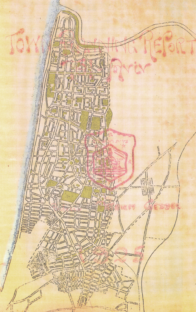

Key principles and design features
Geddes applied a pragmatic, human‑centred approach that combined social observation with practical town planning. Drawing on ideas related to the garden city movement and his own ecological view of cities, he emphasised a balance of built form and open space, a clear street hierarchy, and neighbourhood‑scale amenities. Characteristic elements include modestly scaled blocks grouped around inner courtyards, tree‑lined boulevards and green corridors, dedicated areas for public and civic functions, and generous setbacks to encourage light and ventilation.
- Street hierarchy: a graded system of major boulevards, secondary streets and lanes to organise circulation and development.
- Open space: parks, squares and planted buffers integrated with residential streets to improve quality of life.
- Neighbourhood units: self‑contained residential sectors with local shops, schools and services.
- Human scale: mainly low‑rise buildings and articulated facades that respond to climate and social needs.
History and implementation
In the 1920s Tel Aviv was expanding rapidly as new waves of Jewish immigrants settled in Mandatory Palestine. Geddes was invited to produce a coherent urban plan that would guide this growth while linking the new Hebrew settlement to the older Arabic town of Jaffa. His final proposals, accepted in 1929, provided a spatial framework rather than a prescriptive blueprint: streets, public parcels and broad land‑use principles were set out so that subsequent development could follow a consistent pattern. The area he planned comprises about seven and a half percent of today’s municipal territory and remains recognisable as the city’s historic northern quarter.
Legacy and significance
The Geddes Plan stands as an early example of planned urban expansion in the Middle East and as a practical application of interwar planning ideas. It influenced the physical character of central Tel Aviv and helped shape a civic identity based on walkable streets, green spaces and neighbourhood cohesion. As the city grew, parts of Geddes’ framework were adapted, intensified or replaced, which has prompted ongoing debates about conservation, densification and the value of preserving early‑20th‑century urban form.
Notable facts and contemporary relevance
Geddes himself was a Scottish sociologist, biologist and urban thinker whose work combined cultural, environmental and practical concerns. The Tel Aviv plan is often cited in studies of planned cities because it was implemented to a greater degree than most of his other proposals. Today the Geddes Plan is referenced in discussions about urban heritage, the integration of green infrastructure in dense cities, and how early planning choices continue to influence modern municipal development policy.
For those exploring Tel Aviv’s urban history, the Geddes Plan offers a compact, legible example of how a short, focused master plan can leave a lasting imprint on a city’s form and public life.

Questions and answers
Q: What is the Geddes Plan?
A: The Geddes Plan is the first master city plan for Tel Aviv designed by Sir Patrick Geddes in 1925-1929.
Q: Who designed the Geddes Plan?
A: The Geddes Plan was designed by the Scottish city planner Sir Patrick Geddes.
Q: When was the Geddes Plan accepted?
A: The Geddes Plan was accepted in 1929.
Q: What area of Tel Aviv was originally planned by Geddes?
A: The area of Tel Aviv originally planned by Geddes makes up approximately 7.5% of the current day municipality of Tel Aviv and is now known as Tel Aviv’s “Old North”.
Q: Why was the Geddes Plan designed?
A: The Geddes Plan was designed to be an extension of the much older neighboring Arabic port town Jaffa to the south and a home for the increasing population of Jews emigrating from other parts of the world (predominantly Eastern Europe).
Q: Is Tel Aviv a good example of an early planned city?
A: Yes, Tel Aviv is a good example of an early planned city.
Q: Was the Geddes Plan implemented as originally envisioned?
A: Yes, Tel Aviv turned out to be the only example of one of Geddes’ plans being built largely as he envisaged.
Related articles
Author
AlegsaOnline.com Geddes Plan for Tel Aviv Leandro Alegsa
URL: https://en.alegsaonline.com/art/37822