Amu Darya (Oxus) — Major River of Central Asia
The Amu Darya, historically called the Oxus, is a principal river of Central Asia formed by the confluence of the Vakhsh and Panj; it has shaped regional history, irrigation, and modern environmental challenges.
The Amu Darya is one of Central Asia's principal rivers, rising in the highlands of the Pamir and carrying meltwater westward into what was historically the Aral Sea. Formed where the Vakhsh and Panj rivers meet, it has long been a vital watercourse for irrigation, transport and regional settlement. In classical and medieval sources the river appears under several names and has been central to cultural and political geography across millennia.
Image gallery
10 Images


Characteristics
At roughly a few thousand kilometers in length, the Amu Darya drains a vast interior basin that spans parts of modern Tajikistan, Afghanistan, Turkmenistan and Uzbekistan. Its main upper tributaries are the Panj and the Vakhsh; the combined flow historically reached the Aral Sea, but large-scale diversions have greatly reduced that inflow. The river's regime is dominated by seasonal snow and glacier melt from the Pamir and Hindu Kush highlands, producing higher flows in late spring and summer.
History and names
The river has carried many names. In English and classical sources it is often called the Oxus. Persian and local traditions refer to it as Āmūdaryā; Arabic sources have used names recorded near the medieval period such as Jihôn or Jayhoun; and ancient Near Eastern languages also gave it other designations, reflected in the Hebrew form Gozan. Classical geographers treated it as a major frontier: in Iranian epic and historical literature it marked the boundary between the lands of Iran and the steppe region often called Turan. Later, the river's valley supported important cities along trade routes linking Persia, Central Asia and South Asia.
Uses and human impact
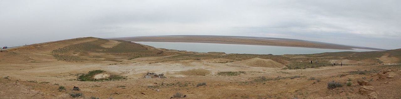
The Amu Darya basin has been intensively cultivated for centuries. In the 20th century large irrigation projects and reservoir construction expanded cotton and cereal production but also altered flow patterns. Hydropower dams on tributaries and the main stem provide electricity and regulation but reduce downstream discharge. Extensive withdrawal for agriculture is one of the principal causes of the Aral Sea's dramatic shrinkage, with consequences including salinization of soils, loss of fisheries and regional climate effects.
Modern significance and issues
Today the Amu Darya remains politically important because it forms portions of international boundaries and because its waters are shared by several states. Transboundary water management, seasonal variability, and the legacy of Soviet-era engineering create ongoing challenges for cooperation, sustainable irrigation and ecosystem restoration. Efforts to balance hydropower, agricultural needs and environmental recovery continue to shape regional policy.
Notable facts and distinctions
- The river's course and distributaries have shifted over time, altering local landscapes and settlement patterns.
- It functions as a cultural and historical landmark in Iranian, Turkic and South Asian traditions.
- Portions of the modern river form borders between Afghanistan and its northern neighbors; see general regional maps for details: Central Asia overview and Iran-related historical context.
Understanding the Amu Darya requires attention to its physical geography, its role in human economies and the complex international governance needed to manage a river that crosses national lines and sustains millions of people.
Questions and answers
Q: What is the Amu Darya river?
A: The Amu Darya is a major river in Central Asia.
Q: What are some of the other names for the Amu Darya river?
A: The Amu Darya is also called Oxus and Amu River.
Q: What countries does the Amu Darya river flow through?
A: The Amu Darya flows through Tajikistan, Afghanistan, Turkmenistan, and Uzbekistan.
Q: How is the Amu Darya formed?
A: The Amu Darya is formed by the junction of the Vakhsh and Panj rivers.
Q: What was the Amu Darya river considered to be in ancient times?
A: In ancient times, the Amu Darya river was regarded as the boundary between Iran and Turan.
Q: What is the meaning of the name "Amu Darya"?
A: "Amu Darya" means "the giver of life" in Persian.
Q: What is the significance of the Amu Darya river in Central Asia?
A: The Amu Darya river is significant for the region as it is a major source of water for irrigation and agriculture, as well as being a transportation and trade route.
Tags
Related articles
Author
AlegsaOnline.com Amu Darya (Oxus) — Major River of Central Asia Leandro Alegsa
URL: https://en.alegsaonline.com/art/3685