Fresno, California
Fresno is the largest city in California's Central Valley, an agricultural and cultural hub near the Sierra Nevada. It serves as a regional center for education, transport, and access to national parks.
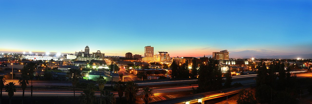
Fresno, California sits near the geographic center of the state in the San Joaquin Valley at the foothills of the Sierra Nevada. As a regional population and economic center, Fresno serves as a trading, education and transportation hub for the surrounding agricultural counties. The city's name—Spanish for "ash tree"—reflects early vegetation along local streams and appears on the municipal flag.
Image gallery
10 Images


Geography and climate
Fresno occupies a broad, flat portion of central California with nearby foothills rising to the east. The climate is characterized by hot, dry summers and cooler, wetter winters; summertime temperatures frequently exceed comfortable levels while winter can bring dense tule fog in low-lying areas. The city's location makes it a common staging point for visitors to nearby national parks, including Yosemite, Sequoia and Kings Canyon.
History and development
The Fresno area was long home to Native American peoples before Spanish and Mexican-era land grants. The modern city grew up in the late 19th century after the arrival of railroad lines and development of irrigation, which transformed the valley into highly productive farmland. Fresno incorporated as a municipality in the late 1800s and expanded through the 20th century with waves of migration, agricultural development and suburban growth.
Economy, education and culture
Agriculture remains the foundation of Fresno's regional economy: the surrounding county ranks among the nation's most productive for fruits, nuts and vegetables. The urban economy also includes education, healthcare, manufacturing and distribution. California State University, Fresno (commonly Fresno State) is a major local institution, contributing to research, athletics and cultural life. The city supports performing arts, museums, festivals and a diverse culinary scene reflecting its multiethnic population.
Landmarks and neighborhoods
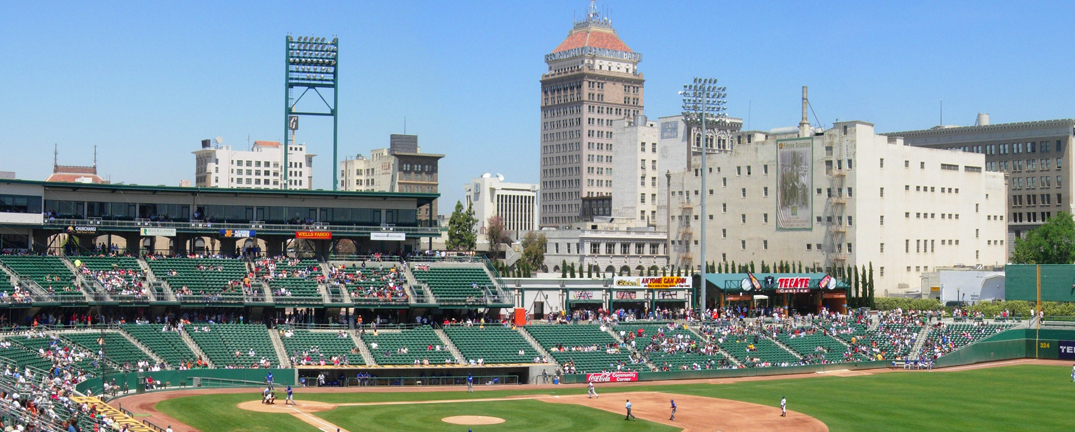
- Downtown Fresno and its civic centers, theaters and growing business district.
- The Tower District, known for nightlife, restaurants and historic architecture.
- Woodward Park, extensive urban green space and the city zoo nearby.
- Access corridors to the Sierra Nevada and nearby national parks that bring tourism and outdoor recreation.
Transportation and notable facts
Fresno is served by highways, a regional airport, freight rail and bus networks that connect it to California's larger metropolitan areas. The city is also notable for its demographic diversity and evolving urban revitalization efforts. While agriculture shapes the surrounding landscape, Fresno itself balances suburban neighborhoods, older urban districts and ongoing projects aimed at improving housing, public spaces and economic opportunity.

Population development
Like many cities in California, Fresno is growing rapidly. Its population more than quintupled between 1950 and 2010. From 1980 to 2010, it more than doubled:
| Year | Inhabitants¹ |
| 1950 | 91.669 |
| 1960 | 133.929 |
| 1970 | 166.655 |
| 1980 | 217.491 |
| 1990 | 355.202 |
| 2000 | 429.583 |
| 2010 | 496.112 |
| 2016 | 522.053 |
¹ 1950-2010: Census results; 2016: US Census Bureau estimate.
History
The original inhabitants of the San Joaquin Valley area were the Yokuts. They traded with other California tribes. Fresno County was formed in 1856 after the California Gold Rush. It was named for the ash trees (Spanish: Fresno) that stood on the banks of the San Joaquin River.
Millerton, near Fort Miller, became the county seat. Other early settlements of the county were Firebaugh's Ferry, Scottsburg, and Elkhorn Springs.
On December 24, 1867, the San Joaquin River overflowed its banks and flooded Millerton. Some residents rebuilt everything, others moved away.
The actual founding of Fresno is credited with the establishment of the Central Pacific Railroad's depot at Easterby's in 1872. They established the first Southern Pacific lines at that time. A business center quickly formed around the railroad station, and Millerton residents began moving near it, partly to escape further flooding. Just two years after the railroad station was built, the township seat was moved there. This was followed in 1885 by the incorporation of the independent city of Fresno. The old parishes of Millerton were flooded with the construction of the Friant Dam and today lie under Millerton Lake.
The central location in the Valley influenced further development. As early as 1910, the California state government decided to build a central road axis, parts of which were designated California State Route 99 in 1926. At that time, ideas for the construction of a transverse axis connecting the coast with Yosemite National Park also emerged. The construction company was formed in 1930, and in 1934 the route was designated California State Route 41. The third route included a connection to the Kings River, which was laid out as early as 1905 - this was extended by 1933 and designated California State Route 180 in 1935. Today, the three state routes encircle the business center of Fresno as a freeway ring - the intersection-free extension with three interchanges was completed by 1980.
The Fresno Municipal Sanitary Landfill was the first modern landfill in the United States. It opened in 1937 and was closed in 1987.
In September 1958, Bank of America introduced a new product called BankAmericard in Fresno. BankAmericard became the first successful credit card, which was spun off to Visa Inc. in 1970.
Related articles
Author
AlegsaOnline.com Fresno, California Leandro Alegsa
URL: https://en.alegsaonline.com/art/36664