Firth of Forth
56.01-3.17Coordinates: 56° 0′ 36″ N, 3° 10′ 12″ W
The Firth of Forth (Gaelic Abhainn Dhubh) is an estuary on the east coast of Scotland and also the mouth of the River Forth on the North Sea. The English word firth means "firth" or "fjord". The channel of the Firth of Forth was formed during the last British Ice Age by the Forth Glacier, which migrated down from the highlands. That is why the Firth of Forth is geologically a fjord. It is approximately 80 km long and up to 21 km wide from the place Kinkardine to the Isle of May.
To the north is the county of Fife, to the south are the counties of East Lothian and West Lothian and the city of Edinburgh. The tides make their presence felt all the way up to Stirling.
On both shores are numerous towns, the petrochemical works at Grangemouth, the port of Leith, the oil rig works at Methil, the shipbreaking plant at Inverkeithing, and the naval dockyard at Rosyth. Other industrial sites are located at Forth Bridgehead, Burntisland, Kirkcaldy, Bo'ness and Leven. Crossing the Firth of Forth are the Forth Bridge railway bridge, opened in 1890, and the Kincardine Bridge road bridge of 1936, Forth Road Bridge of 1964, Clackmannanshire Bridge of 2008 and Queensferry Crossing of 2017.
In 1850 the Firth of Forth was crossed by the world's first railway ferry; the ship was called Leviathan and had 417 gross tons.
In the inner part of the Firth, that is in the area between Kincardine and the Forth Bridges, about half the inlet has been filled in by land reclamation, partly for agricultural but mainly for industrial purposes and as a dumping ground for the coal slag from Longannet Power Station.
Despite heavy industrial use, the Firth is important for nature conservation. The Firth of Forth Special Protection Area is home to over 90,000 breeding seabirds each year. There is a bird watching station on the Isle of May.
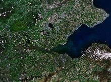
Satellite image of the Firth of Forth
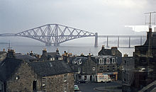
Forth railway bridge 1972
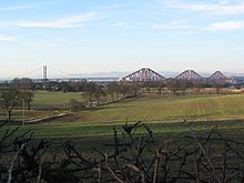
The two Forth bridges
Islands in the Firth of Forth
- Bass Rock
- Craigleith
- Cramond
- Eyebroughy
- Fidra
- Inchcolm
- Inchgarvie
- Inchkeith
- Inchmickery
- Isle of May
- The Lamb
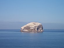
Bass Rock with lighthouse
Towns and villages along the Firth of Forth
North shore
|
|
|
South shore
|
|
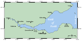
Map of the Firth of Forth
Search within the encyclopedia