Geologic fault — fractures and movement in the Earth's crust
A geologic fault is a fracture in the Earth's crust where blocks of rock have moved. Faults shape landscapes, produce earthquakes, and reveal past tectonic forces and stress regimes.
A fault is a fracture or zone of fractures in the Earth's crust along which there has been measurable displacement of rock on either side. Faults form when stresses in the crust exceed rock strength and produce brittle failure. They occur at many scales, from microscopic cracks to long, complex fault systems that separate large blocks of the lithosphere.
Image gallery
10 Images


Key characteristics and parts
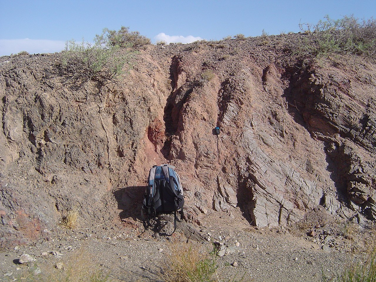
A fault surface where slip takes place is called the fault plane. The angle between that plane and an imaginary horizontal surface is the dip, while the direction of the line formed by the intersection of the fault plane with a horizontal plane is the strike. The block above the fault plane is the hanging wall and the block below is the footwall. Where a fault cuts the ground surface it can produce a steep face or slope known as a fault scarp.
- Materials involved: fractured rock and fault gouge constitute the slip zone; surrounding intact rock is called the wall rock. See rock.
- Driving forces: movement is triggered when shear stress and other stresses overcome friction and cohesion.
- Geometry: dip angle ranges from shallow to steep; the horizontal reference is often implied by an imaginary horizontal plane.
Types and tectonic setting
Faults are commonly classified by the relative motion of the blocks. Normal faults accommodate extension, with the hanging wall moving down. Reverse and thrust faults form under compression and push the hanging wall up. Strike‑slip faults involve predominantly horizontal motion. Faults may occur at plate boundaries or within plates and are a primary mechanism by which crustal deformation is expressed.
Importance and hazards
Active faults are the source of many earthquakes because sudden slip releases stored elastic strain; they therefore are central to seismic hazard assessment and engineering. Faults also influence topography, control the location of springs and groundwater flow, and can host mineral deposits that concentrate ores. Some faults are blind (do not reach the surface), making them harder to detect until they produce earthquakes or are identified by geophysical methods.
In studies and maps, geologists combine field observations, trenching, seismology and remote sensing to characterize fault geometry, activity level, and past slip. Understanding specific faults helps communities plan, design infrastructure, and reduce earthquake risk. For general background on earthquakes see earthquakes and for further technical resources consult lithosphere studies or regional fault catalogs at rock and geoscience portals (stress analysis tools and mapping using a horizontal reference).
Questions and answers
Q: What is a fault?
A: A fault is a fracture, or break, in the Earth's crust (lithosphere).
Q: What happens when sections of rock move past each other?
A: When sections of rock move past each other it can sometimes cause earthquakes.
Q: What causes faulting?
A: Faulting occurs when shear stress on a rock overcomes the forces which hold it together.
Q: What is the name for the fracture itself?
A: The fracture itself is called a fault plane.
Q: How does a fault plane appear at the Earth's surface?
A: When it is exposed at the Earth's surface, it may form a cliff or steep slope called a fault scarp.
Q: What is the angle between the fault plane and an imaginary horizontal plane called?
A: The angle between the fault plane and an imaginary horizontal plane is called the dip angle of the fault.
Q: How are faults categorized?
A: Faults are categorized into three types.
Related articles
Author
AlegsaOnline.com Geologic fault — fractures and movement in the Earth's crust Leandro Alegsa
URL: https://en.alegsaonline.com/art/33670
Sources
- bgs.ac.uk : "3. Structural terms including fault rock terms"
- csmres.jmu.edu : "A primer on Appalachian structural geology"