Ambergris Caye — Belize's largest island and barrier-reef gateway
Ambergris Caye, Belize’s largest island, lies off the northeast coast. Known for its beaches, mangroves and access to the Belize Barrier Reef, it supports tourism, fishing and small-town life.
Overview
Ambergris Caye is the largest island of Belize, located off the northeast coast in the Caribbean Sea. It is administered as part of the Belize District and lies close to the mainland area of the Corozal District. The word caye (pronounced "key") denotes a low island or sand cay. The island’s English name refers to lumps of ambergris that historically washed ashore here; it is a long, narrow island of mostly sandy rim and interior mangrove wetlands.
Image gallery
10 Images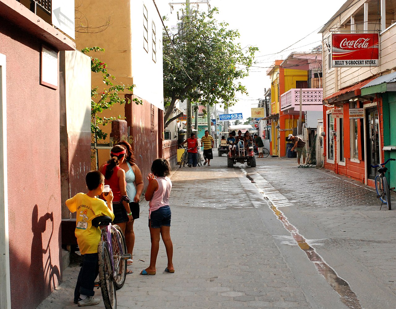


Geography and climate
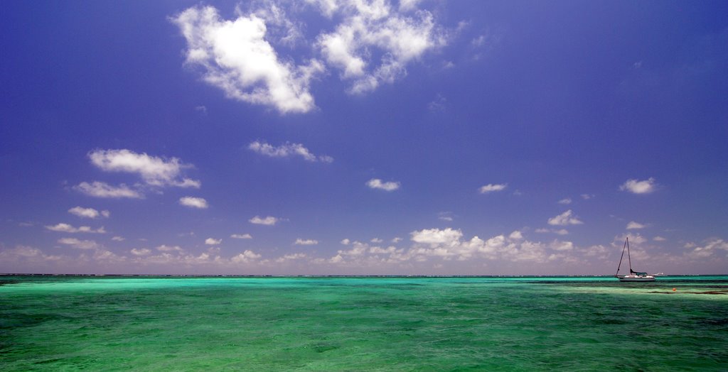
Ambergris Caye stretches roughly 40 kilometres from north to south and is usually only a kilometre or two wide. Its coastal margin consists of white sand beaches backed by mangrove forest and brackish swamp in the interior. Offshore, seagrass beds and coral formations lie close to the shore, directly adjacent to the Belize Barrier Reef, one of the world’s largest coral reef systems. The island experiences a tropical climate with a wet and a dry season, and warm temperatures year-round.
History and culture
There is archaeological evidence of Pre‑Columbian Maya use of Ambergris Caye and nearby cayes; pottery and other remains indicate the islands were part of wider coastal and maritime networks. In later centuries the island supported fishing communities and a modest trading presence; in the 20th and 21st centuries tourism and recreational fishing became dominant economic drivers. The island retains a mixture of Creole, Mestizo and other Belizean cultural influences, visible in local food, music and festivals.
Settlements and population
The principal settlement is San Pedro Town, the island’s largest town and service centre for visitors and residents. Smaller villages, fishing camps and resort developments are scattered along the coast. Local life revolves around fishing, tourism services and small-scale trade.
Economy and tourism
Tourism is the island’s primary economic activity. Visitors come for scuba diving, snorkeling, sport fishing, birdwatching and beach recreation. The proximity of the reef and easy access to well-known marine sites support dive shops, tour operators, guesthouses and restaurants. Local fisheries, including traditional harvests of lobster and conch, remain important to community livelihoods.
Notable sites and marine attractions
- Access to the Belize Barrier Reef, including protected pockets of coral and marine life.
- Popular dive destinations and shallow coral gardens; many visitors also travel to areas renowned for rays and reef fish.
- Beaches and mangrove habitats that support birdlife and nursery grounds for fisheries.
- Comparative reef context: the Belize reef is second only to Australia’s Great Barrier Reef in scale.
Transport and access
Ambergris Caye is served by regular water taxis and private boats from mainland ports and by short domestic flights to the island’s airstrip. Once on the island, travel is often by golf cart, bicycle or small truck rather than large vehicles, reflecting the narrow roads and village layouts.
Conservation and management
Conservation efforts focus on protecting reef health, managing fisheries and conserving mangrove and seagrass habitats that buffer the shoreline. National authorities, local organisations and tourism operators collaborate on marine reserves, visitor guidelines and community-based initiatives to promote sustainable use of natural resources.
Practical information
Visitors should plan for tropical weather, respect marine protected areas and local regulations, and support responsible operators that follow conservation practices. For maps and official references consult island maps and travel guides (map), country context (Belize), coastal and habitat information (mangrove), and local administrative resources (Belize District, Corozal).
Questions and answers
Q: What is Ambergris Caye?
A: Ambergris Caye is the largest island of Belize in the Caribbean Sea.
Q: What does "Caye" mean?
A: "Caye" means an island.
Q: How big is Ambergris Caye?
A: Ambergris Caye is about 40 kilometres (25 mi) long from north to south, and about 1.6 kilometres (1 mi) wide.
Q: How did Ambergris Caye get its name?
A: Ambergris Caye was named after large lumps of ambergris which washed ashore there.
Q: What was the Maya community on Ambergris Caye known for?
A: The Maya community on Ambergris Caye was known for making polished red ceramics during Pre-Columbian times.
Q: What is the largest settlement on Ambergris Caye?
A: San Pedro Town is the largest settlement and only town on Ambergris Caye.
Q: What are the main attractions of Ambergris Caye?
A: The main attractions of Ambergris Caye are the Belize Barrier Reef and its beaches, with the barrier reef being the second-largest in the world after the Great Barrier Reef of Australia.
Related articles
Author
AlegsaOnline.com Ambergris Caye — Belize's largest island and barrier-reef gateway Leandro Alegsa
URL: https://en.alegsaonline.com/art/3286
Sources
- commons.wikimedia.org : Ambergris Caye