Estuary: Coastal Zones Where Freshwater Meets the Sea
An estuary is a semi-enclosed coastal water body where freshwater and seawater mix, producing brackish conditions that support productive ecosystems, fisheries, and coastal protection.
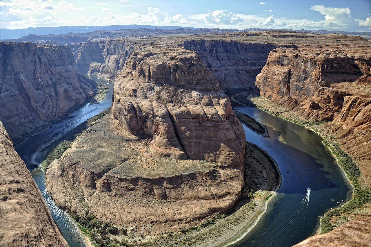
An estuary is a transitional zone where a river flows into a larger body of saltwater such as the sea or ocean. In that zone freshwater from land mixes with tidal saltwater to create gradients of salinity, sediments and nutrients. These gradients make estuaries among the most biologically productive places on Earth and important hubs for fish, birds and other wildlife.
Image gallery
10 Images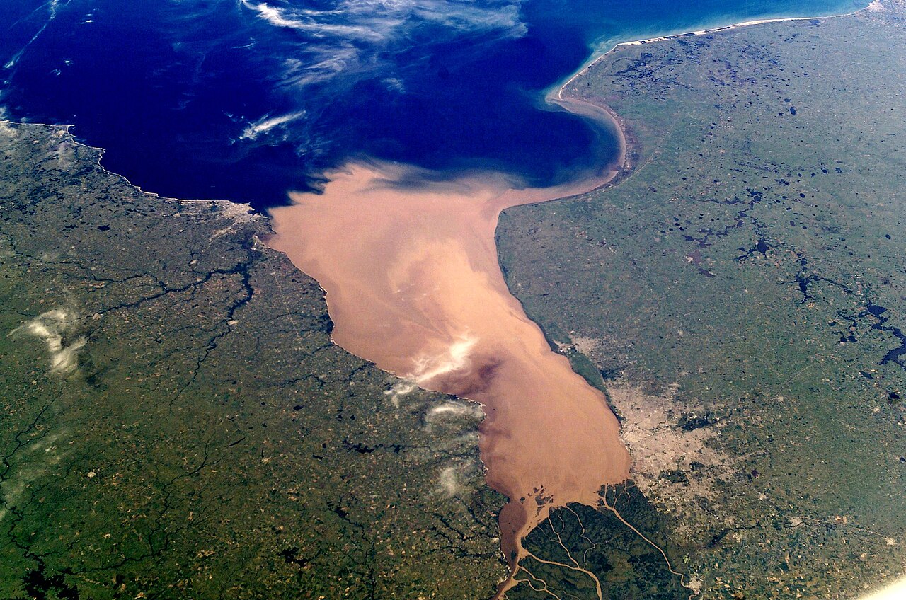


Key characteristics
Estuaries are defined by several interacting features: tidal influence, variable salinity (commonly called brackish water), high rates of sediment deposition and complex habitats such as mudflats, channels and wetlands. Many estuaries are visually winding as rivers meander across the lowland before meeting the sea. Vegetated wetlands that border estuaries include coastal marshes (marshes) and, in some regions, wooded wetlands or swamps. The local climate—temperate, tropical or polar—shapes the dominant plants and animals found there.
Formation and types
Estuaries form through different geologic processes. Common types include drowned river valleys (formed when rising sea level floods a river mouth), bar-built estuaries behind sandbars, fjord-type estuaries carved by glaciers, and tectonic estuaries formed by land subsidence. Unlike deltas, which typically have multiple distributary channels and build outward into a sea, many estuaries have a single main outlet that connects the river and ocean and often collect fine sediments transported from inland.
Ecological and human importance
Ecologically, estuaries function as nurseries for commercially important fish and shellfish, provide feeding and resting areas for migratory birds, and support diverse plant communities that stabilize shorelines. For people, estuaries supply fisheries, transportation routes, recreational spaces and natural filtration of pollutants. Many cities and ports developed on estuaries because of their protected waters and access to inland rivers—for example, Chesapeake Bay is a large estuary system where multiple rivers drain into the Atlantic Ocean.
Threats and conservation
Estuaries face pressures from land-use change, nutrient and chemical pollution, dredging, and rising seas. Excess nutrients can cause algal blooms and oxygen loss, degrading habitat. Conservation measures include protected areas, habitat restoration, pollution controls and sustainable fisheries management. Maintaining estuarine health benefits biodiversity, coastal resilience and local economies.
Notable distinctions and facts
- Estuaries are distinct from open coasts because of their semi-enclosed nature and freshwater input.
- The salinity in an estuary varies with tides, river flow and seasons; organisms there are adapted to changing conditions.
- Because of high productivity, estuaries often rank among the most valuable ecosystems per unit area for fisheries and wildlife.
Understanding estuaries requires integrating hydrology, geology, ecology and human uses. Their complex dynamics and central role in coastal systems make them a priority for study and stewardship in a changing climate.

Origin and characteristics
Funnel-shaped estuaries
Typical estuaries are formed under the influence of tidal currents, whereby the river mouth is widened in a funnel shape (funnel estuary): In these tidally influenced transition zones between marine and fluvial areas, the tides cause a pendulum motion of often greater volume than the seaward discharge of the river water. The high flow velocities associated with the pendulum motion ensure that erosion is greater than sedimentation. The heavy salt water advances wedge-shaped into the river from the sea at high tide and is overlain by the fresh water of the river. In the process, the strong tidal flow erodes the riverbed and banks, and much material is transported upstream.
This material cannot be removed by the usually weaker ebb current. For this reason, delta formation can occur at the upper end of estuaries. A remnant of such a delta is the branching of the Elbe into the Norderelbe and Süderelbe in Hamburg. Shipping has used estuaries as natural harbours for centuries. Here, ships were protected from storms and pirates. Before motorisation, vessels were driven by the tidal current to the harbour towns, which were usually founded at the inner end of the funnel and, being located in the middle of the country, had a large catchment area. Although not quite as confusing as deltas, estuaries also mostly require pilots.
Due to the Coriolis force, seawater is deflected clockwise in the northern hemisphere and counterclockwise in the southern hemisphere. Depending on the geographical conditions, the riverbanks can be affected differently by erosion and sedimentation.
In the Amazon, the flood flow can be traced up to about 870 km from the coast.
| Characteristics of four German estuaries flowing into the German Bight | ||||
| Eider | Elbe | Weser | Ems | |
| Catchment area above the dam [10³-km²]. | 02 | 135 | 038 | 013 |
| Mean water discharge rate [m³/s] | 23 | 725 | 323 | 125 |
| Mean tidal range in the area of the weir [m]. | 02 | 002,4 | 004,1 | 002,8 |
| Length of inner estuary [km] | 21 | 120 | 070 | 050 |
Lagoon estuaries
On coasts without a significant tidal range, the current acceleration caused by the tides is missing. The defining feature "exposed to the tide" is therefore missing. Here, the slowing of the current dominates at river mouths. Dunes on the coast form an additional flow obstacle. On uplift coasts, sedimentation in the accumulation area leads to rapid siltation and thus to delta formation. On subsidence coasts, sedimentation is compensated for by the continuous rise in sea level, especially in rivers with a low bedload. This results in microtidal estuaries, not funnel-shaped but lagoon-shaped, such as the Lower Warnow and the Szczecin Lagoon at the mouth of the Oder. Bays formed during the ice age can also become estuaries, such as Traveförde in the Trave estuary.
Water quality
Estuaries, like deltas, are characterized by the transition of freshwater to saltwater (brackish water), a material load resulting from the movement of water. This depends on the flow velocity of the outflowing freshwater of the river in relation to the tide and the amount of saltwater flowing up with it. The tide in turn depends on the position of the moon (see spring tide, neap tide) and the respective weather conditions (possible storm surge) and thus also results in a very individual change of flora and fauna from the river area to the sea due to the resulting average water temperature.


Rivers with estuaries
Estuary funnel
America
- Amazon - its northern estuary combined with a forming underwater delta
- Hudson
- Río de la Plata - common estuary of Paraná and Uruguay
- Saint Lawrence Current
Africa
Asia
Australia
The southeastern Australian state of New South Wales has more than 170 estuaries along more than 1100 kilometers of coastline. Since 2006, the state has been comprehensively measuring the water temperature in 1 m water depth. This shows that the brackish water is warming at an above-average rate in the wake of man-made global warming: by almost 2.2 ° in less than 12 years.
Europe
France
- Scheldt
- Loughor
- Mersey
- Thames
- Conwy
Estuarine Lagoon
- Jeja
- Cameroon Estuary
- Cuban
- Oder / Szczecin Lagoon
- Trave
- Warnow
Transitional forms

Related articles
Author
AlegsaOnline.com Estuary: Coastal Zones Where Freshwater Meets the Sea Leandro Alegsa
URL: https://en.alegsaonline.com/art/32330