Erfurt — Capital of Thuringia, Germany
Erfurt is the capital of Thuringia in central Germany, known for a well-preserved medieval centre, the River Gera, university traditions and key cultural and transport roles in the region.
Overview
Erfurt is the capital city of the German state of Thuringia and a regional centre in central Germany. The city covers about 269.17 km² and the River Gera flows through its urban area. In recent decades the municipality has had a population of roughly 210,000 inhabitants (reported in 2015). Erfurt combines administrative functions with commerce, education and cultural life.
Image gallery
10 Images


Geography and urban character
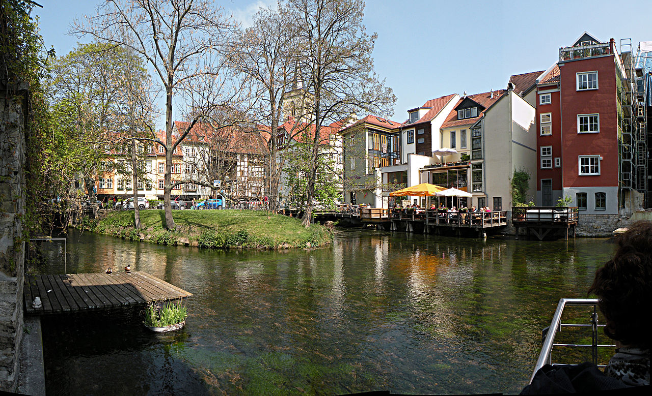
Located in a broad basin of Thuringia, Erfurt's layout blends an intact medieval core with residential quarters and modern developments. Narrow streets and historic squares sit beside parks and riverfront promenades. The city's form reflects centuries of continuous settlement and adaptation to changing transport and housing needs.
History and development
Erfurt developed into an important medieval market and ecclesiastical centre, benefiting from trade routes across central Germany. It acquired municipal privileges in the Middle Ages and later became a seat of learning and religious life. Over time Erfurt expanded beyond its medieval walls, integrating industry and modern infrastructure while preserving many historic buildings.
Landmarks and cultural life
The city is known for a well-preserved old town and notable monuments. Key sites include:
- Erfurt Cathedral and the adjacent Severikirche, dominating the cathedral hill.
- The Krämerbrücke, a bridge historically lined with shops and houses.
- Historic monasteries and the university area associated with religious and intellectual history, where figures such as Martin Luther studied.
These places are focal points for festivals, museums and everyday cultural activity, and they attract regional tourism and scholarly interest.
Economy, education and transport
Erfurt combines public administration with education, services and light industry. Its university and research institutions contribute to academic life and innovation. The city is an important transport hub in Thuringia, with rail and road links that connect it to larger German cities and regional centres. Visitors and residents typically access municipal services, cultural venues and green spaces across a compact urban area.
Notable facts and distinctions
As the state capital, Erfurt hosts regional government institutions and cultural organizations, giving it political significance beyond its size. The River Gera remains a central element of its identity, and the preservation of the historic centre is often cited as one of the city's distinguishing features. For official information about municipal services and tourism consult the city portal listed as the capital's official site or regional resources at area information and visitor guides linked via population and statistics. Additional cultural and travel details can be found through local tourism pages and academic sites (river and geography, state resources).

Geography
Erfurt lies on the southern edge of the Thuringian Basin, in the wide valley of the Gera, a tributary of the Unstrut. In the south, the city area is bordered by the wooded heights of the Steigerwald. The largest extension of the city area is 21 km from north to south and 22.4 km from east to west. Due to the location of the city in the transition from the Thuringian Basin to the foothills of the Thuringian Forest, the altitude in the urban area varies between 158 m above sea level in the north and 430 m above sea level in the southeast. The city area is drained to different rivers: the Nesse drains the western districts to the Weser, while Gera and Gramme drain the middle and east of the city to the Elbe.
Neighbouring cities are Weimar in the east, Gotha in the west, Arnstadt in the south and Sömmerda in the north, each about 20 kilometres from Erfurt. The nearest major cities are Leipzig (95 kilometres northeast), Halle (85 kilometres northeast), Jena (40 kilometres east), Kassel (110 kilometres northwest), Göttingen (95 kilometres northwest), Frankfurt am Main (180 kilometres southwest) and Nuremberg (160 kilometres south, distances as the crow flies). Since Erfurt is only about 50 kilometers southeast of the center of Germany, it is the central major city of the country. Like most major cities in eastern Germany, the city does not have a particularly pronounced suburban belt and is not located in a metropolitan area. However, the links to the large neighbouring cities of Weimar and Jena are close in many areas, which is also expressed in various regional cooperations. A term for cities such as Erfurt, which are not the centre of a metropolitan region, but which also have more functions than a normal regional centre, is that of the regiopole.
The relatively dense development of the city centre can be attributed to the fact that comparatively few buildings were destroyed in Erfurt during the Second World War and these gaps - in contrast to many other large cities - were mostly built on again. The local recreation areas in Erfurt are therefore almost exclusively located on the outskirts of the city, such as the Steigerwald, the Nordstrand or the ega Park. In addition to the Steigerwald, there are two other forests in the city area, the Willroder Forst in the southeast near Windischholzhausen and the forests in the Schaderoder Grund above Tiefthal in the northwest. The remaining undeveloped area is mainly used for agriculture, as the fertile soils are suitable for high-yield farming. The only major bodies of water are the Erfurt Lakes, a series of flooded gravel pits near Stotternheim in the north of the city.
Extension of the urban area
Until the abolition of the Erfurt fortress by the Prussian government in 1873, the built-up area of the city was within the city fortifications dating from the 14th century. The city fortifications surrounded Erfurt in a circle and had numerous gates, which gave their names to the suburbs that later developed outside. Erfurt's fortifications also included the Petersberg citadel and the Cyriaksburg citadel as well as two city ditches (the Wilde Gera in front of the inner wall, now filled in, and the Flutgraben in front of the outer wall). The centre of this "old Erfurt" was the fish market. Between 1873 and 1918, an unbroken belt of Wilhelminian quarters formed around the Old Town, the middle-class quarters being Löbervorstadt and Brühlervorstadt in the southwest and the working-class quarters being Krämpfervorstadt and Johannesvorstadt in the northeast. Daberstedt and Andreasvorstadt were partly middle-class and partly working-class. This ring of old buildings in the Prussian style is still completely preserved today, which is relatively rare in Germany. In addition, the largest suburb grew in the north of the city: Ilversgehofen with over 12,000 inhabitants (1910), which was incorporated in 1911. In the period up to 1945, further residential quarters were built in the north and southeast, so that the round city became an "elongated" one.
In GDR times, the city first grew to the north, where from 1969 the residential area Erfurt-North, consisting of Rieth, Berliner Platz, Moskauer Platz and Roter Berg was built. From 1979 onwards, Erfurt-Southeast, consisting of Herrenberg, Wiesenhügel and Melchendorf with the prefabricated housing areas Drosselberg and Buchenberg, was built. After reunification, new settlements of detached and terraced houses were built on the Ringelberg and in the surrounding villages, which had been incorporated in 1950 and 1994. In the prefabricated housing areas, an emigration trend to the inner city, surrounding villages or the old federal states became noticeable from 1990 onwards, so that several prefabricated buildings had already been demolished in these parts of the city. New green spaces were created in these places.
Neighboring communities
The following municipalities border the city of Erfurt. Clockwise, starting in the east, these are:
- in the administrative district of Weimarer Land: Grammetal and Klettbach (the latter belongs to the administrative community of Kranichfeld)
- in the Ilm district: Amt Wachsenburg
- in the Landkreis Gotha: Nesse-Apfelstädt as well as Nottleben, Zimmernsupra and Bienstädt (Verwaltungsgemeinschaft Nesseaue)
- in the administrative district of Sömmerda: Witterda (fulfilling municipality is Elxleben), Elxleben, Walschleben (administrative community Gera-Aue), Riethnordhausen (administrative community Straußfurt) as well as Nöda, Alperstedt, Großrudestedt, Udestedt, Kleinmölsen and Großmölsen (all administrative community Gramme-Vippach)
Town structure and population distribution
→ Main article: List of districts of Erfurt
The urban area of Erfurt is divided into 53 districts. 44 of these also form a district within the meaning of § 45 of the Thuringian Local Government Code. The districts were established by the main statutes of the city of Erfurt. These are predominantly spatially separated villages, which were formerly independent municipalities. For 38 districts there is in each case a district council elected by the people on the occasion of a citizens' assembly, which has between four and ten members depending on the number of inhabitants. In each case three local parts form a common local part council with neighbouring local parts. The chairman of this body is the district mayor, who is also elected by the people. The local district councils are to be heard on all matters concerning the local district and can decide on their own authority on matters whose significance does not go significantly beyond the local district.
The population of Erfurt is roughly divided into three types of settlements: (old) urban parts, Plattenbau areas and villages (all incorporated localities except Melchendorf and Ilversgehofen). In 2010, 51.9% of the population lived in urban parts, 26.5% in Plattenbau areas and 21.4% in villages. In 1990, only 48% of the inhabitants lived in urban parts, 40% in prefab areas and only 12% in villages (the 1994 incorporations are already included here). Most of the urban districts, however, combine two completely different types of settlement: densely built-up districts of tenement houses (built between 1873 and 1940; the population density of these areas is around 15,000 inhabitants per square kilometre) and old new buildings (around 1950 to 1970) bordering the old town, and on the other side a little further out of town single-family housing estates (built from around 1920 onwards) with a low population density. Overall, however, Erfurt has a very compact structure compared to other German cities of the same size. Thus, the majority of the population is concentrated in the old town and the immediately adjacent Gründerzeit belt of apartment buildings. This concentration towards the city centre has increased significantly since 2000. On the one hand, the wave of suburbanisation triggered by reunification ebbed away, on the other hand, inner-city redevelopment measures progressed, and thirdly, the peripheral prefabricated housing areas shrank continuously. On the other hand, the area belonging to the city of Erfurt is very large, which is why the population density in relation to the total city area is the third lowest among major German cities after Wolfsburg and Salzgitter. Erfurt's extensive rural catchment area has a certain tradition; the city council built up extensive municipal land holdings as early as the Middle Ages, so that most of today's districts have been under the control of the Erfurt council for the longest period of their history (with interruptions in the 19th and 20th centuries). There are eight housing cooperatives in Erfurt, which own a comparatively high proportion of the housing stock. In contrast, the proportion of single-family houses is low. In the city area proper, excluding the incorporated villages, only 5784 (just under 6.4%) of 91,011 dwellings were in single-family houses in 2009, compared to a national average of about 28.3%. The foreign population was 6.1% in 2015 (3.8% in 2012) with Eastern Europe, Central Asia and Vietnam as the main regions of origin. Neighbourhoods with a prominent ethnic infrastructure (e.g. migrant retail, services) are located, for example, around Schmidtstedter and Trommsdorffstraße in the south-east of the old town, and to some extent along Magdeburger Allee in Ilversgehofen.
The urban morphology of Erfurt leads to a very high social segregation between residential areas. Thus, the cheap housing is found in prefabricated housing, which in Erfurt (unlike, for example, in Dresden or Magdeburg) was almost exclusively built separately from other types of construction and in spatial concentration on the periphery, and thus has only a low attractiveness compared to old buildings near the centre. A 2018 study found a segregation index of 38.9 related to households dependent on unemployment benefit II in 2014. This put Erfurt in joint top position with Rostock, Erlangen and Potsdam among major German cities, with the average for all major cities being 26.6. The social segregation of the city continues to increase, with the proportion of households dependent on social benefits falling from 19.6% to 12.4% between 2005 and 2014 in old urban districts, but only from 31% to 30.2% in prefabricated urban districts. The segregation of rich households is also comparatively high; these are concentrated in a few residential locations in the Brühlervorstadt and Löbervorstadt districts, as well as in upscale new construction in gaps in the old town.
Climate
Erfurt's climate is characterized by its location on the southern edge of the Thuringian Basin and the surrounding low mountain ranges of the Harz and Thuringian Forest. The lee effect of these mountains, some of which are over 1000 meters high, results in a climate that is quite dry for Central Europe. While the relatively flat areas of the city centre and the northern parts of the city have a fairly uniform climate, local climatic peculiarities arise in the southern parts of the town, such as Bischleben or Molsdorf, due to the mountain ranges Fahner Höhe and Steigerwald, which tower over the city centre by about 150 metres.
The average annual temperature in Erfurt from 1961 to 1990 was 7.9 °C, with the mean daily maximum temperature in January being +2 °C and the mean minimum temperature being -2 °C. In July, the mean maximum temperature is 24 °C and the mean minimum temperature is 14 °C. The average annual precipitation in the period mentioned was 500 mm, making Erfurt one of the driest major cities in Germany, along with Halle and Magdeburg. The precipitation total falls into the lower twentieth of the values recorded in Germany. Lower values are recorded at only one percent of the measuring stations of the German Weather Service. The driest month is January, the most precipitation falls in June. In June, 2.7 times more precipitation falls than in January, which means that precipitation varies greatly. Lower seasonal variations are recorded at 68% of the monitoring stations. The number of annual sunshine hours is about 1600 and is about 50 hours higher than the values of the immediate surroundings, due to the heat development of the city. The average wind speed is about 6 m/s in winter, decreasing to 4 m/s in summer. The main wind direction is southwest. The values originate from the Erfurt weather station in the Bindersleben district at an altitude of 315 m above sea level; it is supposed to be representative for the natural region of the Thuringian Basin. Since Erfurt's city centre is only 200 metres above sea level, it can be assumed that the temperature values there are on average about one Kelvin higher, also due to the warming effect of the city itself.
| Erfurt | ||||||||||||||||||||||||||||||||||||||||||||||||
| Climate diagram | ||||||||||||||||||||||||||||||||||||||||||||||||
| ||||||||||||||||||||||||||||||||||||||||||||||||
| Monthly average temperatures and precipitation for Erfurt
Source: | ||||||||||||||||||||||||||||||||||||||||||||||||||||||||||||||||||||||||||||||||||||||||||||||||||||||||||||||||||||||||||||||||||||||||||||||||||||||||||||||||||||||||||||||||||||||||||||||||||||||||||||||||||||||||||||||||||||||||||||||||||||||||||||


History
→ Main article: History of the city of Erfurt
Early history
Traces of the first settlements in the current city area can already be found from prehistoric times. Archaeological finds in the north of Erfurt bear witness to human traces from the Palaeolithic period around 100,000 BC. Further finds in the Erfurt-Melchendorf pit prove settlement in the Neolithic period.
To the west of Erfurt, a large Germanic settlement existed in the centuries AD. It was cut open in 2000 during the construction of the federal motorway 71 and about half of it was excavated between 2001 and 2003 (Erfurt-Frienstedt). For 480, the Germanic collective of the Thuringians (Thuringi) from Hermundurians, Angles and Warns in the Erfurt area has so far been documented by lore, without any archaeological finds being found for the 4th to 10th centuries. From the Roman period, on the other hand, almost 200 coins were found dating back to the 3rd century, as well as 150 Roman pottery fragments and more than 200 fibulae. In addition, there are eleven inhumation graves of the Haßleben-Leuna group.
In the aforementioned Germanic settlement, the Frienstedt site near Erfurt, the oldest Germanic word discovered in central Germany, written in runic script, was found on a comb from a sacrificial shaft: "kaba" (pronounced: kamba; comb).
Medieval
The oldest known documentary mention of Erfurt is found in a letter of Boniface, anno 742 as missionary archbishop to Pope Zacharias II, in which he asks him to confirm the bishops he consecrated and the bishopric seats he established, namely "... the third in the place, (in loco) which is called 'Erphesfurt', which has already been a fortified settlement (urbs) of pagan peasants before times..."
The thus founded bishopric of Erfurt was already united with that of Mainz in 755, when Boniface became archbishop of Mainz. The reasons for this are unclear, possibly the border proximity to the Saxons and Slavs played a role. At the latest with the founding of the bishopric, there must also have been an episcopal church and it can be assumed that this was a precursor church of today's cathedral on the Domberg. In 805 Charlemagne declared Erfurt to be one of the border trading places, not far from the border of the then Frankish Empire. Erfurt had a royal palace under the Carolingians and Ottonians, which is assumed to be safely located on today's Petersberg. In the 10th century Erfurt came under the secular rule of the archbishops of Mainz, which lasted until the Imperial Deputation in 1803.
In the Middle Ages, Erfurt was a staging post on the once important east-west long-distance trade route, the trade fair route from Leipzig via Cologne to the Duchy of Brabant, which is why it is also called the Brabant Road.
Erfurt has preserved outstanding evidence of Jewish culture from the high and late Middle Ages. These include the OldSynagogue, whose construction began in 1094, making it the oldest surviving synagogue in Europe. The adjacent mikveh, dating from the 13th century, is also one of the oldest in Europe. In 1998, a Jewish treasure was found during excavations in Michaelisstraße, the contents of which are among the most important testimonies to Jewish medieval culture in Europe. The first Jewish community came to an abrupt end with a plague pogrom in 1349. From 1354 a second Jewish community arose until the Erfurt council withdrew the protection of the Jews in 1453/54 and forced them to emigrate. It was not until the 19th century that Jews again settled in the city.
With a population of around 18,000 to 20,000, the city developed into a major medieval city in the 14th and 15th centuries, surpassed in size only by Cologne, Nuremberg and Magdeburg. Erfurt thus reached the peak of its economic, political and intellectual-cultural development in the Middle Ages and became the centre of trade in the central Holy Roman Empire. This included Erfurt's development into one of the largest woad markets in the empire, which began as early as the 13th century. In 1331 Erfurt received the trade fair privilege from Emperor Ludwig IV.
Already in the 13th century, the city had grown into an educational centre of far-reaching importance. No other city in Germany had more students in the second half of the 13th century. In the first half of the 14th century, the Erfurt Studium generale developed into the most important educational institution in the Roman-German Empire. In 1392 the city - and not the archbishop - opened the third university on German soil, which with its founding privilege of 1379 can also be considered the oldest.
early modern period
One of the most famous graduates of the University of Erfurt was Martin Luther, who studied here from 1501 to 1505 and received his master's degree from the Faculty of Philosophy. During the Reformation, the majority of the city turned to the Lutheran confession. In 1521, the first Lutheran pastor, Georg Petz, was appointed. The Erfurt council signed the Lutheran Formula of Concord of 1577.
On April 21, 1618, a treaty was signed between the Archbishop of Mainz, Johann Schweikhard von Cronberg, and the city of Erfurt, which confirmed the religious freedom already granted earlier and expressly extended it to the Erfurt countryside. As for the legal status of the city, it was stipulated that it was the property of the Archbishopric of Mainz and renounced any imperial status. The Thirty Years' War severely damaged the city. Erfurt was occupied by the Swedes from 1632 to 1635 and from 1637 to 1650. The Peace of Westphalia did not bring the city the hoped-for imperial freedom. This again triggered years of conflict.
In 1664, French and imperial troops of the Elector of Mainz and Archbishop Johann Philipp von Schönborn conquered the city. This restored Electoral-Mainzian rule. Erfurt was now ruled as the capital of the Erfurt State together with the Eichsfeld by a Mainz governor, who had his seat in the Elector Mainz Governor's Office (today's State Chancellery). In order to prevent further uprisings and as protection against the Protestant powers, the Elector Palatine and Archbishop, Johann Philipp von Schönborn, had a citadel built on the site of the Petersberg.
In 1682 and 1683 Erfurt experienced the worst plague years in its history; in 1683 alone more than half the population succumbed to the deadly disease.
In Erfurt, witch hunts are known from 1526 to 1705. Trial records are only incompletely available. Twenty people were put on witch trials, at least eight people were killed. In 1705, the 42-year-old goose herder Anna Martha Hausburg from Mittelhausen was tortured, beheaded and then burned. Her 7-year-old daughter Katharina Christina had to watch her mother's execution.
19th century
In 1802, in accordance with the Reichsdeputationshauptschluss, the city and countryside of Erfurt came to Prussia as compensation for lost territories on the left bank of the Rhine. After Napoleon's victory over Prussia at the Battle of Jena and Auerstedt, French troops occupied the fortress without a fight on 16 October 1806 after its surrender. In 1807 Napoleon declared Erfurt together with Blankenhain as the Principality of Erfurt an imperial domain, which was not part of the Confederation of the Rhine but directly subordinate to it.
In 1814, after a successful siege of Erfurt by Prussian, Austrian and Russian troops, the French occupation ended, and in 1815, as a result of the Congress of Vienna, Erfurt was once again awarded to Prussia, which ceded most of its territory and the Blankenhain area to Saxony-Weimar-Eisenach. The hardship prevailing at the time was alleviated by British aid money, which also benefited war orphans in particular and was part of the first ever major humanitarian aid campaign. With the establishment of important engineering companies, Erfurt became an important industrial location at the end of the 19th century. Horticulture and seed breeding are still of particular importance today. Native Erfurt residents owe the nickname "Puffbohne" (broad bean) to this. The company "N.L. Chrestensen" has played an important role here since 1867. Around 1900 the commercial horticulture of the "flower city" Erfurt had a leading position worldwide.
20th century
In 1906, Erfurt became a major city with 100,000 inhabitants. The First World War cost the lives of 3579 citizens. When the state of Thuringia with the state capital Weimar was formed in 1920, the Prussian areas of Thuringia including Erfurt were not included due to the resistance of the Prussian government. These, like Erfurt, belonged in part to the province of Saxony. On 26 June 1921, the Thuringian Traditional Costume and Heritage Festival was held in Erfurt.
After positive development from 1923 to 1928, the city was massively affected by the world economic crisis from 1929.
In 1933, the NSDAP took control of the city. In 1938 Erfurt was one of the largest garrisons in the German Reich.
On Reichspogromnacht, the Great Synagogue was burned down and the deportation of the approximately 800 Jewish residents began. The Memorial Book of the Federal Archives for the Victims of the National Socialist Persecution of Jews in Germany (1933-1945) lists by name 447 Jewish residents of Erfurt who were deported and mostly murdered.
Between 1939 and 1945, between 10,000 and 15,000 prisoners of war as well as men and women from numerous countries occupied by Germany were forced to perform forced labor, primarily in armaments factories in the city.
→ Main article: Air raids on Erfurt
During the Second World War, Erfurt experienced 27 British and American air raids, not counting the numerous attacks by fighter-bombers in April 1945. 1100 tons of bombs were dropped. About 1600 civilians lost their lives. 530 buildings were totally destroyed, 2550 severely or moderately damaged. 17% of the dwellings were completely destroyed, many more severely damaged. The historic old town of Erfurt was particularly affected. 23,000 people lost their homes. 100 industrial buildings were destroyed or severely damaged. Valuable secular and sacred buildings were lost, such as the Collegium Maius of the old university and the library of the Augustinian monastery. All the churches in the city centre were hit more or less severely by bombs and artillery fire. The ruins of the Barfüßerkirche, destroyed by an aerial mine on 26 November 1944, still stand today as a memorial. On 3 and 4 April 1945, the Royal Air Force had planned an area bombing raid on Erfurt using 2740 tons of bombs. The attack was cancelled due to the rapid advance of US ground troops.
On 12 April 1945, units of the 3rd US Army under the command of General George S. Patton occupied Erfurt, after fighting in the city and its surroundings. On 1 July, the Prussian district government ceased its activities. The city was assigned to the state of Thuringia along with the administrative district of Erfurt. On 3 July, due to the 1st London Zone Protocol of 1944 and the decisions of the Yalta Conference, units of the Red Army took over the city, Erfurt became part of the Soviet occupation zone.
Erfurt began to slowly recover from the effects of the war. 30,000 cubic metres of rubble were cleared from the streets, the tramway and gas supply were put back into operation and the schools reopened. After the dissolution of the state of Prussia on 25 February 1947, which was also legally executed by the Allied Control Council Act No. 46, the Thuringian state parliament declared Erfurt the state capital of Thuringia on 7 July 1948, before the state of Thuringia was dissolved in 1952 and divided into three districts, with Erfurt becoming the seat of the Erfurt district.
During the GDR era, large-scale demolition of the Krämpferviertel on the eastern edge of the old town began in the late 1960s. The new construction of 11- to 16-storey and up to 120-metre-long prefabricated slab buildings permanently impaired the cityscape, which had been relatively intact and characterised by church towers until then - despite the destruction caused by the war. In addition, by the end of the 1970s, new residential areas with a total of over 17,000 apartments had been built on the outskirts of the city. The demolition of the Andreasviertel was prevented by citizen protests and the fall of the Berlin Wall in 1989.
In March 1970, Erfurt was the scene of the Erfurt summit meeting between Federal Chancellor Willy Brandt and the Chairman of the Council of Ministers of the GDR, Willi Stoph. Brandt showed up at the window of the Hotel Erfurter Hof, located across from the main train station, among other places. The crowd greeted him enthusiastically with shouts of "Willy, Willy" and "Willy Brandt to the window!".
In 1975, riots in Erfurt resulted in the first pogrom-like incidents in Germany since 1945. The events of 10 to 13 August were directed against Algerian contract workers who had been employed in various Erfurt factories since June 1975. During this period, Algerians were chased through Erfurt city centre by Germans on several occasions and attacked with iron bars and wooden slats, among other things.
In the autumn of 1989, ever larger demonstrations in Erfurt also heralded the turnaround and peaceful revolution in the GDR. In 1991, 49 of 88 members of the state parliament voted for Erfurt as the capital of Thuringia. In 1994, Erfurt University was reestablished; also in that year, the Episcopal Office of Erfurt-Meiningen, which had existed since 1973, was elevated to the status of the Diocese of Erfurt.
21st century
The image of the city has changed significantly in the years since reunification. Many buildings in the historic old town have been renovated, and new buildings have been constructed in some places. The redesign of the Fischmarkt was awarded the special prize of the German Urban Development Prize 2014.
On 26 April 2002, Erfurt became the subject of worldwide media attention as a result of the so-called Erfurt killing spree. The rampage at Gutenberg-Gymnasium was the first rampage perpetrated by a student at a school in Germany. Eleven teachers, a trainee teacher, a secretary, two pupils and a policeman were killed. Afterwards, the 19-year-old rampage killer killed himself.
Since the 1990s, organised crime has been able to gain a foothold in Erfurt with several mafia groups, such as the Italian 'Ndrangheta, but also the Armenian Mafia (thieves under the law). Among other things, there was a robbery and an arson attack in the catering industry, as well as a shooting on the open street in 2014. The Hells Angels rocker group was also active in the city.
In 2016, Erfurt was awarded the honorary title of "Reformation City of Europe" by the Community of Protestant Churches in Europe.
Incorporations
The following communities and parishes were incorporated into Erfurt:
| Date | Incorporated places |
| 1813(a) | Daberstedt |
| 1911, April 1 | Ilversgehofen |
| 1937 | Parts of the Marbacher Ortsflur |
| 1938, April 1 | Hochheim, Melchendorf as well as parts of the Binderslebener and the Salomonsborner Ortsflur |
| 1950, July 1 | Bindersleben, Bischleben, Dittelstedt, Gispersleben, Marbach, Möbisburg, Rhoda and Schmira |
| 1994, April 1 | Alach, Ermstedt, Frienstedt, Gottstedt, Salomonsborn and Schaderode |
| 1994, July 1 | Azmannsdorf, Büßleben, Egstedt, Hochstedt, Kerspleben, Kühnhausen, Linderbach, Mittelhausen, Molsdorf, Niedernissa, Rohda, Schwerborn, Stotternheim, Tiefthal, Töttleben, Urbich, Vieselbach, Wallichen, Waltersleben and Windischholzhausen |
| 1994, October 12 | Toettelstädt |
(a) The village of Daberstedt was destroyed by Napoleonic troops in 1813 and not rebuilt. The village was then divided, with the northern part becoming part of the city of Erfurt and the southern part becoming part of Melchendorf.
Population development
→ Main article: Population development of Erfurt
In 1880 Erfurt had more than 50,000 inhabitants. In 1906, the city's population exceeded 100,000, making it a major city. Shortly after the end of World War II on 1 December 1945, the city had 164,998 inhabitants, and in 1973 it exceeded 200,000. In 1989, the population reached its historic high of just over 220,000. After the fall of communism in the GDR, the city lost a total of around 20,000 people by 2002 due to emigration, suburbanisation and a decline in the birth rate, despite numerous incorporations in 1994. Since 2003, the number of inhabitants has been rising again, so that so far about a quarter of the post-reunification decline has been compensated for. This means that Erfurt has had the most stable demographic development since 1990 among the comparably sized eastern German cities (Magdeburg, Halle (Saale), Chemnitz and Rostock).
On 31 December 2019, a total of 214,417 people with their main residence could be counted in the population register of the state capital Erfurt. These are divided into 104,630 males and 109,787 females. The number of foreign residents living in Erfurt is currently 18,811. This means that the proportion of foreigners is 8.8 percent. The average age of the population living in Erfurt on this date is 44.3 years.


Related articles
Author
AlegsaOnline.com Erfurt — Capital of Thuringia, Germany Leandro Alegsa
URL: https://en.alegsaonline.com/art/31865
Sources
- destatis.de : "Alle politisch selbständigen Gemeinden mit ausgewählten Merkmalen am 31.12.2018 (4. Quartal)" · web.archive.org
- destatis.de : destatis.de/DE/ZahlenFakten/LaenderRegionen/Regionales/Gemeindeverzeichnis/Administrativ/…
- statistik.thueringen.de : "Bevölkerung der Gemeinden, Gemeinschaftsfreie Gemeinde, erfüllende/beauftragende Gemeinden, Verwaltungsgemeinschaft/Mitgliedsgemeinden in Thüringen"
- citypopulation.de : www.citypopulation.de.Erfurt
- weihnachtsmarkt.erfurt.de : The official Erfurt Christmas Market Portal
- welterbe-luther.de : UNESCO World Heritage. Augustinian Monastery, Erfurt extension application
- whc.unesco.org : Old synagogue and Mikveh in Erfurt - UNESCO world heritage centre
- erfurt-web.de : Petersberg - Erfurt-web.de