
East London
A concise encyclopedia overview of East London: boundaries, boroughs, history of docks and railways, demographic and cultural development, regeneration, and the East End distinction.
Overview
East London is the broad northeastern sector of the capital city of London, lying immediately east of the medieval City of London. It has no single statutory boundary and the term has meant different things at different times; contemporary usage commonly refers to the area described in older sources as "that part beyond the Tower" and to the informal discussions of its limits found in studies and guides (definition and delimitation). The area combines historic inner neighbourhoods close to the old city with outer suburbs that expanded later in the nineteenth and twentieth centuries.
Image gallery
4 Images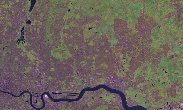


Administrative areas
The modern concept of East London is most often mapped to a cluster of London boroughs. These local authorities cover the mix of dense urban districts, port-related land, and suburban zones that people associate with the east of the capital. Principal boroughs commonly included are:
History and development
East London grew outward from the riverside. The River Thames shaped early settlement and commerce, and a string of docks, wharves and shipyards established the area as a centre for maritime trade and shipbuilding. These industries declined sharply in the mid‑twentieth century, particularly after the disruptions of World War II and the later shift to containerised shipping; container ports such as Felixstowe took on much of the long‑distance freight role, driven by changes in container handling and modern port planning (ports and logistics).
The arrival and expansion of railways during the Victorian and Edwardian eras encouraged population growth and suburban development farther from the river. In several inner districts population densities were high by the late nineteenth century; official counts and studies mark peaks and later declines in some boroughs before recent decades of renewed growth (population trends).
Culture, community and the East End
The phrase East End denotes a smaller, historically working‑class zone within East London, generally the neighbourhoods closest to the old boundary of the City. East London more broadly is notable for its ethnic and cultural diversity: successive waves of migrants — Irish, Jewish, South Asian and many others — have shaped local life, commerce and cuisine. Areas such as Spitalfields, Brick Lane and Shoreditch are well known for markets, food, art scenes and historic streets that reflect this layered heritage.
Regeneration and modern importance
From the late twentieth century onwards, parts of East London have been the focus of substantial regeneration projects, mixing new housing, business districts, transport improvements and cultural venues. Former industrial land near the river has been redeveloped for offices and apartments, while inner neighbourhoods have seen new creative industries and hospitality sectors take root. Transport links, public investment and changing housing demand continue to shape East London’s role in the wider metropolis.
Notable points and distinctions
- East London covers inner and outer areas rather than a single administrative unit, so its definition varies by context.
- The East End is a historic subset often associated with dockworkers and dense Victorian housing.
- Maritime history remains visible in converted docklands and place names, even where containerisation shifted freight to ports like Felixstowe.
- Cultural landmarks and markets in places such as Spitalfields and Brick Lane continue to attract residents and visitors.
Questions and answers
Q: What is East London?
A: East London is the northeastern part of London, east of the City of London. It does not have an official definition but it includes the London boroughs of Barking and Dagenham, Hackney, Havering, Newham, Redbridge, Tower Hamlets and Waltham Forest.
Q: What is the origin of East London?
A: The idea has its origins in 1720 as "That part beyond the Tower". By 1950 it was called East London and included all of Greater London east of the City of London and north of the River Thames.
Q: What caused early development in East London?
A: Shipping on the River Thames caused early development in East London. There were docks and shipbuilding industries which declined after World War II. Felixstowe is now used as the main container port for southern England.
Q: How did population growth change over time in Tower Hamlets?
A: In Tower Hamlets, population peaked in 1891 and growth was restricted to outer boroughs until 1971 when population had peaked everywhere and there was a decline across all boroughs. By 2011 census this had reversed with some growth seen in every borough.
Q: Are there any famous places located in East London?
A: Yes, many famous places like Spitalfields, Brick Lane and Shoreditch are located in EastLondon.
Q: Is there a large ethnic minority population living in EastLondon?
A: Yes, there is one of highest ethnic minority populations livinginEastLondon mostly consistingof South Asian families.
Related articles
Author
AlegsaOnline.com East London Leandro Alegsa
URL: https://en.alegsaonline.com/art/29673
Sources
- visionofbritain.org.uk : "Barking and Dagenham"
- visionofbritain.org.uk : "Hackney"
- visionofbritain.org.uk : "Havering"
- visionofbritain.org.uk : "Newham"
- visionofbritain.org.uk : "Redbridge"
- visionofbritain.org.uk : "Tower Hamlets"
- visionofbritain.org.uk : "Waltham Forest"