Durrington Walls — Neolithic settlement and henge near Stonehenge
Durrington Walls is a major Neolithic site near Stonehenge: a large henge earthwork and the remains of a substantial contemporary settlement, important for understanding ritual landscape and prehistoric life in Britain.
Overview
Durrington Walls is the location of one of the largest known Neolithic settlements and a substantial henge earthwork in southern England, lying about two miles (c. 3 km) north‑east of Stonehenge and just north of Amesbury. The site occupies a prominent position within the Stonehenge World Heritage Site and has attracted sustained archaeological attention because it appears to combine extensive domestic occupation with large ceremonial or communal monuments. Visitors today see the wide bank and ditch that form the visible rim, but beneath and around that feature lie traces of houses, timber circles and other buried features revealed by excavation and remote sensing.
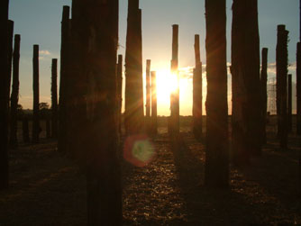
Image gallery
8 Images


Archaeology and discoveries
Excavations and surveys over recent decades have transformed understanding of Durrington Walls. Work led and published by several teams uncovered a dense cluster of Neolithic house floors close to the eastern bank and evidence interpreted as a substantial seasonal or permanent village. Fieldwork reported in the 2010s identified hundreds of dwelling structures and suggested population estimates in the low thousands at peak occupation, with radiocarbon dates placing much activity around the third millennium BCE. In one phase researchers used sophisticated non‑invasive methods to map buried features and later targeted trenches to secure dating information and artefacts.
Physical layout and features
The henge itself is a broad circular or oval earthwork with a central hollow and an encircling bank and external ditch. The ditch in some parts was originally deep and broad, while the surviving bank can be very wide; these earthworks form a rim roughly half a kilometre in diameter and include two principal entrances set opposite each other. Within the enclosure archaeologists have identified timber circles, smaller enclosures and occupation deposits. High‑resolution geophysical surveys have also detected linear and curvilinear anomalies interpreted as standing stones or stone settings lying a few feet below the present ground surface.
Notable finds and methods
In addition to conventional excavation, researchers have relied on ground‑penetrating radar, magnetometry and other remote sensing tools to reveal buried features without broad disturbance. These methods produced surprising results, including evidence for nearly one hundred underground stone settings recorded as a slightly curved row beneath the henge and the outlines of timber monuments. Such discoveries have prompted fresh debate about the sequence of construction at Durrington Walls and how it related to activities at Stonehenge. Published fieldwork reports and press summaries have highlighted results from prominent projects and seasons, including significant work reported in 2013 by a major excavation team (excavation report), and wider landscape surveys carried out by collaborative research groups (henge studies).
Interpretation and significance
Durrington Walls is widely interpreted as a place where domestic life and ritual activity intersected. Some researchers argue it functioned as a large communal centre for feasting and social gatherings, perhaps connected by processional routes to other monuments in the area; others emphasise seasonal occupation by groups drawn together for specific ceremonies. Its scale and proximity to Stonehenge have encouraged models in which the two sites formed complementary parts of a ritual landscape within the broader World Heritage area (heritage context). The combination of house remains, timber and stone settings makes the site unusually informative about both everyday and ceremonial behaviours in the later Neolithic.
Ongoing research, public access and distinctions
Research at Durrington Walls remains active: new remote sensing, re‑analysis of finds and targeted excavations continue to refine chronology and function. The site is sometimes described as among the largest Neolithic settlements known in northern Europe, and the scale of the henge makes it one of the largest in Britain. For those wanting to learn more there are scholarly publications, public outreach materials and site summaries prepared by heritage organisations; for practical information about visiting or guided interpretation see local visitor resources (Amesbury information) and heritage guidance (site overview). The patchwork of evidence — house floors, timber circles, buried stones and monumental earthworks — means Durrington Walls will remain central to debates about how Neolithic communities in Britain organised ceremony, residence and landscape.
Questions and answers
Q: What is Durrington Walls?
A: Durrington Walls is the site of a large Neolithic settlement and later henge enclosure in the Stonehenge World Heritage Site. It is located 2 miles north-east of Stonehenge in the parish of Durrington, just north of Amesbury.
Q: How many homes were found at the settlement?
A: Excavations in 2013 revealed that there were 1,000 homes at the settlement, which would have supported a population of 4,000 people at one time.
Q: When was the village carbon dated to?
A: The village was carbon dated to about 2600 B.C.
Q: What technology has been used to reveal evidence of nearly 100 stones without excavation?
A: Remote sensing and geophysical imaging technology has been used to reveal evidence of nearly 100 stones without needing excavation.
Q: What remains visible today from Durrington Walls?
A: Today what visibly remains from Durrington Walls is the 'walls' or ridge surrounding a central basin which originally had a ditch 5.5m deep and 7m wide at its bottom and 18m wide at its top with a bank 30m wide in some areas. There are two entrances through this bank and ditch – one on either side – as well as several timber circles and smaller enclosures within it not all of which have been excavated yet.
Q: What lies underneath Durrington Walls? A: About three feet underneath Durrington Walls there are remains of about 90 standing stones which were found in 2015 using special archaeological research tools such as ground-penetrating radar. Scientists do not know if this feature is from an earlier time than Stonehenge or not yet.
Q: How big is the henge monument compared to other henges in Britain? A: At 500m in diameter, the henge monument at Durrington Walls is thought to be complementary to Stonehenge and also happens to be largest henge monument in Britain
Related articles
Author
AlegsaOnline.com Durrington Walls — Neolithic settlement and henge near Stonehenge Leandro Alegsa
URL: https://en.alegsaonline.com/art/29328
Sources
- whc.unesco.org : "Stonehenge, Avebury and Associated Sites"
- list.english-heritage.org.uk : English Heritage Scheduled Monument record: Henge monuments at Durrington Walls and Woodhenge, a round barrow cemetery, two additional round barrows and four settlements
- bbc.co.uk : bbc.co.uk/news/uk-21724084
- news.bbc.co.uk : news.bbc.co.uk/1/hi/sci/tech/7078578.stm
- nytimes.com : The New York Times
- npr.org : "Stonehenge Has A New (Old) Neighbor: Row Of Huge Stones Found Nearby"
- bbc.co.uk : bbc.co.uk/news/uk-england-wiltshire-34156673