
Dissected Till Plains
A physiographic region of the Central Lowlands characterized by glacial till, loess mantles, rolling hills, fertile soils and intensive agriculture across parts of the U.S. Midwest.
Overview
The Dissected Till Plains form a distinct physiographic area within the Central Lowlands of the United States. This region occupies portions of southern and western Iowa, northeastern Kansas, the southwestern corner of Minnesota, northern Missouri, eastern Nebraska, and southeastern South Dakota. Geographically it belongs to the broader Interior Plains and represents the western margin of the American Corn Belt, where large-scale row cropping is common.
Image gallery
4 Images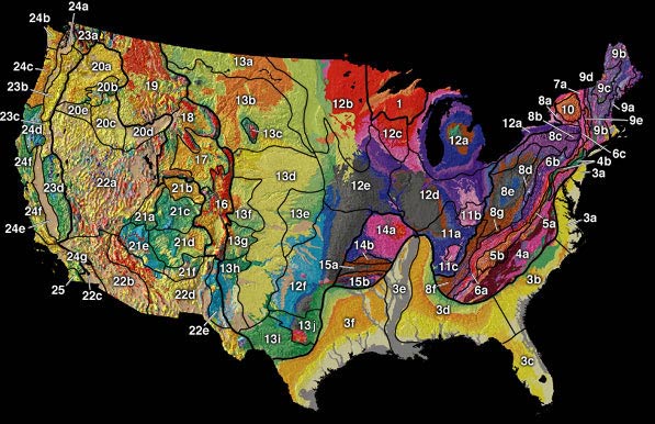


Formation and geology
The area is built on glacial deposits laid down before and during the Pleistocene. Pre-Wisconsin glaciers in the Pre-Illinoian interval left thick sheets of till—unsorted mixtures of clay, silt, sand and rock fragments—over older bedrock. Subsequent activity of the Laurentide ice sheet and periglacial processes reshaped that till, and during the later Wisconsin Stage wind-blown silt (loess) accumulated across many slopes and interfluves. The name "dissected" refers to how rivers and streams cut into the till and loess, producing a gently rolling, well-drained landscape of ridges and valleys. Important geologic processes for the region include glacial deposition, post-glacial erosion, and loess accumulation; for further reading about glacial influences see glacial processes.
Soils, topography, and characteristics
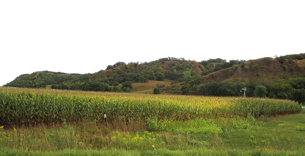
The Dissected Till Plains are noted for deep, dark, fertile soils—commonly mollisols—with good structure and high organic matter where prairie vegetation once dominated. Topography is commonly described as rolling to undulating: broad interfluves, rounded knolls, dissecting stream valleys, and occasional escarpments where resistant deposits cap slopes. Drainage is generally good compared with lowland plains, which has favored extensive cultivation. Typical landscape elements include terraces, small gullies, and remnant prairie patches.
Land use and ecological importance
Agriculture is the dominant land use: corn and soybeans, livestock pastures, and smaller mixed farms characterize the region. Its position on the edge of the Corn Belt reflects both climate and the soil resources available. Remnant native grasslands and riparian corridors provide habitat for prairie species, migratory birds, and pollinators, but much original prairie has been converted to cropland. Conservation practices—contour farming, terraces, cover cropping and riparian buffers—are widely used to reduce soil erosion and protect water quality.
Distinctions, history and human context
Compared with adjacent physiographic units, the Dissected Till Plains are distinguished by a thicker mantle of glacial till and loess and by more pronounced stream dissection than the smoother Lowland Plains. Their development is tied to repeated Pleistocene glaciations and to post-glacial wind action that deposited loess. Human settlement and agricultural expansion since the 19th century have intensified land use, transforming the vegetation and soil surface. Regional planning and soil conservation efforts continue to balance high crop productivity with long-term landscape stability.
Notable facts and resources
- The term "till" denotes unsorted glacial debris that is a primary substrate here.
- Loess mantles typical slopes, influencing fertility and erosion potential.
- The Dissected Till Plains are part of the broader Central Lowlands province of the Interior Plains.
- For general context on the region's physiography and adjacent units consult regional maps and resources at state geological or federal agencies (Nebraska, South Dakota).
The Dissected Till Plains thus combine geological complexity, productive soils and an agricultural landscape shaped by both ice-age processes and modern land management.
Questions and answers
Q: What are the Dissected Till Plains?
A: The Dissected Till Plains are a physiographic part of the Central Lowlands province and are part of the Interior Plains physiographic part of the United States.
Q: Where are the Dissected Till Plains located?
A: The Dissected Till Plains are located in southern and western Iowa, northeastern Kansas, the southwestern corner of Minnesota, northern Missouri, eastern Nebraska, and southeastern South Dakota.
Q: How were the Dissected Till Plains created?
A: The Dissected Till Plains were created by pre-Wisconsin glaciers during the Pre-Illinoian Stage. Glacial scouring and deposition by the Laurentide ice sheet and the later accumulation of loess during the Wisconsin Stage created the rolling hills and good, healthy dirt in the region.
Q: What is the significance of the Dissected Till Plains in agriculture?
A: The Dissected Till Plains are the western edge of the Corn Belt and have good, healthy dirt, making them significant in agriculture.
Q: What is the Pre-Illinoian Stage?
A: The Pre-Illinoian Stage is the period before the Wisconsin Stage when pre-Wisconsin glaciers shaped the land.
Q: What is loess?
A: Loess is a fine, silt-like sediment that is blown by the wind and is often deposited in thick layers.
Q: What is the Laurentide ice sheet?
A: The Laurentide ice sheet is a massive sheet of ice that covered much of Canada and the northern United States during the last Ice Age.
Related articles
Author
AlegsaOnline.com Dissected Till Plains Leandro Alegsa
URL: https://en.alegsaonline.com/art/27723
Sources
- tapestry.usgs.gov : "US Geological Survey: A Tapestry of Time and Terrain"