
Canton of Diekirch
Diekirch is a northern Luxembourg canton centered on the town of Diekirch. It combines upland countryside, river valleys and small towns and serves as a regional administrative and cultural area.
The Canton of Diekirch is an administrative division in northern Luxembourg. Its administrative centre is the town of Diekirch, which gives the canton its name. The canton occupies part of the higher, forested Oesling region and includes river valleys that contrast with its plateaus and ridges.
Image gallery
5 Images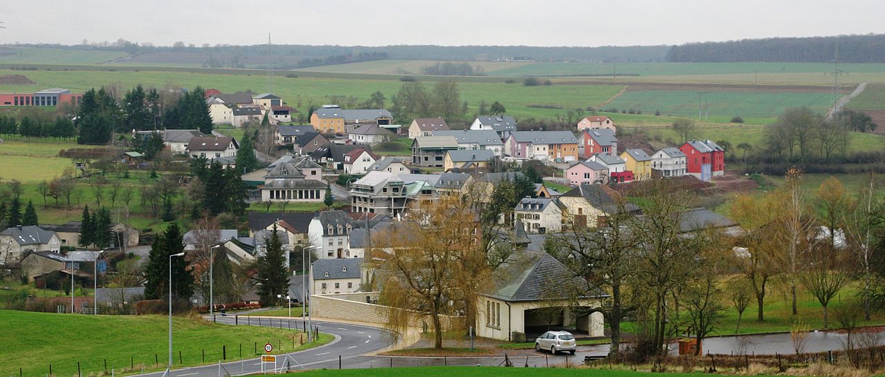


Geography and administrative role
Diekirch lies roughly near the coordinates 49°52′N 6°10′E and comprises a mix of rolling hills, wooded areas and agricultural land. As a canton it functions as a subnational unit for statistical, electoral and some local administrative purposes within the Grand Duchy. Locally spoken place names include the Luxembourgish form Dikrech.
Landscape, towns and communities
The canton contains several small towns and dispersed villages, with the town of Diekirch serving as the cultural and service centre. The environment supports outdoor activities such as walking, cycling and nature observation; wooded slopes and river corridors are typical features.
History and culture
Like the rest of the country, Diekirch developed within the historic Duchy of Luxembourg and evolved under modern administrative reforms. The town of Diekirch is known for local museums and traditions; it also lent its name to a regional brewery whose products are familiar in Luxembourg and neighbouring areas.
Economy and tourism
Economic activity in the canton is a mix of services, light industry, agriculture and tourism. Visitors come for museums, regional food and beer, and access to countryside trails. Local facilities serve residents of surrounding rural communities and help preserve regional identity.
Notable points
- The canton functions as a regional unit within the national administrative structure of Luxembourg.
- The town of Diekirch is the canton seat and cultural focal point; see local guides and museum listings for details.
- Coordinates and mapping references are commonly given as 49°52′N 6°10′E for the town area.
For further administrative or visitor information consult official regional resources and municipal pages about the canton and its communities, including articles about the capital and local landmarks (capital information).
Questions and answers
Q: What are the coordinates of Diekirch?
A: The coordinates of Diekirch are 49°52'N 6°10'E / 49.867°N 6.167°E / 49.867; 6.167.
Q: What is the capital of the canton in Luxembourg that Diekirch belongs to?
A: The capital of the canton in Luxembourg that Diekirch belongs to is also Diekirch.
Q: In what language is "Diekirch" pronounced?
A: "Diekirch" is pronounced in Luxembourgish as "Dikrech".
Q: How many degrees north and east are represented by the coordinates for Diekirch?
A: The coordinates for Diekirch represent 49°52'N and 6°10'E respectively.
Q: What does "" mean in this context?
A: The symbol indicates a non-breaking space, which means it prevents an automatic line break at its position when text wraps around it.
Q: How many decimal places are used to represent the latitude and longitude of Diekirch?
A: The latitude and longitude of Diekirch are represented with four decimal places each (49.867°N 6.167°E).
Q: Is there a difference between how the coordinates for DieKirsch appear with or without ?
A: No, there is no difference between how the coordinates for DieKirsch appear with or without - they both represent exactly same location (49°52′N 6°10′E/49.867°N 6.167°E/49.867;6.167).
Related articles
Author
AlegsaOnline.com Canton of Diekirch Leandro Alegsa
URL: https://en.alegsaonline.com/art/27278
Sources
- commons.wikimedia.org : Canton of Diekirch
- statistiques.public.lu : "Surface area of the cantons and municipalities"
- statistiques.public.lu : "Population by canton and municipality 1821 - 2017"
- legilux.public.lu : "Mémorial A, 2011, No. 110"