
Dere Street: Roman road from York to the Antonine Wall
Dere Street was a major Roman military road linking Eboracum (York) northwards to the Antonine Wall at Bo'ness; many stretches survive as modern roads, earthworks and archaeological remains.
Overview
Dere Street was a principal Roman road in Britain that ran north from Eboracum (modern York) toward the Antonine Wall near Bo'ness. Built to move troops, supplies and communications, it provided a direct north–south axis through what is now northern England and the Lowlands of Scotland. In later medieval sources parts of the route were described in Latin as a 'royal way' or Via Regia in Scottish contexts.
Image gallery
10 Images





Route and surviving traces
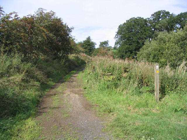
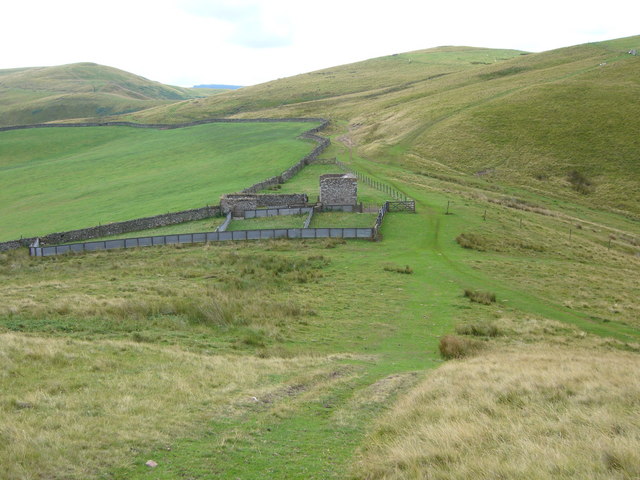
The road originally left the Roman metropolitan centre of Britain's provincial capital at Eboracum and proceeded northwards. Major stretches survive as modern highways, most notably incorporated into the course of the A1 in places and the A1 / A1 corridor near Corbridge and as the A1 / A1 network. North of Corbridge the alignment is closely followed by the A68 for significant stretches. Remains visible on the ground include raised aggers, ditches, and the footprints of Roman forts and marching camps.
Key places along the road
- Start: Eboracum (York) — Roman administrative and military hub (York).
- Corbridge area — important frontier supply and garrison zone.
- Scots Lowlands — continued military use toward the Antonine frontier at the Antonine Wall and Bo'ness.
History and naming
Constructed in the Roman period to carry legions and materiel, the road remained a visible and practical line of communication after Rome's withdrawal. Its modern name, 'Dere Street', derives from the Anglo-Saxon kingdom of Deira, which covered the southern part of the route in the early medieval period. Because medieval mapmakers sometimes reused the term 'Watling Street', Dere Street has occasionally been conflated with the southern Watling Street that ran from Dover toward Wroxeter; this is a separate Roman route (Watling Street).
Importance and archaeology
Archaeologists and historians value Dere Street for what it reveals about Roman military logistics, roadbuilding techniques and subsequent historical continuity. Excavations along the route have uncovered road surfaces, milestones, and evidence of roadside military installations. The road's later medieval and post-medieval use ensured that many parts were kept as principal thoroughfares, preserving alignments that continue to influence modern transportation networks.
Notes and further study
For regional studies consult sites and archives that track Roman Britain and medieval routes. Broader context on Roman frontiers can be found in literature on the Antonine Wall and Roman infrastructure. For an introduction to Anglo-Saxon place-name influences see works that treat the kingdom of Anglo-Saxon England and the territory of Deira. Further reading and maps are available from local historic trusts and national heritage bodies (British sources).
Questions and answers
Q: What is Dere Street?
A: Dere Street is a Roman road in Britain that ran between Eboracum (York) and the Antonine Wall at Bo'ness (Veluniate), in what is now Scotland.
Q: Does Dere Street still exist?
A: Yes, Dere Street still exists as the route of major roads, including the A1 and A68 just north of Corbridge.
Q: Where does the name "Dere Street" come from?
A: The name "Dere Street" comes from the post Roman Anglo-Saxon kingdom of Deira, through which the first part of its route lies.
Q: Was Dere Street ever referred to as "Watling Street"?
A: Yes, Dere Street was sometimes referred to as "Watling Street" and marked on some maps as such.
Q: What can cause Dere Street to be confused with another road?
A: Dere Street can be confused with the Watling Street that linked Dover with Wroxeter because it was sometimes marked on maps as "Watling Street."
Q: What major roads follow the route of Dere Street today?
A: The A1 and A68 major roads follow the route of Dere Street today, just north of Corbridge.
Q: What two cities did Dere Street connect?
A: Dere Street connected Eboracum (York) and the Antonine Wall at Bo'ness (Veluniate), in what is now Scotland.
Related articles
Author
AlegsaOnline.com Dere Street: Roman road from York to the Antonine Wall Leandro Alegsa
URL: https://en.alegsaonline.com/art/26760