
Aliso Creek (Orange County, California)
A coastal stream draining the Santa Ana Mountains to the Pacific. About 19 miles long with a 30.4 sq mi watershed, known for urbanization, several tributaries, pollution challenges and restoration efforts.
Aliso Creek is a coastal stream in Orange County, California, in the United States. It flows roughly 19 miles from headwaters in the Santa Ana Mountains to its outlet at the Pacific Ocean. The creek drains a predominantly urban watershed of about 30.4 square miles and links inland canyons with coastal beaches. Because of its urban setting and proximity to recreation areas, Aliso Creek is both valued for outdoor access and scrutinized for environmental impacts.
Image gallery
10 Images


Physical characteristics and tributaries
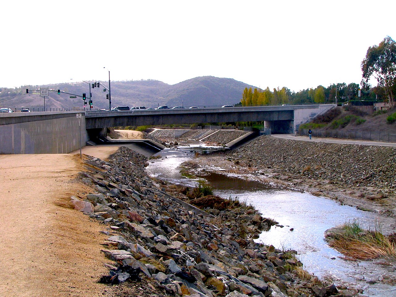
Aliso Creek begins in the hills above Laguna Beach and descends through a mix of natural canyon, parkland and engineered channels before reaching the coast. Its course collects runoff from several smaller streams and channels. Major tributaries include:
- Wood Canyon Creek
- Sulphur Creek
- The Dairy Fork
- Aliso Hills Channel
- Munger Creek
- English Canyon
The creek alternates between more natural reaches—particularly upstream in wilderness park areas—and modified, graded sections closer to urban development where flood control measures and storm drains influence flow patterns.
Hydrology and watershed behavior
Historically the stream exhibited seasonal variability typical of Southern California coastal canyons, with wetter winters and drier summers. Urbanization has altered that regime: stormwater runoff from paved surfaces, landscaped areas and municipal drainage systems increases flow during storms and adds a persistent base flow in places. Channel narrowing, sediment deposition and erosion have changed habitat structure and water quality. These hydrologic shifts are relevant both for flood management and ecological health.
Name, human history and land use
The creek’s name comes from the Spanish word "aliso", referring to the native alder trees that once grew along its banks. Long before European contact the coastal canyons around the creek were occupied and used by Native American communities, who relied on canyon resources for food and materials. Over the 19th and 20th centuries the watershed experienced ranching, suburban development and infrastructure expansion that reshaped riparian zones and floodplains.
Environmental challenges and restoration
Aliso Creek faces several environmental pressures, most notably urban pollution from runoff, elevated bacterial levels at the mouth, sedimentation, and loss of native vegetation. Trash, nutrients and pathogens carried by stormwater have led to advisories at times for water contact at Aliso Creek Beach. Local governments, regional agencies and community organizations have launched monitoring, habitat restoration and stormwater management projects to reduce contaminant load, restore riparian vegetation, and improve aquatic habitat. Efforts include replanting native species, controlling invasive plants, and implementing better stormwater capture and treatment practices.
Recreation, ecology and management
The Aliso Creek corridor includes public open space such as the Aliso and Wood Canyons wilderness lands, trails, and popular coastal access at the creek mouth. It provides habitat for birds, amphibians and other wildlife where riparian conditions persist. Because the creek connects mountainous terrain with a public beach, it is a focus for both conservation-minded recreation and watershed planning. Management involves collaboration among municipal authorities, county agencies, park districts and local stakeholders who balance flood protection, water quality, recreational access and habitat restoration.
As a comparatively small but heavily influenced coastal stream, Aliso Creek illustrates common Southern California watershed issues: competing land uses, altered hydrology, and the challenge of restoring ecological function while serving dense urban communities. Continued monitoring and coordinated restoration remain central to improving water quality and sustaining the creek’s recreational and environmental values.
Questions and answers
Q: Where is Aliso Creek located?
A: Aliso Creek is located in Orange County, California, in the United States.
Q: How long is Aliso Creek from its source to its mouth?
A: Aliso Creek is about 19 miles (31 km) long from its source in the Santa Ana Mountains to its mouth at the Pacific Ocean.
Q: What is the size of Aliso Creek's watershed?
A: The watershed of Aliso Creek is about 30.4 square miles (79 square kilometers) in size.
Q: What is the origin of the name "Aliso"?
A: The name "Aliso" comes from the Spanish word for alder.
Q: How many tributaries join Aliso Creek along its length?
A: Six tributaries join Aliso Creek along its length, which are Wood Canyon Creek, Sulphur Creek, the Dairy Fork, Aliso Hills Channel, Munger Creek, and English Canyon.
Q: Why is Aliso Creek heavily polluted?
A: Aliso Creek is heavily polluted due to urban runoff from streets in cities around the creek flowing into it, contributing to an increased year-round flow and excessive pollution.
Q: What is the current status of pollution at the mouth of Aliso Creek?
A: To this day, the creek is still a big problem in terms of pollution at its mouth, the popular Aliso Creek Beach.
Related articles
Author
AlegsaOnline.com Aliso Creek (Orange County, California) Leandro Alegsa
URL: https://en.alegsaonline.com/art/2640
Sources
- ocwatersheds.com : "Introduction to Aliso Creek Watershed"
- ceres.ca.gov : "Sterilizing Creek Water"