
Delhi: The National Capital Territory — history, geography, culture, and governance
Delhi, officially the National Capital Territory, is India's capital region centered on New Delhi. This article covers its geography, long history, key monuments, cultural life, and its distinctive administrative status.
Overview
Delhi, officially the National Capital Territory (NCT), is a densely inhabited territory in northern India that contains the nation's seat of government and the planned capital district of New Delhi. The NCT covers roughly 1,484 square kilometres, making it small compared with many Indian states but larger than some island territories. It is also the core of a wider metropolitan zone commonly referred to as the National Capital Region (NCR), which includes surrounding districts and urban centres. Delhi's population and built environment reflect centuries of layered growth and repeated political importance.
Image gallery
10 Images
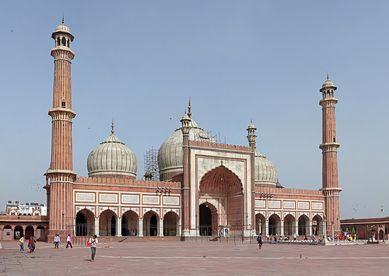


Geography and administration
Situated on the floodplain of the Yamuna River, Delhi occupies a strategic position on the Indo-Gangetic plain. The territory combines older urban cores and newer planned districts, parks, and industrial areas. Administratively, Delhi has a hybrid status: it possesses an elected legislature and its own civic institutions, but certain powers—especially those over police, public order and land—remain with the central government. For this reason its governance is often described as state-like but constitutionally distinct from full statehood. The NCT is frequently discussed in the context of pan-regional planning and coordination across the India–wide governance framework.
History and development
Human settlement in the Delhi region dates back millennia. Ancient Indian texts and archaeological evidence associate the area with the legendary city of Indraprastha and with successive kingdoms. Over the centuries several imperial capitals arose on or near the site; historians often refer to the many historic layers collectively as the "seven cities of Delhi," each layer corresponding to a different era and dynasty.
From medieval Sultanate and Mughal rule—when monumental constructions such as the Qutb complex and the Red Fort were created—to the colonial period when a new administrative capital was laid out by British planners, Delhi's urban fabric preserves distinctive architectural and cultural traces. In the 20th century, New Delhi was designed as the ceremonial capital by architects such as Edwin Lutyens and Herbert Baker, creating a planned civic core alongside the older lanes and markets.
Cultural life and economy
Delhi is a national cultural crossroads. It hosts major museums, universities, performing arts venues and festivals that reflect the country's linguistic, religious and culinary diversity. Languages commonly spoken include Hindi and English alongside regional languages such as Punjabi and Urdu. Economically, the city functions as a government and services hub, with large sectors in administration, commerce, information technology, finance, education and tourism. Street vendors, markets and formal retail trade all contribute to a heterogeneous urban economy.
Landmarks and public spaces
- Qutb Minar and complex: early medieval minaret and surrounding ruins from the Delhi Sultanate period.
- Red Fort: Mughal fortress and a symbol of the Mughal capital era.
- Humayun’s Tomb: a precursor to later Mughal garden-tombs and a UNESCO-listed site.
- India Gate: a prominent war memorial designed during the British period; beneath its archway a commemorative flame known as the Amar Jawan Jyoti marked remembrance of unknown soldiers since 1971.
- New Delhi civic axis and government buildings: planned avenues, parliamentary precincts and official residences laid out in the early 20th century.
Distinctive features and notable facts
Delhi's character derives from its long history of changing capitals, a mix of planned and organic urbanism, and its role as the political heart of the nation. It hosts courts and institutions including its own high court and an elected assembly supported by a council of ministers. The territory's legislature and related bodies perform many functions similar to those of Indian states, while national agencies and the central government retain important responsibilities, giving Delhi a unique constitutional position often discussed in public policy. As a hub of migration and commerce, the city continues to evolve, balancing heritage conservation with modern infrastructure priorities and metropolitan planning considerations tied to the broader Faroe Islands–size comparison or the scale of other territories such as Guadeloupe when discussing area and administration.
For official matters, civic information and visitor guidance, readers can consult government portals and reputable travel and cultural resources such as municipal and national tourism pages (legislature and civic resources provide entry points to authoritative materials).
City name
The name of the city in Western languages is Delhi. In the local languages (Hindi, Urdu and Panjabi) Delhi is usually called Dillī. In addition, there is the variant Dehlī or Dihlī, which was originally used mainly by the Muslims. The name is thought to derive from the ancient Hindustani word dil for "hill". The name is also often derived from a legendary king named Dhilu, who is said to have ruled Delhi in the 1st century BC. A derivation from the Sanskrit word dehalī for "threshold" or the Persian dehlīz for "plank" has also been suggested; according to this, the name would refer to Delhi's location on the "threshold" between Punjab and the Doab. The derivation from the Persian Hindustani word dil for "heart" (Delhi would thus be the "city of the heart"), on the other hand, must be considered a folk etymology.
More recently, it has been proposed to change the English name of the city from Delhi to Dilli. Similarly, a number of other Indian cities have had their colonial-era names replaced (cf. the renaming of Bombay to Mumbai, Calcutta to Kolkata, and Madras to Chennai).
The relationship between the names Delhi and New Delhi is complex. In a narrow sense, New Delhi only refers to the government district that was laid out according to plan during the British colonial period. This also corresponds to the administrative boundaries of New Delhi. However, New Delhi is often used complementarily to Old Delhi or Old Delhi to refer to all areas of Delhi outside Shahjahanabad. Often the names Delhi and New Delhi are entirely interchangeable.

Geography
Geographical location
Delhi is situated on the river Yamuna an average of 216 meters above sea level.
Climate
The average annual temperature is 25 degrees Celsius and the average annual rainfall is 719 millimeters. The warmest month is June with an average of 33.4 degrees Celsius and the coldest is January with an average of 14.5 degrees Celsius. The most precipitation falls in the month of August with an average of 206 millimeters, the least in November with 4 millimeters on average.
| Delhi | ||||||||||||||||||||||||||||||||||||||||||||||||
| Climate diagram | ||||||||||||||||||||||||||||||||||||||||||||||||
| ||||||||||||||||||||||||||||||||||||||||||||||||
| Monthly average temperatures and precipitation for Delhi
Source: India Meteorological Department/World Meteorolocical Organization; wetterkontor.de | ||||||||||||||||||||||||||||||||||||||||||||||||||||||||||||||||||||||||||||||||||||||||||||||||||||||||||||||||||||||||||||||||||||||||||||||||||||||||||||||||||||||||||||||||||||||||||||||||||||||||||||||||||||||||||||||||||||||||||||||||||||||||||||
Related articles
Author
AlegsaOnline.com Delhi: The National Capital Territory — history, geography, culture, and governance Leandro Alegsa
URL: https://en.alegsaonline.com/art/26392
Sources
- m.timesofindia.com : "Anil Baijal takes over as new Lt Governor of Delhi" · web.archive.org
- financialexpress.com : "Senior IAS officer Vijay Kumar Dev to be next Delhi Chief Secretary" · web.archive.org
- ndtv.com : "Amulya Kumar Patnaik Officially Takes Charge As Delhi Police Commissioner" · web.archive.org
- citypopulation.de : "Delhi (India): Union Territory, Major Agglomerations & Towns – Population Statistics in Maps and Charts" · web.archive.org
- delhi.gov.in : "Official Language Act 2000" · web.archive.org
- delhiplanning.nic.in : "Gross State Domestic Product of Delhi"
- indiapost.gov.in : "Find Pin Code"
- hdi.globaldatalab.org : "Sub-national HDI – Area Database" · web.archive.org
- planningcommission.gov.in : "Census 2011 (Final Data) – Demographic details, Literate Population (Total, Rural & Urban)"