Darmstadt, Germany
Darmstadt is a city in the German state of Hesse, known for its technical university, research institutions (including ESOC and GSI), Art Nouveau heritage and as namesake of the element darmstadtium.
Overview
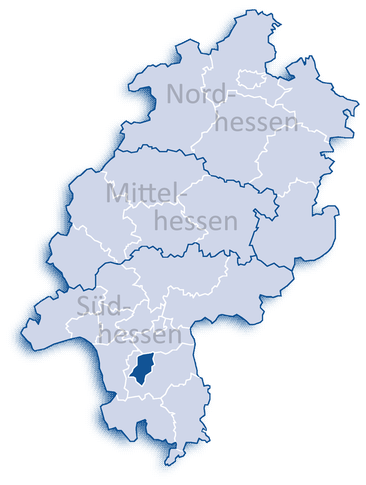
Darmstadt is a city in the federal state of Hesse in central Germany. It lies within the Rhine‑Main metropolitan region and serves as a regional administrative, cultural and research centre. The urban area combines residential neighbourhoods, industrial sites and scientific campuses, and benefits from close transport links to nearby Frankfurt and other cities.
Image gallery
10 Images


History
The settlement developed around a medieval core and later became the seat of local rulers, shaping its role as a ducal and administrative centre. In the late 19th and early 20th centuries Darmstadt gained prominence for its association with the Jugendstil (Art Nouveau) movement; the artists' colony on Mathildenhöhe remains an important cultural reference and continues to attract visitors and scholars.
Science, education and research
Darmstadt hosts the Technical University of Darmstadt, known for engineering, computer science and architecture. The city is home to major research facilities, including the European Space Operations Centre (ESOC) and the GSI Helmholtz Centre for Heavy Ion Research (GSI), where several transuranium elements were produced; the synthetic element darmstadtium was named after the city and the laboratory involved in its synthesis. Local universities and institutes maintain strong links with industry and international partners.
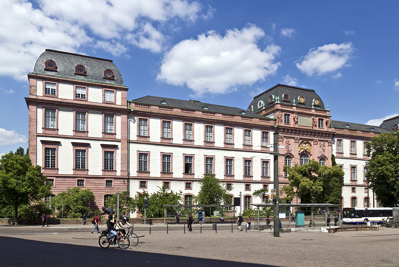
Economy, culture and landmarks
Key economic sectors include information technology, chemicals, engineering and services. Cultural life features museums, theatres, festivals and design institutions. Notable sites include Mathildenhöhe, historic churches and restored urban districts; the city also supports contemporary arts, design education and a lively student community.
Transport and regional role
Darmstadt is integrated into regional rail and road networks and participates in the economic and research ecosystem of the Rhine‑Main area. Its location contributes to commuter and business connections across the region and to international gateways.
Notable facts
- Regional centre in Hesse with historical significance as a ducal seat.
- Science and space: hosts facilities such as ESOC and research centres like GSI.
- Higher education: see Technical University and other institutions for engineering and computer science.
- Namesake element: darmstadtium bears the city's name.
- Part of the Rhine‑Main metropolitan area with transport links described at regional portals (city information).


Geography
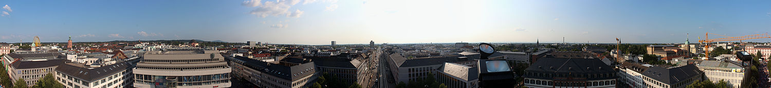
enlarge and show information about the image
![]()
360-degree panoramic view from the Ludwig Monument - visible are: Kollegienhaus (right), the Hessian State Museum and the Hessian State Archives, Residenzschloss, behind it Mathildenhöhe with Wedding Tower, White Tower and City Church, Luisencenter and high-rise building of the Darmstadt University of Applied Sciences, Rheinstraße (center). On the right far in the background the Taunus with the Feldberg, on the left the Odenwald with the cone of the Melibokus. June 2012
![]()
enlarge and show information about the image
![]()
Darmstadt from the southeast Ludwigshöhe
Geographical position
Four natural areas meet in Darmstadt: The western part of the city is located in the Upper Rhine Plain. This is followed in the southern part of the city by the narrow fringe of the Bergstrasse, which begins here. The southeastern part of the city is part of the Vorderer Odenwald up to Mathildenhöhe. The northernmost point of the Odenwald lies on the B 26 near the Institute of Botany and Zoology. The northeast of Darmstadt, on the other hand, belongs to the Messeler Hügelland natural area. Among others, the Darmbach flows through the city and the Modau in the southern district of Eberstadt.
As a regional center, Darmstadt is also the central location for the districts of Darmstadt-Dieburg and Odenwaldkreis as well as the municipalities of the southern district of Groß-Gerau, an area with a total population of around 650,000. Neighboring centers are Frankfurt am Main in the north, Aschaffenburg in the east, Heidelberg and Mannheim/Ludwigshafen in the south, and Mainz in the northwest.
Neighboring communities
Darmstadt borders the district of Offenbach to the north and the district of Darmstadt-Dieburg to the east, south and west. It borders (clockwise from the north) the municipality of Egelsbach, the towns of Langen and Dreieich (all three in the district of Offenbach), the municipalities of Messel, Groß-Zimmern and Roßdorf, the town of Ober-Ramstadt, the municipalities of Mühltal and Seeheim-Jugenheim, the towns of Pfungstadt, Griesheim and Weiterstadt, and the municipality of Erzhausen (all in the district of Darmstadt-Dieburg).
City division and districts
The urban area of Darmstadt is divided into nine districts. For statistical reasons, they are divided into statistical districts, each of which is numbered. Of the total of nine districts, five belong to the inner city (districts 100 to 500) and four to the outer districts (districts 600 to 900). In detail, there are the following districts:
| No. | Designation | Area in hectares | Population (2017) | Note |
| 100 | Darmstadt Center | 232,7 | 20.200 | a. o. with city center and Eichberg quarter |
| 200 | Darmstadt North | 1.231,0 | 32.219 | including Johannesviertel, Martinsviertel and Waldkolonie with Europaviertel |
| 300 | Darmstadt East | 2.757,7 | 14.688 | with Mathildenhöhe and Woogsviertel, among others |
| 400 | Bessungen | 552,4 | 14.874 | incorporated on April 1, 1888 |
| 500 | Darmstadt-West | 1.514,7 | 18.901 | a. o. with Heimstättensiedlung |
| 600 | Arheilgen | 1.126,0 | 17.682 | incorporated on April 1, 1937 (*) |
| 700 | Eberstadt | 1.808,4 | 23.479 | incorporated on April 1, 1937 (*) |
| 800 | Wixhausen | 2.322,8 | 6.212 | incorporated on 1 January 1977 |
| 900 | Kranichstein | 655,0 | 11.907 | - — |
| Darmstadt | 12.200,7 | 159.982 |
|
(*) With the incorporation of Arheilgen and Eberstadt on April 1, 1937, Darmstadt became a major city.
Darmstadt's social geography shows a relatively strong divide between affluent and socially weaker neighborhoods, which has existed since the 19th century. In the core city (excluding outer districts), there is a clear east-west divide with the wealthiest residential neighborhoods on the eastern outskirts of the city from the Komponistenviertel in the north through Rosen- and Mathildenhöhe, Lichtwiese and Paulusviertel to Ludwigshöhe in the south. The city center with its reconstructed post-war buildings is average, while Johannesviertel and Martinsviertel in the north and Alt-Bessungen in the south are among the more desirable residential areas due to their partially preserved old buildings, where gentrification processes have been taking place since about 1975. In contrast, the western part of Darmstadt is characterized by a strong mix of commercial, residential and former military use, so that many conversion areas are located here and the high immission levels from industry and traffic as well as the partial lack of social infrastructure cause urban development problems. On the other hand, the west is the only inner-city area where a significant amount of new residential space can still be created to alleviate the general shortage in Darmstadt. Thus, this area along the Main-Neckar railroad as Weststadt has been the focus of Darmstadt's urban planning since the turn of the millennium and is undergoing major changes.
Climate
Darmstadt is located in the temperate climate zone. The average temperature is 10.1 °C. The warmest month is July with 19.3 °C on average. The coldest month is January with an average of 0.9 °C.
Darmstadt and the Rhine-Main region are located at the northern end of the Upper Rhine Plain, which is climatically one of the warmest regions in Germany. The annual average temperature of 10.1 °C (long-term average for the reference period 1981-2010) is above that of other German metropolises (Berlin 9.0 °C, Hamburg 9.1 °C, Munich 7.7 °C). The sun shines longest in July, averaging 7.5 hours a day. In December, the sun shines the shortest with an average of 1.2 hours a day. The climate is therefore quite mild overall. In the period from November to January, there are on average only one to two hours of sunshine during the day. The average precipitation is 765 mm per year.
Snow lies in winter on average on about fifteen days. The snow depth rarely exceeds ten centimeters and the snow usually does not stay for long. White Christmas occurs on average every 10 years.
The summer is quite warm with highs around 25 °C (on average eleven days a year even over 30 °C); in addition, it is slightly changeable with occasional showers or thunderstorms, but this is also the sunniest time with seven to eight hours daily.
The extreme values are about -21 °C in winter and about +39 °C in summer. The highest temperature ever measured in Darmstadt was 39.5 °C, measured on August 7, 2015. The lowest temperature ever measured in Darmstadt was -26.9 °C, measured on January 19, 1940. The average annual temperature increased by about 0.4 to 10.1 °C between 1981 and 2010.
The average annual precipitation was about 600-700 mm. The most precipitation falls in July, the least in April on average from 1981 to 2010. The average humidity is about 76%.
The prevailing wind direction is west.
Climate diagram from 1981 to 2010, for the city of Darmstadt
| Monthly average temperatures and precipitation for Darmstadt
Source: German Weather Service; wetterkontor.de | ||||||||||||||||||||||||||||||||||||||||||||||||||||||||||||||||||||||||||||||||||||||||||||||||||||||||||||||||||||||||||||||||||||||||||||||||||||||||||||||||||||||||||||||||||||||||||||||||


History
→ Main article: History of the city of Darmstadt
The name "Darmstadt
The origin of the name Darmstadt is unclear. The oldest preserved mention of the settlement under the name Darmundestat dates back to the 11th century, several centuries after the settlement was founded. The attempts to explain the origin of the name are very different:
- The local press prefers the explanation that Darmstadt was the fortified settlement of a royal Wildhübner named Darimund.
- Another interpretation sees the name as a derivation of the terms darre for gate or obstacle and mund for protection, thus Darmundestat would be a settlement at a fortified passage.
- Another derivation wants to recognize the Celtic word stems dar for oak or tree and mont for mountain.
- Furthermore, it is also tried to see in the Darmbach the origin of the name. Following this theory, Darmstadt would be either the site at the torrent (Dam-unda-stat) or the site at the moor brook (Darm-unda-stat). Against this thesis speaks, however, that the Darmbach was called so according to current knowledge only later.
Darmstadt is the only German city after which an element, Darmstadtium, was named.
→ Further detailed explanations of the name derivation in the parallel article: History of the city of Darmstadt
Historical name forms
Historically documented mentions of the place are (in parentheses the year of mention):
- Darmundestat (2nd half 11th century)
- Darmistat (1234)
- Darmstat
- Darmestat (1315)
- Darmstad (1377)
- Darmbstadt (1451)
- Darmstatt (1477)
- Darmstait (1479)
- Darmstadt (1488)
- Darmbstadt (1555)
- Darmstatt (1586)
- Darmbstatt (1600)
Incorporations
The municipality of Bessungen was incorporated on April 1, 1888. On April 1, 1937, Arheilgen and Eberstadt were added, as well as about 25% of Griesheim, including the military training area with the August Euler airfield, the Tann settlement and what is now Sankt Stephan. Wixhausen followed on January 1, 1977.
Spin-offs
On January 1, 1977, the St. Stephen's Settlement, with a population of about 2,000 at the time, was returned to the neighboring city of Griesheim.
Deserts
Klappach was a hamlet from the 13th to the 15th century, located south of the village of Bessungen near Darmstadt.
Population development
On April 1, 1937, the city's population exceeded 100,000 due to the incorporation of Arheilgen and Eberstadt. During World War II, the city lost about 40 percent (45,000) of its residents between 1939 (115,000 residents) and 1945 (70,000 residents). By 1953, the population had returned to its pre-war level. Darmstadt's population reached its previous high on December 31, 2016, with 159,982 registered residents.
The following overview shows the population figures according to the respective territorial status. Up to 1833, these are mostly estimates, thereafter census results (highlighted in color) or official updates of the respective statistical offices or the city administration itself. From 1843, the data refer to the "local population", from 1925 to the resident population and since 1987 to the "population at the place of principal residence". Before 1843, the number of inhabitants was recorded inconsistently.
|
|
|
|
Census results highlighted in color


Related articles
Author
AlegsaOnline.com Darmstadt, Germany Leandro Alegsa
URL: https://en.alegsaonline.com/art/25559
Sources
- destatis.de : "Alle politisch selbständigen Gemeinden mit ausgewählten Merkmalen am 31.12.2018 (4. Quartal)" · web.archive.org
- statistik.hessen.de : "Bevölkerung der hessischen Gemeinden"