Algiers — capital city and Mediterranean port of Algeria
Algiers is the capital and largest city of Algeria, on the Mediterranean coast of northern Africa. It is a political, cultural and historical center known for the Casbah, its port and its role in anti-colonial movements.
Overview
Algiers is the capital city of Algeria and the country's principal port and administrative centre. Located on the Mediterranean, the city sits along a sweeping bay of the northern African coast and combines older hilltop neighbourhoods with broad modern avenues. Its population in the city proper is roughly 1.5 million, while a larger metropolitan region surrounds the core.
Image gallery
10 Images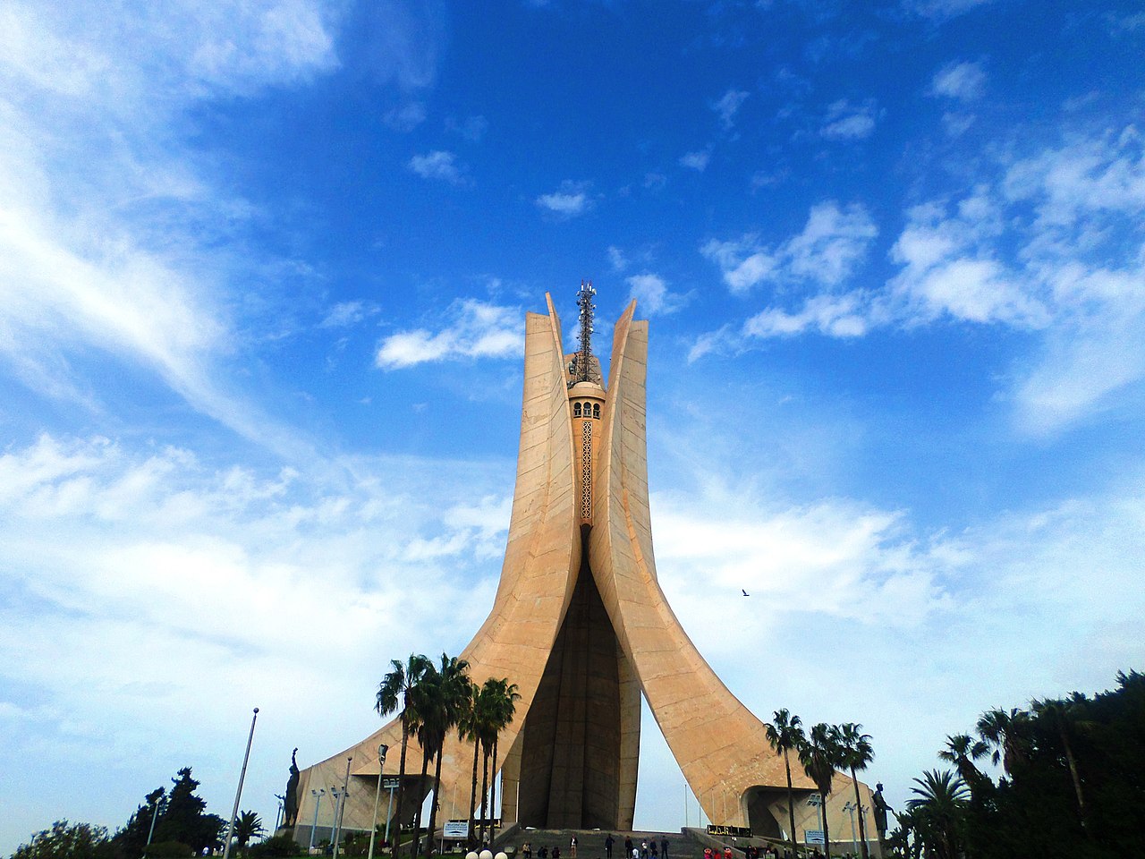


Geography and urban character
The urban fabric of Algiers contrasts a historic, tightly packed medina on the heights with flat coastal districts and twentieth-century residential and government zones. The waterfront hosts shipping and commerce, while inland districts contain government ministries, museums and cultural venues. Visitors often note the whitewashed facades and steep streets of the old quarter.
History and political importance
Algiers has layers of history shaped by indigenous, Ottoman and European influences. It was a major Ottoman port before coming under prolonged French colonial rule in the 19th and 20th centuries. After Algeria won independence, Algiers emerged as an emblematic centre for anti-colonial movements and a gathering place for activists and revolutionaries from many parts of the world.
Economy, culture and institutions
The city functions as Algeria's political heart, hosting national government institutions, foreign embassies and cultural organizations. Its economy mixes port operations, light industry, public administration and services. Cultural life includes museums, theatrical and musical events, and neighborhoods where traditional crafts and markets continue to thrive.
Notable sites
- The Casbah, an historic hilltop medina with narrow alleys and Ottoman-era architecture.
- Major government and boulevard-lined districts reflecting French colonial planning.
- Monuments and museums commemorating the struggle for independence and modern Algerian history.
- The working port and seaside promenades that define the city's maritime role.
Further context and distinctions
Algiers is often referenced when discussing the modern history of northern Africa and post-colonial diplomacy. Its role as a gathering point for international anti-colonial activists and revolutionaries made it an influential hub after independence. As the capital, Algiers represents the state of Algeria, situated in northern Africa on the northern coast. Contemporary descriptions frequently mention its population figures; official sources give a city population near 1.5 million while the wider metropolitan area is substantially larger.
For readers seeking more, scholarly histories and travel guides offer detailed accounts of the Casbah, the colonial period, and Algiers's continuing cultural and economic transformations. Online and print resources indexed by municipal and national archives provide primary documents and visitor information.
Etymology
The name derives from the Arabic al-Jazā'ir ("the islands") and refers to four islands on which the city was founded. These became part of the mainland in the 16th century.
Geography
Geographical position
Algiers is located in the province of the same name in the western part of a bay of the Mediterranean Sea, on the mountain slopes of the Algerian Sahel (Sahel algérois), a foothill of the Atlas Mountains.
Behind the narrow, bay-rich fringe of the Mediterranean coast rises the steeply rising Tell Atlas with the Algerian capital. The mountain range, divided by basins, longitudinal and transverse valleys, reaches an altitude of 2,308 metres east of Algiers in the wildly gorged Kabylia. On its southern side, the Tellatlas slopes down to the highlands of the Schotts (391 meters to well over 1,000 meters above sea level), which have numerous drainless, marshy salt lakes, the so-called Schotts, in their interior.
The mostly short permanent rivers in the coastal region can turn into raging torrents due to heavy rainfall. In the vicinity of Algiers, on the sufficiently irrigated northern side of the Tell Atlas, Mediterranean shrubs such as maquis, Aleppo pines, cork oaks and holm oaks as well as (above 1,600 metres) Atlas cedars grow; in the Kabylia there are still contiguous forest areas.
The province has an area of 865 square kilometers. Of this, 273 square kilometers (32 percent) belong to the core city (high building density and closed place form), 592 square kilometers (68 percent) consist of suburbs and areas with rural settlement structure. The urban settlement area has an extension of about 30 kilometres.
Geology
The Algerian capital Algiers is located in a zone at risk from earthquakes. In terms of plate tectonics, the Atlas Mountains form the boundary between the Eurasian Plate in the north and the African Plate in the south. When these two plates rub against each other, earthquakes can occur. Records of strong earthquakes in the region around the capital Algiers date back to the 14th century.
On January 2, 1365 and March 10, 1673, severe earthquakes shook Algiers. An earthquake on 3 February 1716 killed around 20,000 people in the region around Algiers. An earthquake in the city of Blida, southwest of the capital, claimed about 7,000 lives on March 2, 1825. The city was completely destroyed. Only a few decades later, on 2 January 1867, Blida was again destroyed by an earthquake.
In the town of Ech Cheliff, west of the Algerian capital, an earthquake measuring 7.3 on the Richter scale killed around 5,000 people on 10 October 1980. An earthquake measuring 6.8 on the Richter scale killed around 2,000 people in the town of Zemmouri, east of Algiers, on 21 May 2003.
City breakdown
The province of Algiers (of which the core city of Algiers takes up about one third) is divided into 13 districts (daïras) and 57 municipalities (communes), one of which is the municipality of Alger-Centre (about 150,000 inhabitants).
- Daïra of Bab El Oued: Bab El-Oued, Casbah, Bologhine, Hammamet, Oued Koriche, Rais Hamidou
- Daïra of Baraki: Baraki, Les Eucalyptus, Sidi Moussa
- Daïra of Bir Mourad: Raïs, Bir Mourad Raïs, Birkhadem, Gué de Constantine, Saoula
- Daïra of Birtouta: Birtouta, Ouled Chebel, Tessala El Merdja
- Daïra of Bouzareah: Ben Aknoun, Beni Messous, Bouzareah, Dely Brahim
- Daïra of Chéraga: Aïn Benian, Chéraga, Ouled Fayet, El Achour
- Daïra of Dar El Beïda: Aïn Taya, Bab Ezzouar, Bordj El Bahri, Bordj El Kiffan, Dar El Beïda, El Marsa
- Daïra of Draria: Baba Hassen, Douera, Draria, Khraïssia
- Daïra of El Harrach: Bachdjerrah, El Harrach, Oued Smar, Mohammadia
- Daïra by Hussein Dey: Bourouba, El Magharia, Hussein Dey, Kouba
- Daïra of Rouïba: H'raoua, Reghaïa, Rouïba
- Daïra of Sidi M'Hamed: Algiers Centre, Sidi M'Hamed, El Biar, El Madania, El Mouradia, Hamma-Anassers, Hydra
- Daïra of Zeralda: Mahelma, Rahmania, Souidania, Staouali, Zeralda
Climate
Algiers is located in the Mediterranean climate zone with warm and dry summers and cool and rainy winters. The average annual temperature is 18.2° Celsius. The warmest month is August with an average of 25.2° Celsius, the coldest months are January and February with an average of 12.2 to 12.6° Celsius. Sea breezes provide cooling on hot days. In winter there are often storms with heavy rainfall.
On 9 November 2001, severe storms in Algiers killed 672 people and left 1500 families homeless. Heavy rainfall had triggered mudslides and debris avalanches that swept away lightly built dwellings in the poor quarters on the hillsides of the Algerian capital. With 120 millimetres of rain in one day, more precipitation fell than in the whole of the rest of the month.
The annual precipitation is 598 mm on average. The most precipitation falls between November and February with an average of 72.7 to 91.0 mm, the least between June and August with an average of 4.5 to 8.5 mm.
| Algiers | ||||||||||||||||||||||||||||||||||||||||||||||||
| Climate diagram | ||||||||||||||||||||||||||||||||||||||||||||||||
| ||||||||||||||||||||||||||||||||||||||||||||||||
| Monthly average temperatures and precipitation for Algiers
Source: wetterkontor.de | ||||||||||||||||||||||||||||||||||||||||||||||||||||||||||||||||||||||||||||||||||||||||||||||||||||||||||||||||||||||||||||||||||||||||||||||||||||||||||||||||||||||||||||||||||||||||||||||||||||||||||||||||||||||||||||||||||||||||||||||||||||||||||||||||||||||||||||||||||||||||||


Related articles
Author
AlegsaOnline.com Algiers — capital city and Mediterranean port of Algeria Leandro Alegsa
URL: https://en.alegsaonline.com/art/2544