
Crossrail (Elizabeth Line): London's new east–west railway
Crossrail — marketed as the Elizabeth Line — is a major east–west rail route serving London and surrounding counties, created to increase capacity, shorten journeys and link airports and suburbs.
Overview
Crossrail, widely known by its operational name the Elizabeth Line, is a major new railway running east–west through the London area. The full route measures about 118 kilometres (73 miles) and connects outer commuter corridors with newly built central tunnels and stations. The scheme stitches together upgraded surface lines in the suburbs with a new high-capacity central core under central London to form a single through-running service.
Image gallery
10 Images




Route and infrastructure
The line links western branches that serve parts of Berkshire and Heathrow with eastern arms into Essex and beyond, while also passing through central London stations such as Paddington, Bond Street, Tottenham Court Road, Farringdon and Liverpool Street. In broad terms the project provides continuous services from the west — including connections to Heathrow and Reading-area routes — through the new central tunnels to eastern termini beyond central London.
Characteristics and components
The scheme combined new bored tunnels and central underground stations with improvements to existing rail corridors. Key features include:
- a twin-bore tunnel core beneath central London designed for high-frequency trains;
- new, enlarged or modernised stations with step-free access and interchange facilities;
- upgraded signalling and platform infrastructure on suburban approaches to allow longer trains and shorter intervals;
- integration with the wider transport network, giving direct links to many Underground lines and national rail services.
History and development
The Crossrail idea originated from long-term planning to relieve congestion on central routes and improve orbital and cross-London travel. The legal framework for the scheme was established in the late 2000s and construction progressed through the 2010s, combining large civil engineering contracts for tunnelling with many local works to adapt existing railways. The central section between Paddington and Abbey Wood opened for passenger services as the Elizabeth Line, marking the completion of the core tunnels and central stations.
Operations, benefits and examples
Services are run under the Elizabeth Line brand and operate through the central core to suburban branches. This creates several practical benefits: higher peak capacity for commuters, fewer changes for many journeys across London, faster airport access for travellers, and improved connections between suburban counties and central London. For example, journeys that previously required multiple transfers across the city can now be completed on a single through service, and passengers travelling from northeast suburbs to Heathrow gain a direct, cross-London option.
Organisation, naming and local reach
Delivery of the project involved a dedicated body and partnerships between national and local transport organisations. The railway adopted the name Elizabeth Line in honour of Queen Elizabeth II. The line serves communities in and around London and extends into counties such as Berkshire, Buckinghamshire and Essex, while incorporating services that had previously been branded and operated under TfL Rail before full through running commenced.
Notable facts and distinctions
Crossrail is one of the largest recent rail infrastructure projects in the UK, notable for the scale of its central tunnels and the way it joins pre-existing suburban lines to create a new cross-city trunk route. It differs from many older rail improvements by delivering a continuous, high-frequency service designed around a modern central core rather than only piecemeal station upgrades. While delivery involved complex engineering and programme challenges, the line has reshaped travel patterns across the metropolitan area and improved direct access to key destinations such as airports and business districts.
Further information about timetables, stations and step-free access can be found through official transport sources and local travel guidance. For more context on how the route interacts with regional services and ticketing arrangements consult the relevant network operator pages.
London | Berkshire | Buckinghamshire | Essex | TfL Rail | Queen Elizabeth II | Heathrow
Planning
Proposals from 1948
Railway historian George Dow first presented a concept of large diameter railway tunnels linking Paddington and Liverpool Street terminus stations in central London in The Star newspaper in June 1941. He also proposed north-south lines, anticipating the Thameslink lines of the post-war years. The current Crossrail project dates back to the County of London Plan of 1943 and the Greater London Plan of 1944, both prepared by town planner Patrick Abercrombie. These concepts were reviewed in detail by the Railway (London Plan) Committee, which reported in 1946 and 1948. Route A would have run from Loughborough Junction to Euston, with the Blackfriars Bridge being rebuilt. Route F would have linked Lewisham to Kilburn via Fenchurch Street, Trafalgar Square, Marble Arch and Marylebone. Ultimately only Route C came to fruition around 1970 in the form of the Victoria Line, albeit with smaller diameter tunnel tubes.
Proposals from 1974
The term Crossrail first appeared in 1974 in the London Rail Study Report of a steering committee set up by the Department of the Environment and the Greater London Council to investigate future transport needs and produce strategic plans for London and the South East of England. The report included several options for new lines and extensions, including the Jubilee Line (then called the Fleet Line) to Fenchurch Street, the River Line (now the eastern part of the Jubilee Line) and the Chelsea-Hackney Line. Proposals were also made for the reopening of the Snow Hill Tunnel and the construction of two low-lying railway tunnels.
- northern tunnel: from Paddington to Liverpool Street (via Marble Arch, Bond Street, Leicester Square/Covent Garden and Holborn/Ludgate)
- southern tunnel: from Victoria to London Bridge (via Green Park/Piccadilly, Leicester Square/Covent Garden, Ludgate/Blackfriars and Cannon Street/Monument).
The 1974 study assumed that 14,000 passengers would use the northern tunnel and 21,000 the southern tunnel every hour during rush hour. Comparisons were made with the RER Paris and the S-Bahn Hamburg. A connection to Heathrow Airport was also considered. Although the concept was considered imaginative, only a vague cost estimate of £300 million existed. The authors recommended a feasibility study with a high degree of urgency, as well as a planning safeguard for the tunnel route.
Proposals from 1989
The Central London Rail Study of 1989 recommended three British Rail standard tunnels between different parts of the existing rail network, named East-West Crossrail, City Crossrail and North-South Crossrail. The East-West scheme provided a route from Liverpool Street to Paddington/Marylebone, with two connections at the western end to the Great Western Main Line and the Metropolitan Line. The City Route was proposed as a new link from the Great Northern Route through the City of London to London Bridge. The North-South Route was to bundle trains from the West Coast Main Line, Thameslink and Great Northern Route at Euston and King's Cross/St Pancras and take them into a tunnel via Tottenham Court Road to Victoria, from where they would continue to Crystal Palace and Hounslow. The report also proposed a number of other lines, including a Thameslink Metro and a new Chelsea-Hackney line. The cost of the east-west route, including vehicles, was estimated at £885 million.
Proposals from 2003/04
Cross London Rail Links (CLRL), a joint venture between Transport for London and the Department for Transport further developed the East-West Plan from 2001, as well as a line between Wimbledon and Hackney. In 2003 and 2004, a 50-day touring exhibition took place, presenting the proposals at 30 different locations.
A more ambitious proposal was the £13 billion Superlink in 2004, which involved additional infrastructure outside London: in addition to the East-West Tunnel, new lines would have opened up Cambridge, Ipswich, Southend-on-Sea, Pitsea, Reading, Basingstoke and Northampton. According to the promoters, the Superlink would have carried four times as many passengers and as a result would have required lower public subsidies. Mayor Ken Livingstone and the Department for Transport did not support the proposal.
Crossrail project and approval
Consultation in the UK Parliament was required to approve the Crossrail project. A commission of members of the House of Commons met between December 2005 and October 2007. The commission issued a preliminary ruling in July 2006 that called on the promoters to add a station at Woolwich. The government, as the developer, initially did not want to do this because otherwise the affordability of the whole project would have been jeopardised, but later relented. While the Bill was still under consultation, Transport Minister Ruth Kelly ordered spatial planning measures on 24 January 2008 to protect the proposed transport corridor from other developments that would otherwise have stood in the way of Crossrail and possible future extensions. In February 2008, the Bill was considered by a House of Lords committee. On 22 July 2008, the Crossrail Act 2008 became law by Royal Assent.
The Crossrail Act 2008 was accompanied by an environmental impact assessment, plans and other associated information. The Act gave Cross London Rail Links the necessary powers to build the line. Transport Minister Andrew Adonis announced a £230 million contribution from BAA and confirmed that funding had been secured despite the global financial crisis. The funders (including Transport for London, the Department for Transport, Network Rail, BAA and the City of London) secured full funding to the tune of £15.9 billion on 4 December 2008. Transport for London advised in December 2018 that up to an additional £2.2 billion would be required on top of the £600 million handed over in summer 2018. Crossrail's final budget is then up to £17.6 billion, including contingency funding.
Transport for London was awarded a £1 billion loan from the European Investment Bank on 7 September 2009. After the 2010 House of Commons election, the new Conservative-Liberal coalition government confirmed that the project would go ahead as agreed. According to the original timetable, the first trains should have run in 2017. A financial analysis carried out in the same year showed that a simpler but slower construction method (made possible by fewer tunnel boring machines and access shafts) could save more than a billion pounds. As a result, the commissioning of the central section was postponed by one year.
The project is being implemented by the company Crossrail Ltd. It was jointly owned by Transport for London (TfL) and the UK Department for Transport until December 2008, after which it became wholly owned by TfL. The company has £16 billion available to complete the project. While the branch lines to the west and to Shenfield will continue to be owned by Network Rail, TfL will own and operate the tunnel in the city centre and to Woolwich.


Track
Western sections
The main part of the western section, the Great Western Main Line, runs above ground from Reading to Paddington. The stations in this section have been modernised and upgraded. At Acton, a flyover structure was built so that passenger trains can overtake slower freight trains travelling to a marshalling yard there. The structure was completed in July 2016 and opened in January 2017.
The Heathrow branch, which starts at Airport Junction between Hayes & Harlington and West Drayton, has three underground stations in the London Heathrow Airport area. A flyover structure at Hayes & Harlington called Stockley Flyover allows Heathrow Express trains to cross the Crossrail tracks without crossing.
Central part
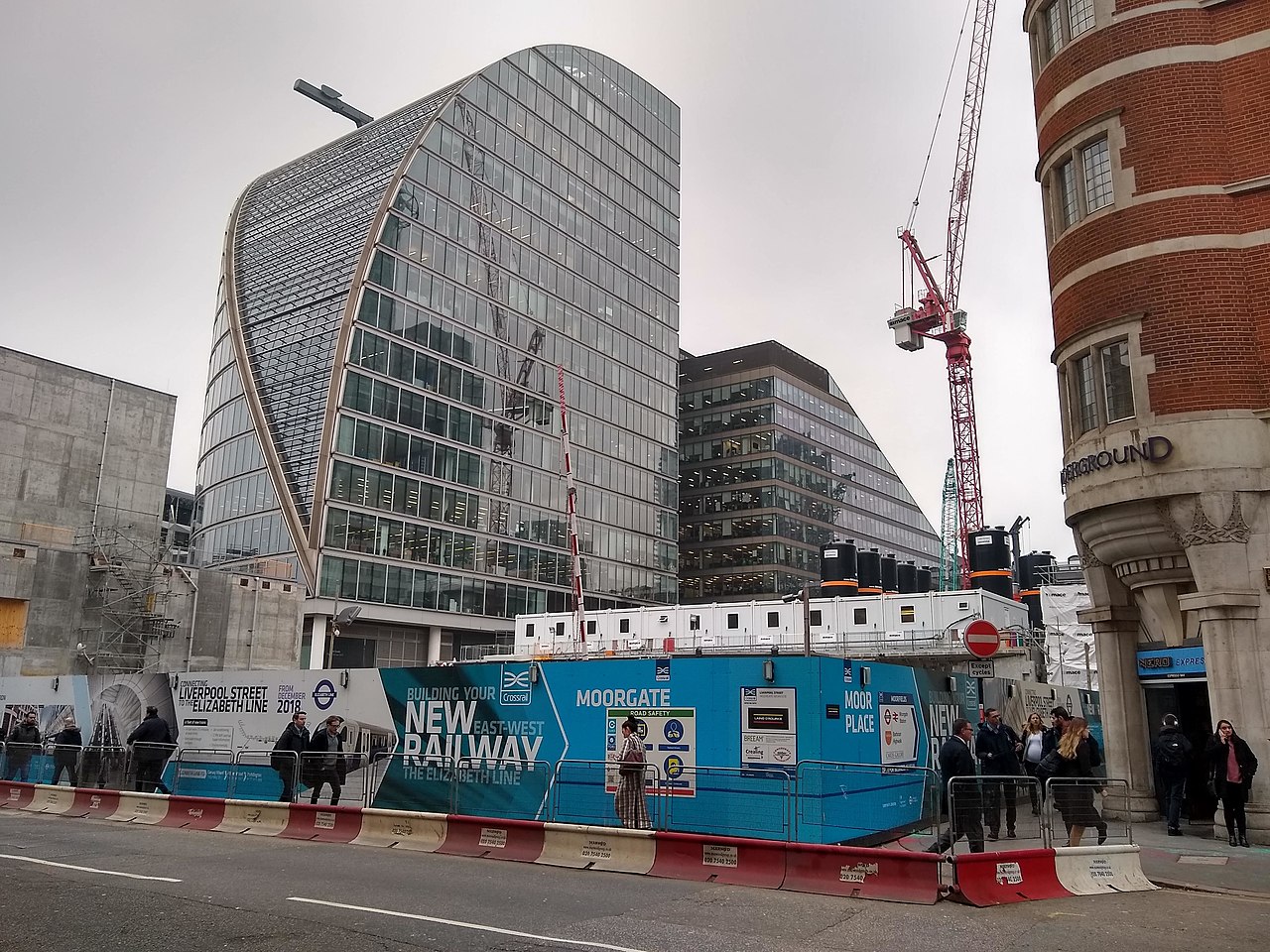
The central section of the link crosses the city centre underground in a west-east direction, with the tunnel portals located west of Paddington and east of Whitechapel. New underground stations are being built at Paddington, Bond Street, Tottenham Court Road, Farringdon, Liverpool Street and Whitechapel. All offer interchange facilities with other tube and rail services. Due to the length and positioning of the platforms, Farringdon is connected to Barbican tube station, as is Liverpool Street to Moorgate station.
Eastern sections
East of Whitechapel station, the route branches. One of the two route branches leads to the already existing Great Eastern Main Line, whereby the tunnel portal is located slightly south of the Olympic Stadium. Via Stratford Shenfield is reached.
The other branch of the line first runs underground to Canary Wharf and comes to the surface at Custom House. It then uses a section of the North London Line, closed in 2006, to North Woolwich. The line then crosses under the Thames and reaches Abbey Wood station on the North Kent Line via Woolwich.
List of stations
| Name | Connecting lines | Location | District | Region |
| Main line Reading - Abbey Wood | ||||
| Great Western Main LineReading | Coord. 51.45934-0.97254 | |||
| Twyford | Henley branch | Coord. 51.47536-0.86345 | Wokingham | |
| Maidenhead | Marlow branch line | Coord. 51.51849-0.72264 | Windsor and Maidenhead | |
| Taplow | Coord. 51.52344-0.68152 | |||
| Burnham | Coord. 51.52334-0.64664 | Berkshire | ||
| Slough | Slough - Windsor & Eton | Coord. 51.51214-0.59141 | ||
| Langley | Coord. 51.5079-0.54185 | |||
| Iver | Coord. 51.50865-0.50671 | Buckinghamshire | Buckinghamshire | |
| West Drayton | Coord. 51.50985-0.47193 | |||
| Hayes & Harlington | Heathrow branch line | Coord. 51.50302-0.42022 | ||
| Southall | Coord. 51.50597-0.37838 | |||
| Hanwell | Coord. 51.51173-0.33865 | |||
| West Ealing | Greenford branch line | Coord. 51.51348-0.31983 | ||
| Coord. 51.51474-0.30167 | ||||
| Acton Main Line | Coord. 51.51715-0.26716 | |||
| Old Oak Common | High Speed 2 | Coord. 51.52185-0.25271 | ||
| Great Western Main Line | Coord. 51.5163-0.17758 | |||
| Bond Street | Coord. 51.51356-0.14942 | |||
| Tottenham Court Road | Coord. 51.51596-0.13017 | |||
| Thameslink | Coord. 51.51961-0.10507 | |||
| Great Eastern Main LineWest | Coord. 51.51715-0.08257 | |||
| Whitechapel | Shenfield branch line | Coord. 51.52-0.05998 | ||
| Canary Wharf | Coord. 51.50608-0.01727 | |||
| Coord. 51.509660.02586 | ||||
| Woolwich | Coord. 51.491760.07223 | |||
| Abbey Wood | North Kent Line | Coord. 51.49110.12125 | Greenwich / Bexley | |
| Heathrow branch line | ||||
| Hayes & Harlington | ||||
| Heathrow Central | Coord. 51.47185-0.45447 | |||
| Heathrow Terminal 4 | Piccadilly Line | Coord. 51.45886-0.44607 | ||
| Heathrow Terminal 5 | Coord. 51.47195-0.48781 | |||
| Shenfield branch line | ||||
| Whitechapel | East London Line | |||
| Great Eastern Main LineWest | Coord. 51.54175-0.00344 | |||
| Maryland | Coord. 51.546010.00595 | |||
| Forest Gate | Coord. 51.549510.02465 | |||
| Manor Park | Coord. 51.552480.04634 | |||
| Ilford | Coord. 51.559170.06956 | |||
| Seven Kings | Coord. 51.564020.09701 | |||
| Goodmayes | Coord. 51.565680.11099 | |||
| Chadwell Heath | Coord. 51.568050.12906 | |||
| Romford | Romford - Upminster | Coord. 51.574740.18274 | ||
| Gidea Park | Coord. 51.58170.20554 | |||
| Harold Wood | Coord. 51.592790.23324 | |||
| Brentwood | Coord. 51.61360.29981 | Brentwood | ||
| Shenfield | Great Eastern Main LineShenfield | Coord. 51.630650.33016 | ||


Related articles
Author
AlegsaOnline.com Crossrail (Elizabeth Line): London's new east–west railway Leandro Alegsa
URL: https://en.alegsaonline.com/art/24354