Aare (Aar): Switzerland's longest river wholly within its borders
The Aare (Aar) is a major Swiss river rising in the Bernese Alps, flowing through lakes and the capital Bern before joining the Rhine. It is notable for hydropower, recreation and ecological recovery.
Overview
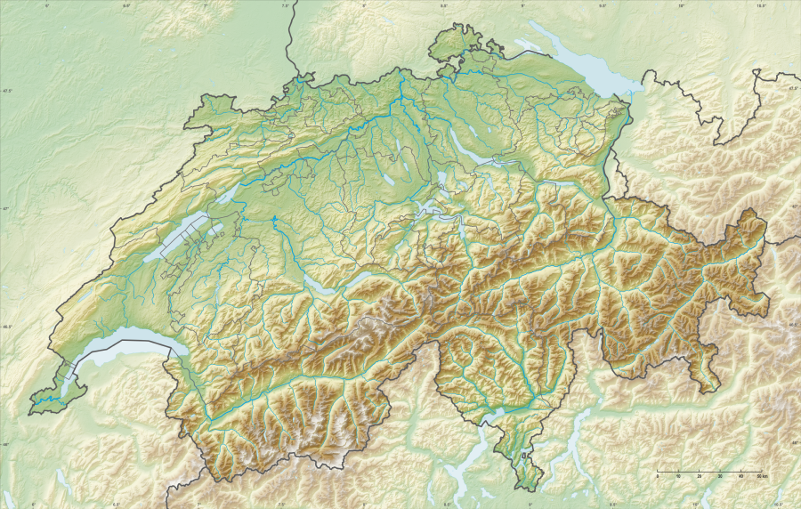
The Aare, spelled Aare in German and sometimes rendered Aar in English, is a principal river of Switzerland and a tributary of the Rhine. It is famed as the longest river wholly within Switzerland, rising in alpine headwaters and completing its course without leaving the country's borders, a fact often summarized as flowing entirely inside Switzerland.
Image gallery
10 Images


Course and main features
The Aare originates in the Bernese Alps, fed by glaciers and mountain streams, and passes through several large lakes on its way north. Along its course it links high-mountain landscapes with lowland plains, creating notable contrasts of fast alpine torrent and broader meandering reaches. The river winds past key towns and cities, most famously through the city of Bern, where a looping reach defines part of the historic centre.
Uses and human influence
For centuries the Aare has been central to human activity in Switzerland. It has supported transport and trade historically, and since the industrial era it has been harnessed extensively for hydropower and municipal water supply. Engineering works — dams, weirs and canals — regulate floods, generate electricity and shape navigation and irrigation. Recreational uses are popular: swimming, boating and river festivals are important summer activities, particularly in urban stretches.
Ecology and management
Efforts to improve water quality and restore habitats have been important in recent decades. Pollution controls, fish passages and managed flows have helped recover biodiversity in many reaches. The Aare basin supports diverse freshwater species and riparian ecosystems, while ongoing river management balances ecological goals with flood protection and energy production.
Notable facts
- It is widely recognized as the longest river entirely within Switzerland.
- Its passage through Bern is a defining feature of the Swiss capital's geography and urban identity.
- Contributions from alpine headwaters make its flow highly seasonal and sensitive to glacier and snowpack changes.
The Aare remains a vital natural artery of Switzerland, blending cultural history, practical utility and environmental value across a range of landscapes.
Flood
Flood probability
The mean annual flood of the Aare at the Untersiggenthal monitoring station near Stilli is 1574 m³/s.
The highest annual peak measured so far was reached during the flood of the century in 2007 and amounted to 2656 m³/s.
The flood probability table:
| Probability of occurrence of annual flood values (HQn) | ||||||
| Annuality (years) | 2 | 5 | 20 | 30 | 50 | 100 |
| Discharge (m³/s) | 1518 | 2221 | 2446 | |||
| Note on HQn: the number corresponds to the flood flow (HQ = flood quantity) in m³/s, which is repeated - on average - with the specified annuality (n = number of years). | ||||||
Historical floods of the Aare
The most severe surviving flood in the Aare river basin occurred during the Magdalen flood of 1480, which also affected other parts of the Rhine region, but not as extensive regions as the Magdalen flood of 1342. After a rainy May and June, a heat wave had accelerated the melting of snow in the Alps. Then heavy precipitation fell for days in the foothills of the Alps. The damage to the towns along the Aare is well documented in the late medieval chronicles. In Solothurn, part of the town and the Aare bridge were flooded.
Other exceptional floods occurred in the Aare in 1651, 1852, 1876 and 1999.
Possible extreme flooding
A report published in 2021 on behalf of the FOEN, SFOE, ENSI, FOCP, MeteoSwiss and carried out by the Swiss Federal Institute for Forest, Snow and Landscape Research WSL, the University of Zurich and the Paul Scherrere Institute PSI, among others, estimates the possible effects of floods with a return period of up to 100,000 years. This applies in particular to the Mühleberg, Gösgen and Beznau nuclear power plants, which are located on the Aare: At Mühleberg, a 100,000-year flood would inundate the site to a height of just under 1 m; at the Gösgen NPP, the water depth would be 1.15 m in the event of a 100,000-year flood, while at Beznau it would be approximately 1.1 m. In addition, at the Hagneck Canal, the water depth would be 1.5 m. This would mean that a flood of up to 1.5 m could occur. In addition, the old course of the Aare could be reactivated at the Hagneck Canal.

History of use and culture
Early use
In the Middle Ages, the Aare was an important border river: for example, it separated the tribal duchies of Burgundy and Alemannia, was a border section of the Carolingian divisions of the empire and also separated Hochburgund from the Roman-German Empire for a while. With the founding of the city of Bern at the end of the 12th to the 13th century, the character of the Aare changed, because from the middle of the 13th century at the latest, there were bridges across the river and contiguous dominions developed on both sides of the Aare.
The short border sections that deviate from the Aare bed at various points today are due to the former natural meanders that defined the border at the time and have now fallen dry.
For a long time, the Aare was important for timber rafting. Wood from the Emmental was transported to the Rhine and to its mouth in the North Sea. To commemorate this tradition, the cultural-historical rafting trail exists between Stilli and Laufenburg.
The stretch of the Aare from Nidau to Solothurn is navigable, as is Lake Biel. The Aare has been used for shipping since ancient times, as can be seen from a stone inscription by Roman shipmen in Avenches. Long-distance traffic on the river only came to a standstill at the end of the 19th century after the construction of the railway lines and the first river power stations.
Current use
Power stations
Hydropower
The waters of the Aare are used to produce electricity in numerous hydroelectric power stations. The headwaters of the Grimsel are home to the Kraftwerke Oberhasli (KWO) power plant group. With its storage power plants and pumped storage power plants, it processes the water from the Oberaar, Grimsel, Räterichsboden and Gelmer reservoirs into peak-load energy, which plays an important role in grid regulation. In the short term, a capacity of 1.3 GW can be called up, which is roughly equivalent to the capacity of the Leibstadt nuclear power plant.
From Interlaken to the mouth of the river, the water of the Aare is used to power several low-pressure run-of-river power stations.
Map
|
|
List of hydroelectric power stations on the Aare:
| Name of the power plant | Owner | Type of power plant | Location | first commissioning | Flow rate | Height dif m | Turbine | Power MW | Energy per year GWh/a |
| Grimsel 1 Lake Oberaar | KWO | Storage power plant | Chessituren, Guttannen | 1954 | 8 | 536 | 1 × Double Pelton | 33,6 | 74 |
| Grimsel 1, Grimselsee | KWO | Storage power plant | Chessituren, Guttannen | 1974 | 20,2 | 142 | 1 × Francis | 32,2 | 32,8 |
| Grimsel 2 | KWO | Circulation | Chessituren, Guttannen | 1981 | 100 | 4 horizontal machine groups consisting of Francis + motor/generator + single-stage pump, of which one group with frequency converter | 388 | 600 | |
| Grimsel Nollen | KWO | small run-of-river power station in the Grimselsee-Gelmersee connecting tunnel (replenishment turbine) | Spittelnollen, Guttannen | 2017 | 2,5 | 1 × Francis | 1,1 | 5 | |
| Hand corner 1 | KWO | Storage power plant | Handegg, Guttannen | 1932 | 10,5 | 680 | 2 × Pelton | 45 | 168 |
| Handeck 2 + 2a | KWO | Storage power plant | Handegg, Guttannen | 1950 | 465 | 5 × vertical Pelton | 215 | 262 | |
| Hand corner 3 (Isogyre) | KWO | Pumped storage power plant | Handegg, Guttannen | 1976 | 14,3 | 1 × horizontal Isogyre pump turbine | 55 | 39 | |
| Hopflauenen (drift) | KWO | Storage power plant | Hopflauenen, Gadmen | 1967 | 23,6 | 463 | 2 × Double Pelton | 81,6 | 245 |
| Innertkirchen 1 + 1a | KWO | Storage power plant | Innertkirchen | 1943 | 69 | 6 × Pelton | 394 | 720 | |
| Innertkirchen 2 | KWO | Storage power plant | Innertkirchen | 1967 | 29,5 | 242 | 2 × Francis | 54,8 | 161 |
| Interlaken | IBI | Run power plant cottage industry | Ship canal, Interlaken | 1897 | 30 | 3,6 | 3 × chaplain | 0,82 | 5,1 |
| Interlaken-Dotierzentrale | IBI | Doping center (small power plant) | Aare weir, Interlaken | 1996 | 15 | 0,3 | 1,2 | ||
| AAREwerk62 | Energy Thun | Run-of-river power plant (diversion power plant) | Thun | 1962 | 125 | 2 × vertical Kaplan | 6,32 | 32 | |
| AAREwerk94 | Energy Thun | Run-of-river power plant (run-through power plant) | Thun | 1917 | 49,7 | 1 × S-Turbine | 2,83 | 8,4 | |
| Thun | RUAG | small run-of-river power station of the munitions factory | Trade canal, Thun | 1901 | 6 | 0,44 | 2 | ||
| Mat | EWB | Run-of-river power plant (diversion power plant) | Mat, Bern | 1891 | 40 | 2–3 | 1 × S-Turbine | 1,16 | 6,8 |
| Engehalde doting center | EWB | Doping center (small power plant) | Weir at Felsenau power station, Felsenau, Berne | 1998 | 16 | 0,44 | 2,6 | ||
| Felsenau | EWB | Run-of-river power plant (diversion power plant) | Felsenau, Bern | 1909 | 100 | 1 × Pipe turbine | 11,5 | 73 | |
| Mühleberg | BKW | Run-of-river power station at Lake Wohlen (continuous power plant) | Buttenried, Mühleberg | 1919 | 291 | 20 | 1× Chaplain 6× Francis | 45 | 160 |
| Niederried-Radelfingen | BKW | Run-of-river power plant (diversion power plant) | 1963 | 170 | 2 × chaplain | 15 | 81,2 | ||
| Aarberg | BKW | Run-of-river power plant (run-through power plant) | 1968 | 170 | 2 × chaplain | 15 | 90 | ||
| Kallnach | BKW | Run-of-river power plant (Expelling power plant) | 1913 | 45 | 1 × Pipe turbine | 8,1 | 49 | ||
| Hagneck (old) | Lake Biel Power stations | old run-of-river power plant used as doping plant | Hagneck Canal, Hagneck | 1900 | 40 | 3 × propeller 2 × chaplain | 3 | 11 | |
| Hagneck | Lake Biel Power stations | Run-of-river power plant (run-through power plant) | Hagneck Canal, Hagneck | 2015 | 280 | 2 × bulb turbine | 21 | 99 | |
| Brügg | Lake Biel Power stations | Run-of-river power plant (Bay power plant) | Nidau-Büren Canal, Brügg | 1995 | 219 | 2 × bulb turbine | 5,2 | 21,3 | |
| Flumenthal | Alpiq | Run-of-river power plant (run-through power plant) | 1970 | 395 | 6–8.5 | 3 × Pipe turbine | 23,4 | 147 | |
| Bannwil | BKW | Run-of-river power plant (run-through power plant) | 1970 | 435 | 3 × Pipe turbine | 28,5 | 149 | ||
| Wynau | Onyx | Run-of-river power plant (run-through power plant) | 1996 | 220 | 1 × Pipe turbine | 12 | 51 | ||
| Blackhouses | Onyx | Run-of-river power plant (run-through power plant) | 1923 | 200 | 4 × propeller | 8,2 | 41 | ||
| Ruppoldingen | Alpiq | Run-of-river power plant (run-through power plant) | 2000 | 475 | 4–6.5 | 2 × bulb turbine | 21,1 | 115 | |
| Gösgen | Alpiq | Run-of-river power plant (Expelling power plant) | Niedergösgen | 1917 | 380 | 13–17.4 | 5 × chaplain | 48.5 | 300 |
| Aarau city | Eniwa | Run-of-river power plant (Expelling power plant) | 1893 | 394 | 5.3–7.4 | 9 × chaplain 2 × propeller 1 × Francis | 16 | 102 | |
| Ruechlig | Axpo | Run-of-river power plant (Expelling power plant) | Aarau | 1929 | 360 | 3.3–3.5 | 4 × bulb turbine | 9 | 54 |
| Ruechlig | Axpo | Doping center (small power plant) | Aarau | 2014 | 40 | 1,2 | 8,1 | ||
| Rupperswil-Auenstein | Axpo | Run-of-river power plant (Expelling power plant) | 1945 | 492 | 2 × chaplain | 40 | 221 | ||
| Rupperswil | Axpo | Doping center (small power plant) | 1945 | 25 | 1,7 | 10 | |||
| Wildegg-Brugg | Axpo | Run-of-river power plant (Expelling power plant) | 1953 | 410 | 2 × chaplain | 50 | 290 | ||
| Wildegg-Brugg | Axpo | Doping center (small power plant) | 1953 | 11,5 | 0,6 | 3,5 | |||
| Beznau | Axpo | Wehrkraftwerk | 2001 | 140 | 1 × chaplain | 6 | 36 | ||
| Beznau | Axpo | Run-of-river power plant (Expelling power plant) | 1902 | 418 | 11 × propeller | 20 | 120 | ||
| Klingnau | Axpo | Run-of-river power plant (run-through power plant) | Gippingen | 1935 | 810 | 3 × chaplain | 38 | 230 | |
| Total | 2501 | 4827 |
Nuclear power plants
The Swiss nuclear power plants Mühleberg, Gösgen and Beznau, whose cooling systems use water from the Aare, are located along the river.
Traffic
Sewerage system
In several sections, the course of the river was altered by major construction work. From the 18th century onwards, the cantons of Bern and Solothurn attempted to secure the banks, which were endangered by erosion, in numerous places and called in the Grisons specialist Richard La Nicca for this purpose. With the first Jura water correction, one of the largest river engineering projects in Switzerland in the 19th century, the federal government and cantons restored the marshy Bernese Seeland, which was threatened by frequent flooding, by diverting the Aare and its bedload into Lake Biel. Since 1939, the Port weir has controlled the water balance of the lakes and the Aare in the section at the southern foot of the Jura. The water level of the Aare, which is decisive for regulation, is measured at the gauging station near Murgenthal, because the water volume supplied by the Emme also has an effect there.
The second Jura water correction improved the effect of water level regulation around 1960.
The Working Group for the Protection of the Aare, founded in 1964, campaigned against the expansion of the river road through the planned Transhelvetian Canal.
Shipping
Today, the Bielersee-Schifffahrts-Gesellschaft AG, which emerged from a predecessor company in 1966 and is based in Biel, operates the courses on Lake Biel and the Aare.
Bridges
Numerous bridges cross the Aare. In the city of Bern alone, there are 18 of them. (→ List of bridges over the Aare)

Related articles
Author
AlegsaOnline.com Aare (Aar): Switzerland's longest river wholly within its borders Leandro Alegsa
URL: https://en.alegsaonline.com/art/238