Couesnon (river in northwestern France)
The Couesnon is a small river rising in Mayenne and flowing into the tidal bay of Mont‑Saint‑Michel. Its shifting course, estuary dynamics and cultural role have influenced local landscape, borders and conservation efforts.
Overview
The Couesnon is a modest river in north‑western France that travels from inland highlands toward the Bay of Mont‑Saint‑Michel. Although not large by volume, the river is significant for the way its lower course interacts with very strong tides and wide intertidal flats around Mont‑Saint‑Michel. Its behaviour has affected sedimentation patterns, local land use and a well‑known regional proverb about borders.
Image gallery
7 Images


Course and physical characteristics
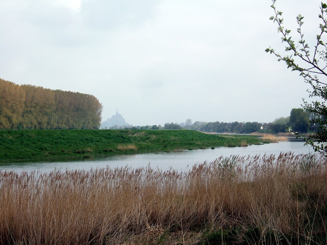
The stream originates in the département of Mayenne and flows across agricultural plains and small settlements before reaching a broad estuary. As it nears the sea the Couesnon spreads into channels and marshes within a large tidal zone. The lower reach is subject to frequent change: currents, storm events and human works have all influenced the position and number of channels that carry flow to the bay. The river is often referred to simply as the Couesnon on maps and local signage.
Geology, hydrology and estuary dynamics
The Couesnon enters an estuarine system characterised by rapid tidal exchanges and extensive sand and mud flats. Sediment transported by the river is redistributed by tides, contributing to the growth of salt marshes and the development of tidal channels. Seasonal freshwater input, combined with powerful tidal currents from the English Channel, produces a fluctuating salinity gradient and a mosaic of habitats important to birds and intertidal species.
History, shifting course and the border
Historically the Couesnon has altered its course, sometimes flowing to the north of Mont‑Saint‑Michel and at other times to the south. When the main channel stabilized to the south the mount appeared to lie within Normandy rather than Brittany, giving rise to the saying, in French, "Le Couesnon en sa folie mit le Mont en Normandie." Despite popular perception, the present legal and administrative boundary between the neighbouring regions does not simply follow the riverbed. The lower stretch of the river long formed a local limit between the historical duchies, and today the line between Normandy and Brittany lies some distance to the west of the mount.
Ecology
The estuary and adjacent marshes support salt‑tolerant vegetation, wading birds, waterfowl and fish that use the tidal flats for feeding and nursery grounds. These habitats are sensitive to changes in sedimentation, nutrient inputs and land reclamation. Conservation initiatives focus on maintaining the dynamic processes that sustain the bay’s biodiversity while limiting harmful impacts of drainage, intensive agriculture and unchecked development.
Human influence and management
Human activity over centuries — causeways, dykes, drainage and more recent engineering works — has altered the Couesnon’s natural dynamics. In modern times, management efforts aim to restore more natural tidal circulation around Mont‑Saint‑Michel and to control sediment deposition that could isolate the mount from tidal action. Decisions balance heritage access, flood protection, agricultural use and environmental conservation, and are often made in coordination with regional authorities and protected‑area managers.
Cultural significance and tourism
The Couesnon figures in regional identity and popular folklore because of its shifting mouth and the famous proverb about the mount’s placement. For visitors to Mont‑Saint‑Michel the river is part of the tidal spectacle that surrounds the island‑abbey. Local guides, museums and information centres explain how the river and tides shaped the landscape and human settlement patterns over time.
Practical information and further reading
Local authorities and visitor organisations provide guidance on conservation, access, and ongoing restoration work. Relevant administrative and geographic topics are discussed by regional bodies concerned with the departments and historical territories through which the Couesnon flows. See links below for thematic information and authoritative sources.
- Couesnon — name and mapping resources
- Mayenne — source département
- North‑western France — regional context
- Estuary — tidal environment around the mouth
- Mont‑Saint‑Michel — landmark at the mouth
- Border's last stretch — lower course role
- Historical duchies — territorial history
- Normandy — one historic region
- Brittany — other historic region
- Administrative boundary — modern delimitation
- Regions — wider administrative framework
Note: This article provides a concise summary of the Couesnon’s geography, ecology and human relationships. For detailed hydrological data, legal boundary texts or specific project reports consult regional agencies and specialist publications accessible through official sources.
Questions and answers
Q: What is the Couesnon River?
A: The Couesnon River is a river in northwestern France.
Q: Where does the river start?
A: The river starts in the département of Mayenne in northwestern France.
Q: Where does the river form an estuary?
A: The river forms an estuary at Mont-Saint-Michel.
Q: What is the last stretch of the river?
A: The last stretch of the river is the border between the historical duchies of Normandy and Brittany.
Q: Why is the Couesnon River important?
A: The Couesnon River is important because, in the past, its course changed often between two beds, and it settled to the south bed, creating the saying "The Couesnon's madness placed Mont Saint-Michel in Normandy."
Q: What is the administrative boundary that separates two regions created by the Couesnon River?
A: The administrative boundary that separates two regions created by the Couesnon River is about six kilometres west of the Mount.
Q: Does the administrative boundary that separates two regions depend on the course of the river?
A: No, the administrative boundary does not depend on the course of the river.
Related articles
Author
AlegsaOnline.com Couesnon (river in northwestern France) Leandro Alegsa
URL: https://en.alegsaonline.com/art/23409
Sources
- geoportail.fr : geoportail.fr
- sandre.eaufrance.fr : The Couesnon at the Sandre database