
Cotswolds: hills, villages and heritage of central‑southwest England
Gently rolling limestone hills in central–southwest England known for honey‑coloured stone villages, medieval wool wealth and protected landscapes. Popular for walking, heritage and rural tourism.
The Cotswolds are a distinctive upland area in central and south‑west England noted for long, gently rolling hills, broad valleys and a characteristic building stone. Often called the "Heart of England," the region is valued for its rural character and historic villages. Visitors come for scenery, heritage and outdoor recreation.
Image gallery
10 Images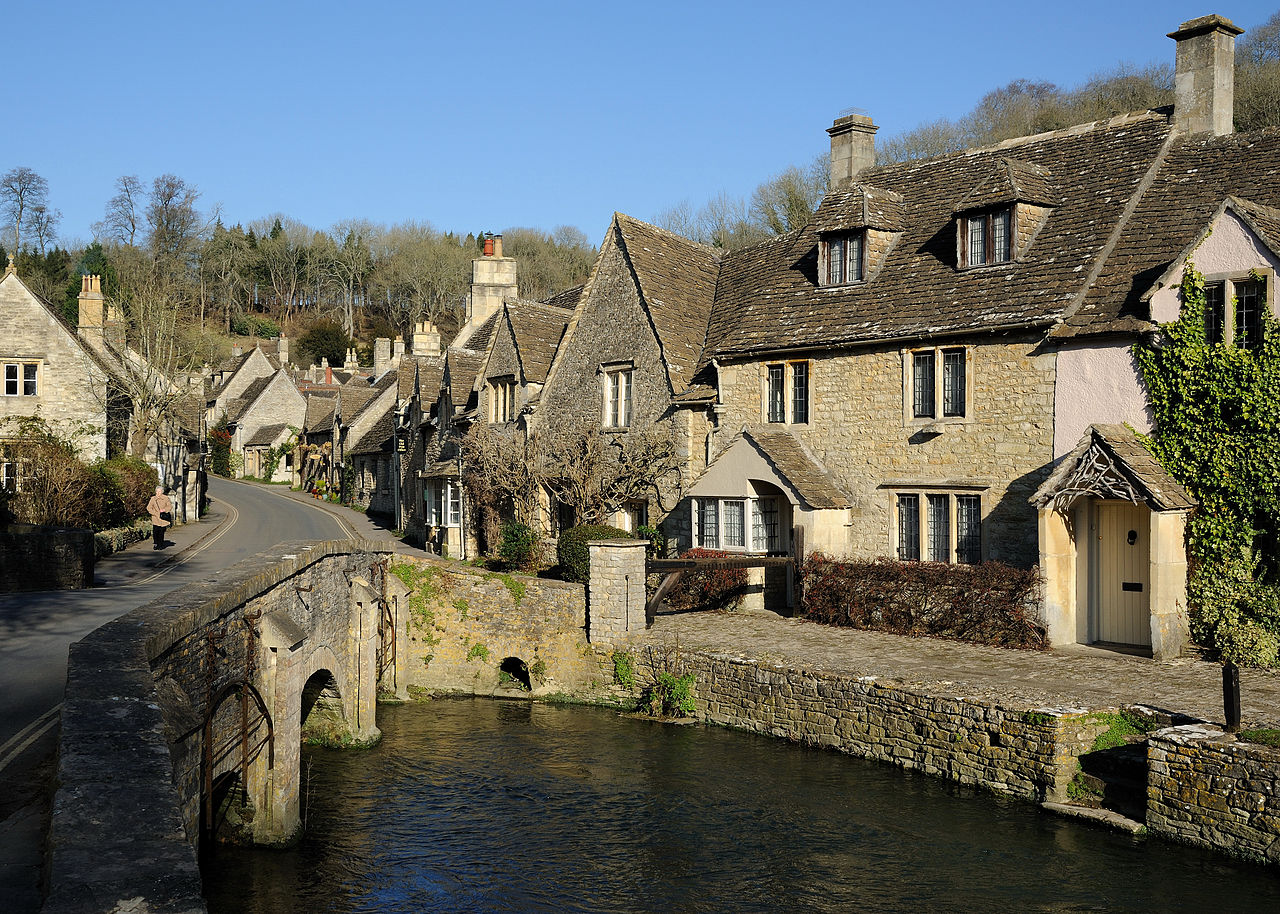




Geography and geology
The landscape is formed largely of Jurassic limestone that weathers to a warm, golden hue known as Cotswold stone. A prominent escarpment faces west and the ground falls toward the Thames valley to the east. The highest summit in the area is Cleeve Hill, which reaches about 330 m (roughly 1,080 ft). The Cotswolds sit within central and south‑west England and their compact mix of ridges and plateaus creates a varied rural mosaic of pastures, hedgerows and small woods.
Villages, architecture and economy
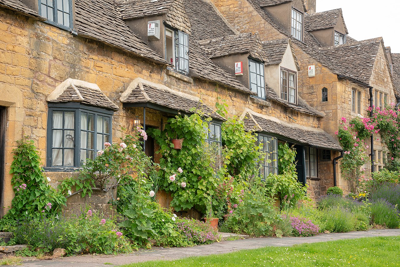
Small towns and villages are a defining feature. Buildings built of the local limestone, narrow streets and parish churches give many settlements a cohesive historic appearance. Traditional centres such as Bourton‑on‑the‑Water, Stow‑on‑the‑Wold and Chipping Campden illustrate the region’s vernacular architecture. Historically the wool trade and sheep farming shaped local prosperity; later industries included cottage crafts and small‑scale agriculture.
History and cultural importance
The Cotswolds’ human story stretches from prehistoric field systems and Roman roads through medieval market towns and the medieval wool boom that financed many churches and manor houses. The continuity of vernacular building materials and patterns of land use has produced a landscape with strong cultural resonance, often celebrated in literature, painting and conservation efforts.
Conservation, recreation and designation
Much of the Cotswolds has statutory protection as an Area of Outstanding Natural Beauty to conserve its distinctive landscape and biodiversity. The designation encourages careful planning, habitat restoration and sensitive tourism. Popular pursuits include long‑distance walking, cycling, visiting historic houses and gardens, and low‑impact rural tourism. For information on the protected status see Area of Outstanding Natural Beauty.
Extent and administration
Administratively the region overlaps several modern counties and local authorities. The Cotswolds lie within the current ceremonial counties of:
Gloucestershire contains the largest contiguous portion of the hills, but the Cotswolds are best understood as a landscape that transcends administrative boundaries. Their appeal combines natural scenery, built heritage and a living rural economy, making the area an enduring focus for conservation and tourism.
Questions and answers
Q: Where is Cotswolds located?
A: Cotswolds is located in central-southwest England.
Q: What is Cotswolds known as?
A: Cotswolds is sometimes known as the "Heart of England".
Q: How high does Cotswolds reach?
A: Cotswolds is a hilly area that reaches over 300 m in height.
Q: What is the highest point in Cotswolds?
A: The highest point in Cotswolds is Cleeve Hill, which stands at 330 m (1083 ft).
Q: What designation has been given to the Cotswolds?
A: The Cotswolds has been designated as an Area of Outstanding Natural Beauty.
Q: In which ceremonial counties does Cotswolds lie?
A: Cotswolds lies within the ceremonial counties of Oxfordshire, Gloucestershire, Wiltshire, Somerset, Warwickshire, and Worcestershire.
Q: Which county forms the largest area of the Cotswolds?
A: The county of Gloucestershire forms the largest area of the Cotswolds.
Related articles
Author
AlegsaOnline.com Cotswolds: hills, villages and heritage of central‑southwest England Leandro Alegsa
URL: https://en.alegsaonline.com/art/23364