
Cotentin Peninsula (Cherbourg Peninsula): geography, history and economy
Peninsula in Normandy projecting into the English Channel. Overview of its geography, towns, transport links, wartime history, economy and role linking mainland France to the Channel Islands.
Overview
The Cotentin Peninsula, often called the Cherbourg Peninsula, is a distinct landform in northwestern Normandy that juts into the English Channel. Administratively it lies within the Manche department and forms an identifiable arm of the coast of France. The headland narrows toward the northwest where the important port town of Cherbourg stands; smaller harbours and fishing villages are distributed around its fringe. The name Cotentin is used for both the physical peninsula and the surrounding historical area, while "Cherbourg Peninsula" highlights the prominence of the northern port in regional life. More detailed maps and regional guides often treat the peninsula as a single geographic unit.
Image gallery
6 Images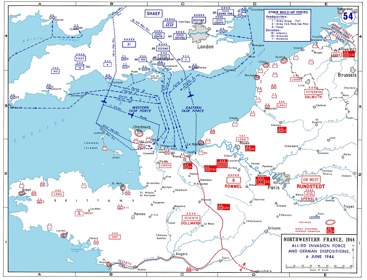



Geography and landscape
The Cotentin stretches roughly northwest from the Normandy plain and shows varied coastal forms: long sandy beaches, rocky headlands, tidal flats and dune systems. A distinctive west coast, sometimes called the Côte des Îles, faces the nearby Channel Islands. The terrain inland becomes gently rolling, with hedged fields, bocage countryside and pockets of heathland. Maritime influences moderate the climate, producing relatively mild winters and cool summers compared with interior France. Several rivers flow across the peninsula into estuaries that provide important habitats for birds and marine life.
Major towns and connections
Cherbourg is the largest urban centre and an important maritime gateway. Other notable ports and towns include Barfleur, Carteret and the port of Dielette, which operates ferry services to the islands of Jersey, Guernsey and Alderney. The peninsula is served by regional roads and rail links to the rest of Normandy, and local ferry routes maintain cultural and economic ties across the Channel. Visitors and freight frequently use these connections for tourism, trade and commuting between island and mainland communities.
History and cultural significance
The Cotentin has a layered history from prehistoric coastal settlements to medieval churches and fortifications. Its position on the Channel made it strategically important across centuries: maritime trade, fishing and cross-Channel links shaped local culture and economy. In the 20th century the peninsula attracted attention during the Second World War for its coastal defences and its role in Allied operations; its towns and countryside bear architectural and memorial traces of that period. Local traditions, cuisine and dialects reflect Norman influences as well as maritime heritage.
Economy, land use and tourism
Agriculture (dairy, cereals and market gardens), fishing, maritime industries and port activities form the economic backbone. Tourism is significant: beaches, historic ports, coastal walks and wildlife attract visitors, while seasonal ferry services support island tourism and supply chains. The Cotentin also hosts industrial sites and smaller high-technology facilities in and near Cherbourg, balancing traditional livelihoods with modern economic activity.
Notable distinctions and practical information
- The peninsula is sometimes described as the most westerly extension of continental Normandy and serves as a geographical bridge toward the Brittany and the islands beyond.
- Its west-facing Côte des Îles presents views toward the Channel Islands and seasonal ferry routes from Carteret and Dielette link to Jersey, Guernsey and Alderney.
- For administrative and tourism details consult regional authorities and port operators; local guides and maps (Cotentin resources) provide up-to-date schedules and visitor information.
Whether considered for its strategic maritime position, its rural landscapes or its role as a staging point between mainland France and nearby islands, the Cotentin Peninsula remains a distinct and historically rich part of Normandy that continues to influence cross-Channel connections today. For additional regional context see maritime and departmental resources (Channel, French coast).
Questions and answers
Q: What is the Cotentin Peninsula?
A: The Cotentin Peninsula is a peninsula located in Normandy, France that extends in a northwest direction into the English Channel.
Q: What is another name for the Cotentin Peninsula?
A: The Cotentin Peninsula is also known as the Cherbourg Peninsula.
Q: What is to the west of the Cotentin Peninsula?
A: To the west of the Cotentin Peninsula are the Channel Islands.
Q: What is to the southwest of the Cotentin Peninsula?
A: To the southwest of the Cotentin Peninsula is the Brittany Peninsula.
Q: Where is the largest town on the Cotentin Peninsula located?
A: The largest town on the Cotentin Peninsula, Cherbourg, is located on the north coast.
Q: What is Cherbourg known for?
A: Cherbourg is known for being a major port on the English Channel.
Q: Which islands can be reached by ferry from the port of Dielette on the Cotentin Peninsula?
A: Ferry links serve Carteret, and the islands of Jersey, Guernsey and Alderney from the port of Dielette on the Cotentin Peninsula.
Related articles
Author
AlegsaOnline.com Cotentin Peninsula (Cherbourg Peninsula): geography, history and economy Leandro Alegsa
URL: https://en.alegsaonline.com/art/23354
Sources
- rex.iutcaen.unicaen.fr : Twelve essential old Scandinavian words (old Norse) in placenames of Normandy (R. Lepelley. Caen University)