Communes of Cantal, France
Overview of the 260 communes of Cantal (a French département), their organization, intercommunal structures, geography, economy, and notable features.
Overview
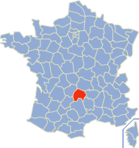
The communes of the Cantal département form the lowest tier of local government in this rural part of south-central France. There are 260 communes in Cantal, each administered by a mayor (maire) and a municipal council elected by local residents. Communes range from small mountain villages with only a handful of inhabitants to larger towns that serve as local service centres. For a compiled list of the communes and their basic data, official resources and departmental records are typically consulted.
Image gallery
2 Images
Administrative organization
Cantal is one of the départements of Cantal in the broader structure of the French state, itself a type of département. Communes sit below cantons and arrondissements; the department contains several arrondissements whose prefectures or subprefectures are based in towns such as Aurillac, Saint-Flour and Mauriac. At commune level, responsibilities commonly include local planning, primary schools, civil registry, and municipal roads, while additional services are often shared through intercommunal cooperation.
Intercommunal cooperation
To pool resources and coordinate services, communes in Cantal participate in intercommunal structures called communautés. These bodies handle tasks like economic development, waste management, and some infrastructure. Major groupings in the department include:
- (CAA) Communauté d'agglomération du Bassin d'Aurillac
- (CCC) Communauté de communes du Cézallier
- (CCCA) Communauté de communes de Caldaguès-Aubrac
- (CCACGC) Communauté de communes de l'agglomération de Cère et Goul en Carladès
- (CCCR) Communauté de communes entre Cère et Rance
- (CCHC) Communauté de communes de la Haute-Châtaigneraie
- (CCM) Communauté de communes de Montsalvy
- (CCMT) Communauté de communes Margeride-Truyère
- (CCP) Communauté de communes de la Planèze
- (CCPG) Communauté de communes du Pays de Gentiane
- (CCPMas) Communauté de communes du Pays de Massiac
- (CCPMauc) Communauté de communes du Pays de Mauriac
- (CCPMaus) Communauté de communes du Pays de Maurs
- (CCPMu) Communauté de communes du Pays de Murat
- (CCPP) Communauté de communes du Pays de Pierrefort
- (CCPS) Communauté de communes du Pays de Salers
- (CCPSF) Communauté de communes du Pays de Saint-Flour
- (CCSA) Communauté de communes Sumène Artense
Landscape, economy and local life
Cantal lies largely within the Massif Central and is noted for its volcanic plateaus, rolling highlands and the Monts du Cantal. These geographic features shape local economies: livestock farming (notably cattle breeds associated with regional cheeses), pastureland, forestry and seasonal tourism are important. Commune centres often preserve traditional stone architecture, Romanesque churches and small markets that sustain rural life. Hiking, winter sports and gastronomic tourism attract visitors to many villages and towns.
History, trends and notable facts
The pattern of many small communes reflects centuries of localized settlement and administration in France. In recent decades there has been a trend toward greater intercommunal cooperation and occasionally the voluntary merging of communes (communes nouvelles) to improve administrative efficiency and public services. While communes retain a strong sense of local identity, cooperative structures help them address modern challenges such as demographic change, infrastructure upkeep and economic development. For context on national administrative terms and the role of communes within France, authoritative governmental sites provide summaries and current governance information.

Because local governance is fundamental to daily life in Cantal, understanding the communes—how they are organized, how they work together and how they preserve local heritage—gives insight into both the administrative map and the living cultural landscape of this mountainous département.
Questions and answers
Q: What is the text about?
A: The text is about a list of 260 communes in the Cantal département in France.
Q: What are some of the communautés listed?
A: Some of the communautés listed include Communauté d'agglomération du Bassin d'Aurillac, Communauté de communes du Cézallier, Communauté de communes de Caldaguès-Aubrac, and Communauté de communes Sumène Artense.
Q: How many communes are there in total?
A: There are 260 communes in total.
Q: What does "CAA" stand for?
A: CAA stands for Communauté d'agglomération du Bassin d'Aurillac.
Q: What does "CCC" stand for?
A: CCC stands for Communauté de communes du Cezallier.
Q: What does "CCCA" stand for?
A: CCCA stands for Communauté de Communes de Caldaguès- Aubrac.
Q: What does "CCMT" stand for?
A: CCMT stands for Communauté de Communes Margeride-Truyère
Related articles
Author
AlegsaOnline.com Communes of Cantal, France Leandro Alegsa
URL: https://en.alegsaonline.com/art/22074