Climate of California: regional types, causes, and impacts
Summary of California’s varied climate zones, the physical factors that shape them, their seasonal patterns, and key impacts on water, agriculture, and wildfire risk.
California's climate ranges from sun-drenched deserts to snowbound high mountains. The state's long north–south extent, sharp changes in elevation, and proximity to the Pacific Ocean create a patchwork of climate zones with very different seasonal rhythms. Coastal areas tend to be temperate with cool summers and mild winters; inland valleys can be hot in summer and cool in winter; the mountains receive snow and alpine conditions; and the southern deserts are hot and dry for much of the year. For basic descriptions of specific categories, see Mediterranean climates and general desert summaries at desert regions.
Image gallery
9 Images


Regional climate types
- Coastal Mediterranean: Much of the central and southern coast has a Mediterranean pattern — wet winters and dry summers — moderated by the ocean air. This pattern helps explain California’s seasonal rainfall and agricultural calendar (coastal influence).
- Interior valleys and steppe: Areas such as parts of the Central Valley and southern inland basins experience hotter summers, cooler winters, and a semi-arid or steppe climate; San Diego’s climate is often described as semi-arid in parts (urban and regional climates).
- Deserts: The Mojave and Colorado Desert regions in the south have long, hot summers and mild winters, with sparse and highly variable rainfall (desert climate overview).
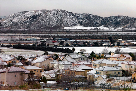
- Mountain and alpine: The Sierra Nevada and other ranges produce high-elevation, alpine conditions with heavy snowfall at higher elevations, important freshwater storage for the state (elevation effects).
Climate drivers and variability
Several physical factors shape California’s weather. Latitude determines seasonal sun angles and day length, while elevation controls temperature lapse rates and precipitation type. The Pacific Ocean, the California Current and coastal upwelling keep nearby air cooler and more stable, and mountain ranges create rain shadows that produce drier inland areas. Interannual variability is influenced by large-scale patterns such as El Niño and La Niña, which alter storm tracks and rainfall from year to year. For more on how latitude and large-scale variability affect the state see latitude effects and climate summaries from agencies like NOAA.
Impacts, importance, and notable facts
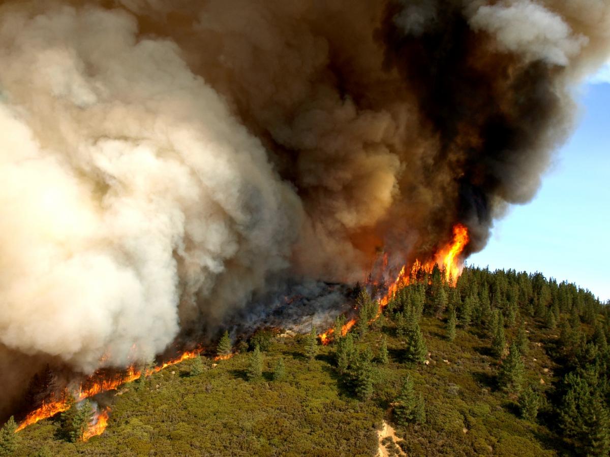
California’s climate has major consequences for people and ecosystems. The Mediterranean winter rainfall regime supports a large portion of the nation’s fruit, nut and vegetable production, but agricultural water supply depends heavily on winter snowpack in the Sierra Nevada. Periodic droughts, driven by multi-year precipitation deficits and warmer temperatures, increase competition for water, stress ecosystems and amplify fire risk. Wildfires are affected by prolonged dry seasons, vegetation buildup, and episodic wind events. Coastal fog and marine layers influence urban heat and local ecosystems. Observational assessments (for example, multi-decade averages from 1981–2010) have placed California among the warmer U.S. states, with an average annual temperature reported by some agencies near 58.4 °F; see NOAA summaries and regional climate portals at state climate data for details.
Where to learn more
- State and federal climate summaries and water agency reports (coastal and oceanographic resources).
- Regional climate atlases and university research on Sierra snowpack and drought resilience (mountain hydrology).
- Local forecasts and seasonal outlooks that discuss El Niño/La Niña impacts (regional outlooks, seasonal climate notes).
Because of its diversity, California’s climate is best understood region by region: general descriptions are useful, but local topography and coastal proximity often determine the weather experienced in a particular place.
Questions and answers
Q: What is the climate of California?
A: The climate of California varies widely from desert to alpine depending on latitude, elevation and how close the area is to the coast. Most of the coastal and southern parts of the state have a Mediterranean climate with somewhat rainy winters and dry summers. The deserts in the south of the state have very hot summers and mild winters. Parts of the south have a semi-arid/steppe climate, for example San Diego.
Q: How warm is California compared to other states?
A: According to the National Oceanic and Atmospheric Administration (NOAA) averages from 1981-2010, California is the 13th warmest state in the United States with an average annual temperature of 58.4°F (14.7 °C).
Q: Are there any areas in California that are particularly hot or cold?
A: Yes, deserts in southern California tend to be very hot while areas closer to mountains can be quite cold due to higher elevations.
Q: Is it generally wet or dry in most parts of California?
A: Most parts of coastal and southern California tend to be relatively dry with some rain during winter months. However, northern parts may experience more rainfall throughout year due to their proximity to ocean currents coming off Pacific Ocean.
Q: What type of climate does San Diego have?
A: San Diego has a semi-arid/steppe climate which means it experiences little rainfall but temperatures remain relatively mild throughout year.
Q: Does elevation affect temperature in certain areas?
A: Yes, higher elevations tend to experience colder temperatures than lower elevations due their increased distance from Earth's surface where heat accumulates more readily.
Related articles
Author
AlegsaOnline.com Climate of California: regional types, causes, and impacts Leandro Alegsa
URL: https://en.alegsaonline.com/art/20994
Sources
- currentresults.com : "Average Annual Temperature for Each US State"
- nws.noaa.gov : "NOWData - NOAA Online Weather Data"
- nws.noaa.gov : "NOWData - NOAA Online Weather Data"
- nws.noaa.gov : "NOWData - NOAA Online Weather Data"