
Chukchi Sea: geography, ecology, and human use
A concise overview of the Chukchi Sea—its boundaries, physical features, ecology, human history and contemporary significance, including navigation, indigenous use, and environmental change.
The Chukchi Sea is a shallow marginal arm of the Arctic Ocean that lies between northeastern Siberia and northwestern Alaska. It is commonly described as a marginal sea because it forms a distinct coastal basin connected to larger ocean basins. Covering roughly 595,000 km², the Chukchi Sea has long been important to coastal communities, marine mammals, and seasonal navigation along the Arctic rim.
Image gallery
7 Images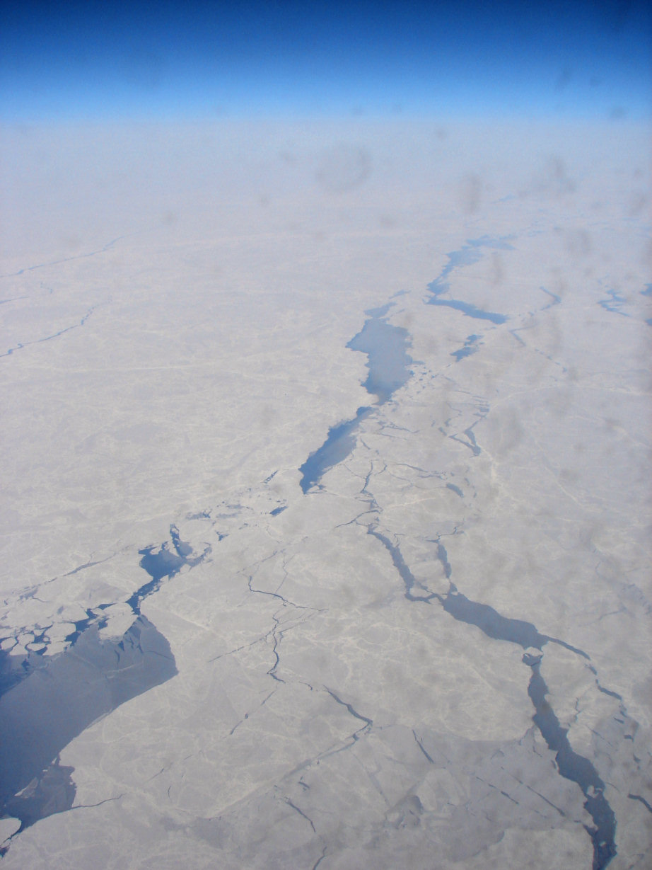



Geography and boundaries
The sea is bounded on the west by the De Long Strait near Wrangel Island and on the east by Point Barrow in Alaska, beyond which lies the Beaufort Sea. To the south the narrow Bering Strait links the Chukchi with the Bering Sea and, ultimately, the Pacific Ocean. The sea’s northern margin approaches the Arctic pack ice and a few small islands such as Herald Island, while the more substantial Wrangel Island marks a northwestern limit.
Because of its location the Chukchi Sea is crossed by the International Date Line, which is displaced eastward here so as to avoid bisecting Wrangel Island and the Russian mainland of Chukotka. The principal port on the Russian side is Uelen, and settlement patterns along both coasts reflect centuries of adaptation to a short open-water season.
Physical characteristics and navigation
The Chukchi is relatively shallow compared with many ocean basins, and large areas remain covered by sea ice for much of the year. Typically only about four months afford safe and practical navigation, though seasonal and interannual variability have increased with recent warming. The sea contains relatively few islands compared with other Arctic shelves; notable features include Wrangel and Herald, plus scattered coastal islets and lagoons.
Ecology, resources, and human use
Marine life in the Chukchi Sea is rich and adapted to cold, productive waters. Seals, walrus, polar bears and several whale species, including bowhead and beluga, forage in its coastal and shelf waters. The indigenous Chukchi and other Arctic peoples have relied on fishing, whaling and walrus hunting for subsistence and cultural practices for generations, with communities located along both Siberian and Alaskan coasts.
Interest in the Chukchi Sea has grown due to fishing, potential hydrocarbon and mineral resources, and the seasonal opening of shipping routes. At the same time, climate-driven reductions in sea ice are altering habitat and creating management challenges for conservation and coastal livelihoods.
Rivers and coastal places
Several rivers discharge into the Chukchi Sea, supplying freshwater, nutrients, and sediments that shape coastal ecosystems. On the Alaskan side these include:
- Kobuk River
- Kivalina
- Kokolik
- Kukpowruk, Kukpuk, Noatak, Utukok, Pitmegea, Wulik
On the Siberian coast, notable points and waterways include Cape Billings, Cape Schmidt, the Amguyema and Chegitun rivers, Kolyuchinskaya Bay, Neskynpil'gyn Lagoon, Enurmino, Inchoun, Uelen and Cape Dezhnev. These coastal features are focal points for local economy and wildlife, including the hunted walrus.
For further reading on regional geography and management, see resources indexed under geographic and maritime entries such as marginal seas, the Arctic Ocean, and regional environmental reports from Alaska and Siberia. Additional mapping and historical accounts touch on places like Wrangel Island, Beaufort Sea studies, and cross-strait dynamics at the Bering Strait.
Questions and answers
Q: What is the Chukchi Sea?
A: The Chukchi Sea is a marginal sea of the Arctic Ocean, located between Wrangel Island and Point Barrow, Alaska. It is connected to the Bering Sea and Pacific Ocean by the Bering Strait.
Q: How large is the Chukchi Sea?
A: The Chukchi Sea has an area of about 595,000 km² (230,000 mi²).
Q: When can one travel on the Chukchi Sea?
A: One can only travel on the Chukchi Sea for about four months of the year.
Q: Are there any islands in the Chukchi Sea?
A: There are very few islands in the Chukchi Sea compared to other seas of the Arctic. Wrangel Island is at its northwestern limit and Herald Island is near its northern limit. There are also a few small islands along both Siberian and Alaskan coasts.
Q: Who lives on or near its shores?
A: The people who live on or near its shores are called "Chukchis". They work at fishing, whaling and hunting walrus in this cold sea.
Q: What places are located along Siberia's coast of this sea?
A: Places located along Siberia's coast include Cape Billings, Cape Schmidt, Amguyema River, Cape Vankarem, Kolyuchinskaya Bay, Neskynpil'gyn Lagoon, Cape Serdtse-Kamen, Enurmino, Chegitun River Inchoun Uelen and Cape Dezhnev.
Q: What rivers flow into it from Alaska and Siberia respectively?
A: Rivers flowing into it from Alaska include Kivalina River , Kobuk River , Kokolik River , Kukpowruk River , Kukpuk River , Noatak River , UtokokRiver PitmegeaRiverand WulikRiver . Rivers flowing into it from Siberia include AmguyemaRiver IoniveyemRiverand ChegitunRiver .
Related articles
Author
AlegsaOnline.com Chukchi Sea: geography, ecology, and human use Leandro Alegsa
URL: https://en.alegsaonline.com/art/20280