
Chocolate Hills (Bohol, Philippines)
Conical limestone mounds in Bohol, Philippines — over a thousand grassy karst hills that turn brown in the dry season. Noted for geology, fossils, caves, tourism and proposals for UNESCO recognition.
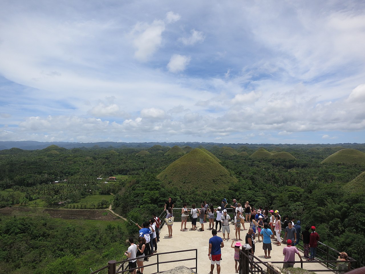
The Chocolate Hills are a distinctive landscape of conical limestone mounds located in Bohol Province, Philippines. Spread across a plateau of roughly 50 square kilometres, the group includes at least 1,260 hills and possibly many more. A continuous cover of short grass keeps the slopes green during the wet season; in the dry months the vegetation browns, giving the formations their common name, Chocolate Hills. They are widely acknowledged as a local icon and a major tourist attraction, appearing on provincial symbols and recognized by national geological authorities.
Image gallery
8 Images




Geology and formation
Scientifically the feature is best described as a field of geological formations of conical karst hills. The underlying rocks are marine limestones — sandy to rubbly deposits that accumulated when this part of the Philippines lay beneath a warm, shallow sea. These limestones contain abundant fossils, including corals, foraminifera, molluscs and algae, which record the area’s marine origin. Uplift raised the strata above sea level, and subsequent chemical weathering and dissolution by rainfall and groundwater sculpted the distinctive conical forms. Later surface runoff and erosion by streams shaped the plains between hills and exposed caves and springs.
Appearance, distribution and karst features
The hills are remarkably uniform in shape and size, ranging from a few meters to more than one hundred meters high, and are separated by low, almost flat plains. Karst processes have produced numerous subterranean features: caves, sinkholes and freshwater springs that support local water supplies and ecosystems. Visitors often see the landscape as a carpet of domes stretching to the horizon; in dry months the brown grass emphasizes the similarity of tone across many mounds.
- Main rock type: marine limestone and reef-derived sediments (limestone).
- Fossils present: foraminifera, coral, molluscs and algae.
- Landforms: conical karst hills, caves and springs (caves and springs).
History, scientific study and comparisons
Geologists interpret the Chocolate Hills as the product of long-term marine deposition followed by uplift and karstic dissolution. Similar conical karst topographies occur in limestone regions elsewhere, allowing useful comparisons: parts of Slovenia, certain areas of Croatia, northern Puerto Rico, and Pinar del Río in Cuba show related landforms. The pattern seen in Bohol provides an accessible example of how reefal and marine sediments evolve into a complex karst landscape. As a recognized natural monument, the site has been documented by national authorities and proposed for inscription on the UNESCO World Heritage list.
Uses, tourism, conservation and notable facts
The Chocolate Hills attract thousands of visitors each year and are central to Bohol’s tourism economy. They are promoted in travel guides and managed as a protected landscape and natural attraction at provincial and national levels. Because the hills rest on soluble limestone, protection focuses on preventing quarrying, limiting unplanned development, and managing visitor access to reduce erosion and vegetation loss. The area’s caves and springs are ecologically important and supply freshwater to nearby communities.
Local and scientific interest also highlights a few notable points: the hills’ seasonal colour shift, their unusually regular conical shapes, and the combination of scenic, fossil and karst values that make them an educational resource. They are officially recognized in the Philippines as a national geological monument, and ongoing discussions consider further international recognition and conservation measures to preserve this distinctive karst landscape (conical karst topography).
For further context and comparative studies, see regional and international karst examples in Cuba, studies of coral-derived limestones (coral), and accounts of island karst hydrology and erosion. Additional resources and travel information are maintained by local tourism bodies and national geological agencies (vegetation and seasonal change, visitor information, geological background).
Questions and answers
Q: What are the Chocolate Hills?
A: The Chocolate Hills are a geological formation in Bohol Province, Philippines. They consist of at least 1,260 conical karst hills spread over an area of more than 50 square kilometres (20 sq mi).
Q: How did the Chocolate Hills form?
A: The Chocolate Hills probably started as corals growing in a warm, shallow sea about two million years ago. The hills consist of sandy to rubbly marine limestones which were created by limestone dissolving in rainfall and groundwater. There was also erosion by rivers and streams after they were lifted above sea level.
Q: Why are they called the Chocolate Hills?
A: The hills are covered in green grass that turns brown (like chocolate) during the dry season, hence the name.
Q: Are the Chocolate Hills a tourist attraction?
A: Yes, they are a famous tourist attraction of Bohol and have been declared the country's third National Geological Monument and proposed for inclusion in the UNESCO World Heritage List.
Q: Where else can similar topography be found?
A: Similar topography can be found in Slovenia, Croatia, northern Puerto Rico, and Pinar del Río Province, Cuba.
Q: What type of fossils can be found within these limestones?
A: These limestones contain abundant fossils of foraminifera, coral, molluscs, and algae.
Q: How old is this formation estimated to be?
A: This formation is estimated to be around two million years old.
Related articles
Author
AlegsaOnline.com Chocolate Hills (Bohol, Philippines) Leandro Alegsa
URL: https://en.alegsaonline.com/art/19919
Sources
- globaleye.org.uk : Eye on the Philippines
- sevennaturalwonders.org : Chocolate Hills
- bohol.gov.ph : The Bohol Flag and Seal
- whc.unesco.org : Chocolate Hills Natural Monument
- dlib.si : Protection of karst in the Philippines (Varstvo Krasa na Filipinih)
- ccop.or.th : Geoheritage of East and Southeast Asia.