
Alagnon (river of the Massif Central, France)
A volcanic highland river in central France. The Alagnon rises in the Parc Naturel Régional des Volcans d'Auvergne and is a left tributary of the Allier, influencing local ecology, landscape and rural uses.
The Alagnon is a river in central France that rises on the volcanic plateaux of the Massif Central within the Parc Naturel Régional des Volcans d'Auvergne. The river flows away from its upland source through a landscape shaped by basalt plateaux, former lava flows and steep-sided valleys. For a map reference see the river's coordinates.
Image gallery
6 Images


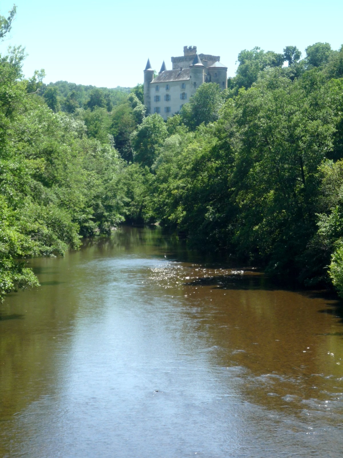

Course and physical characteristics
The Alagnon follows a course typical of upland rivers: a relatively steep, rocky upper reach with narrow gorges and cascades, giving way downstream to broader valley floors and gentler gradients before it joins the Allier as a left-bank tributary. Seasonal changes in precipitation and snowmelt on the Massif Central affect its flow regime. Regional hydrological summaries and basin studies provide data on discharge, watershed limits and sediment transport at local and departmental levels; consult regional hydrology and river basin resources for technical details.
Geology and landscape
The river basin reflects the volcanic origins of the area: bedrock often includes basalt and other volcanic deposits that influence riverbed composition and valley shapes. Soils derived from volcanic materials support a mosaic of heath, montane grasslands and woodland on the higher ground, while lower slopes and valley bottoms retain deeper, more fertile soils used for pasture and mixed farming.
Natural environment and ecology
Because much of the upper basin lies within a protected park, the Alagnon corridor retains important habitats. Cold, well-oxygenated headwaters are suitable for trout and other freshwater species, while slower stretches and associated wetlands support amphibians, aquatic invertebrates and a range of riparian plants. Conservation actions and habitat management are coordinated with the park authority and local environmental schemes; see information from Volcanoes of Auvergne park and park publications for conservation priorities.
Human use, culture and history
Human settlement along the Alagnon has long been adapted to upland conditions. Historically the river powered mills and provided water for livestock and small-scale agriculture; in modern times sections are used for modest hydropower, irrigation and recreation. Popular recreational activities include angling, walking along valley trails and paddling on gentler reaches. Regional planning and cultural heritage bodies document the river's role in local history and rural life; see Auvergne-Rhône-Alpes resources and regional archives.
Notable facts and river network
- The Alagnon is a left tributary of the Allier, which itself contributes to the Loire basin; this links the Alagnon to one of France's major river systems — background on the Allier is available at Allier river.
- Its volcanic setting gives the river corridor notable scenic and scientific interest and supports a diversity of upland habitats; basin and network summaries can be consulted at river network.
Further information on the Alagnon can be found in park guides, regional hydrological reports and local naturalist surveys cited by the authorities and organisations linked above. These provide the most reliable, up-to-date accounts of the river's physical characteristics, ecology and role in the surrounding human landscape.
Questions and answers
Q: Where does the Alagnon river start?
A: The Alagnon river starts in the Massif Central within the Regional Natural Park of the Volcanoes of Auvergne.
Q: Through which region does the Alagnon river flow?
A: The Alagnon river flows through the Auvergne-Rhône-Alpes region.
Q: What is the Alagnon river?
A: The Alagnon river is a left tributary of the Allier.
Q: What are the coordinates of the Alagnon river?
A: The coordinates of the Alagnon river are 45°27′8″N 3°18′14″E / 45.45222°N 3.30389°E / 45.45222; 3.30389.
Q: Where is the Massif Central located?
A: The Massif Central is located within the Regional Natural Park of the Volcanoes of Auvergne.
Q: What is the French name for the Regional Natural Park of the Volcanoes of Auvergne?
A: The French name for the Regional Natural Park of the Volcanoes of Auvergne is Parc Naturel Régional des Volcans d'Auvergne.
Q: Which river does the Alagnon river flow into?
A: The Alagnon river flows into the Allier river as its left tributary.
Related articles
Author
AlegsaOnline.com Alagnon (river of the Massif Central, France) Leandro Alegsa
URL: https://en.alegsaonline.com/art/1937
Sources
- commons.wikimedia.org : Alagnon
- services.sandre.eaufrance.fr : "L'Alagnon (K25-0300)"
- hydro.eaufrance.fr : "L'Alagnon à Lempdes"
- geoportail.gouv.fr : "Source de l'Alagnon"
- geoportail.gouv.fr : "Embouchure de l'Alagnon"