
Chesil Beach: the shingle bank, Fleet Lagoon and coastal landscape of Dorset
Long, narrow shingle barrier in Dorset that links the Isle of Portland to the mainland, shelters the Fleet Lagoon, supports wildlife and has shaped local history and coastal management.
Overview
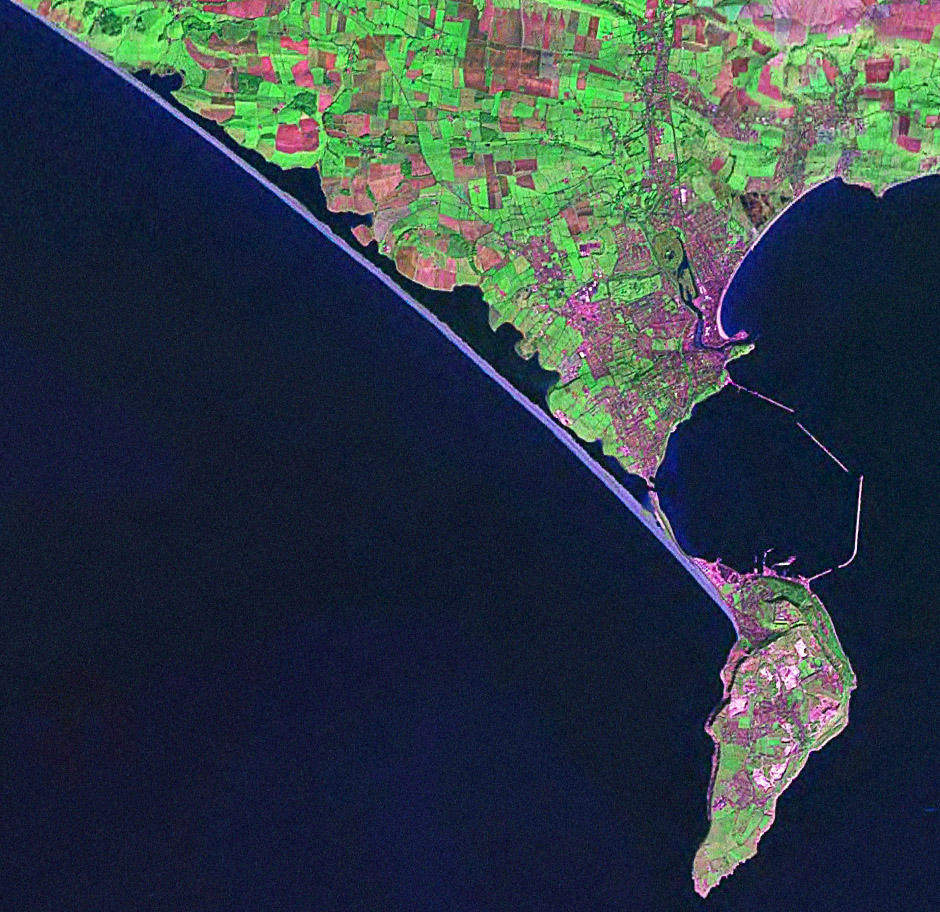
Chesil Beach is a distinctive, long shingle bank off the coast of Dorset in southern England. It functions as an offshore barrier and tombolo, joining the mainland to the Isle of Portland near Portland Bill. The enclosed stretch of calm water behind the bank is the Fleet, sometimes called the Fleet Lagoon, which together with the beach forms part of the Jurassic Coast, a protected landscape recognized by UNESCO as a World Heritage Site.
Image gallery
10 Images




Physical characteristics
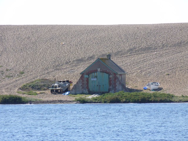
The bank is one of Britain’s largest shingle formations and is often described in terms of its length and profile: roughly 18 miles (about 29 km) long and rising to heights of over ten metres in places. The shore faces and lagoon side show marked gradients in pebble size: pebbles are small and almost pea-sized at the western end and increase in diameter toward the east, where they may reach the size of small oranges. The composed material is predominately flint and chert gravel, with local concentrations of flint nodules. The structure is sometimes referred to more generally as one of the major shingle structures in Britain.
Formation and geology
Chesil Beach is a product of coastal processes operating over millennia. Longshore drift and wave action have worked with rising and falling sea levels to sort and accumulate gravels along the shore. The bank acts as a natural barrier, creating the shallow tidal lagoon of the Fleet, which has a limited tidal range and sheltered waters. The name "Chesil" comes from Old English roots meaning gravel or shingle; the linguistic origin is often cited through the Old English term ceosel (also spelled cisel).
Ecology and conservation
The Fleet Lagoon and adjacent habitats host a range of coastal species, including migratory and wintering birds, saltmarsh plants and intertidal invertebrates. Because of its ecological value and its geological importance along the Jurassic Coast, the area receives protective designations and is managed to balance habitat conservation with flood protection and public access. The sheltered waters behind the bank have historically supported eelgrass beds and other important littoral communities.
Human history and uses
Chesil Beach has influenced settlement and activity along this stretch of coast. The bank provides shelter from prevailing westerly winds and waves for nearby settlements, notably Weymouth and the low-lying village of Chiswell on the Isle of Portland, helping to reduce storm damage. Historically the beach and lagoon have been associated with fishing, small-scale industry and folklore: stories of smugglers navigating at night and using the graded pebbles as a guide to location are part of local tradition, and the bank's protection has been a factor in defence planning in several periods.
Culture, management and public access
The dramatic sweep of Chesil and the placid Fleet have attracted artists, writers and visitors; the bank features in literature and has served as backdrop for study and recreation. Ian McEwan used the name and setting in his novel On Chesil Beach, which brought the place additional cultural attention. Today the coastline is subject to managed coastal defences, conservation measures and controlled visitor access to reduce erosion and protect habitats. Local authorities and conservation organisations work together to monitor pebble movement, maintain sea walls where necessary and sustain the balance between human use and natural change.
Notable facts and practical points
- The bank acts as a natural sea defence and has a characteristic slope of shingle grading from small at the western end to larger pebbles in the east; this variation was used by locals and sailors to judge position at night.
- Dimensions commonly cited for the beach include a width often approaching 200 metres in places (historically noted as about 220 yards) and local heights that can exceed ten metres above high water.
- As part of the wider coastal system, Chesil is influenced by prevailing winds and wave patterns and remains under ongoing observation to understand long-term change.
- Visitors can see the stark contrast between the exposed seaward slope and the calm waters of the Fleet Lagoon, and interpretive material at local centres explains the bank's geology and ecology.
For further local information, maps and guidance on visits, conservation projects and research relating to Chesil Beach and the Fleet, consult regional resources and park authorities who coordinate protection of this distinctive coastal landform.
Dorset • southern England • shingle structures • Old English • Portland Bill • The Fleet • shingle beach • 220 yards • Jurassic Coast • UNESCO • World Heritage Site • Ian McEwan • Isle of Portland • prevailing winds • Weymouth • flint • chert
Questions and answers
Q: What is Chesil Beach?
A: Chesil Beach, sometimes called Chesil Bank, is a shingle structure located in Dorset, southern England. It is part of the Jurassic Coast and a UNESCO World Heritage Site.
Q: What does its name mean?
A: The name "Chesil" is derived from the Old English ceosel or cisel, meaning "gravel" or "shingle".
Q: How long and wide is it?
A: Chesil Beach is 18 miles long (29km) and 220 yards wide (200m).
Q: What other features are associated with it?
A: The lagoon between the chesil and the mainland is called The Fleet or The Fleet Lagoon. At the eastern end of the beach at the village of Chiswell, against the cliffs of the Isle of Portland, there is also a sheltered cove which protects low-lying areas from flooding.
Q: How deep is The Fleet Lagoon?
A: The Fleet Lagoon has a depth of 9½ feet (3m).
A: What purpose does it serve for Weymouth and Chiswell?
Q: What purpose does it serve for Weymouth and Chiswell?
A: Chesil Beach provides shelter from prevailing winds (from the west) and waves for both Weymouth town and Chiswell village which would otherwise not exist.
Q: How high is Chesil Bank above mean high water level?
A:Chesil Bank stands 14.7 metres (48 ft) above mean high water level.
Related articles
Author
AlegsaOnline.com Chesil Beach: the shingle bank, Fleet Lagoon and coastal landscape of Dorset Leandro Alegsa
URL: https://en.alegsaonline.com/art/19331
Sources
- jurassiccoast.com : jurassiccoast.com/380/the-coast-uncovered-30/geo-highlights-226/chesil-beach-finest-barri…
- markhousby.tripod.com : "A Personal History Of Portland"