
Chennai (Madras): geography, history, economy and cultural highlights
Chennai, formerly Madras, is the capital of Tamil Nadu on India’s Coromandel Coast. This article summarizes its geography, history, economy, culture, landmarks and transport.
Overview
Chennai, historically known as Madras, is the capital of Tamil Nadu and one of the largest metropolitan areas in India. The city is a major regional center for commerce, education and the arts. The population of the city proper is roughly seven million, while the wider metropolitan region is considerably larger; it is commonly ranked among India’s top cities by population and economic output. For administrative matters and public services see state and municipal resources.
Image gallery
10 Images


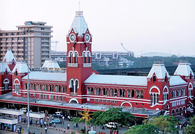


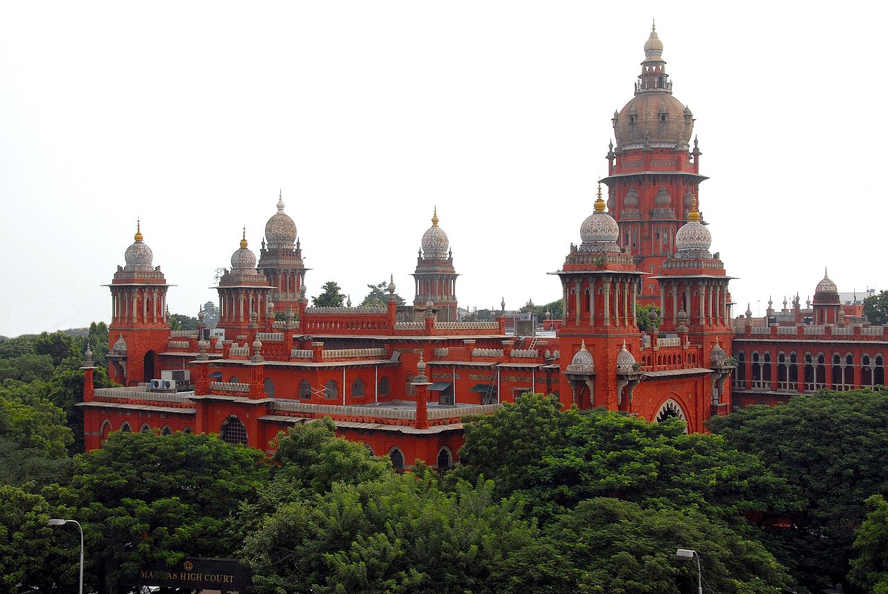
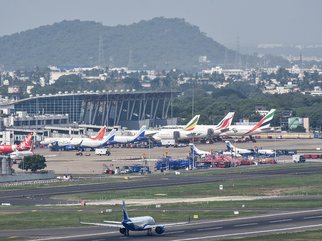
Geography and environment
Chennai lies on the Coromandel Coast of the Bay of Bengal, facing the eastern seaboard of India. Its coastline includes the long, sandy Marina Beach, often described as one of the world’s longest urban beaches. The shoreline and low-lying terrain shape the city’s climate and flood risk, particularly during seasonal monsoon rains.
The urban area is crossed by several waterways: the Cooum River and the Adyar River bisect sections of the city, and the historic Buckingham Canal runs parallel to the coast. These rivers and canals once supported trade and transport; today they also form part of drainage and environmental management efforts.
History and development
The modern settlement grew in the 17th century during the expansion of European trading companies and was formally established by British interests on the southeastern coast. Over centuries the city developed as a colonial administrative center and port, retaining many historic buildings and fortifications from that period. Local and imperial histories converge in its neighborhoods, temples and civic institutions; preserved sites and museums document this layered past.
Economy and industry
Chennai is an important industrial and financial hub. It has a diverse economy that includes automobile manufacturing, information technology, finance and shipping. The city is often referred to as the automobile hub of India or the Detroit of the region because of its concentration of vehicle plants and component manufacturers. Major sectors include:
- Automotive and auto components
- Information technology and services
- Manufacturing and shipping
- Healthcare and education
Culture, landmarks and institutions
Chennai is a center for Tamil language culture, classical music (Carnatic), dance (notably Bharatanatyam) and cinema. The city hosts music festivals, religious processions and theatrical traditions that attract regional and international visitors. Important sites include temples, colonial-era forts and civic buildings that reflect both local and cosmopolitan influences.
Notable landmarks and cultural institutions:
- Marina Beach promenade
- Historic Fort area and museums
- Major temples and shrines
- Cultural halls and music academies
Transport, administration and notable facts
The city is served by a major international airport, an expanding suburban rail and metro network, and a busy port that supports regional trade. Urban planning must balance growth with coastal and riverine flood management, public transit expansion and heritage conservation. Key administrative and civic references include municipal agencies, state departments and academic research centers addressing urban challenges.
Other points of interest: urban conservation, economic clusters, port operations, cultural festivals, educational institutions, research centers, public parks, maritime history, architectural heritage and contemporary civic issues such as climate resilience.
The name of the city
Since 1996 the name of the city is officially Chennai, but the old name Madras is still common. Both names have been in parallel use since the 17th century. Chennai is short for Chennappattinam (pattinam meaning city) and was apparently the name of the settlement formed around Fort St. George, founded by the British in 1639. The name is usually derived from a local ruler named Chennappa Nayak. Madras or Madrasapattinam, on the other hand, seems to have originally been the name of a nearby village. The origin of the name is unclear: suggested derivations have been from the Arabic word madrasa for "school" (literally "place of study"), the Portuguese Madre de Deus ("Mother of God", after a church of the same name), a Portuguese merchant clan called Madeiros, and even the Sanskrit word Mandarajya ("realm of the simple-minded").
After the two places had grown together, Madras became the name of the city in English, while Chennai remained in use in Tamil. In 1996, the DMK-led government of Tamil Nadu arranged for the official name of the city to be changed from Madras to Chennai. By erasing the name Madras, which was closely associated with British colonial history and perceived as "un-Tamil", it was possible both to serve an anti-colonial sentiment and to emphasise the city's Tamil identity. Similarly, a number of other Indian cities have had their colonial-era names replaced (cf. the renaming of Bombay to Mumbai and Calcutta to Kolkata).

Geography
Location and extent
Chennai is located in southeastern India on the Coromandel Coast on the Bay of Bengal. Within the state of Tamil Nadu, the capital Chennai is located far to the northeast. It is only about 40 kilometers to the border of the northern neighboring state of Andhra Pradesh, while Cape Comorin, the southernmost point of Tamil Nadu and all of India, is 625 kilometers away.
As of 2011, the Chennai city has an area of 426 square kilometers. Before the expansion, Chennai's administrative urban area covered only 174 square kilometers, while the agglomeration had grown far beyond its boundaries. Coexisting with the city of Chennai is Chennai District, one of 32 districts of Tamil Nadu. Besides the city proper, the Chennai Metropolitan Area includes the wider catchment area of Chennai in the neighbouring districts of Tiruvallur and Kanchipuram. It has an area of 1189 square kilometers.
Chennai is located in the flat coastal plain with an average elevation of only six meters above sea level. On the seaside of Chennai is the 13-kilometer-long sandy Marina Beach. The Cooum and Adyar rivers flow through the city. The Cooum flows into the sea in the northern part and the Adyar in the southern part of Chennai. Five kilometers inland, the Buckingham Canal runs parallel to the coast, connecting the two rivers. To the southwest of Chennai, a few isolated hills rise from the otherwise flat surroundings. The most famous of these is St. Thomas Mount. Northwest of the city are several lakes of varying sizes.
City breakdown
Since the city expansion of 2011, Chennai is divided into 200 wards. Each ward is represented by a councillor in the Chennai Municipal Government. The 200 wards are grouped into the following 15 zones:
- I Tiruvottiyur
- II Manali
- III Madhavaram
- IV Tondiarpet
- V Royapuram
- VI Tiru Vi. Ka. Nagar
- VII Ambattur
- VIII Annanagar
- IX Teynampet
- X Kodambakkam
- XI Valasaravakkam
- XII Alandur
- XIII Adyar
- XIV Perungudi
- XV Sholinganallur
Climate
Chennai has an alternating humid tropical climate. The climate is hot and humid all year round and is only made more bearable by occasional sea breezes. The average annual temperature is 28.6 °C. The temperatures are subject to only slight fluctuations throughout the year: The warmest month is May with an average temperature of 33.0 °C, the coolest is January with 24.3 °C. Rainfall in Chennai, as in all of India, is significantly influenced by the monsoon. Unlike most of the country, the main rainy season on the southeast coast is the winter or northeast monsoon, which brings heavy rainfall from October to December. More than half of the annual rainfall of 1,197 millimeters falls during these three months. Rain also falls during the summer monsoon from July to September, but the rainfall is less. During the dry season between January and June there is hardly any rain.
| Chennai | ||||||||||||||||||||||||||||||||||||||||||||||||
| Climate diagram | ||||||||||||||||||||||||||||||||||||||||||||||||
| ||||||||||||||||||||||||||||||||||||||||||||||||
| Monthly average temperatures and precipitation for Chennai
Source: WMO | ||||||||||||||||||||||||||||||||||||||||||||||||||||||||||||||||||||||||||||||||||||||||||||||||||||||||||||||||||||||||||||||||||||||||||||||||||||||||||||||||||||||||||||||||||||||||||||||||


Questions and answers
Q: What is the former name of Chennai?
A: The former name of Chennai was Madras.
Q: How many people live in Chennai?
A: Approximately 7 million people live in Chennai.
Q: What is the fourth largest city of India?
A: The fourth largest city of India is Chennai.
Q: When was Chennai founded?
A: Chennai was founded in 1661 by the British East India Company.
Q: What is the longest beach located in Chennai?
A: The longest beach located in Chennai is Marina Beach, which is 12 km (7 mi) long.
Q: Which two rivers divide the city into three parts?
A: The Cooum River and Adyar River divide the city into three parts.
Q: What runs through the city almost parallel to its coast?
A: The Buckingham Canal runs through the city almost parallel to its coast.
Related articles
Author
AlegsaOnline.com Chennai (Madras): geography, history, economy and cultural highlights Leandro Alegsa
URL: https://en.alegsaonline.com/art/19238