Chemnitz
![]()
This article is about the city in Saxony. For other meanings, see Chemnitz (disambiguation).
Chemnitz [![]()
![]() ˈkʰɛmnɪt͡s] (from 1953 to 1990 Karl-Marx-Stadt) is an independent city in the southwest of the Free State of Saxony and its third largest major city after Leipzig and Dresden. The river that gives it its name runs through the city, which lies on the northern edge of the Erzgebirge mountains in the Erzgebirge basin. Chemnitz is the headquarters of the Saxony State Administration and part of the metropolitan region of Central Germany. On 28 October 2020, the city was selected as the European Capital of Culture 2025.
ˈkʰɛmnɪt͡s] (from 1953 to 1990 Karl-Marx-Stadt) is an independent city in the southwest of the Free State of Saxony and its third largest major city after Leipzig and Dresden. The river that gives it its name runs through the city, which lies on the northern edge of the Erzgebirge mountains in the Erzgebirge basin. Chemnitz is the headquarters of the Saxony State Administration and part of the metropolitan region of Central Germany. On 28 October 2020, the city was selected as the European Capital of Culture 2025.
The oldest documented reference to Chemnitz as Kameniz (from Sorbian kamjenica, "stone brook") dates back to 1143. With the industrial revolution, a strong population growth began in the 19th century, and after the founding of the German Empire in 1871, Chemnitz developed into an important industrial city. During the period of high industrialization in the German Empire, Chemnitz became a large city in the course of 1882. The population reached its historic peak at the beginning of the 1930s with over 361,000 people. During the Second World War, 80% of the city centre was destroyed in the air raids on Chemnitz in February and March 1945. By decision of the Central Committee of the SED and the government of the GDR, the city was renamed Karl-Marx-Stadt on 10 May 1953.
With over 200 years of industrial history, the city is now a technology location with a focus on the automotive and supplier industry, information technology and mechanical and plant engineering. Chemnitz is home to a technical university.
The city in the foothills of the Ore Mountains is home to numerous leisure facilities and museums, including the Chemnitz Art Collections and the Chemnitz State Museum of Archaeology.
Well-known sons and daughters of the city are the painter Karl Schmidt-Rottluff, the writer Stefan Heym and the designer Marianne Brandt.
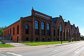
The Industrial Museum Chemnitz
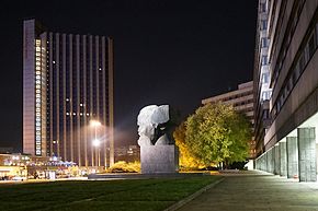
The former Karl Marx Forum with the Karl Marx Monument inaugurated in 1971
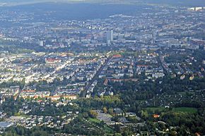
View over the Gründerzeit quarter "Kaßberg" to the city center of Chemnitz 2014
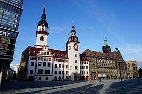
The Old and New Town Hall at the Chemnitz market place
Chemnitz forms a triangle of cities with the other two major Saxon cities of Leipzig and Dresden, with Chemnitz forming the south-western corner. The city lies in the natural area Erzgebirgsbecken and the urban area in the south on the foothills of the Middle Ore Mountains and in the north on the about 300 m high elevations of the natural area Mulde Loess Hill Country partly also called Middle Saxon Hill Country. The river Chemnitz (river bottom at about 290 metres above sea level), which bears this name from the confluence of the two low mountain rivers Zwönitz and Würschnitz in Altchemnitz, has favoured the establishment of a settlement by digging a wide valley.
The geological subsoil of Chemnitz can be divided into three different major units. The northern and northwestern parts of the city lie on granulite mountains, which extend as part of the Mittelsächsisches Hügelland between Glauchau and Döbeln. This geological zone is further divided from north to northwest into the Auerswalder Lösshügelland, the Untere Chemnitztal, the Wittgensdorfer Lössplatte and the Röhrsdorfer Schieferhügelland.
The Erzgebirge basin, which is about seven to eight kilometres narrow near Chemnitz, runs in a southwest-northeast direction through the city area. Within the basin is the Beutenberg (420.9 m), which borders the city in the northeast. Predominant rocks of the ore basin are Rotliegend sediments, tuffs and loess loams. In the Chemnitz area, the Ore Mountain Basin is subdivided into the Zschopau-Hochtalboden, the Kohlung-Platte, the Zeisigwald-Struth-Hügelland, the Chemnitztal, the Chemnitz-Terrassenriedel, Siegmar-Bornaer Hügelland, the Neukirchener Hügelland and the Untere Würschnitztal.
The northern edge of the Erzgebirge shows a clear relief in the Chemnitz area. In this geological unit south of the line from the Galgenberg in the district of Euba (471.2 m) over the Adelsberg (508.4 m) to the district of Klaffenbach, clay-shale-like phyllites and alluvial sediments predominate. Cut by the valleys of the Würschnitz and Zwönitz rivers, this terrain level reaches heights of 500 to 550 m above sea level southwest of the confluence with the Chemnitz. Here is the highest mountain in the urban area: the Klaffenbacher Höhe with 523.4 m above sea level. The area finds a further subdivision with the designations Erzgebirgsnordrandstufe, Unteres Zwönitztal, Harthauer Würschnitztal, Berbisdorfer Riedelgebiet, Dittersdorfer Riedelgebiet.
Nature
→ Main article: List of natural monuments and protected areas in Chemnitz
Chemnitz is a city with extensive green spaces and large parks. With more than 1000 hectares of parks, meadows and wooded areas, statistically there are more than 60 square metres of green space for every inhabitant. There are four nature reserves in the Chemnitz urban area (Um den Eibsee, Am Schusterstein, Am nördlichen Zeisigwald and Chemnitzaue bei Draisdorf), as well as numerous landscape conservation areas. These include, for example, the Chemnitz valley, the Sternmühlental valley and the Rabensteiner forest.
See also: List of nature reserves in the city of Chemnitz
City breakdown
The city consists of 39 districts. The districts Einsiedel, Euba, Grüna, Klaffenbach, Kleinolbersdorf-Altenhain, Mittelbach, Röhrsdorf and Wittgensdorf are at the same time localities in the sense of §§ 65 to 68 of the Saxon Municipal Code. These districts were incorporated into the city of Chemnitz as formerly independent municipalities in the course of the last wave of incorporation after 1990 and therefore enjoy this special status compared to the other districts. For each of these localities there is a local council, which, depending on the number of inhabitants of the respective locality, comprises between ten and 16 members as well as a local head as chairman of the same. The local councils are to be heard on important matters affecting the locality. However, a final decision is incumbent on the city council of the entire city of Chemnitz. The official identification of the districts by numbers is based on the following principle: Starting from the city centre (districts of Zentrum and Schloßchemnitz), all other districts are assigned the tens digit of their identification number clockwise in ascending order, the ones digit is assigned in ascending order in the direction of the city periphery.
|
| The districts with their official numbers: | |
|
¹ at the same time locality | |
After numerous incorporations, the city area does not comprise a uniform, closed settlement area. The rural settlements, mainly in the eastern parts of the city, are separated from the settlement area of the Chemnitz core city, whereas this continues in part beyond the western city limits to Limbach-Oberfrohna and Hohenstein-Ernstthal.
enlarge and show information about the picture
![]()
Panoramic view of Chemnitz from south direction
Neighboring communities
The following cities and municipalities border the city of Chemnitz. They are named clockwise, starting in the northwest:
- in the district of Mittelsachsen: Hartmannsdorf, Burgstädt, Taura, Lichtenau, Frankenberg/Sa., Niederwiesa, Flöha and Augustusburg
- in the Erzgebirgskreis: Gornau/Erzgeb., Amtsberg, Burkhardtsdorf, Neukirchen/Erzgeb., Jahnsdorf/Erzgeb. and Lugau
- in the administrative district of Zwickau: Oberlungwitz, Hohenstein-Ernstthal, Callenberg and Limbach-Oberfrohna
Climate
Chemnitz with its fully humid climate lies in the cool-temperateclimate zone, but a transition to the continental climate is noticeable.
During the recording period 1961 to 1990, July and August were the warmest months with average temperatures of 16.6 and 16.4 °C, respectively, and the mean temperature minimum was -1.2 °C in January. The annual average temperature was 7.9 °C. The average sunshine duration is about 1530 hours per year, with 200 sunshine hours July is the sunniest month.
The absolute heat record is +37.8 °C and was registered on 20 August 2012 at the weather station of the German Weather Service DWD at an altitude of 420 m NN. The previous cold record dates back to 10 February 1956 with a lowest temperature of -28.4 °C.
Due to the location on the windward side of the Ore Mountains, there are relatively high amounts of precipitation. Thus, the annual precipitation amounts in the urban area are between 650 and 800 mm. In the reference period from 1961 to 1990, an average annual precipitation of 775 mm was recorded at Küchwald. The month with the most precipitation in the urban area is June, with 85 to 90 mm of precipitation, while February is the month with the least precipitation, with 35 to 45 mm.
The previous maximum precipitation record on one day was 78 litres of rain per square metre, measured on 12 August 2002, while the highest recorded snow cover was measured on 11 March 1988 at a height of 66 cm at the weather station in Stelzendorf.
| Chemnitz | ||||||||||||||||||||||||||||||||||||||||||||||||
| Climate diagram | ||||||||||||||||||||||||||||||||||||||||||||||||
| ||||||||||||||||||||||||||||||||||||||||||||||||
| Monthly average temperatures and precipitation for Chemnitz
Source: DWD, data: 2015-2020 | ||||||||||||||||||||||||||||||||||||||||||||||||||||||||||||||||||||||||||||||||||||||||||||||||||||||||||||||||||||||||||||||||||||||||||||||||||||||||||||||||||||||||||||||||||||||||||||||||||||||||||||||||||||||||||||||||||||||||||||||||||||||||||||
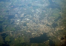
Aerial view from northeast direction (2012)
History
→ Main article: History of the city of Chemnitz
Meaning and origin of the name
The name Chemnitz is derived from the river of the same name that flows through the city. Its name in turn goes back to Old Sorbian Kamenica "Steinbach" (to kamjeń "stone"; cf. Kamenz).
prehistory and early history
The later urban area was located at the equator at the time of the Permian and was covered with tropical rainforest plants. The region was characterized by active volcanism, due to tectonic processes. Under the ash and rock cover ejected by volcanic eruptions, the fauna and flora were buried. The subsequent fossilization created the Petrified Forest of Chemnitz.
Until the 11th century, the Chemnitz area was not yet permanently settled. Dense forests covered the land and mountains. Forest and waters were probably used to a small extent by Slavic hunters and fishermen, who inhabited the Old Sildelland around Rochlitz since the 6th century.
Medieval
In 1136 Emperor Lothar III founded the Benedictine monastery of St. Mary near Chemnitz, which received the market privilege in 1143. The town charter was granted to the settlement of Chemnitz (presumably) at St. John's Church between 1171 and 1174 by Emperor Frederick I (Barbarossa). A new, larger town area was laid out in the drained Chemnitz floodplain from the 13th century onwards. The new city layout corresponded to the high medieval image of a walled city. Chemnitz was the intersection of two important long-distance routes, the road from Leipzig/Altenburg via Zschopau to Bohemia and the Franconian road from Nuremberg/Hof to Freiberg/Dresden and further east to Breslau, which was established in the 13th century. The town was a resting and exchange point for merchants.
After the Wettin victory in the Battle of Lucka in 1307 for supremacy in the Pleißenland, Chemnitz became a Wettin country town, but the monastery retained its imperial position. There were repeated disputes between the town and the monastery until the 16th century. In 1357 four citizens of the town were granted the important bleaching privilege by the margraves Balthasar and Friedrich. This gave Chemnitz a central position in textile production and trade in the margraviate.
early modern period
By purchasing the land of almost all the monastery villages of the Benedictine monastery (1402), the town considerably expanded its territory and new suburbs were able to develop.
In the 15th century Chemnitz continued to be dominated by textile production. A new commercial phase began for Chemnitz with the Great Mining War around 1470, which was accompanied by the discovery of silver in Schneeberg. Chemnitz families not only participated in the mining business, but also in the subsequent processing and manufacturing. The copper hammer and the Saiger smelter were built outside the city gates on the banks of the Chemnitz. At the end of the 15th century, the town hall, the clothmakers' guildhall, the Latin school and several burghers' houses were built, all of which shaped the town.
From around 1531, the important polymath and founder of the mining sciences Georgius Agricola lived and worked as the town doctor in Chemnitz. In 1546, 1547, 1551 and 1553 he took over the office of mayor by order of Duke Moritz of Saxony. His main work De re metallica libri XII was written in Chemnitz.
With the introduction of the Reformation in Albertine Saxony, the first church visitation took place in Chemnitz in 1539. In 1540 the Chemnitz Franciscan monastery was dissolved. The Benedictine monastery was administered secularly from 1541 and was converted into a castle and the monastery area into an office in 1546/1547.
From 1621 to 1622 Chemnitz had a Kippermünzstätte, in which interim coins (Kippermünzen) were struck under mintmaster Christoph Stundheim. These were Kippergroschen and Kreuzer pieces up to the so-called Kippertaler at 60 groschen.
Chemnitz was destroyed several times during the Thirty Years' War. In 1645, as a result of the war, the population of the city was decimated to less than a quarter and numbered only 1200 people. Of 448 houses in the town, 288 were destroyed. The repayment of the war debts took until 1698.
In the century following the Thirty Years' War, Chemnitz developed into a centre of weaving and manufacturing. As an important branch of industry, hosiery weaving developed in the city and the surrounding area.
"Three men, masters Röder, Braun and Sauer, whose names have become indelible, not only for Chemnitz, but for Saxony, indeed for Germany, founded this year (1728) a new branch of industry by transplanting the weaving of cotton stockings, caps, gloves, etc. to Chemnitz."
In the distribution of goods, the publishing industry developed.
1756-1763 Chemnitz was occupied by Prussian troops during the Seven Years' War. The losses of the city amounted to 1.1 million thalers. In the period after the Seven Years' War, Saxony experienced an upswing in economy, trade and commerce thanks to state aid. Chemnitz and its surrounding area developed into a centre of calico printing.
The Chemnitz economy achieved a new quality through the mechanization of spinning by means of water power. Following the English model, machine spinning mills were established under the protection of electoral privileges. The Bernhard spinning mill in Harthau near Chemnitz was the first and the starting point of the Industrial Revolution in Saxony from 1798.
19th and early 20th century
In the course of the 19th century Chemnitz developed into one of the most important industrial cities in Germany, especially a centre of German mechanical engineering. Steam engines were built in Chemnitz from 1835 and locomotives from 1844. The use of steam power in Chemnitz from 1822 onwards changed the appearance of the city. The multitude of chimneys of the factories and foundries and the associated smoke and pollution gave Chemnitz the nickname "Saxon Manchester". In the industrially determined city, social contrasts became apparent. In the middle of the 19th century, wage workers made up one third of the population. In 1852 Chemnitz got a railway connection with the opening of the railway line Riesa-Chemnitz.
Alongside Wernervon Siemens, the long-serving mayor of Chemnitz Wilhelm André was one of the initiators of the enactment of the German Patent Act of 1877, which for the first time gave inventions legal protection. In 1891, six times as many patent applications came from Chemnitz as the national average.
In 1883 Chemnitz became a large city with 103,000 inhabitants. With the rapid population growth since the middle of the 19th century, the city was considerably expanded structurally. In the last third of the 19th century the residential districts Brühl, Sonnenberg and Kaßberg were built.
At the turn of the 19th and 20th centuries, Chemnitz was identified in administrative reports and address books as a "factory and trading town". Mechanical engineering and the textile industry dominated. In addition, iron foundry, metal goods manufacturing, electrical engineering, bicycle manufacturing, dyeing and chemical industry had developed into important branches of production. During this period, the city recorded the highest per capita tax revenue and the highest per capita value added of all German cities.
In 1900 Chemnitz became the seat of the district administration and thus the centre of an administrative district. Numerous incorporations enlarged the city area.
Until the First World War, representative buildings were erected in Chemnitz for cultural institutions, for the administration and for trade, such as the Theaterplatz (1909) with the König-Albert-Museum and the New Municipal Theatre (from 1925 opera house), the New Town Hall (1911) and the Tietz department store (1913).
Weimar Republic
In the 1920s, many projects with social housing goals could be realized. In 1928, the city passed a resolution on social housing construction. New housing estates in the style of garden cities and residential yards were built. Furthermore, a whole series of new buildings for industry, trade and administration were erected in the modernist style, such as the Schocken department store on Brückenstraße, designed by the architect Erich Mendelsohn, by 1930. Chemnitz also received new modern school buildings, and sports and recreational facilities were expanded. In the municipal theatres, the "Tauber era" began with the general director Anton Richard Tauber. On 2 March 1913 his son Richard Tauber sang an opera at the municipal theatre for the first time in his career.
Since 1926 Chemnitz had an airport with a connection to international air traffic, which no longer exists today.
In 1930 the city reached its largest population to date with over 360,000 inhabitants.
Third Reich and Second World War
Chemnitz was one of the first German cities in which the National Socialists brought the city parliament into line. The development of culture and education was cut short, 650 works of art were removed from the art collections and 3300 books from the city library.
In the 1930s, construction projects begun before the Great Depression were completed, such as the construction of the city swimming pool and the Südkampfbahn (South Combat Course) as well as the creation of the "Neue Schlossteichanlagen" (New Castle Ponds) on the site of the former Hartmannwerke. A central thoroughfare in Chemnitz city centre was also named after the founder of the Hartmannwerke. In 1936, Auto Union AG moved its headquarters to Chemnitz. Vehicle construction became a determining branch of production in Chemnitz, the automobiles of the "Wanderer" brand were manufactured in Chemnitz.
The Jewish population, which had contributed to the development and upswing of Chemnitz, was discriminated against and persecuted. Jewish entrepreneurs were expropriated. The synagogue was burned down on the night of the pogrom and subsequently completely removed. The Jewish population that could not flee was deported to ghettos and extermination camps.
→ Main article: Air raids on Chemnitz
During the air war in World War II, the city became a late target of Allied air raids due to its difficult accessibility. The attacks on 14/15 February and 5 March 1945 by bombers of the British Royal Air Force as part of the Allied Operation Thunderclap ("Thunderclap") were mainly directed against the city centre. The attacks by the United States Army Air Forces were concentrated on railway stations and armaments factories such as the Siegmar plant of Auto Union, where half of all engines for the "Tiger" and "Panther" tanks were built. The Chemnitz flak had already been transferred to the Eastern Front by this time. A total of 7,360 tons of bombs were dropped on the city in over 10 air raids. The stock of churches, public buildings and residential buildings in the historic city centre and the inner suburbs was almost completely destroyed, and a quarter of the city's housing stock was destroyed. A total of about 3,700 air war victims were mourned in Chemnitz.
In mid-April 1945, American troops reached the north of Chemnitz. In the west, they advanced as far as the Chemnitz-Zwickau motorway and moved into the towns of Grüna, Rabenstein and Siegmar-Schönau. After continued artillery bombardment of the town, the city authorities attempted to surrender Chemnitz to the Americans without a fight. In accordance with Allied orders, Chemnitz was turned over to a Soviet city commander on the morning of May 8. On the same day, an advance detachment of the Soviet army marched into Chemnitz.
After 1945
The destruction of the war had left 100,000 people homeless. The city took in refugees and displaced persons. The resulting large number of people looking for housing also had to move to the surrounding communities. One of the first measures taken by the city administration was to restore the supply of water, electricity and gas.
The debris removal of the city began. A rubble train transported the salvaged material to the Südkampfbahn, where it was used to build a new cycling track by 1950. Further large amounts of rubble were filled into the former quarries in the Zeisigwald. A cement substitute developed in Chemnitz, together with the timber-saving vault construction technique, was used to build the first new residential buildings.
After the war, only about one seventh of the Chemnitz companies were still capable of production. Dismantling, withdrawals and reparations resulted in lasting losses. As a result of orders from the occupying power and as part of the "referendum on the expropriation of Nazi and war criminals" in Saxony (1946), 127 companies were expropriated in Chemnitz.
In June 1946, an advisory assembly consisting of representatives of the various parties and organizations was constituted as the predecessor of the city council. On 1 September 1946, the SED achieved an absolute majority in the municipal elections in Chemnitz. The city council made its decisions based on the orders of the Soviet military administration and the local command. After the founding of the GDR in 1949, the city commander handed over the tasks of the Soviet military administration to the Chemnitz City Council. Chemnitz remained a Soviet garrison town. In 1948 Chemnitz became the headquarters of the Soviet joint stock company Wismut, which operated uranium mining in the GDR.
GDR times
In 1952, the southwestern part of Saxony was merged into the district of Chemnitz in the course of the "democratization of the administration". As the third largest city in Saxony, Chemnitz was given the status of a district city. Chemnitz thus formed the administrative center of the GDR's most populous and densely populated district, with 2 million inhabitants.
On the occasion of the "Karl Marx Year" in 1953, Chemnitz was renamed Karl-Marx-Stadt. On 10 May, Minister President Otto Grotewohl carried out the name change in an act of state and justified it primarily with the strong traditions of the workers' movement in Chemnitz and the achievements of the city in the reconstruction. The decision to rename the city was made by the Central Committee of the SED and the government of the GDR. The inhabitants of the city had not been given the opportunity to express their opinions. At the same time, the district was renamed "Bezirk Karl-Marx-Stadt" and the county "Kreis Karl-Marx-Stadt".
The renaming of the city was associated with a special requirement for the rebuilding of the city centre. Initially, the reconstruction took place until the early 1950s, following the old layout of the city and local building traditions. With the reconstruction of the Old Town Hall, the Siegert House on the Market Square, the Red Tower and the Opera House, important buildings of the old Chemnitz were restored. Differing opinions on the layout of the "Central Square" in the city centre as a parade ground for political rallies and on the routing of traffic via a new intersection or the old Johannisplatz led to a revision of the plans and delayed the further construction of the city centre. It was not until 1960 that the second phase of the reconstruction of the Karl-Marx-Stadt city centre began with the construction of the buildings on the Straße der Nationen and the Rosenhof. This involved the implementation of a revised plan that envisaged a holistic new layout of the streets in the city centre. The architecture of the buildings was influenced by industrial construction. In the 1960s, the city center underwent extensive construction. In addition to residential and administrative buildings, infrastructure facilities such as the central bus stop (1967) and the bus station (1968) continued to be built. As the core of the new city centre, the building ensemble of the Karl-Marx-Stadt City Hall with the hotel high-rise "Kongreß" was built from 1969 to 1974. The "Central Square", originally planned as a parade ground, was transformed into a park next to the town hall. It was framed by the new administrative buildings of the Karl-Marx-Stadt industrial centre and the district council, which were erected between 1966 and 1971, with the Karl Marx Monument unveiled on 9 October 1971. In the course of the housing construction program of the GDR decided in 1973, after the completion of the hotel high-rise "Congress" in 1974, until the reunification only isolated new buildings were built in the city center and the implementation of the planning for the reconstruction of the city center remained unfinished.
In the course of the redevelopment of the inner city, old town quarters in the inner city that had been preserved since the mid-1960s were demolished. On March 15, 1961, the ruins of St. Paul's Church, built between 1750 and 1756, were demolished in the city center.
Since the 1960s, several new large residential areas were built in Karl-Marx-Stadt, such as the Flemming area (Altendorf) 1962-1965, the Beimler area (Gablenz) 1967-1970 and the Yorck area 1970-74. The largest new residential area, the Fritz-Heckert area, was built in industrial style from 1974 onwards and reached a population of 80,000 by 1990.
Karl-Marx-Stadt developed a powerful industry. 20 % of the GDR's industrial production was concentrated in Karl-Marx-Stadt, almost half of the textile machines produced in the GDR and about one third of the machine tools came from the city. Karl-Marx-Stadt's industry produced products and technologies of international standing (such as the Malimo stitch-bonding technique), even in the face of state regulation and suppression of private-sector initiative.
The district town was a centre of attraction in the cultural and sporting fields. Since its opening in 1974, the Karl-Marx-Stadt town hall has been one of the most modern event centres in the GDR. The Karl-Marx-Stadt theatres were successful throughout the GDR with their performances of contemporary plays. As a center of competitive sports, Karl-Marx-Stadt received international attention, especially in the sports of figure skating, cycling, swimming and weightlifting.
In Karl-Marx-Stadt, the economic problems and democratic deficits in the GDR became apparent towards the end of the 1980s. There was an open exchange of ideas in the already existing church groups and the new citizens' initiatives and movements that arose in the summer/autumn of 1989. On 7 October 1989 the first demonstration for democratic reforms in the GDR took place in Karl-Marx-Stadt.
In Karl-Marx-Stadt there was also a movement to reintroduce the historic city name. On voting cards the inhabitants of the city could put their cross for Karl-Marx-Stadt or Chemnitz until 22 April 1990. On 23 April 1990 the votes were counted and in the evening the result of 76% of the votes for Chemnitz was announced. The new, democratically elected city parliament decided at its first meeting on 1 June 1990 to rename Karl-Marx-Stadt back to Chemnitz.
1990 to the present
Chemnitz and the Chemnitz region experienced a structural change after 1990. The lack of sales markets in Eastern Europe particularly affected the classic Chemnitz industries and - combined with the problems associated with privatisation by the Treuhandanstalt - resulted in job losses. With its high potential of well-trained specialists, Chemnitz was able to develop into a modern location for business, technology and innovation with globally active companies in the more than two decades following reunification. Since 1995, more than 7000 new companies have been established in Chemnitz and the region.
In connection with the re-establishment of the Free State of Saxony in October 1990, the district of Karl-Marx-Stadt, which had existed since 1952, was dissolved. However, Chemnitz remained an important administrative location. From 1991 to 2008, Chemnitz was the administrative seat of the Chemnitz administrative district. In the course of the Saxon administrative reorganization and the district reform of Saxony in 2008, Chemnitz was subsequently the administrative seat of the administrative district of Chemnitz until 2012. Since 1 March 2012, Chemnitz has been the headquarters of the Saxony Regional Directorate.
After 1990 the cultural offer of the city of Chemnitz was expanded. The construction of the Saxon Industrial Museum Chemnitz began, which opened in 1992 and has been located in the reconstructed former machine tool factory "Hermann und Alfred Escher AG" on Zwickauer Straße since 2003. In 1992, after four years of renovation, the Chemnitz Opera House was reopened as one of the most modern in Europe. In September 1995, after 15 years of construction, the Schloßbergmuseum Chemnitz reopened as a city history museum in the former Benedictine monastery of St. Marien. Under its director Ingrid Mössinger, the Chemnitz Art Collections in particular have been making the city known as a city of culture beyond the region since the 1990s with much-visited exhibitions. In 2004, the cultural department store "DAStietz" opened in the former Tietz department store on Bahnhofstraße, which was built in 1913. It houses the Chemnitz Adult Education Centre, the Chemnitz City Library, the Chemnitz Museum of Natural History, the New Saxon Gallery as well as shops and cafés on an area of around 20,000 square metres. In 2003 Alfred Gunzenhauser transferred a large part of his private collection of 20th century German art to a foundation based in Chemnitz, where the former headquarters of the Chemnitz Savings Bank, dating from 1930, was converted into a museum for this purpose from 2005 to 2007. The Gunzenhauser Museum was opened on 1 December 2007 by the then Federal President Horst Köhler. Since 15 May 2014, Chemnitz has had a state museum, the Chemnitz State Museum of Archaeology. Chemnitz also received an individual cultural imprint after 1990 through a variety of initiatives and associations, festivals and projects.
After reunification, Chemnitz was faced in particular with the task of modernising the housing stock and further developing the city centre. As a result of the ownership structure inherited from the GDR, the housing stock newly built after 1945 and a large part of the city's old buildings were owned by a few housing associations. Since the 1990s, the focus of redevelopment activities here has been on modernising the building fabric created in the GDR. Despite the destruction in the Second World War, Chemnitz still had a large part of the city extensions of the Gründerzeit in 1990. Large parts of Chemnitz's Gründerzeit districts remained unrenovated in the GDR, despite selective building measures from the end of the 1970s onwards, and were in poor structural condition in 1990. Due to this large stock of Gründerzeit apartments that were no longer habitable and the extensive stock of new apartments built in the GDR, there was a considerable overcapacity of apartments in Chemnitz following the population decline since reunification as a result of emigration and a decline in birth rates. As a result of the federal government's demolition subsidy for vacant apartments, there was extensive demolition of old buildings owned by the municipal housing company in Chemnitz between 2005 and 2010, supported by the city's urban development plans.
Since 1990, the refurbishment of old buildings in Chemnitz has been carried out almost exclusively on the initiative of the private sector.
"The demolition of monuments from the Wilhelminian period, some of which were historically valuable, in favour of the upgrading of prefabricated housing estates, which was also associated with the "Urban Redevelopment East", was therefore very controversial." Between 1990 and 2007, more than 250 architectural monuments were leveled. "Now, however, the architectural heritage is being decimated with a mindless demolition policy [and] the new wastelands bear witness to extreme ruthlessness towards the urban organism," formulates a well-known architecture critic. Supported by the state-subsidized construction of owner-occupied homes, since the mid-1990s there has been a strong movement of migration to the surrounding countryside, which has benefited rural urban areas such as Reichenhain and Adelsberg.
There was a protest movement in Chemnitz against the demolition of old buildings, supported by the local and national press. After the end of the demolition subsidy and the associated demolitions, there was an extensive change in ownership of the unrenovated old buildings in Chemnitz from the municipal housing company to the private sector between 2010 and 2013. Subsequently, a stronger renovation activity of the private sector on the Chemnitz old building substance developed, favoured by the interest rate situation for construction financing. Part of this development was the Brühl district, which was converted into a shopping street at the end of the 1970s and has been largely vacant since the 2000s.
Chemnitz has an extensive stock of historic industrial buildings. Due to the decline of industry after 1990 and the creation of new industrial estates, the old industrial sites in the city lost their use. Since 1990, many monuments of industrial history in Chemnitz have been redeveloped for new uses, such as office use, residential use or use for gastronomic facilities. Due to vacancy with accompanying decay and lack of initiative, however, numerous industrial monuments in Chemnitz were also demolished.
The reconstruction of the Karl-Marx-Stadt city centre had not been completed in the GDR, so that the Chemnitz city centre in the 1990s was not very urban and was characterised by residential quarters in industrial construction, administrative buildings, open spaces and multi-lane roads. Several urban development plans in the course of the 1990s for the further development of Chemnitz city centre did not come to fruition. It was not until the urban development framework planning for the city centre in 2000, which provided for the densification of the immediate centre core around the town hall complex in accordance with the layout of the city centre until 1945, and the construction of the Galerie Roter Turm shopping centre and the Kaufhof department store that a structural development of Chemnitz city centre began.
Numerous internationally renowned architects such as Hans Kollhoff, Helmut Jahn and Christoph Ingenhoven provided the designs for the new buildings. In the 2000s, this resulted in a new structural enclosure of the market square and Neumarkt, as well as the "Mittelstandsmeile", a small-scale quarter between the Inner Klosterstraße and the city hall complex. More than 66,000 square metres of new retail space have been created in Chemnitz city centre since 1990.
At the DIFA-AWARD 2006, the international real estate award for cities, Chemnitz city centre was awarded second prize and achieved the best result of all German participating cities. According to the jury, the inner-city quarter around the town hall is a "successful mix of retail, office, gastronomy, residential, leisure and cultural facilities and a prime example of successful development policy in Germany".
In the period from 2010 to 2015, there were no further new construction projects in Chemnitz city centre apart from the construction of a new multi-storey car park. In the coming years, inner city development is to focus on the undeveloped areas at Getreidemarkt, the areas at Bahnhofstraße and the "Neue Johannisvorstadt" quarter at Johanniskirche. To this end, the Chemnitz city administration has developed urban development framework plans in cooperation with planning offices. On a 1.5 ha site in the city centre, the former "Contiloch", an office complex was built from 2015 onwards, in which the city's Technical Town Hall has been leased since 2017. While hardly any building construction projects have been realised in Chemnitz since the 2000s, more new apartment buildings have been built in the city since 2013. New urban development plans envisage the densification of inner-city districts.
At the end of August 2018, Chemnitz hit the national headlines after spontaneous citizen protests, as well as xenophobic and right-wing extremist riots, and days of demonstrations and clashes between various political groups in the city on the occasion of a homicide against a 35-year-old German-Cuban man.
→ Main article: Riots in Chemnitz 2018
In response to the events and as a protest against the far-right riots, an open-air concert under the motto "Wir sind mehr" (We are more) by well-known bands such as Toten Hosen and Kraftklub was held on 3 September 2018 with an estimated 65,000 visitors.
Incorporations
The first expansion of the fields of the city of Chemnitz took place as early as 1402 with the purchase of the desolate villages of Borssendorf and Streitdorf as well as parts of the monastery villages of Bernsdorf, Gablenz and Kappel. In the 19th century Chemnitz and its surrounding communities experienced a rapid industrial boom due to industrialisation, but the factories and manufactories mostly settled outside the city for reasons of space and taxation. Soon there were the first proposals from the surrounding communities to be incorporated into Chemnitz for economic reasons. The incorporation process began in 1880, apart from the incorporation of Niklasgasse in 1844, with the merger with Schloßchemnitz. Up to and including 1900, the heavily industrialized communities of Altchemnitz, Altendorf, Gablenz and Kappel were incorporated into Chemnitz. Other communities, Borna and Hilbersdorf, followed until 1914, partly for economic reasons, but also to provide settlement space for the workers who had moved to Chemnitz.
The municipalities of Schönau, Siegmar and Rottluff, which were located to the west of Chemnitz and were also industrially strengthened, basically rejected the merger with the city. However, the latter was incorporated together with Ebersdorf and Markersdorf in the next wave of incorporation before the Second World War. Only after the foundation of the GDR were Siegmar and Schönau, in the meantime elevated to the city of Siegmar-Schönau, merged with Chemnitz along with other communities located around Chemnitz. After that, there were only minor border shifts, including the confiscation of a territory from Neukirchen for the construction of the "Fritz Heckert area" in today's Hutholz.
After the re-establishment of the Free State of Saxony in 1990, the Chemnitz district was dissolved. In the course of the district reform in 1994, a part of the towns and municipalities of the Chemnitz district was incorporated into the new Chemnitzer Land district. The other part was merged into the administrative district Mittweida, some communities became part of the Mittlerer Erzgebirgskreis and the administrative district Stollberg. For a long time there have been efforts to incorporate the municipality of Neukirchen into Chemnitz. This failed so far because of the resistance of the district Stollberg and the municipality Neukirchen itself. Chemnitz itself remained an independent city.
The last wave of incorporations took place between 1994 and 1999, when Einsiedel, Röhrsdorf and Grüna were incorporated into the city. At the end of 1993 the size of Chemnitz was 129.75 square kilometres, at the beginning of 1997 it reached 175.67 square kilometres and on 1 January 1999 already 220.85 square kilometres. After these extensive incorporations, Chemnitz is one of the largest cities in Germany.
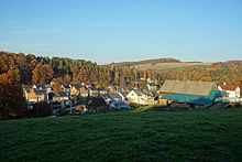
View of the Harthau district, which was incorporated into Chemnitz in 1950

The Chemnitz band "Kraftklub" at the protest concert on September 3, 2018.
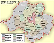
Incorporations into Chemnitz
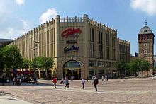
The Galerie Roter Turm with the façade designed by Hans Kollhoff next to the historic Roter Turm
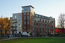
The residential and commercial building "Janssen-Fabrik", a converted industrial monument
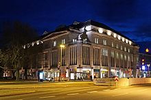
The cultural department store DAStietz, which opened in 2004 in the former Kaufhaus Tietz in Bahnhofstraße
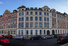
Wilhelminian style facades on Holbeinstraße restored after 1990
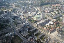
The Chemnitz city centre, 2014
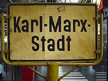
A former town entrance sign of Karl-Marx-Stadt
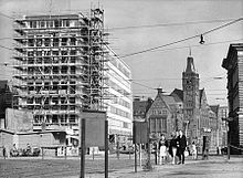
Construction of the building for the SED district leadership on Ernst-Thälmann-Strasse, 1963
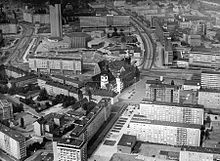
The city centre of Karl-Marx-Stadt in 1977
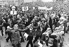
Karl-Marx-Stadt, V. Festival of Friendship GDR - USSR, 1980
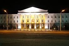
Administration building of the former SDAG Wismut in Chemnitz-Reichenbrand
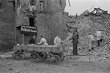
Chemnitz police work to clear the destroyed city of rubble in 1945
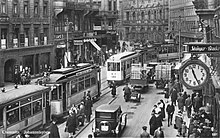
The Johannisplatz in the Chemnitz city centre around 1930
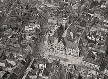
The centre of the city of Chemnitz with market place and double town hall from the airship Parseval PL 5 on October 2, 1910
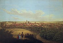
View of the city of Chemnitz from the Hüttenberg around 1840
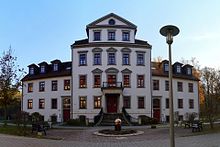
The "Herrenhaus" of the Bernhard spinning mill in Chemnitz-Harthau, built in 1806/07 according to a design by the architect Johann Traugott Lohse.
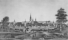
View of Chemnitz from the south , lithograph after a painting made for the weavers' guild of Chemnitz in 1780

View of Chemnitz, copper engraving by Matthäus Merian the Elder in Topographia Germaniae, published 1650
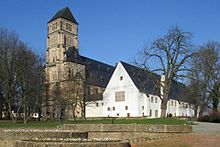
The preserved part of the former monastery of St. Mary with the castle church originally consecrated as St. Mary's Church
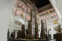
The Petrified Forest of Chemnitz in the atrium of the Museum of Natural History Chemnitz at DAStietz
Questions and Answers
Q: Where is Chemnitz located?
A: Chemnitz is a city located in Germany.
Q: How many people lived in Chemnitz in 2006?
A: About 245,000 people lived in Chemnitz in 2006.
Q: What was the former name of Chemnitz?
A: From 1953 to 1990, the former name of Chemnitz was Karl-Marx-Stadt.
Q: Why was Chemnitz called Karl-Marx-Stadt?
A: Chemnitz was called Karl-Marx-Stadt in reference to the social reformer Karl Marx.
Q: What is the current name of the city?
A: The current name of the city is Chemnitz, which is named after the river that flows through it.
Q: When was the city of Chemnitz first mentioned?
A: The first mention of the city of Chemnitz was in 1143.
Q: What important role did Chemnitz have in history?
A: Chemnitz had an important role in the Industrial Revolution and had a population of over 100,000 inhabitants by around 1883.
Search within the encyclopedia

