
Charente (river)
The Charente is a river in southwestern France that rises in the Massif Central and flows west through Nouvelle-Aquitaine to the Atlantic near Rochefort, influencing navigation, agriculture and the Cognac region.
Overview
The Charente is a river in southwestern France that rises in the highlands of the Massif Central and follows a generally westward course to the Atlantic Ocean, opening onto the Bay of Biscay near the naval town of Rochefort. A representative coordinate point on the river is given at 45°57′15″N 1°04′32″W. In local speech the river is known in Occitan as Charanta.
Image gallery
6 Images


Course and towns
Flowing across the region of Nouvelle-Aquitaine, the Charente meanders through a mix of upland valleys and lowland floodplains. Two modern departments bear its name: Charente and Charente-Maritime. Along its banks are towns and cities with historic connections to river transport and local industry, notably Angoulême, Cognac, Jarnac, Saintes and Rochefort at the estuary.
Physical characteristics and hydrology
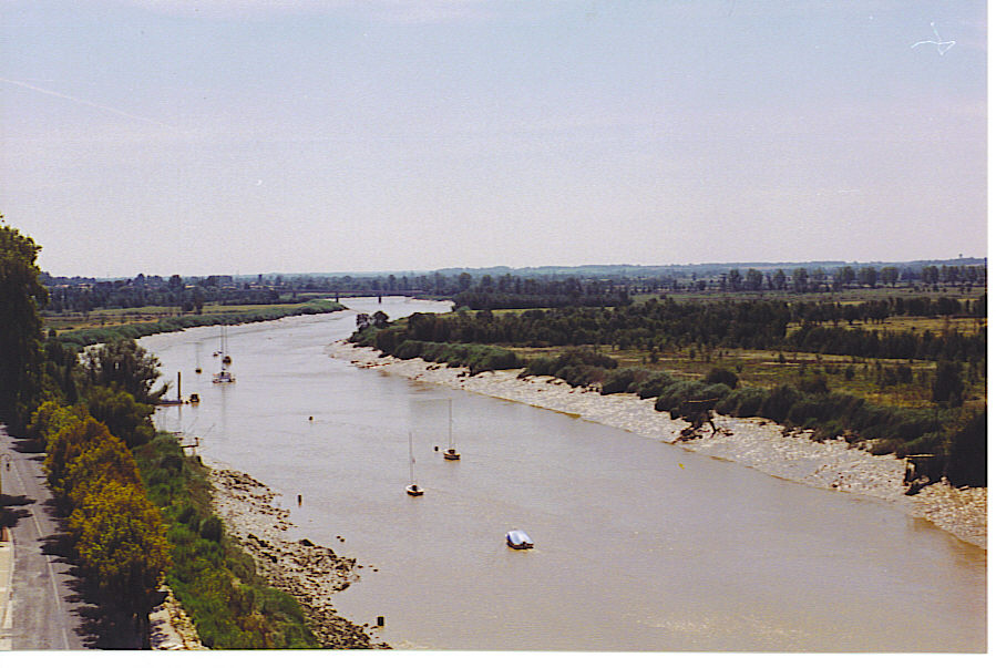
The river has a relatively gentle gradient for much of its length and becomes tidal in its lower reaches where freshwater mixes with seawater. Its floodplain supports fertile soils and a mosaic of wetlands, meadows and riparian woodlands. The Charente is fed by smaller tributaries and seasonal streams that respond to Atlantic and inland rainfall patterns; management of flows, navigation and flood risk is a local priority.
Navigation, economy and culture
Historically the Charente was an important inland waterway for the movement of goods such as timber, salt and wine. The calmer stretches allowed shallow-draft boats and later small steamers to link inland producers with coastal ports. The middle valley is closely associated with the production and trade of Cognac brandy, which relied on the river for transport before modern roads and rail replaced most freight traffic. Today the river supports irrigation, fisheries and a growing leisure economy including boating and riverside tourism.
Ecology and conservation
The estuary and lower river create brackish habitats valuable for birdlife, shellfish and estuarine plants. Conservation and water-quality monitoring aim to balance agricultural use, urban pressures and habitat protection. Local authorities and environmental groups work to maintain fish passages, wetlands and sustainable oyster and shellfish areas in the tidal reaches.
- Representative coordinate: 45°57′15″N 1°04′32″W
- Local name (Occitan): Charanta
- Country: France
- Region: Nouvelle-Aquitaine
- Departments: Charente, Charente-Maritime
- Source region: Massif Central
- Mouth: Atlantic Ocean / Bay of Biscay
Questions and answers
Q: What are the coordinates of the Charente river?
A: The coordinates of the Charente river are 45°57′15″N 1°04′32″W.
Q: In which region of France does the Charente river flow?
A: The Charente river flows through the Nouvelle-Aquitaine region of France.
Q: Which departments in France are named after the Charente river?
A: The Charente and Charente-Maritime departments in France are named after the Charente river.
Q: Where does the Charente river rise?
A: The Charente river rises in the Massif Central.
Q: Which body of water does the Charente river flow into?
A: The Charente river flows into the Atlantic Ocean (Bay of Biscay) near Rochefort.
Q: What is the Saintongeais name for the Charente river?
A: The Saintongeais name for the Charente river is Chérente.
Q: What is the Occitan name for the Charente river?
A: The Occitan name for the Charente river is Charanta.
Related articles
Author
AlegsaOnline.com Charente (river) Leandro Alegsa
URL: https://en.alegsaonline.com/art/18643
Sources
- services.sandre.eaufrance.fr : "La Charente (R---0000)"
- tab.geoportail.fr : "Source de la Charente"
- tab.geoportail.fr : "Confluence de la Charente"