California's Central Valley: geography, agriculture, and environmental issues
A comprehensive overview of California's Central Valley — its geography, climate, major rivers and cities, agricultural importance, history of development, and key environmental challenges.

The Central Valley, often called the Great Central Valley, is a broad inland plain running roughly 450 miles through the center of California. Bordered by the Sierra Nevada to the east and the Coast Range to the west, the valley is made up of two linked basins: the Sacramento Valley in the north and the San Joaquin Valley in the south. The region's scale, climate and soils have made it one of the most productive agricultural areas in the world, while its growing cities and intensive water use have created complex social and environmental challenges.
Image gallery
10 Images


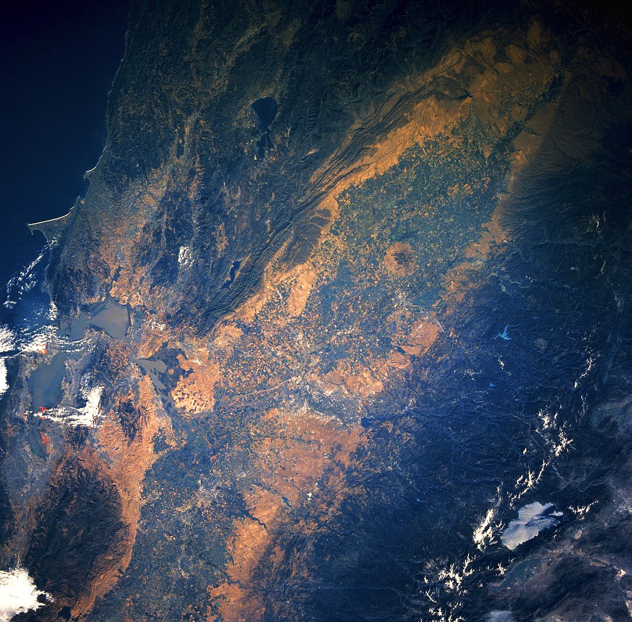

Geography and hydrology
The valley floor is primarily alluvial — built from sediments carried down from surrounding mountains — and ranges from broad floodplains to level agricultural fields. The Sacramento River drains the northern basin and the San Joaquin River drains the southern basin; their waters eventually flow into the Sacramento–San Joaquin Delta and out to the Pacific via San Francisco Bay. Human-built systems of reservoirs, aqueducts and canals, including major projects begun in the 20th century, redistribute runoff for irrigation, urban supply and flood control. See a regional map here and river data here.
Climate, soils and ecosystems
The Central Valley has a Mediterranean climate with hot, dry summers and cool, wet winters, though interior extremes are common. Deep, fertile soils and a long growing season support a wide variety of crops. Historically, the valley supported extensive grasslands, wetlands and riparian forests; much of that native habitat has been converted to farms and towns. For information on native plants and restoration efforts, consult resources such as regional ecological guides and conservation programs here.
Agriculture and economy
Agriculture is the Central Valley's dominant industry: fruits, vegetables, nuts (notably almonds), dairy, cotton and rice rank among its principal products. The region supplies a significant share of U.S. fruits and nuts and a wide variety of vegetables year-round. Farm communities, packing and processing businesses, transportation corridors and export facilities link valley production to national and global markets. Economic analyses and county statistics are available here and here.
History and development
Native tribes occupied the valley for millennia, living on fish, game and seasonal plants. European-American settlement and agricultural expansion accelerated in the 19th and 20th centuries with irrigation, railroads and land reclamation. Large water infrastructure projects — federal and state — transformed seasonal rivers into regulated supplies. Historic overviews and archival materials can be found here and educational summaries here.
Environmental and social challenges
Intensive irrigation, groundwater extraction and land conversion have produced several pressing problems: groundwater overdraft and subsidence, contamination from agricultural runoff and legacy pesticides, loss of wetlands and wildlife habitat, and air pollution in valley cities. Droughts and changing precipitation patterns add stress to water systems and farms. Policy responses include groundwater management, wetland restoration, water efficiency programs and pollution controls; policy resources and current initiatives are listed here, here and here.
Places, people and future directions
The valley contains many cities and county seats that serve as regional centers for government, trade and transportation; the state capital, Sacramento, lies at its northern edge. Population growth, shifting crop choices, technological change in irrigation and evolving environmental regulations will shape the valley's future. For demographic, planning and water-project documents see planning resources and project summaries.
- Main rivers: Sacramento River, San Joaquin River
- Major crops: fruits, nuts (almonds), vegetables, dairy, rice, cotton
- Key issues: water availability, groundwater overdraft, habitat loss, pollution
The Central Valley remains central to California's economy, ecology and water politics. Understanding its physical setting, past transformation and current challenges is essential to navigating trade-offs among food production, environmental protection and community resilience.


Questions and answers
Q: What is the Central Valley?
A: The Central Valley is a very large valley in the middle of California, in the United States. It consists of two connected, differently named valleys, the Sacramento Valley and the San Joaquin Valley.
Q: How big is it?
A: The Central Valley is about 42,000 square miles (108,779 square kilometers) in size, which is roughly equivalent to the size of the state of Tennessee.
Q: Where are its borders?
A: The Sierra Nevada Mountains border the valley on its east side while the Coast Range borders it on its west side.
Q: What rivers flow through it?
A: The Sacramento River flows through the north part of the Central Valley and is also called Sacramento Valley. Meanwhile, San Joaquin River flows through south part of Central Valley and this area is also known as San Joaquin Valley. Both rivers eventually merge and empty into Pacific Ocean via San Francisco Bay.
Q: Where is California's capital located?
A: California's capital city, Sacramento, can be found in north part of Central Valley.
Q: How long does it stretch for?
A: In total, Central Valley stretches for around 450 miles (720 km).
Q: How many counties does it have?
A: There are 18 counties within Central Valley's boundaries. 15 out these 18 counties are among 25 most productive farmland in California.
Related articles
Author
AlegsaOnline.com California's Central Valley: geography, agriculture, and environmental issues Leandro Alegsa
URL: https://en.alegsaonline.com/art/18085
Sources
- britannica.com : "Central Valley (valley, California, United States)"
- library.ca.gov : "The Central Valley is a large and diverse area"
- summitpost.org : "Mount Whitney"
- sacramentoriver.org : "Sacramento River Atlas"
- nrdc.org : "Restoring the San Joaquin River"
- uwsp.edu : "Mediterranean or Dry Summer Subtropical Climate"
- interstate-guide.com : "Interstate 5"
- usbr.gov : "Central Valley Project General Overview"