
Central United States
Overview of the Central United States: definitions, geography, history, and how the term is used and varies between sources and contexts.
Overview
The Central United States is a loosely defined region that lies between the Eastern and Western United States in many informal models. It is not a single official unit, but a convenient label used in geography, journalism, planning and everyday speech to refer to the broad middle portion of the country. Depending on context, "Central" may emphasize physical geography (plains and river valleys), cultural patterns, economic connections, or simple map position.
Image gallery
3 Images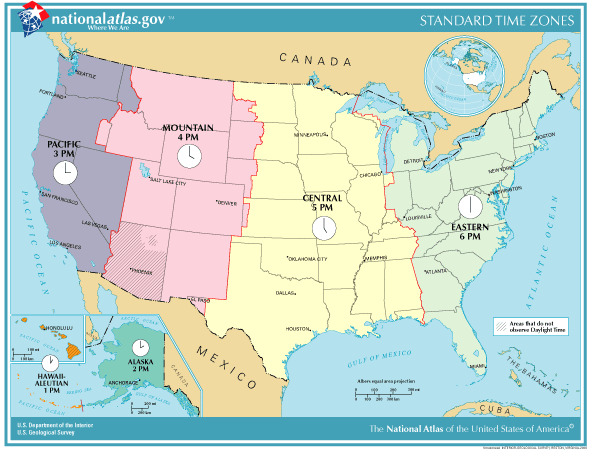


Boundaries and definitions
There is no single authoritative federal definition of a Central region. Some schemes use a three-region split—East, Central, and West—while others equate the term with the Midwestern United States or extend it to include parts of the Southern United States. The U.S. Census Bureau does not publish a formal "Central" region, and agencies, businesses and researchers define central areas to suit particular needs. See the Census Bureau materials for official statistical regions, and for discussions of terminology consult sources noting that there is no standard "central" region.
Geography and physical features
Geographically, the center of the country includes diverse landscapes: the rolling farmlands and lakes of the traditional Midwest, the wide grasslands of the Great Plains, and river systems such as the Mississippi and Missouri. Climate varies from humid continental in the north to humid subtropical in southern fringes, with large seasonal contrasts and significant agricultural productivity across many subregions.
Typical components and characteristics
- States commonly associated with the central area often include those in the interior of the continental United States; exact lists differ by source.
- Common features: agricultural heartland, transportation hubs, inland waterways and river commerce, and a mix of urban centers and rural counties.
- Economies combine manufacturing, farming, energy production and services, with important regional variations.
History and development
Settlement and development of the central interior were shaped by indigenous cultures, exploratory routes, westward migration, the arrival of railroads and later highways, and the expansion of agriculture and industry. Historical patterns include frontier settlement, urbanization around river and rail junctions, and shifting economic bases through the 19th and 20th centuries.
Uses, examples and distinctions
The label "Central United States" is useful for describing weather forecasts, logistics planning, cultural comparisons, and regional studies, but users should specify which states or boundaries they mean. For clarity, many writers prefer more precise terms—Midwest, Great Plains, or Central Plains—or they list the specific states involved. When consulting official statistics, rely on the agency's defined regions rather than informal central/centrality labels.
Further reading
For differing maps and uses of the term, look up regional studies and governmental regional definitions. Organizations and publications that map U.S. regions will often provide their own boundaries and rationales for what they call the Central United States.
Questions and answers
Q: How is the Central United States generally defined?
A: The Central United States is generally defined as part of a three-region model, which coincides roughly with the Midwestern United States plus the western and central portions of the Southern United States.
Q: Is the Central United States synonymous with the Midwest?
A: The Central United States is sometimes used as a synonym for the Midwest, but it can also leave out all or most of the South.
Q: Does the Census Bureau provide a standard definition of the "Central" region of the United States?
A: No, the Census Bureau does not provide a standard definition of the "Central" region of the United States.
Q: Are organizations that need to subdivide the US free to define a "Central" region?
A: Yes, organizations that need to subdivide the US are free to define a "Central" region to fit their needs.
Q: What regions are included in the Central United States according to the three-region model?
A: The Central United States is roughly coincident with the Midwestern United States plus the western and central portions of the Southern United States.
Q: What is the term used to describe the three regions of the United States?
A: The three regions of the United States are sometimes referred to as the Eastern United States, Central United States, and Western United States.
Q: How is the Central United States sometimes used in reference to the South?
A: The Central United States is sometimes used to leave out all or most of the South.
Related articles
Author
AlegsaOnline.com Central United States Leandro Alegsa
URL: https://en.alegsaonline.com/art/18084
Sources
- ypo.org : YPO
- folkworm.ceri.memphis.edu : CERI
- crh.noaa.gov : NOAA
- hsus.org : HSUS
- cr.usgs.gov : USGS
- adventure-camp.com : Adventure Camp