
Les Casquets — rocky islets and navigational hazard off Alderney
Les Casquets are a small group of barren rocks northwest of Alderney in the English Channel, known for strong tides, a long history of lighthouses and significance to navigation and wildlife.
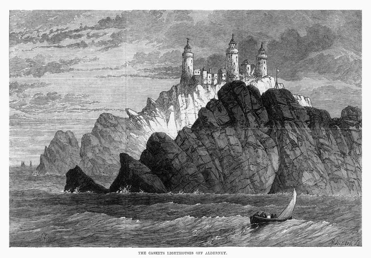
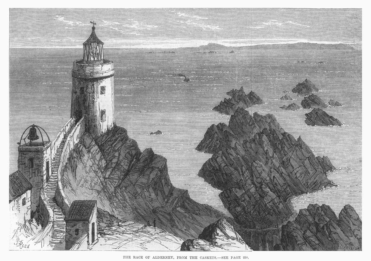
Les Casquets are a cluster of low, jagged rocks lying about 13 kilometres northwest of Alderney in the English Channel. The group stands above an underwater sandstone formation and presents a continuous hazard to passing ships. The rocks themselves support little vegetation and are effectively uninhabited, but they are well known to mariners for the danger they pose in poor visibility and strong tidal streams.
Image gallery
7 Images



Geography and physical characteristics
The outcrops rise only a short distance above sea level and are separated by turbulent water and submerged reefs. They form part of an extended sandstone ridge that stretches under the surrounding sea and links other rocky features of the Channel Islands. Nearby emergent islets on the same ridge include Burhou and Ortac. Surface soil is scant; the Casquets are largely bare rock with patches of hardy coastal plants where detritus accumulates.
Navigation, lighthouses and maritime history
Because of their exposed position and the complex tidal flows around them, the Casquets have long been recognised as a seafaring hazard. To reduce collisions and groundings a lighthouse presence has existed on the rocks for centuries. The light complex on Les Casquets—famous in nautical circles—has guided shipping through the busy approaches of the Channel and has been rebuilt and modernised several times. Local accounts and charts record multiple wrecks in the vicinity, underlining the importance of reliable aids to navigation.
Wildlife and environment
Although vegetation is scant, the rocks and surrounding waters support coastal wildlife. Seabirds use the islets for roosting and resting, and the intertidal and subtidal zones are used by fish and invertebrates that thrive in the nutrient-rich tidal streams. The difficult access and lack of human habitation help preserve the area as a relatively undisturbed marine niche.
Administration, access and modern role
Les Casquets form part of the territorial area associated with the Channel Islands and are administered under the local island authorities. A lighthouse station and associated equipment are maintained to serve contemporary navigation; modern technology has reduced the need for permanent keepers, but the light remains an important marker. Landing on the rocks is hazardous and generally restricted to essential maintenance or scientific visits.
Notable facts and distinctions
- Les Casquets are often mentioned in maritime pilot guides because of their prominence and the strong tidal conditions nearby.
- The name has historical roots in the regional languages of the Channel Islands, and the rocks have attracted interest from cartographers and mariners for centuries.
- The nearby islets of Burhou and Ortac share geological and ecological ties with the Casquets across the same submarine ridge.
For sailors, researchers and visitors to the Channel Islands the Casquets remain a striking example of how small, inhospitable rocks can carry outsized importance for navigation, coastal ecology and local maritime history. Further reading and charts are recommended for anyone planning to approach the area by sea.
Questions and answers
Q: Where are Les Casquets located?
A: Les Casquets are located 13 kilometres northwest of Alderney and are part of an underwater sandstone ridge.
Q: What are the coordinates for Les Casquets?
A: The coordinates for Les Casquets are 49°43.′4″N 2°22.′7″W / 49.71778°N 2.36861°W / 49.71778; -2.36861.
Q: What are the names of the other parts that emerge above the water in the same region?
A: The other parts that emerge above the water in the same region are the islets of Burhou and Ortac.
Q: Is it possible for vegetation to grow on Les Casquets?
A: No, little grows on Les Casquets.
Q: What type of rocks make up Les Casquets?
A: Les Casquets is a group of rocks made up of sandstone.
Q: How far is Les Casquets from Alderney?
A: Les Casquets are located 13 kilometres northwest of Alderney.
Q: Are Les Casquets fully above the water surface?
A: No, Les Casquets are partially submerged and are part of an underwater sandstone ridge.
Related articles
Author
AlegsaOnline.com Les Casquets — rocky islets and navigational hazard off Alderney Leandro Alegsa
URL: https://en.alegsaonline.com/art/17420
Sources
- nytimes.com : Wreck of Warship Is Found in English Channel
- jakesimpkin.org : SS Stella Website
- trinityhouse.co.uk : Trinity House website
- judnick.com : The Lighthouses of Alderney
- alderney.gov.gg : Alderney society and museum - Geology