Bushfires of natural origin have been present on the Australian continent for millions of years, triggered by lightning strikes and thus significantly shaped much of the landscape of the Australian continent before the arrival of man. Aboriginal people used fire for hunting and landscape management for many thousands of years, usually in the cooler seasons and when winds were favourable. Fires set in this way encouraged the growth and expansion of grasslands and facilitated hunting, as well as reducing the stock of combustible material and facilitating penetration into inhospitable areas with dense vegetation.
The increased occurrence of human-caused bushfires allowed fire-resistant plant species to spread, especially eucalypts. With their rapid formation of shoots after fires, woody stem bulges, and fire-resistant seeds, many plants adapted evolutionarily. Some species produce flammable oil, which increases fire effectiveness, eliminating non-fire resistant plant species in the surrounding area.
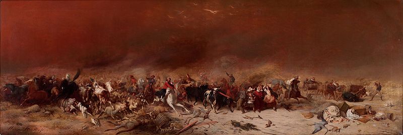
Some of the most dangerous and large Australian bushfires since the arrival of European settlers have been (in chronological order):
| Fire | Area | Burnt area | Date | Dead | Destruction |
| Bushfire in Victoria 1851 | Victoria | estimated 50,000 km² | February 6, 1851 | approx. 12 | 1 million sheep, thousands of cattle |
| Red Tuesday Bushfires | Victoria | 2,600 km² | February 1, 1898 | 12 | 2,000 Buildings |
| Bushfire 1926 | Victoria | | February-March 1926 | 60 | 1,000 houses |
| Bushfire in Victoria 1939 | Victoria | 20,000 km² | December 1938 - January 1939, especially on 13 January 1939 | 71 | 3,700 houses |
| Bushfire 1944 | Victoria | approx. 10,000 km² | 14 January - 14 February 1944 | 15–20 | more than 500 houses |
| Bushfire 1951-1952 | Victoria | | Summer 1951-1952 | 10 | |
| Black Sunday Bushfire (1955) | South Australia | | January 2, 1955 | 2 | |
| Western Australia Bushfire 1961 | Western Australia | 18,000 km² | January-March 1961 | 0 | 160 houses |
| Bushfire 1962 | Victoria | | 14-16 January 1962 | 32 | 450 houses |
| Southern Highlands Bushfire | New South Wales | | 5-14 March 1965 | 3 | 59 houses |
| Tasmanian bushfire of 1967 | Tasmania | estimated 2,640 km² | 1967 | 62 | 1,293 houses |
| Dandenong Ranges Bushfire | Victoria | 19 km² | February 19, 1968 | | 53 houses and 10 other buildings |
| Bushfires in the Northern Territory 1968-1969 | Northern Territory | 400,000 km² | 1968–1969 | | Killarney - Top Springs |
| Bushfires in the Northern Territory 1969-1970 | Northern Territory | 450,000 km² | 1969–1970 | | Dry River - Victoria River |
| Bushfire in South Australia 1969 | Victoria | | January 8, 1969 | 23 | 230 houses |
| Northern Territory Bushfires 1974-1975 | Northern Territory | 450,000 km² | 1974–1975 | | Barkly Tableland, Victoria River District, near Newcastle Waters |
| 1974-1975 Western Australia Bushfire | Western Australia | 290,000 km² | 1974–1975 | | |
| 1974-1975 South Australia Bushfire | South Australia | 170,000 km² | 1974–1975 | | |
| Western Districts-Bushfire | Victoria | 1,030 km² | February 12, 1977 | 4 | 116 houses and 340 buildings |
| Western Australia Bushfire 1978 | Western Australia | 1,140 km² | April 4, 1978 | 2 | 6 buildings (the falling wind in the early evening is believed to have saved the towns of Donnybrook, Boyup Brook, Manjimup and Bridgetown) |
| Northern Sydney Bushfire | New South Wales | | 1979 | | 20 homes in Sydney, the fire spread to Ku-ring-gai-Chase National Park. |
| Ash-Wednesday-Bushfires | South Australia and Victoria | 4,180 km² | February 16, 1983 | 75 | about 2,400 houses |
| Central Victoria Bushfire | Victoria | 508 km² | January 14, 1985 | 3 | > 180 houses |
| Eastern Seaboard Bushfires 1994 | New South Wales | | 27 December 1993 - 16 January 1994 | 4 | 225 houses |
| Wooroloo Bushfire | Western Australia | 105 km² | 8 January 1997 | 0 | 16 houses |
| Dandenongs Bushfire | Victoria | 4 km² | 21 January 1997 | 3 | 41 houses |
| Lithgow Bushfire | New South Wales | | 2 December 1997 | 2 | |
| Perth-and-SW-Region-Bushfire | Western Australia | 230 km² | 2 December 1997 | 2 (21 injured) | 1 House |
| Linton Bush Fire | Victoria | | 1998 | 5 | There were 5 firefighters who died in the line of duty on December 2, 1998. |
| Black Christmas Bushfire | New South Wales | 3,000 km² | 2001–2002 | 0 | 121 houses |
| 2002 Northern Territory Bushfire | Northern Territory | 380,000 km² | 2002 | | |
| Bushfire in Canberra 2003 | Australian Capital Territory | | 2003 | 4 | nearly 500 houses, Canberra |
| Bushfire in Victoria 2003 | Victoria | > 13,000 km² | 8 January - 7 March 2003 | | 41 houses. The bushfire burned for 59 days. |
| Tenterden | Western Australia | | December 2003 | 2 | (21,100 km² of forest burned during the 2002-2003 bushfire season in southwestern Western Australia) |
| Eyre Peninsula Bushfire | South Australia | 8,900 km² | 10-12 January 2005 | 9 | about 50 houses |
| Central Coast Bushfire 2006 | New South Wales - Central Coast | | New Year's Day 2006 | | |
| Jail Break Inn Fire | New South Wales - Junee Shire | 300 km² | New Year's Day 2006 | 0 | 20,000 head of cattle. 7 houses, 7 combines and 4 sheep pens destroyed. 1,500 km of fence was damaged. |
| Victoria bushfire 2005 | Victoria | 1,600 km² | December 2005 - January 2006 | 4 | 57 houses, 359 farm buildings, 65,000 head of livestock. The bushfires occurred in the Stawell, Moondarra, Anakie, Yea and Kingla regions. |
| Grampians Bushfire | Victoria | 1,840 km² | January 2006 | 2 | 25 houses destroyed, 62,000 sheep and 500 cattle burned. |
| Pulletop Bushfire | New South Wales - Wagga Wagga | 90 km² | February 6, 2006 | 0 | 2,500 sheep, 6 head of cattle, 3 vehicles, 2 straw barns and 50 km of fence was destroyed |
| The Great Divides Fire | Victoria | 10,480 km² | 1 December 2006 - March 2007 | 1 | 51 houses |
| Bushfires in Victoria 2006/2007 | Victoria | approx. 12,000 km² | 1 December 2006 - 7 February 2007 | 1 | 41 houses destroyed. The bushfire burned for 69 days |
| Dwellingup Bush Fire | Western Australia | 120 km² | February 4, 2007 | 0 | 12 houses destroyed. |
| Kangaroo Island Bushfire | South Australia | 950 km² | 6-14 December 2007 | 1 | Flinders Chase National Park (630 km² or 85 % of the area of the national park burnt) |
| Boorabbin National Park Bushfire | Western Australia | 400 km² | 30 December 2007 | 3 | Overhead power lines and Great Eastern Highway were destroyed and not usable for 2 weeks |
| Black Saturday Bushfires | Victoria | > 4,500 km² | 7 February 2009 - 14 March 2009 | 173 | > 2,029 houses and 2,000 other structures. In the course of this bushfire, three lightning-generating fire clouds, so-called pyrocumulonimbus, were formed, which rose to a height of up to 15 kilometres. |
| Toodyay Bush Fire | Western Australia | > 30 km² | December 29, 2009 | 0 | 37 houses |
| Lake Clifton brush fire | Western Australia | > 20 km² | 11 January 2011 | 0 | 10 houses destroyed |
| Roleystone-Kelmscott Bush Fire | Western Australia | > 15 km² | 6-8 February 2011 | 0 | 72 homes destroyed, 32 damaged, the Buckingham Bridge on Brookton Highway collapsed and had to be replaced with a temporary bridge. |
| Bushfires in Australia 2019/2020 | New South Wales, Queensland, South Australia, Victoria, Western Australia, Tasmania, Northern Territory | > 126,000 km² | August 2019 - March 2020 | 33 directly + estimated 445 from smoking | 5,900 buildings including 2,800 homes destroyed; 80% of Australia's residents hit by smoke, thousands treated in hospitals for smoke-related illnesses at a cost of AUSD 2 billion (1.2 billion euros), an estimated additional 445 deaths from smoke-related illnesses |
| Bushfire Fraser Island | Queensland | > 800 km² | From mid-October 2020 | | |