Brittany (Bretagne): a concise guide to the region of northwestern France
Overview of Brittany (Bretagne/Breizh): geography, languages, history, economy and key cultural sites including departments, Rennes and the Carnac stones.

Overview
Brittany is a distinct peninsula of northwestern France known in French as Bretagne and in the regional Celtic tongue as Breizh. It is formally one of the country's administrative regions and lies on the Atlantic coast of France. The adjective used for people and things from the region is Breton. The region's identity combines maritime landscapes, strong local traditions and a history shaped by migration, language and centuries of changing political ties.
Image gallery
10 Images


Geography and climate
Brittany projects into the Atlantic with a highly indented coastline of capes, bays and islands. The Gulf Stream moderates temperatures, giving generally mild winters and temperate summers with frequent rain. The region's soils and climate have long supported mixed agriculture and a coastal economy oriented to fishing, ports and trade.
Administrative divisions
The modern administrative region comprises four departments:
- Côtes-d'Armor (Côtes-d'Armor)
- Finistère (Finistère)
- Ille-et-Vilaine (Ille-et-Vilaine)
- Morbihan (Morbihan)
Historically a fifth department, Loire-Atlantique, which contains the city of Nantes, has long been considered part of the cultural or "historical" Brittany. The regional capital today is Rennes, located in Ille-et-Vilaine.
Languages and culture
Brittany preserves two traditional regional languages alongside French. In western parts the Celtic language Breton is spoken and has affinities with Cornish and other Insular Celtic languages. In the eastern part a Romance vernacular called Gallo survives in local speech and literature. French is the national language used in government, education and media.
History and identity
The region's name reflects historical connections with the peoples of Great Britain; in older sources it is called "Lesser" or "Little Britain" to distinguish it from Great Britain. In the early medieval period, movements of Brittonic-speaking people—related to the Celts—helped establish the Breton language and many place names. Later medieval Brittany functioned as an independent duchy before being formally united with the French crown in 1532. It remained a distinct province until the administrative reorganization of the French Revolution; regional institutions were restored in the late 20th century.

Economy, landmarks and notable facts
Agriculture is a cornerstone of Brittany's economy: production includes livestock (notably pig and poultry farming) and crops such as maize used for animal feed. The region also supports fisheries, food processing, maritime industry and a growing services and tourism sector. Brittany is internationally noted for prehistoric sites—the area around Carnac contains one of the largest concentrations of standing stones in the world, often referred to as the Carnac stones (Carnac)—and for a living tradition of music, festivals and maritime crafts.
Distinctive points
Brittany's layered identity combines Celtic heritage, rural agricultural life, coastal economies and modern French civic institutions. Contacts dating from the Anglo-Saxon migrations of the early Middle Ages—when groups arrived in Britain and others moved across the Channel—help explain cultural affinities with the British Isles: this period is sometimes summarized in reference to early movements of Anglo-Saxons and the retreat of Celtic populations. Today, efforts to maintain regional language and customs coexist with participation in national and European political, economic and cultural networks.
For further reading and official information, local museums, archives and tourism offices provide detailed resources on Brittany's departments, languages and archaeological sites.
Geography
Location
Armor is the Breton word for sea, but it does not only mean the coast, but also the islands, the amphibious zone of the tidal flats and the wide coastal strip. Argoat is the name given by the Bretons to the woodland of Brittany.
Brittany is a large peninsula in the far west of mainland France. It is surrounded by the Atlantic Ocean (bret. Meurvor Atlantel) to the north, west and south. Here, Brittany separates the English Channel (bret. Mor Breizh) in the north from the Bay of Biscay in the south. On the mainland, it borders the Normandy region to the northeast and the Pays de la Loire region to the southeast.
In Brittany, at the coordinates 47° 13′ N, 1° 32′ W47.2166666667-1.53333333333, near the city of Nantes, lies the centre of the land hemisphere, that hemisphere of the globe which (computed) has the largest proportion of land.
Geology
Geologically, Brittany is part of the Armorican Mountains, which were folded up in the Carboniferous. The land mass of Brittany rests in large parts on very old and hard rock. Brittany has a very rugged coastline, which - especially in the west - is formed over long stretches as a steep coast. At Cap Fréhel, near the old fortress Fort La Latte, the granite cliffs rise more than 70 metres out of the Atlantic. Elsewhere, the landscape is rather hilly; particularly steep or high mountains are not to be found. The highest elevation is the Roc'h Ruz (385 metres) in the Monts d'Arrée (bret. Menez Are).
Climate
Due to its location near the Atlantic on the western edge of the European mainland and in the sphere of influence of the Gulf Stream, Brittany has a distinctly oceanic climate with relatively mild temperatures that average between 9 and 12 °C per year. Snow and frost are rare, summers are moderately warm with over 2000 hours of sunshine annually.
The weather pattern is characterized by a rapid alternation of high and low pressure areas, which approach from the Atlantic. The prevailing westerly winds often reach gale force, especially in winter. Rain showers and strong winds can occur at very short notice, but are usually short-lived. With an average of between 700 and 800 mm per year, precipitation is relatively low; while rainfall is lower in the coastal areas, the interior is wetter.
The influence of the strong tides on the weather pattern is clearly noticeable, but also the iodine content of the air, which reaches very high values in Brittany. The strong winds also cause a low level of pollutants in the air.
Nature
In the Neolithic period, Brittany was predominantly covered by forest. Remains of this vast forest area can be found between the former Forêt de Scissy near Mont-Saint-Michel (bret. Menez Mikael) and the Brocéliande (bret. Brekilien, today Paimpont west of the city of Rennes). Another well-known forest area is located near Huelgoat in the department of Finistère. The original landscape in the interior has been much altered since the medieval clearances. It has now largely given way to industrialised agriculture. Thus, only a few larger beech and oak forests can still be found in the interior of Brittany. The landscape is now dominated by fields and grassland, divided in a checkerboard fashion by the countless hedgerows (bocage) and stone walls.
Cities
The most populous cities in Brittany are:
| City | Inhabitants (year) | Département |
| 217.728 (2018) | ||
| 139.602 (2018) | ||
| 63.166 (2018) | ||
| 57.084 (2018) | ||
| 53.438 (2018) | ||
| 44.170 (2018) | ||
| 46.478 (2018) | ||
| Lanester | 23.026 (2018) | |
| Fougères | 20.528 (2018) | |
| 20.040 (2018) |


Coat of arms and flag
Heraldic description: In white six rows of interspersed black ermine.
· 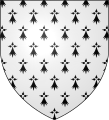
Coat of arms from 1316 (semé d'hermine)
· 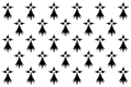
Ermine flag
· 
Kroaz du
· 
Today's regional flag ("Gwenn ha du")
The historical flag of Brittany was the ermine flag. Since the beginning of the 20th century, the "Gwenn ha du" is mainly used.
Tags
Related articles
Author
AlegsaOnline.com Brittany (Bretagne): a concise guide to the region of northwestern France Leandro Alegsa
URL: https://en.alegsaonline.com/art/14582