Mount St. Helens — Volcano in Washington State
Mount St. Helens is an active stratovolcano in Washington’s Cascade Range, best known for its catastrophic 1980 eruption and its ongoing role in volcanology, ecology, monitoring, and public education.
Mount St. Helens is an active stratovolcano in the Cascade Range of the northwestern United States, located in the state of Washington. It lies roughly 96 miles (154 km) south of Seattle and about 53 miles (85 km) northeast of Portland, Oregon. Positioned within the Cascade Volcanic Arc and the broader Pacific Ring of Fire, the mountain is part of a subduction-zone volcanic system that has produced repeated eruptive episodes over hundreds of thousands of years.
Image gallery
10 Images


Geology and volcanic character
Mount St. Helens is a composite cone built by alternating eruptions of lava, ash and fragmented volcanic material. Its magmatic activity originates where the oceanic plate of the Pacific basin subducts beneath the North American Plate, generating magma that feeds eruptive behavior. Typical hazards associated with this style of volcanism include explosive ash columns, pyroclastic flows, lahars (volcanic mudflows), and large-scale sector collapses that can produce debris avalanches and lateral blasts.
Name and human connections
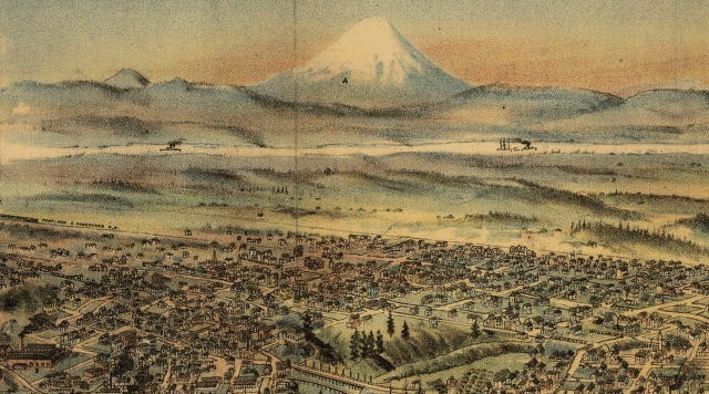
Indigenous peoples in the region knew the peak long before European arrival. The Klickitat and other Native American groups used names for the mountain that translate to meanings such as "smoking" or "fire mountain," reflecting awareness of volcanic activity. Euro-American explorers and mapmakers later applied the English name Mount St. Helens. The mountain lies within public lands and has a long association with nearby communities, recreation, scientific study, and hazard awareness programs.
The 1980 eruption
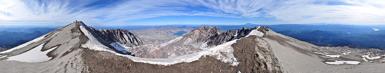
Mount St. Helens' best known eruption began on May 18, 1980. A shallow earthquake and sudden structural failure of the volcano's north flank produced a massive debris avalanche, which exposed pressurized magma and allowed a catastrophic lateral blast. The blast removed much of the summit area and produced a horseshoe-shaped crater nearly a mile wide, dramatically lowering the peak's elevation. The event produced widespread ashfall, pyroclastic flows, and lahars that devastated forests and river valleys in the vicinity.
Human and economic impacts
The 1980 eruption was the deadliest and most economically destructive volcanic event in the contiguous United States in modern times. Dozens of people lost their lives, and extensive damage occurred to homes, bridges, roads, rail lines and timber resources. Long-term effects included altered river courses, thick deposits of volcanic debris in valleys, and extensive loss of forest over large areas. Recovery of infrastructure and landscapes required coordinated efforts by local, state and federal agencies.
Aftermath, research and protection
In the years following the eruption, Mount St. Helens became a focal point for volcanic research and long-term ecological study as scientists investigated eruptive processes and ecosystem recovery. In 1982 the area immediately around the volcano was designated the Mount St. Helens National Volcanic Monument to protect the landscape for scientific investigation, natural recovery and public education while allowing limited recreational access within safety guidelines.
Monitoring and current status
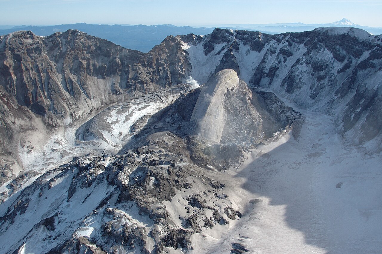
Mount St. Helens remains an active, closely monitored volcano. Modern monitoring combines seismic networks, ground deformation measurements, gas sampling, and remote sensing to detect early signs of renewed activity. Observations made since 1980 have documented subsequent eruptive phases, dome-building episodes within the crater, and continuing geomorphic changes. Scientists emphasize that volcanoes can remain restless for decades and that monitoring and preparedness reduce risk to people and property.
Ecological recovery
The post-eruption landscape has been used to study natural recovery processes. Over time, plants and animals have recolonized blast zones and deposited ash, soil development and succession have been documented, and research has provided insights into resilience and the role of disturbance in shaping ecosystems. The monument and surrounding national forest areas support managed public access and organized research projects examining these processes.
Visiting and safety
Visitors can view many volcanic landforms and recovery zones from designated viewpoints and trails. Park managers and scientists stress the importance of obeying closures, understanding hazard zones, and preparing for variable weather and terrain conditions. Educational programs and interpretive centers provide background on the volcano's geology, history and ongoing scientific study.
Further reading and resources
- Mount St. Helens overview
- Washington state information
- Portland and regional context
- Cascade Range details
- Cascade mountain system
- Cascade Volcanic Arc
- Klickitat people and language
- Indigenous place names
- Volcanic flows and deposits
- 1980 eruption summary
- Historical actions by U.S. leadership
- Legislative background on protection
- Gifford Pinchot National Forest
- Detailed chronology of 1980 events
- Debris and avalanche studies
- Avalanche and landslide research
- Seismic triggers and earthquakes
- Seismic magnitude and measurement
- Crater and summit change
- Magma and volcanic plumbing
- Mantle processes and subduction
Questions and answers
Q: Where is Mount St. Helens located?
A: Mount St. Helens is located in the U.S. state of Washington, 96 miles (154 km) south of Seattle and 53 miles (85 km) northeast of Portland, Oregon.
Q: What mountain range does it belong to?
A: Mount St. Helens belongs to the Cascade Range of mountains and is part of the Cascade Volcanic Arc in the Pacific Ring of Fire that includes over 160 active volcanos.
Q: What does Louwala-Clough mean?
A: Louwala-Clough means "smoking" or "fire mountain" in the language of the Native American Klickitat people.
Q: When did its most famous eruption occur?
A: The most famous volcanic eruption at Mount St. Helens occurred on May 18, 1980.
Q: How large was the area made into a national monument after its 1980 eruption?
A: After its 1980 eruption, U.S President Ronald Reagan and Congress created a 110,000 acre (445 km²) area around Mount St. Helens as a National Volcanic Monument which is also part of Gifford Pinchot National Forest .
Q: What caused the 1980 eruption?
A: The 1980 eruption was caused by an earthquake measuring 5.1 on Richter scale which triggered a massive debris avalanche and released magma from Earth's mantle beneath it .
Q: How much damage did this volcano cause during its 1980 eruption?
A: During its 1980 eruption, 57 people were killed; 250 homes, 47 bridges, 15 miles of railways, and 185 miles of highway were destroyed due to this deadly volcano .
Author
AlegsaOnline.com Mount St. Helens — Volcano in Washington State Leandro Alegsa
URL: https://en.alegsaonline.com/art/143026