
British Isles: geography, history, peoples and political distinctions
An overview of the British Isles: their geography, major islands, human history, political divisions and why the name is sometimes contested.
Overview
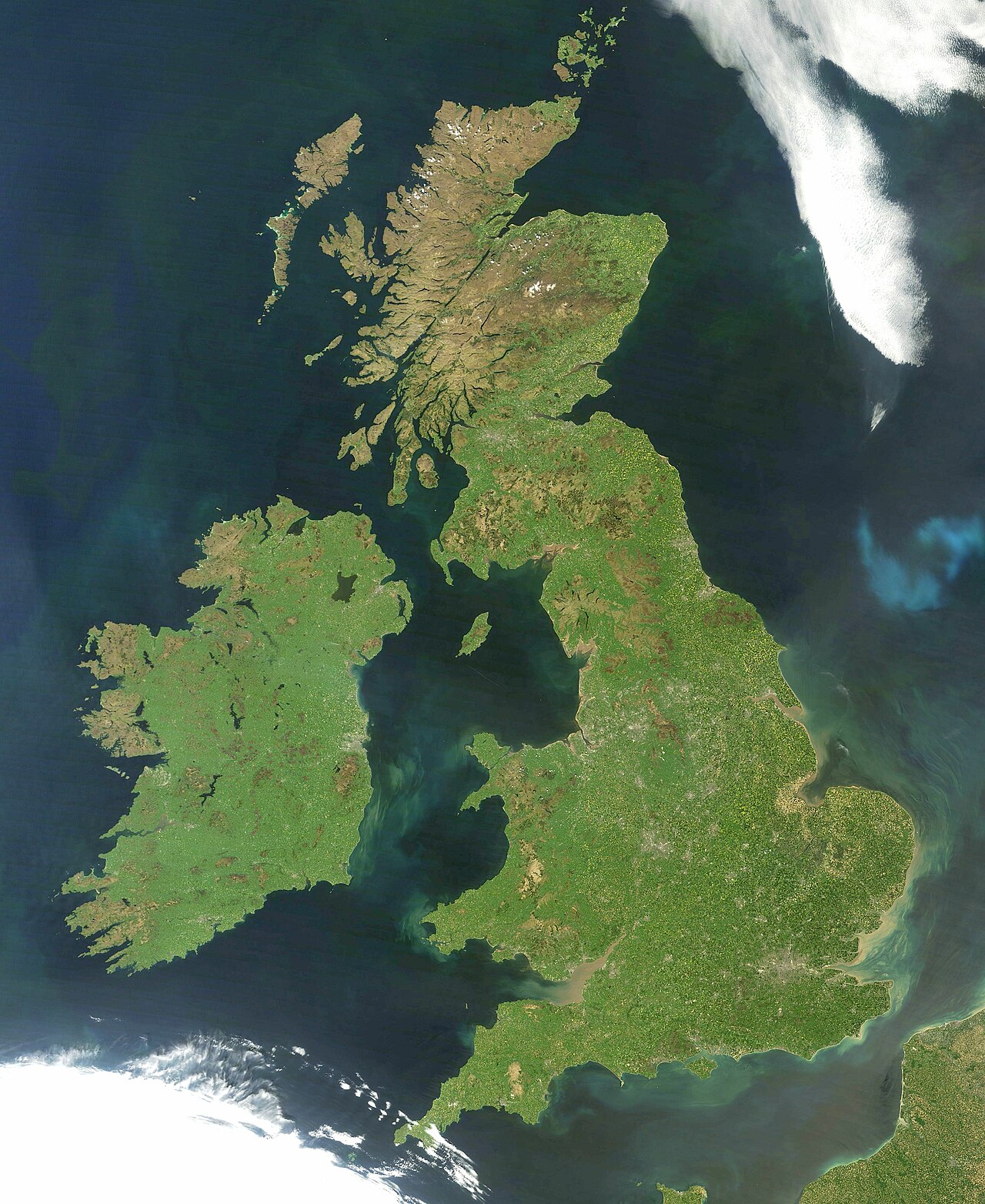
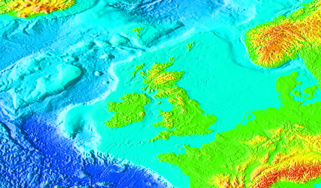
The British Isles is the conventional name for an archipelago off north‑western Europe. It comprises hundreds of islands clustered around two very large landmasses, Great Britain and Ireland, together with numerous smaller islands such as the Isle of Man. The term highlights a geographical grouping rather than a single political entity; the group lies to the northwest of continental Europe and is separated from it by seas and channels.
Image gallery
9 Images



Geography and physical characteristics
Geologically the archipelago has a long history shaped by tectonics, glaciation and sea‑level change. The islands contain a wide variety of landscapes: lowland plains and river valleys, upland moors and mountain ranges, and indented coastlines with bays and estuaries. Major surrounding bodies of water include the North Sea, the Irish Sea and the English Channel. The largest island, Great Britain, is the biggest island in Europe; Ireland is the third largest. Other notable island groups include the Channel Islands, which lie close to France, and a scattering of smaller islands along both coasts.
Political divisions and terminology
Political arrangements across the islands are distinct from the purely geographic label. The island of Great Britain contains three constituent countries: England, Wales and Scotland. The island of Ireland is divided into Northern Ireland and the Republic of Ireland. Together, England, Wales, Scotland and Northern Ireland form the sovereign state known as the United Kingdom. The Isle of Man and the Channel Islands (including Jersey, Guernsey and Sark) are Crown dependencies with their own administrations and are not part of the United Kingdom.
Historical outline
Human presence in parts of the archipelago dates back hundreds of thousands of years; archaeological finds such as the Happisburgh footprints show early habitation in what is now Britain. Over the millennia the islands have experienced waves of migration and cultural change—from prehistoric hunter‑gatherers and farming communities to Celtic societies, Roman contact, and later Norse and Norman influences. Roman-era geographers used Greek and Latin names to describe the larger islands: the cartographer Ptolemy and other classical writers distinguished between the larger island he called "Great Britain" and the neighbouring island of Ireland during the 2nd century CE, terminology that echoes into modern usage.
Cultural, linguistic and natural features
The British Isles support a rich mix of languages, traditions and natural habitats. Indigenous languages include English, Scots, Welsh, Irish and Scottish Gaelic, among others. The archipelago's climate—temperate and maritime—moderates extremes of temperature and supports diverse ecosystems of heathland, upland grassland, temperate broadleaf woodland and coastal wetlands. Human activities have shaped the landscape for millennia; agriculture, urban development and transport networks are prominent, but there are also important protected areas for wildlife and heritage.
Uses, significance and contested names
The islands are central to Atlantic European trade, cultural exchange and political history. Cities on the islands have been global ports, financial centres and cultural capitals. The name "British Isles" is widely used in geography and popular speech, but it can be sensitive in political contexts. Many people in the Republic of Ireland prefer other terms because the label can imply political association with Britain. Discussions about terminology touch on history, sovereignty and identity; in legal, diplomatic and academic settings authors often choose wording carefully. For technical distinctions and further reading see sources on regional geography and history (archipelago, politics, geology). Additional references: Roman accounts, ancient cartography (Ptolemy) and timelines like the 2nd century descriptions offer historical perspective.
- Quick facts: largest islands: Great Britain, Ireland, Isle of Man.
- Nearby states: France lies close to the Channel Islands.
- Administrative note: Crown dependencies include Isle of Man and the Channel Islands such as Jersey, Guernsey and Sark.
For more detailed treatments consult regional atlases and specialist histories linked in scholarly and public resources. The archipelago remains significant geographically, ecologically and culturally across Europe.
Questions and answers
Q: What is the British Isles?
A: The British Isles is an archipelago (a group of islands) in north-western Europe.
Q: How long have people been living in Britain?
A: People have been living in Britain for around 800,000 years, as evidenced by the Happisburgh footprints.
Q: What are the biggest islands of the British Isles?
A: The two biggest islands of the British Isles are Great Britain and Ireland.
Q: How many countries make up Great Britain?
A: Three countries make up Great Britain - England, Wales and Scotland.
Q: Is Ireland part of the United Kingdom?
A: No, Ireland is divided into Northern Ireland and the Republic of Ireland. Northern Ireland is part of the United Kingdom while the Republic of Ireland is not.
Q: Are Jersey, Guernsey and Sark considered part of the British Isles?
A: Some people include these Channel Islands when referring to "British Isles", but they are much closer to France than to Great Britain so it tends not to be used in this way in the Republic of Ireland due to political implications.
Q: Who was Ptolemy and what did he do with regards to naming parts of the British Isles?
A: Ptolemy was a Roman cartographer who used names for different parts of what we now call "British Isles" back in 2nd century AD - he named larger island "Great Britain" (Megale Britannia) and smaller island "Little Britain" (Mikra Britannia).
Related articles
Author
AlegsaOnline.com British Isles: geography, history, peoples and political distinctions Leandro Alegsa
URL: https://en.alegsaonline.com/art/14272