
M1 motorway (Northern Ireland)
Primary motorway linking Belfast and Dungannon in Northern Ireland. About 38 miles (61 km) long, it forms a key regional corridor and continues west as the A4 toward Omagh and Enniskillen.
Overview
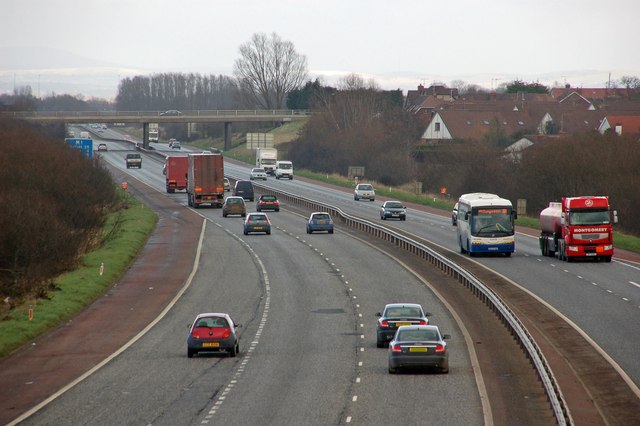
The M1 is a principal motorway in Northern Ireland that links the Belfast area to Dungannon. It runs for approximately 38 miles (61 km), making it the longest motorway entirely within Northern Ireland. The route is an important arterial road for private travel, freight movement and cross‑border journeys.
Image gallery
2 Images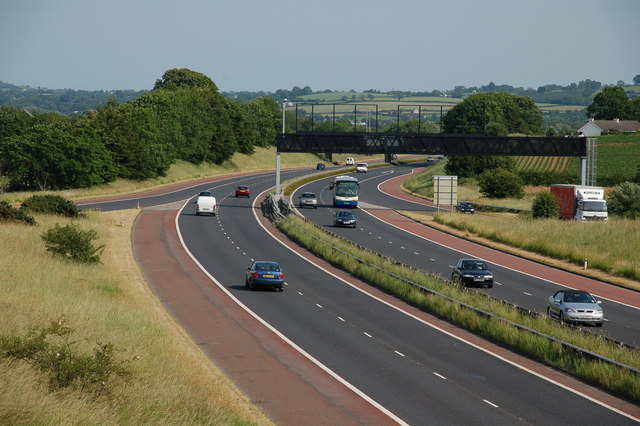
Route and characteristics
The M1 begins in the greater Belfast corridor and extends westward to Dungannon. West of Dungannon the high‑quality single carriageway continues as the A4, which leads on towards Omagh and Enniskillen. The motorway is built to standard high‑speed specifications: separated carriageways, grade‑separated junctions and restricted access for non‑motorway traffic. A portion of its eastern section forms part of the main road link used by many drivers traveling between Belfast and Dublin, connecting with border roads and the Republic of Ireland's M1 corridor (Belfast–Dublin route and M1 (Republic)).
History and development
Constructed in stages during the mid to late 20th century, the M1 was developed to support rising motor traffic and economic growth. Building a continuous high‑capacity road across this corridor reduced journey times between urban centres and helped shift long‑distance traffic off smaller local roads. Like many motorways in the United Kingdom and Ireland, its upgrades and maintenance have continued over decades to improve safety and capacity.
Uses and importance
The motorway serves several roles: commuter traffic into and out of Belfast, regional freight movements linking industrial and distribution centres, and tourism traffic heading to scenic and rural parts of the province. Its connection to cross‑border routes increases its strategic value for trade and travel between Northern Ireland and the Republic of Ireland.
Notable facts and distinctions
- Length: about 38 miles (61 km), the longest motorway in Northern Ireland.
- Continuation: becomes the A4 beyond Dungannon, providing a direct road link to towns such as Omagh and Enniskillen.
- Cross‑border role: eastern sections are commonly used as part of routes between Belfast and Dublin, connecting with the Republic's motorway network (M1).
Management and safety
The M1 is managed and maintained by Northern Irish road authorities and is subject to motorway regulations, signage and safety standards. Improvements over time have focused on junction safety, resurfacing and traffic management measures to keep the route efficient and reliable for both local and longer‑distance travel.
Questions and answers
Q: What is the M1 motorway in Northern Ireland?
A: The M1 motorway is a motorway in Northern Ireland that runs between Belfast and Dungannon.
Q: Where does the M1 motorway go after Dungannon?
A: After Dungannon, the M1 motorway goes in the direction of Omagh and Enniskillen as the A4.
Q: What is the first part of the M1 motorway also part of?
A: The first part of the M1 motorway is also part of the route between Belfast and Dublin (via the N1 in Northern Ireland and the M1 in the Republic of Ireland).
Q: How long is the M1 motorway in Northern Ireland?
A: The M1 motorway in Northern Ireland is about 38 miles (61 km) long.
Q: Is the M1 motorway the longest in Northern Ireland?
A: Yes, the M1 motorway is the longest in Northern Ireland.
Q: How many kilometers long is the M1 motorway?
A: The M1 motorway is about 61 km long.
Q: What cities or towns are connected by the M1 motorway?
A: The M1 motorway connects Belfast and Dungannon, and then goes in the direction of Omagh and Enniskillen as the A4.
Author
AlegsaOnline.com M1 motorway (Northern Ireland) Leandro Alegsa
URL: https://en.alegsaonline.com/art/141957