
Interstate 105 (California) — Glenn Anderson Freeway
A short east–west auxiliary Interstate in Los Angeles County, running about 19 miles from I-605 to State Route 1 at LAX; commonly called the Century Freeway and carrying a light rail line in its median.
Overview
Interstate 105 is an auxiliary Interstate Highway in southern California commonly known as the Glenn Anderson Freeway or the Century Freeway. It is an east–west spur of the Interstate system whose numeric parent is Interstate 5. The route lies in Los Angeles County and runs roughly between the city areas north of Compton and south of central Los Angeles.
Image gallery
3 Images

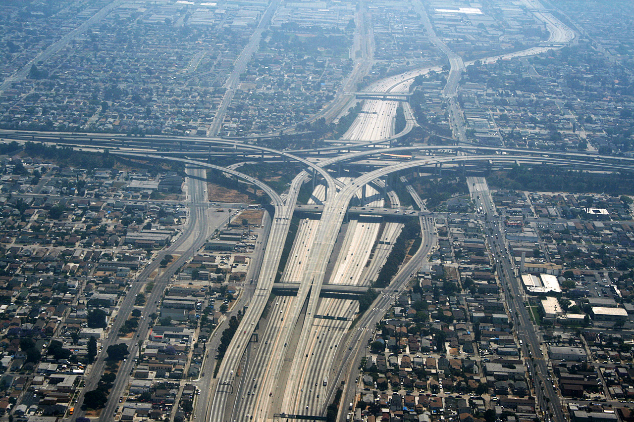
Route and characteristics
The highway extends about 19 miles (approximately 31 km) from its eastern connection with Interstate 605 to its western terminus at California State Route 1 near Los Angeles International Airport. Much of the corridor is built to modern freeway standards and includes a landscaped median that carries the regional light rail line for a substantial portion of the route. Interchanges connect I-105 with several major north–south corridors, serving residential, commercial and industrial neighborhoods along its course.
History and development
Planned for decades to improve east–west mobility on the south side of the Los Angeles basin, the freeway was long delayed by community and environmental concerns. The project was reworked to address housing displacement, air quality, noise, and other impacts; those mitigation measures influenced its final design. After lengthy litigation and negotiation, construction proceeded and the completed freeway opened in the early 1990s. The official name honors Glenn M. Anderson, a former U.S. Congressman and California lieutenant governor; the corridor is still frequently called the Century Freeway in local usage.
Uses, transit integration and importance
I-105 serves as an important commuter and freight route linking the inland suburbs and industrial zones with coastal employment centers and the airport area. A notable feature is the rail transit alignment in the median: the regional light rail improves transit access across the corridor and offers transfers to other transit services. The freeway also includes extensive soundwalls, landscaping, and community mitigation features that reflect the project’s contentious planning history.
Notable facts and distinctions
- The freeway is an auxiliary route numerically related to I-5 but functionally connects multiple radial freeways including I-605 and corridors leading to LAX.
- Its construction was shaped by legal settlements and community agreements that became an influential example of how large urban highways can incorporate mitigation for affected neighborhoods.
- It lies entirely within Los Angeles County, serving cities and communities along its length and providing a direct east–west alternative to routes through central Los Angeles.
For maps, transit connections, and traffic information, consult local transportation resources and regional transit agencies; the route remains a significant element of Southern California’s freeway and transit network.
Questions and answers
Q: What is Interstate 105?
A: Interstate 105 (I-105) is an Interstate Highway in Los Angeles County, California. It is a short spur of the Interstate 5.
Q: Where does I-105 start and end?
A: I-105 starts at the intersection with the Interstate 605 and ends at California State Route 1 at Los Angeles International Airport.
Q: How long is I-105?
A: I-105 is about 19 miles (31 km) long.
Q: What direction does it run in?
A: I-105 runs east to west from its starting point to its ending point.
Q: Where is it located geographically?
A: I-105 runs south of Los Angeles and north of Compton.
Q: What was it originally called when it first opened?
A: When it first opened, I-105 was called the Century Freeway.
Author
AlegsaOnline.com Interstate 105 (California) — Glenn Anderson Freeway Leandro Alegsa
URL: https://en.alegsaonline.com/art/140055
Sources
- scvresources.com : "SC Los Angeles-Orange County fun facts page"
- dot.ca.gov : "Log of Bridges on State Highways"
- dot.ca.gov : "Inside Seven - Caltrans, District 7 - Monthly Newsletter"
- roadstothefuture.com : "I-105 Glenn Anderson Freeway (Century Freeway)"
- art-poetry.info : "Road: Century Freeway Project"
- oac.cdlib.org : "The Finding Aid of the Century Freeway records 0228"
- dot.ca.gov : dot.ca.gov
- traffic-counts.dot.ca.gov : All Traffic Volumes on CSHS
- dot.ca.gov : I-105 Eastbound
- dot.ca.gov : I-105 Westbound