Brazil (Federative Republic of Brazil)
Large South American nation and the world's fifth‑largest country, known for the Amazon, Portuguese language, cultural diversity, and economic importance. Capital: Brasília.
Brazil is a sovereign country occupying roughly half of the eastern side of South America. It is the world's fifth-largest nation by area and has a population of about 212 million people. The modern name derives from the brazilwood tree, widely exploited in early colonial trade; the tree is known in English as brazilwood. The constitutional capital is Brasília, a planned city inaugurated in 1960 and located in the interior.
Image gallery
10 Images


Geography and natural regions
Brazil spans a vast range of landscapes and climates, from the humid tropical Amazon Basin in the north to temperate highlands in the south. Major natural regions include the Amazon rainforest, the cerrados (central savanna), the Pantanal wetlands—the largest tropical wetland on the planet—and the Atlantic Forest along the coastal mountains. A long Atlantic coastline supports major ports and diverse coastal ecosystems. Because of its size and range of environments, Brazil is one of the most biodiverse countries in the world.
History and political development
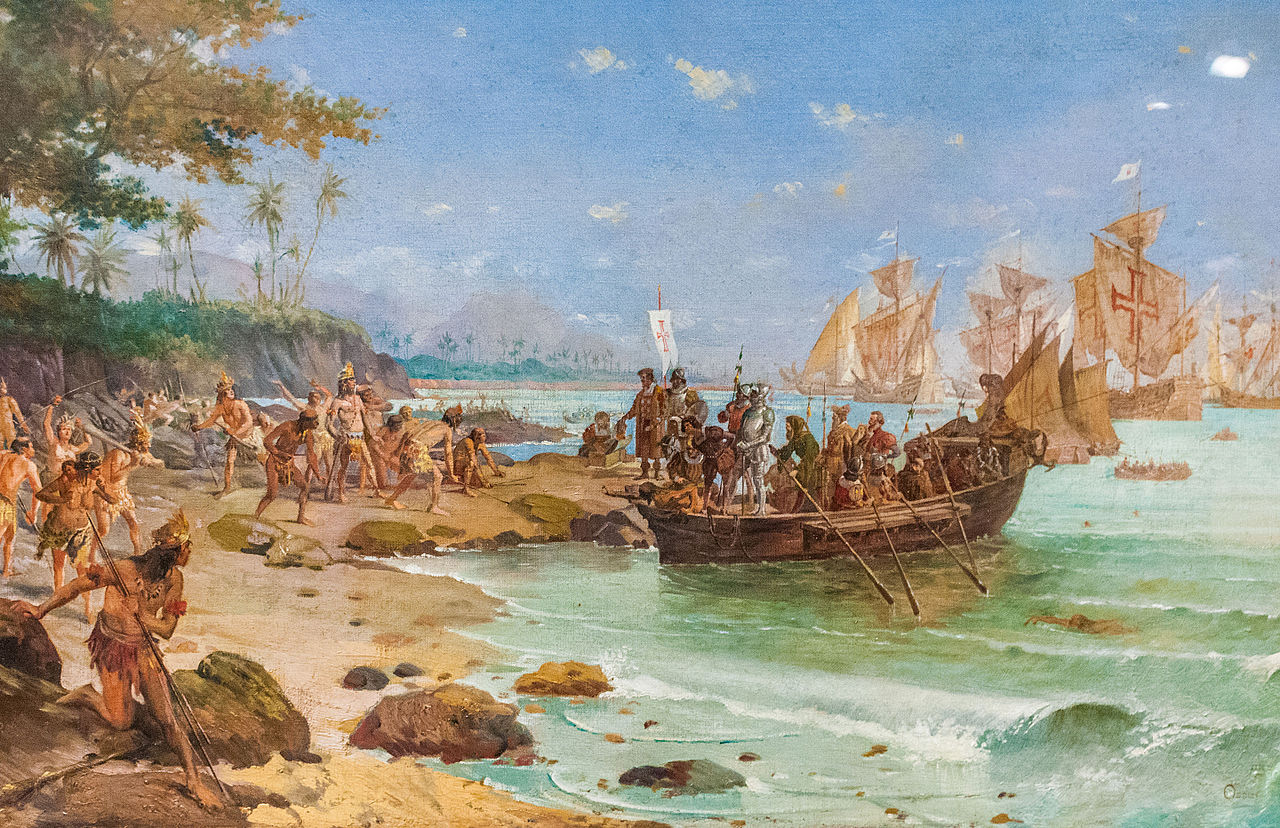
Indigenous peoples lived across the territory for millennia before European contact in the early 16th century. Portuguese colonization shaped language, law and land systems for centuries. Brazil declared independence from Portugal in 1822 and later became a republic, developing federal institutions that divide powers between the national government and individual states. The modern republic is a federal presidential constitutional republic with an elected president and bicameral legislature.
Government, law and administration
Brazil is composed of states and a Federal District; each state has its own governor and legislature. The federal government is responsible for national defense, foreign policy and monetary policy, while states manage local education and public security in many cases. The legal system is based on civil law traditions, adapted from Portuguese precedents and later national legislation.
Economy and environment
The economy is diverse, with strong agricultural, mineral and industrial sectors as well as services. Brazil is a leading global producer of commodities such as coffee, soy, beef and iron ore, and it also has significant oil and manufacturing activities. The country’s natural resources and forests have global importance for biodiversity and climate regulation, but Brazil faces ongoing environmental challenges including deforestation, habitat loss and pressures from agricultural expansion and infrastructure development. Conservation efforts and sustainable-use initiatives are major public debates.
Population, culture and society
Brazilian society reflects long-standing cultural mixing among Indigenous peoples, descendants of European colonists, Africans brought during the slave trade, and more recent immigrants from Europe, the Middle East and Asia. Portuguese is the official language and a strong marker of national identity. Music, dance and popular culture—samba, bossa nova, Carnival celebrations and a deep passion for association football—play major roles in social life. Religious and regional diversity are also notable features.
International role and contemporary issues
As the largest country in Latin America and a major economy, Brazil plays a significant role in regional organizations and global forums. Key contemporary challenges include reducing social inequality, strengthening public institutions, managing urbanization and addressing environmental sustainability. Brazil’s choices on land use, conservation and energy development have implications that extend beyond its borders.
Notable facts
- Largest country in Latin America and the only Portuguese-speaking nation of comparable size in the Americas.
- The Amazon rainforest is a critical reservoir of biodiversity and influences global climate patterns.
- Wide regional contrasts, from dense coastal megacities to sparsely populated forest and savanna areas, shape economic and social life.
Name
The name Brazil derives from the Portuguese name pau-brasil of the brazilwood tree (Caesalpinia echinata), which was an important export product at the time of early colonization from the forests of the Atlantic coast. Brasa means "embers" and "glowing coals" in Portuguese; the adjective brasil ("ember") refers to the color of the wood, which glows red when cut (brasiline) and was used in Europe to dye cloth.
Since 1325, a phantom island called Brasil, located west of Ireland, has been found on maps. According to a letter from an English agent to Christopher Columbus in 1498, it is said to have been discovered in about 1480 by sailors from Bristol. The author of the letter identifies it with the land discovered by the Venetian navigator Giovanni Caboto in 1497, that is, with Newfoundland.
Geography
Brazil's landscape is characterized by vast tropical rainforests of the Amazon lowlands in the north and plateaus, hills and mountains in the south. While the country's agricultural base is in the south and in the savannah areas of the midwest (Cerrado), most of the population lives near the Atlantic coast, where almost all major cities are also located. The coast has a length of 7491 km, most of which are sandy beaches.
Brazil has ten neighbouring countries. It borders - with the exception of Chile and Ecuador - all South American countries (seen from the northeast counterclockwise): French Guiana with 730 km, Suriname with 593 km, Guyana with 1298 km, Venezuela with 1819 km, Colombia with 1645 km, Peru with 2995 km, Bolivia with 3400 km, Paraguay with 1290 km, Argentina with 1132 km and Uruguay with 985 km. The total border length is 15,887 km, making it the third longest land border in the world after the People's Republic of China and Russia.
The continental part of Brazil is in two time zones, with some offshore islands belonging to a third. See also: Time zones in Brazil.
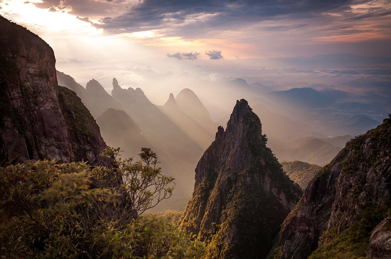
Highest mountains
The highest peak is the 2994 m high Pico da Neblina (pronunciation: ˈpiku dɐ neˈblĩnɐ), which lies in the national park of the same name near the border with Venezuela and Guyana. The second highest mountain is Pico 31 de Março (2973 m) (pronunciation: ˈpiku ˈtɾĩtɐ jũ dʒi ˈmaʁsu). The third highest mountain is Pico da Bandeira (2891 m) (pronunciation: ˈpiku dɐ bɐ̃ˈdejɾɐ). More famous, however, are the 710 m high Corcovado with its 30 m high statue of the Redeemer for its view over Rio de Janeiro, and the 395 m high Sugar Loaf, famous for its conical shape.
Waters
Rivers
The most important river is the Amazon, its water flow of 209,000 m³/s makes it by far the most water-rich river on earth, larger than the next seven smallest rivers in the world combined. The longest flow of its river system measures 6448 km; in this respect it is surpassed only by the Nile, which is much less water-rich. The most important tributaries, the Rio Madeira and the Rio Negro, are already comparable with the largest rivers of other continents. They are followed by the Rio Icá and the Rio Tapajós.
Except for a narrow coastal strip, southern Brazil belongs to the catchment area of the Uruguay (1790 km) and Paraná (3998 km) rivers. The Paraná is almost continuously dammed; the second largest hydroelectric power plant in the world is located in Itaipú. One of its tributaries gave its name to the state of Paraguay; another is known for the Iguazú waterfalls.
See also: List of rivers in Brazil
Lakes
Lagoa dos Patos near Porto Alegre is the largest lagoon in Brazil and the second largest in South America, covering more than 10,000 km². It is followed by Laguna Merín, less than half the size, south of the city of Rio Grande.
Islands
Brazilian territory also includes a number of islands in the Atlantic, such as the Saint Peter and Saint Paul Rocks, about 800 km off the coast, with only one lighthouse, and the former convict colony of Fernando de Noronha, which is not far from the rock group. Both are located on the mid-Atlantic ridge. Of volcanic origin are the islands of Trindade and Martim Vaz, which belong to the state of Espírito Santo. The oval Rocas atoll stretches for several kilometres and has been included as a World Heritage Site due to its exceptional flora and fauna.
The largest island, however, is Marajó between the mouth of the Amazon and the Rio Pará, which belongs to the estuary of the Rio Tocantins. With an area of about 48,000 km², it is larger than Switzerland, for example. However, as large parts are flooded during the rainy season, the island is only populated in some places. Since the northern shore of Marajó is a sea coast, the Ilha do Bananal in the Rio Araguaia with its area of 20,000 km² is considered the largest river island in the world. It is located in a national park in the state of Tocantins and is larger than, for example, Jamaica.
Climate
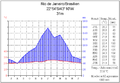
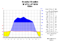
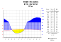
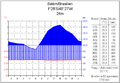
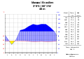
The climate of Brazil, which lies between 5° north latitude and 34° south latitude, is predominantly tropical with little seasonal variation in temperature. Only the subtropical south has a more temperate climate. Especially in the Amazon basin there is abundant rainfall, but there are also relatively dry areas with sometimes long periods of drought, especially in the northeast of the country. In the higher altitudes in the south of the country, precipitation occasionally falls as snow in winter.
In the south, on the border with Bolivia and Paraguay, there is an extensive wetland, the Pantanal.
· 
· 
· 
· 
flora and fauna
Brazil is the most biodiverse country on earth, ahead of Colombia, Mexico and Indonesia. Some 55,000 species of flowering plants, over 3,000 species of freshwater fish, 921 species of amphibians, 749 species of reptiles and 51 species of primates have been discovered so far. Due to the enormous biodiversity (the fourth highest in the world in the Atlantic coastal rainforest at the height of the Tropic of Capricorn), the large number of endemic species, genera and families, and the diverse ecosystems, Brazil is one of the world's megadiverse countries.
Above all, because the forest areas are constantly being reduced, a high proportion of the animal species are endangered in their existence. Nevertheless, the diversity of Amazonia is not yet endangered due to the large areas of largely untouched wilderness regions. The Mata Atlântica (rainforest) and Cerrado (savannah) ecoregions, on the other hand, are counted among the world's biodiversity hotspots due to the high level of endangerment (see Environment section).
The evergreen tropical rainforest of the Amazon is the largest contiguous forest area in Brazil. So far, more than 2500 tree species have been discovered there. Almost all of these trees, which can grow up to 60 m high, are found in the Eté forest of the Terra Firme, which covers 98 % of the Amazon region and is spared from flooding. Among other things, the rubber tree (caucho), various coloured and precious woods (e.g. rosewood), fruit trees (e.g. Brazil nut tree) and medicinal plants grow in this area. Striking are the approximately 1000 different fern and orchid species. Next to the Terra firme there is the Várzea, which is flooded during high water. Jupati and miriti palms grow there. The Igapó area, on the other hand, is constantly flooded. The typical plant in this area is the açaí palm. On the Amazon, but especially on its tributaries, grow water lilies whose flowers can grow 30 to 40 cm in size. Extensive mangrove forests can be found along the Amazon coast (with the exception of the actual mouth of the Amazon), although with only six mangrove tree species they are relatively species-poor.
Particularly well known throughout the Amazon are parrots, toucans and hummingbirds. Extremely many species of insects and butterflies are known. Larger forest animals are the tapir, the peccary, the jaguar and the puma. In addition, smaller wild cats, monkeys, sloths, armadillos and anteaters inhabit the rainforest. Anacondas, caimans and capybaras ("capybaras" - the largest rodents in the world) live on the shores and shallow waters, and other mammals such as giant otters, river dolphins and manatees live in the deeper water. The Amazon is also home to numerous species of fish (about 1500). Among them is one of the largest known freshwater fish in the world: the pirarucú is 2 m long and weighs about 100 kg. An electric eel that delivers 800-volt electric shocks and the piranhas, some species a good 30 cm long, are equally extraordinary.
The extreme northeast of Brazil, formerly also consisting of rainforest, is now almost exclusively used for sugar cane plantations and the cultivation of cotton. Occasionally, mangroves and palm groves can still be found.
The typical vegetation of the semi-arid mountain and highland areas in the center (Cerrado) and northeast of the country (Sertão) is savanna, from tree and grass savannas, towards the northeast, to shrub savannah interspersed with deciduous trees. Typical inhabitants of these dry zones are the large anteater, maned wolf, pampas deer, nandu and various armadillos. All these species, as well as large predatory cats such as jaguars and pumas, are protected in the Emas National Park, which is a World Heritage Site.
The Pantanal has an even greater diversity of animals and plants. Characteristic are besides numerous bird species lowland tapir, swamp deer, capybara and caiman. The swamp region in the midwest of the country is under water for seven months of the year. Higher elevations of the region are predominantly savanna. As in those of the Cerrado and even in the Amazon, pastures for cattle make their way there.
The coastal mountains of the south and southeast are the focus of colonial development and the most densely populated areas. Instead of the original Atlantic rainforest, habitat for monkeys and numerous other animal species, coffee plantations dominate. The original vegetation can only be found in some national parks.
The south shows subtropical vegetation; the original forests of araucaria, which reach a height of up to 40 m, have been largely destroyed for timber extraction. Today, low grass steppes are more common in this region.
Nature Conservation
Brazil has 62 national parks (Parques Nacionais). Protected areas of a similar character exist under the name Estação Ecológica. There are also protected areas of the states (Parques Estaduais) and at the municipal level. These and other areas have been placed under protection because of their ecological, scientific, touristic and educational importance.
Some organizations dedicated to nature and species conservation are:
- Instituto Onca-Pintada (IOP): Brazilian NGO for the protection of the jaguar (Jaguar Concervation Fund - JCF)
- Whale and Dolphin Conservation (WDC): international organization for the protection of dolphins and whales in the Amazon region.
- Amazon Region Protected Areas Program (ARPA): Protected area program for the preservation of the rainforest
Environment
Destruction of the rainforest
While around 93% of the Atlantic coastal rainforest has already been destroyed and the remnants are highly fragmented, the tropical rainforest of the Amazon is one of the largest remaining primeval forest areas in the world. Until the arrival of the Europeans, it was used extensively and sustainably by the indigenous original population, so that the changes brought about to the ecosystems benefited rather than harmed biodiversity. Many of the modern land use changes, on the other hand, inflict immense damage on forests. These are primarily clearing for the creation of agricultural land, plantation-like agriculture and forestry (e.g. the Jari project), but also infrastructure projects such as roads (for example the Transamazônica and the Perimetral Norte), mines (e.g. Serra dos Carajás) and large dams (even on direct tributaries of the Amazon such as Tucuruí or Belo Monte). It is not only the land consumption caused by the construction projects themselves that has an impact. The associated roads make the areas available for (today mainly illegal) logging.
The wood from these forests is only partly used by the local population (e.g. as firewood or for higher-value products already manufactured in Brazil, such as plywood, pulp or building materials). A large part is traded internationally. In Brazil, there are about 2500 companies that buy and sell tropical hardwood. Most of them are large foreign companies. Although some tropical hardwoods, such as mahogany, are now protected by law, trade continues illegally.
According to FAO data, 60.1% of the country's land area was still covered by virgin forest in 2010, compared to 66.9% in 1990 (excluding afforested areas). In the period 2000-2005, the loss of virgin forest was 32,000 km² per year. In relation to the total area of forests, around 0.5 % was lost annually over the last 20 years.
From 2004 (approximately 27,000 km² annually) to 2012, rates were declining. In 2005, 18,793 km² were announced, in 2006 it was 14,039 km². According to the German BMZ, in 2012 the deforestation rate was "only" around 4570 km² (which is slightly less than the area of the Balearic Islands or 0.09% of the total rainforest area of Brazil). From August 2012 to July 2013, however, deforestation increased again to 5800 km².
The Brazilian government attributed the decline in the loss of primary forest to the enforcement of its environmental standards; environmentalists see the strength of the real and falling soybean prices as the reasons. As a result, an emergency government cabinet deliberated on measures in January 2008. The authorities for the protection of the rainforest are struggling with a lack of money and personnel as well as corruption. Only within the framework of protected areas does the Amazon forest experience relative protection. In 2002, for example, the world's largest protected area (Tumucumaque) of a tropical rainforest was established in northern Brazil.
In mid-2008, Brazil launched a fund to protect the Amazon rainforest and for the first time accepted a link between this protection and global warming. The government plans to invest several million euros by 2021 to develop sustainable economic bases for the Amazon population in place of clearing. But the country is defensive about foreign interference in its Amazon policy. Indigenous peoples, environmentalists and human rights activists fear that deforestation will continue under President Jair Bolsonaro, who has been in office since 2019.
Rainforest soils are nutrient-poor, so vegetation relies on recycling nutrients and minerals from dead biomass. In the tropical hot and humid climate, microorganisms decompose leaf litter in a very short time and feed it back to the plants, whereas hardly any soil-forming processes take place. However, if the forest is removed and the humus layer lies unprotected against the sun and precipitation, or if no new humus can form on the infertile subsoil, it dries out and erosion occurs. If the cleared areas are larger, the forest cannot regenerate there.
Trees bind carbon dioxide, which causes a greenhouse effect in the atmosphere. Three quarters of the greenhouse gases released in Brazil are due to slash-and-burn agriculture and one quarter to the burning of fossil fuels.
See also: Deforestation
Other environmental problems
Another environmental problem is open-pit bauxite and gold mining, which poisons the rivers and endangers the local population. The gold miners (garimpeiros) use mercury (amalgam process) to wash out the gold. The toxic vapours escape into the air and the heavy metal contaminates water, soil and groundwater, causing serious damage to human and animal health.
Like everywhere else, the extraction of oil causes problems: in 2000, there was an oil spill in the Iguaçu River. A year later, the world's largest drilling platform sank off the Brazilian coast, threatening the ecosystem there. Cities are struggling with air pollution and sewage problems.
In Brazil, a certain amount of alcohol is added to the fuel. In addition to environmental reasons (reduction of pollutant emissions), the main reason for this is cost: ethanol is significantly cheaper than automotive and aviation gasoline. The percentage of ethanol in gasoline is regulated by law and was reduced from the former 25% to 20% in 2006. In Brazil, you can drive cars that have ethanol, gasoline or flex-fuel engines. The three millionth flex-fuel car was sold in December 2005. The first airplanes are also flying on ethanol, reducing overall air pollution. The world's first alcohol-fueled aircraft, the EMB-202 Ipanema, was built by Embraer in Brazil in 2002. Brazil is the fourth largest producer of automobiles and the second largest producer of aircraft in the world, with 12,000 aircraft.
On the 2019 oil spill:
→ Main article: Oil spill off Brazil 2019
Environmental agreement
Brazil has participated in these environmental agreements: Ramsar Convention (1971), Washington Convention on International Trade in Endangered Species of Wild Fauna and Flora CITES (1973), Convention on Biological Diversity (1992), Basel Convention (1989), Framework Convention on Substances that Deplete the Ozone Layer, Kyoto Protocol (1997).


Questions and answers
Q: What is the official name of Brazil?
A: The official name of Brazil is the Federative Republic of Brazil.
Q: How do you pronounce "Brazil"?
A: The pronunciation of "Brazil" is IPA:[bɾɐˈziw].
Q: How many people live in Brazil?
A: Approximately 212 million people live in Brazil.
Q: What is the capital city of Brazil?
A: The capital city of Brazil is Brasília.
Q: What country does Brazil belong to?
A: Brazil belongs to South America.
Q: How large is Brazil compared to other countries?
A: In terms of size, it is the world's fifth largest country.
Q: Why was the country named "Brazil"?
A:The country was named after brazilwood, which was a tree that grew abundantly along the Brazilian coast.
Tags
Related articles
Author
AlegsaOnline.com Brazil (Federative Republic of Brazil) Leandro Alegsa
URL: https://en.alegsaonline.com/art/13806
Sources
- brasil.gov.br : "Demographics"
- ibge.gov.br : Caracteristicas da População e dos Domicílios do Censo Demográfico 2010 — Cor ou raça
- bbc.com : "Brazil President Dilma Rousseff removed from office by Senate"
- cia.gov : "The World Factbook"
- imf.org : "Brazil"
- tradingeconomics.com : "Brazil - Economic Indicators"
- nationsonline.org : "The Human Development Index 2016"
- pcdsh01.on.br : "Hora Legal Brasileira" · web.archive.org
- books.google.com : A Concise History of Brazil
- books.google.com : People of the Earth: An Introduction to World Prehistory
- school.eb.com : "Brazil"
- geohive.com : "The 50 largest (area) countries in the world"
- cnn.com : "Mixing sushi and samba - meet the Japanese Brazilians"