Brasília: Brazil’s planned capital and modernist landmark
Brasília is the planned capital of Brazil, inaugurated in 1960 on the Central Plateau. Known for its modernist architecture and winged layout, it is the seat of government and a UNESCO World Heritage Site.
Overview
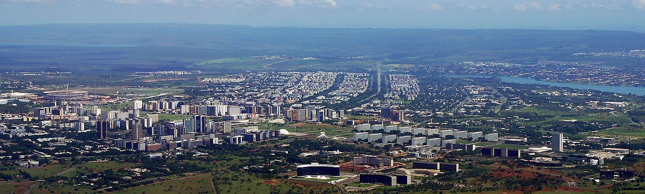
Brasília is the national capital city of Brazil, located on the high central plateau known as the Planalto Central. Built deliberately as a planned capital and formally inaugurated in 1960, Brasília functions as the centre of the national government and as a symbol of mid‑20th‑century modernist urban design. The city is part of the unique administrative entity called the Federal District, and its built area and surrounding settlements together form a wider metropolitan area. UNESCO recognised Brasília’s original core as a World Heritage Site for its architectural and town‑planning significance.
Image gallery
10 Images


Design, layout and principal features
Brasília was conceived through an open competition won by urban planner Lúcio Costa; many of its signature buildings were designed by architect Oscar Niemeyer. From above the central sector resembles an airplane or butterfly: a long east–west Monumental Axis hosts the principal government buildings and monuments, while a curved residential axis shapes neighborhoods and services. The plan deliberately separates functions into sectors — residential, commercial, cultural and administrative — and emphasizes broad avenues, green spaces and superquadras (large residential blocks).
- Monumental Axis: government ministries, the national stadium and major monuments.
- Residential superquadras: organized housing clusters with schools and shops.
- Lake Paranoá: an artificial lake created to increase humidity and provide leisure areas.
- Modernist landmarks: cathedral, National Congress, Supreme Court and numerous public buildings.
History and purpose
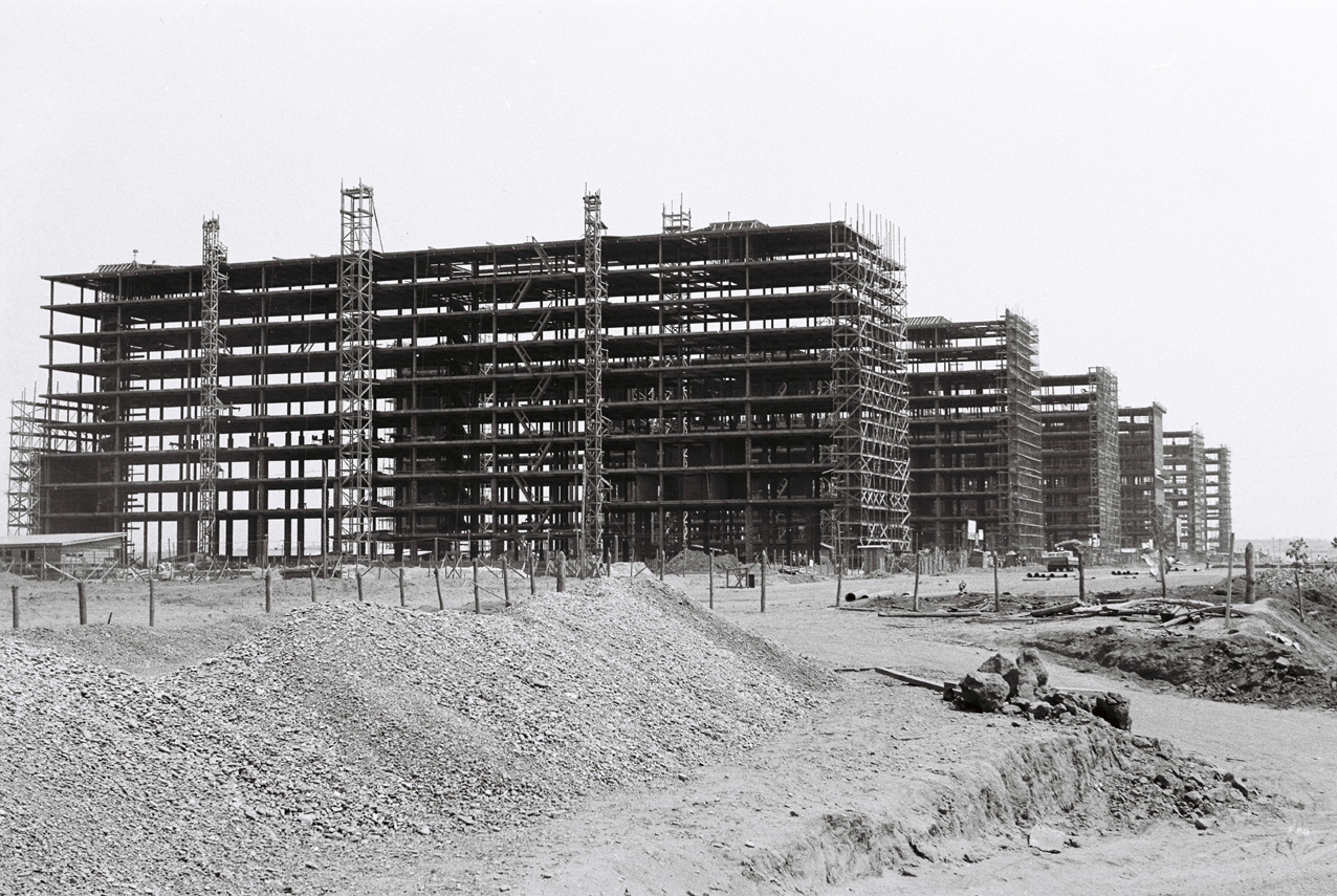
The decision to relocate the capital inland dated back to 19th‑ and early 20th‑century debates about national integration and development. Under President Juscelino Kubitschek the federal government accelerated planning and construction in the 1950s; workers who migrated to build the city were commonly called candangos. Brasília’s inauguration in April 1960 marked the transfer of Brazil’s capital from the coastal city of Rio de Janeiro to a purpose‑built administrative centre intended to encourage interior settlement and reflect a modern national identity.
Government, population and economy
As the seat of the executive, legislative and judicial branches, Brasília concentrates federal ministries, agencies and diplomatic missions; it hosts many foreign embassies. The Federal District has its own administrative structure and is not organized as a municipality in the same way as most other cities in Brazil — a distinction that affects local governance compared with other Brazilian municipalities. The local economy is dominated by public administration, services, construction and related sectors rather than heavy industry.
Climate, culture and transport
Located at some altitude on the central plateau, Brasília has a tropical savanna climate with a clear wet season and a pronounced dry season. Its cultural life includes museums, theatres and civic festivals; the city also serves as a transport hub with road and air connections to the rest of the country. Urban planners and architects study Brasília as a key case of planned modernist citymaking — praised for its ambitious design and criticized at times for social and mobility challenges created by its strict zoning and car‑oriented avenues.
Notable facts and distinctions
- Planned and built quickly in the 1950s to become the national capital in 1960.
- Recognized by UNESCO for its modernist architecture and urban plan.
- Its aerial silhouette is widely described as an airplane or butterfly.
- Residents are commonly known as brasilienses, while the early construction workers were called candangos.
Today Brasília remains central to Brazil’s public life: a purpose‑built capital with a distinctive visual identity, continuing debates about urban policy, and an important administrative and diplomatic role on the national stage.
Questions and answers
Q: What is the name of the capital city of Brazil?
A: The capital city of Brazil is Brasília (bɾaˈziliɐ).
Q: How many people live in Brasília?
A: According to the 2008 IBGE estimate, about 2,557,000 people live in Brasília. The metropolitan area has a population of 3,599,000.
Q: What are residents of Brasília known as?
A: Residents of Brasília are known as brasilienses or candangos.
Q: What does "Brasília" usually refer to in local usage?
A: In local usage, "Brasília" usually refers only to the First Administrative Region within the Distrito Federal (Federal District), where the most important government buildings are located.
Q: Is Brasília a legal municipality like other cities in Brazil?
A: No, Brasília has a unique status in Brazil as it is an administrative division rather than a legal municipality like nearly all other cities in Brazil.
Q: What does the plan for residential buildings around expansive urban areas include?
A: The plan for residential buildings around expansive urban areas includes large avenues and divides the city into sectors with different purposes such as accommodation and tourism.
Q: What is located at the center of Brasilia?
A: At the center of Brasilia is an artificial lake called Lake Paranoá.
Related articles
Author
AlegsaOnline.com Brasília: Brazil’s planned capital and modernist landmark Leandro Alegsa
URL: https://en.alegsaonline.com/art/13743
Sources
- www2.mre.gov.br : "Lista do Corpo Diplomático e Organismos Internacionais"
- infobrasilia.com.br : "Lucio Costa"
- maps.google.com : "Google Maps"
- aboutbrasilia.com : "About Brasilia"