The state of Brandenburg is located in the northeast of the Federal Republic of Germany. It borders Saxony to the south, Saxony-Anhalt to the west, Lower Saxony to the northwest, Mecklenburg-Western Pomerania to the north, and the Republic of Poland to the east. Brandenburg has five exclaves, which lie within the borders of Saxony-Anhalt and belong to the municipalities of Buckautal and Ziesar. Brandenburg is the fifth largest state in Germany by area, with a total area of 29,654 km², and is also the largest of the new states, with a maximum diagonal extent of 291 km, a north-south extent of 244 km, and an east-west extent of 234 km. The core area of Brandenburg is also referred to by the historical name Mark Brandenburg.
In terms of economic geography, the states of Berlin and Brandenburg together form the European metropolitan region of Berlin/Brandenburg. Around six million inhabitants live in the conurbation known as the Berlin-Brandenburg capital region. The Berlin agglomeration, with 4.4 million inhabitants, whose narrower area around Berlin is known as the "Speckgürtel", includes Berlin and parts of Brandenburg. This corresponds to the typical orientation of Brandenburg's infrastructure, such as motorways and main railway lines, towards the federal capital Berlin, which is located in the state in the form of an island.
Outside of the larger cities such as Brandenburg an der Havel in the west, Frankfurt (Oder) in the east and Cottbus, the city with the largest population after Potsdam, in the south, the state is relatively sparsely populated. The south of the state is made up of Lower Lusatia, small parts of Upper Lusatia and the Elbe-Elster region. To the west of Brandenburg belong the Havelland, south of Berlin the Teltow and northeast the Barnim. On the borders lie in the north the Oberhavel (with the Fürstenberger Werder, which historically belonged to Mecklenburg until 1950), in the northwest the Prignitz, in the northeast the Uckermark, in the east the Oderbruch and in the southwest the Fläming.
Geology and soils
→ Main article: Geology and landscape development in Brandenburg
The state of Brandenburg is located in the North German Lowlands and was decisively shaped on the earth's surface by the repeated advances of the Scandinavian inland ice during the Ice Age. Therefore, almost exclusively cold and warm period deposits are present. The most common deposits are boulder clay and meltwater sands. Typical for the surface formation are the elements of the glacial series. One of their landscape forms is the glacial valley. These show a worldwide unique accumulation in this country: Netze-Randow, Thorn-Eberswalde, Warsaw-Berlin, Glogau-Baruth and Wroclaw-Bremen glacial valleys.
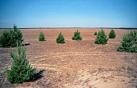
Due to the diversity of the glacial deposits in Brandenburg, the resulting soil communities are very diverse. Their yield ranges from extremely nutrient-poor and infertile to very fertile. Nevertheless, the nutrient-poor sandy soils, which give the state its characteristic character, predominate in terms of area, especially in central and southern Brandenburg.
Brandenburg is considered a supplier of raw materials, especially in the south. Large lignite deposits are located along the Lausitzer Grenzwall, and deep copper deposits have been found in the southeast around Spremberg. Oil has been found in isolated cases in the area.
Landscapes
The main large-scale landscapes of Brandenburg are, from north to south, the Baltic or Northern Land Ridge, the zone of plates and glacial valleys, and the Southern Land Ridge.
Heights of over 100 m are reached on both land ridges. In Brandenburg, the Fläming and its eastern continuation, the Lausitzer Grenzwall with the Muskauer Faltenbogen are assigned to the Southern Land Ridge, which reaches from the Harburg Mountains to Poland (Katzengebirge). It is on average higher than the Baltic Land Ridge. The latter stretches from Jutland to the Baltic. It includes the Mecklenburg Lake District, which extends into Brandenburg. The rivers Havel, Rhin and Dosse have their source in this lake district. In the southeast with the Lausitzer Urstromtal (part of the Breslau-Bremer Urstromtal) and northeast with low-lying parts of the Uckermark, Brandenburg extends beyond the aforementioned mountain ranges.
Between the land ridges lies the area of the central Brandenburg plates and glacial valleys. Extensive lowlands such as the Rhinluch, the Havelländisches Luch and the chain of lakes of the middle Havel delimit the island-like rising plates such as Barnim, Nauener Platte and the Ländchen from each other. The level of the Urstrom valleys and the associated side valleys shows a slight gradient from southeast to northwest. It ranges from about 60 m at the Neisse to below 20 m at the mouth of the Havel. The average height of the slabs decreases from east to west from more than 100 m at the Oder to 40 m to 50 m in the west. The Oder valley is particularly deep in the northeast almost at sea level.
In terms of landscape, the difference between the old moraine and the young moraine country is striking. While there are almost no natural lakes in the south and in the Prignitz, the young glaciated area is rich in lakes. There are regional differences. Many high-lying ground moraine areas, such as the Barnim or the Land Lebus, are poor in lakes. On the other hand, areas such as parts of the western Uckermark, where large areas of dead ice blocks were buried and preserved, are rich in lakes.
- Barnim
- Dahmeland
- Elbe-Elster-Land
- Fläming
| - Havelland
- Karow Plate
- Land Lebus
- Land of Löwenberg
| - Lusatia
- Märkische Schweiz
- Oderbruch
| - Prignitz
- Ruppin region
- Schorfheide
| - Teltow
- Uckermark
- Blackout
|
See also: List of landscapes in Brandenburg
Climate
The state of Brandenburg is located in the transitional area between the oceanic climate in Western Europe and the continental climate in the East. Due to the relatively small differences in altitude, the climatic differences within the state are rather small, but can be felt in certain weather conditions.
The average annual temperature is around 9 °C. The coldest month is January with an average of -1 °C. The warmest month is July with an average temperature of 18 °C. With the air temperature, a slight increase in continentality is already noticeable from Prignitz, located in the northwest, to Niederlausitz, located in the southeast. Especially in the winter months, with low wind radiation weather conditions, Lusatia is usually significantly colder than Prignitz.
With an average annual precipitation sum of less than 600 mm, Brandenburg is one of the driest federal states, perhaps the one with the least precipitation. Mostly the average annual precipitation is around 550 mm. Only the Prignitz, located in the northwest, and some high areas such as the Hohe Fläming and the Hohe Barnim reach or exceed the 600 mm mark per year. East of the highlands, a low rain shadow is noticeable, so the low-lying Oderbruch is one of the driest regions in Germany with less than 500 mm annual precipitation.
While winter and spring are comparatively dry, precipitation throughout the state falls mainly in the summer months. Nevertheless, pronounced dry phases can also occur during the warm season, during which the risk of forest fires in Brandenburg rises sharply. In 2018, Brandenburg's forests burned 512 times (an average of around 300 forest fires per year), including eleven major fires. The sun shines for an average of about 1600 hours a year.
In order to stabilise the forest for the demands of climate change (including heavy rainfall and droughts), the state of Brandenburg spends 8.5 million euros annually (as of 2018) on a forest conversion programme in order to achieve, among other things, an increased presence of different tree species in several age classes.
From 1881 to 2018, the temperature in Brandenburg increased by 1.3 degrees Celsius compared to the pre-industrial value. This value could rise to 3.8 degrees by the end of the century if the current development path is maintained. According to assumptions, Brandenburg will be increasingly affected by extreme weather events, including longer periods of drought and locally occurring heavy precipitation events. In addition, the phenological seasons will shift; winter will become shorter, spring will begin earlier and autumn will become longer. Overall, a three-week longer vegetation period can be assumed on average in Brandenburg, which will have an impact on fruit and wine growing, agriculture, forests, as well as on biotic communities and species. Due to global warming, the sea level is expected to rise by 80 to 100 cm by the turn of the century; thus, the salt water limit is located in the Lower Oder Valley.
Waters
Brandenburg is considered to be the federal state with the most water bodies in Germany. There are over 3000 naturally formed lakes, in addition to numerous man-made ponds, quarry lakes and similar bodies of water. Furthermore, there are more than 33,000 km of running waters, most of which are man-made drainage ditches and other canals. On the other hand, due to the lack of precipitation in Brandenburg, the groundwater is renewed only very slowly. The residence time of the water in the water bodies is therefore quite long.
Rivers
Larger rivers touch Brandenburg only at its borders. The Elbe (total length 1091 km) runs for a few kilometers in the extreme southwest and northwest of Brandenburg, where it marks the state border almost without exception. Only the 0.5 km² area around the ferry landing stage at the mouth of the river Dahle, including a section of the federal road 182, which belongs to Mühlberg, represents the only area of Brandenburg on the left bank of the Elbe. The Oder (total length 866 km) forms together with the Neiße as its tributary the entire eastern border of Brandenburg. Only the outermost northeastern border kilometres are excluded.
Brandenburg's most important inland rivers are the 334 km long Havel and the 400 km long Spree as its largest tributary. The Spree has more water at its confluence than the Upper Havel, so that the Spree and the Lower Havel form a 560 km long river course running mainly in Brandenburg (350 km of which are navigable). All other watercourses in Brandenburg are small rivers and streams of regional importance. In northern Brandenburg, the Stepenitz, the Dosse, the Rhin, the Ucker and the Finow are worth mentioning. In the central part, the Plane, the Nieplitz, the Panke, the (Jüterboger) Nuthe, the Notte and the Dahme have some importance. The largest river in the south of Brandenburg is the Schwarze Elster. After that, rivers like the Kleine Elster, the Oelse or the Schlaube have to be mentioned.
See also: List of rivers and canals in Brandenburg
Lakes
Due to its ice-age formation history, Brandenburg is extremely rich in naturally formed lakes. There are more than 800 bodies of water with an area of more than one hectare. The largest natural lake in Brandenburg is the Schwielochsee with an area of 13.3 km². It is followed by the Scharmützelsee (12 km²), the Unteruckersee (10.4 km²), the Parsteiner See (10 km²), the Ruppiner See (8.25 km²), the Schwielowsee (7.9 km²), the Werbellinsee (7.8 km²) and the Grimnitzsee (7.8 km²). With a depth of almost 70 m, the deepest lake in the state and also the one with the best water quality is the Großer Stechlinsee.
In addition to the numerous natural lake areas in Brandenburg, there is also a man-made lake area: the Lusatian Lakeland is the result of the flooding of open-cast mining pits that are no longer in use. At 13 km², Lake Senftenberg is currently the largest body of water in it. In 2025 it will be Europe's largest artificial water landscape and Germany's fourth largest lake district. Lake Sedlitz (13.3 km²) will grow to become the largest lake by then, and together with Lake Schwieloch it will be the largest lake in Brandenburg. The Spremberg dam, with 6.7 km², forms the largest reservoir in Brandenburg.
See also: List of lakes in Brandenburg
flora and fauna
In 2011, the primeval beech forests were included in the World Heritage List. Among others, the beech forest in Grumsiner Forst in the Schorfheide-Chorin Biosphere Reserve has been declared part of the World Natural Heritage. Here, there are distinctive flutter grass beech forests, which are considered to be the remnants of the large-scale beech stands that once existed in Central Europe.
The Lower Oder Valley National Park is home to the kingfisher and the sedge warbler, which is one of the most endangered songbirds in Europe. Larger populations of this songbird species can otherwise only be found in the marsh and floodplain landscapes of Eastern Europe further to the east. White storks breed on the roofs of the surrounding villages. Also to be found, albeit very hidden, are the very rare black storks, of which there are currently 3 to 5 breeding pairs. Rare bird species such as the lesser spotted eagle have also found a refuge there.
The meadows, which are flooded in winter, offer resting opportunities for numerous migratory birds. Among the birds that can be observed here is, for example, the Whooper Swan. The breeding birds of this national park include such rare meadow breeders as the corncrake, the ruff and the black-tailed godwit, and the oriole nests in the floodplain forests and the deciduous forests of the Oder slopes. The largest breeding colony of the Black Tern is also located in the national park.
Wild boars, otters, beavers, wolves, raccoons, roe deer, red deer and white-tailed eagles have settled in Brandenburg as permanent species.
Nature Parks
A total of 15 so-called large protected areas have been designated in Brandenburg. They cover about one third of the state's area. These include the Lower Oder Valley National Park (106 km²) and the three areas designated as UNESCO biosphere reserves: the Elbe-Brandenburg River Landscape Biosphere Reserve (533 km²), the Schorfheide-Chorin Biosphere Reserve (1291 km²) and the Spreewald Biosphere Reserve (474 km²). In addition, there are eleven nature parks: Barnim Nature Park (750 km²), Dahme-Heideseen Nature Park (594 km²), Hoher Fläming Nature Park (827 km²), Märkische Schweiz Nature Park (204 km²), Niederlausitzer Heidelandschaft Nature Park (490 km²), Niederlausitzer Landrücken Nature Park (580 km²), Nuthe-Nieplitz Nature Park (623 km²), Schlaubetal Nature Park (225 km²), Uckermärkische Seen Nature Park (895 km²), Westhavelland Nature Park (1315 km²), Stechlin-Ruppiner Land Nature Park (1080 km²).
· 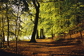
Forest area at the Werbellinsee
· 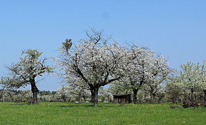
Orchard meadow in the Niederlausitzer Heidelandschaft Nature Park
· 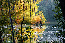
Small ham lake in the nature park Schlaubetal
· 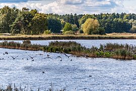
Wild geese at the Blumberger fish ponds in the biosphere reserve Schorfheide-Chorin
·