1980 Atlantic hurricane season
Summary of the 1980 Atlantic hurricane season: dates, activity level, meteorological characteristics, notable storms (including Hurricane Allen), impacts, and historical significance.
Overview
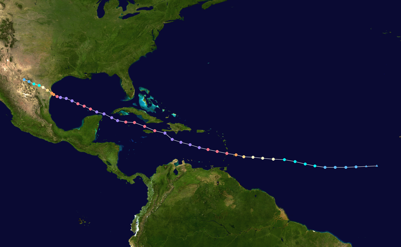
The 1980 Atlantic hurricane season formally ran from June 1 to November 30, 1980. It produced roughly average cyclone activity for the basin, with about 15 tropical cyclones observed and 11 systems reaching tropical storm strength and receiving names. The season is best remembered for the exceptionally powerful Hurricane Allen, which stands out among that year's storms.
Image gallery
10 Images


Season characteristics
Storms in 1980 developed from the typical source regions: African easterly waves, the tropical Atlantic, and the Caribbean Sea. Several systems intensified into hurricanes while a smaller number reached major hurricane status. Steering currents and sea surface temperatures influenced tracks that took systems toward the Greater Antilles, the Gulf of Mexico, and the open Atlantic. Routine tools available by 1980—satellite imagery, reconnaissance aircraft, and evolving numerical models—helped forecasters monitor and issue warnings.
Notable storms and impacts
Hurricane Allen was the most significant cyclone of the year; it became an extremely intense hurricane and inflicted severe winds and storm impacts across portions of the Caribbean and parts of continental North America. Other named storms during the season caused coastal flooding, wind damage, and rainfall-related hazards where they made landfall or passed close to shore. Impacts ranged from localized property and infrastructure damage to loss of life in some affected regions; emergency response and warnings limited larger-scale losses in other cases. More information on specific storm summaries and impacts can be found through historical summaries and storm archives (further reading).
Meteorology and forecasting
By 1980, meteorologists relied on a combination of satellite reconnaissance, ship and buoy reports, and targeted aircraft flights into cyclones to estimate intensity and forecast tracks. While model guidance existed, it was less advanced than modern systems, so forecasters emphasized trends, climatology, and observational updates to refine warnings. Seasonal activity reflected short-term atmospheric patterns as well as oceanic conditions that year.
Legacy and notable facts
- The 1980 season is considered near average overall in terms of named storms and cyclones.
- Hurricane Allen remains one of the most intense Atlantic hurricanes observed up to that era and is frequently cited in historical records and research (see archive).
- Advances in observation and forecasting evident in 1980 continued to influence improvements in warning systems in later decades.
For detailed storm-by-storm data, official post-season reports and hurricane databases provide comprehensive tracks, wind estimates, and impact assessments compiled by meteorological agencies and researchers.
Questions and answers
Q: When did the 1980 Atlantic hurricane season start and end?
A: The 1980 Atlantic hurricane season began on June 1, 1980, and ended on November 30, 1980.
Q: How many storms were in the 1980 Atlantic hurricane season?
A: There were 15 storms in the 1980 Atlantic hurricane season.
Q: How many of the 15 storms in the 1980 Atlantic hurricane season were named?
A: 11 of the 15 storms in the 1980 Atlantic hurricane season were named.
Q: Was the activity of the 1980 Atlantic hurricane season below, above or average?
A: The activity of the 1980 Atlantic hurricane season was about average.
Q: What was the significant feature of the 1980 Atlantic hurricane season?
A: The significant feature of the 1980 Atlantic hurricane season was the very powerful Hurricane Allen.
Q: How powerful was Hurricane Allen?
A: Hurricane Allen was very powerful.
Q: Were there any other hurricanes that were stronger than Hurricane Allen in the 1980 Atlantic hurricane season?
A: The text does not provide any information about whether there were any other hurricanes that were stronger than Hurricane Allen in the 1980 Atlantic hurricane season.
Author
AlegsaOnline.com 1980 Atlantic hurricane season Leandro Alegsa
URL: https://en.alegsaonline.com/art/133549